
Where Flight Simulation Enthusiasts Gather from Around the World!
AVSIM Library - Search Results

| Category: Flight Simulator 2004 - Scenery | |
| Kaltag KAL in Alaska |

|
Images related to this file:
File Description:
Kaltag is a small village on the west bank of the Yukon River, around 65 miles east of the coast at Unalakleet and about 40 miles south of where the river turns from north-south to east-west, east being upstream towards the distant Fairbanks. The population is just under 200 and living from fishing and the land. The airfield is close by and has a gravel runway aligned 21-3 and just under 5,000 feet long. Apart from the airfield itself, and it's buildings, this scenery modifies the local land class, adds village buildings while reducing the village size to reality, and creates a new airfield background. Kaltag is located on the edge of three different airlines coverage areas, and is served by Bering Air from the northwest, ERA from the southwest, and also by Wright Air from Fairbanks in the east. These are included in the AI.
A note here about my scenery making. This is post number 507 and there will not be many more to follow this as I am almost at the end of the photos I either took or found for scenery purposes. There is a limit to what can be located online and I have already been making use of the little there is; eg Unalakleet. So, if you are near an airport (preferably Canadian or Alaskan) and have a camera..... Let me know.
| Filename: | Kaltag_KAL_in_Alaska.zip |
| License: | Freeware, limited distribution |
| Added: | 20th August 2019, 19:04:35 |
| Downloads: | 103 |
| Author: | Roger Wensley |
| Size: | 3.57 MB |
| Category: Flight Simulator 2004 - Scenery | |
| PAIW Wales, Alaska, USA |
|
Images related to this file:
File Description:
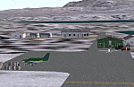
Googly scenery for Wales - a small domestic airport on the western coast of Alaska that is poorly provided for in Flight Simulator 2004. These scenery files add taxiways, aprons, buildings and other airport features, so that you and your "AI" traffic can land, taxi, park and take off in a realistic manner.
Wales is a small village with a population of just over 150 people, so the facilities at this 4000 foot gravel airstrip are fairly limited. The airport is allocated the ICAO code PAIW, although Microsoft has ignored this in Flight Simulator and uses the IATA ticket code IWK. Wales is served by light aircraft from airlines such as Bering Air, Cape Smythe Air, Frontier Flying Service, and Hageland Aviation Services. You might find it a convenient stopping-off point for a quick trip across to Russia - this is about as close as you can get and a nip across the Bering Strait will find you there in no time.
The scenery does not purport to be ultra-accurate. Based on high-detail satellite imagery from Google Earth, the layout is proportionally correct but the added airport features, such as buildings, are built from default Microsoft objects and add-on libraries so will not look like the real thing.
You are not obliged to download and install any additional scenery libraries, but to enjoy this scenery in its entirety, you may wish to. It will work fine, with or without.
[File re-uploaded at request of AVSIM]
| Filename: | PAIW_Wales_Alaska_USA.zip |
| License: | Freeware |
| Added: | 26th June 2010, 13:51:45 |
| Downloads: | 1,268 |
| Author: | John Hinson |
| Size: | 76.81 KB |
| Category: Flight Simulator X - Scenery | |
| Loney's Alaska FSX 1 |
|
File Description:
FSX Scenery - Loney's Alaska for FSX. This is a compilation of my Alaskan scenery series. This download is a rendering of 20 Alaskan airports. Some of which include, English Bay (KEB), Boswell Bay (AK97), Minchumina (PAMH), Buck Creek (AK98) and Ft Yukon (PFYU). Created with EZ Scenery, Rwy_12 and FSDS2. Please read the readme file for important information about the scenery and textures. By John B.Loney, Jr.
| Filename: | Loneys_Alaska_FSX_1.zip |
| License: | Freeware |
| Added: | 4th January 2007, 01:03:52 |
| Downloads: | 5,212 |
| Author: | John B. Loney, Jr. |
| Size: | 1.9 MB |
| Category: Flight Simulator 2004 - Scenery | |
| PABR - Barrow - Alaska, USA |
|
Images related to this file:
File Description:
The town of Barrow is in the far north of Alaska, and is best known in flying circles as the place where Wiley Post crashed his floatplane on takeoff and killed himself and Will Rogers. The crash was some 15 miles south of Barrow and was "assisted" by the mismatched fuselage, wings, and floats that had been assembled to create the floatplane. The Barrow population is largely Inupiat and totals some 4,400. The downtown area of Barrow is immediately north of the airport. The second and largest part of Barrow is further north past a string of lagoons and is locally called Browerville. To the northeast along the coast is the smallest part around what used to be the Naval Arctic Research Lab, and is now a college. To the east of this are the DEW buildings, plus two large navy hangars and the gravel runway that was used to serve the DEW station. The PABR runway is aligned 06-24 in FS9 and is 7,100 feet long and 150 feet wide, built on top of a gravel base and surround that copes with the underlying permafrost. There is PAPI at both ends and an ILS and approach lights on 06; 06 circuits are to the right. The airport notes include a warning that the apron is not a standard width and that large planes that are enroute to the far end of the runway will not be able to taxi past a plane parked at the gate and should use the runway as a taxiway, then turn and takeoff. FS9 AI cannot cope with that, so the apron here is wider. There are, in real life and the AI, daily flights by Air Alaska (three at least) and Era (several, and which is now called Ravn, hence the new hangar door motif) and air cargo flights by Northern Air Cargo and Everts, plus GA. The buildings have been made with photographic textures or textures made from reference photos. I decided that while 500+ scenery objects was probably ok for most people the required 900+ to "make" the town of Barrow would likely not be. The auto-generated FS9 town objects could not be left as Barrow with trees would not look at all like reality; I have "faded" the density of the town buildings into the distance from the airport.
| Filename: | PABR__Barrow__Alaska_USA.zip |
| License: | Freeware, limited distribution |
| Added: | 17th May 2016, 09:32:36 |
| Downloads: | 977 |
| Author: | Roger Wensley |
| Size: | 15.12 MB |
| Category: Flight Simulator 2004 - AI Flight Plans | |
| Alaska Airlines - Summer 2012 |
|
Images related to this file:
File Description:

Alaska Airlines Summer 2012.
3309 weekly flights.
Hub - PDX/KPDX, Portland International Airport (USA).
Hub - SEA/KSEA, Seattle���¢��������Tacoma International Airport (USA).
Hub - ANC/PANC, Ted Stevens Anchorage International Airport (USA).
Autor: Michael 'Pushen' Babitskiy.
| Filename: | Alaska_Airlines__Summer_2012.zip |
| License: | Freeware, limited distribution |
| Added: | 18th May 2012, 08:41:00 |
| Downloads: | 1,042 |
| Author: | Michael Babitskiy,UnitedTrafficTeam |
| Size: | 138.47 KB |
| Category: Flight Simulator 2004 - AI Flight Plans | |
| Alaska Airlines Summer 2012 |
|
Images related to this file:
File Description:

This is part of our flightplans for the Summer 2012 season. The team aims to provide high quality flightplans for the FS community. Each flightplan has been tested using many resources, and our goal is to make a realistic representation of each airline's route network.
| Filename: | Alaska_Airlines_Summer_2012.zip |
| License: | Freeware, limited distribution |
| Added: | 15th July 2012, 21:19:25 |
| Downloads: | 2,337 |
| Author: | Rob Corp & Alpha India Group |
| Size: | 36.43 KB |
| Category: Flight Simulator 2004 - AI Flight Plans | |
| Alaska Airlines Summer 2009 |
|
Images related to this file:
File Description:

This is part of our 1st round of flightplans for the Summer 2009 season. The team aims to provide high quality flightplans for the FS community. Each flightplan has been tested using many resources, and our goal is to make a realistic representation of each airline's route network. Visit us at www.alpha-india.net for more information.
| Filename: | Alaska_Airlines_Summer_2009.zip |
| License: | Freeware, limited distribution |
| Added: | 7th February 2010, 17:37:40 |
| Downloads: | 616 |
| Author: | Yohann Baptiste (Pax), Brian Wheatley (Cargo) & Alpha India Group |
| Size: | 54.34 KB |
| Category: Flight Simulator 2004 - AI Flight Plans | |
| Alaska Airlines Summer 2008 |
|
File Description:
This is part of our 16th round of Summer flightplans for 2008. The team aims to provide high quality flightplans for the FS community. Each flightplan has been throughly tested using all available resources, and our goal is to make the most accurate possible representation of each airline's route network. Visit us at www.alpha-india.net for more information.
| Filename: | Alaska_Airlines_Summer_2008.zip |
| License: | Freeware, limited distribution |
| Added: | 7th October 2008, 19:44:16 |
| Downloads: | 1,083 |
| Author: | Ben MacDougall & Alpha India Group |
| Size: | 59.4 KB |
| Category: Flight Simulator 2004 - AI Flight Plans | |
| Alaska Airlines Winter 2008 |
|
File Description:
These are flightplans for scheduled Alaska Airlines flights drawn from their online schedule. They include 2,791 flights, now transitioned to an all Boeing 737 fleet. Alaska Airlines is an airline based in Seattle, Washington, USA. It operates four hubs located at Seattle-Tacoma International Airport, Ted Stevens Anchorage International Airport, Portland International Airport and Los Angeles International Airport. These plans may be installed using MRAI setup, or manually using Lee Swordy's TTools. As part of my effort to expand the AI world, here you go!
| Filename: | Alaska_Airlines_Winter_2008.zip |
| License: | Freeware |
| Added: | 17th October 2008, 21:40:48 |
| Downloads: | 1,023 |
| Author: | David Nelson |
| Size: | 50.79 KB |
| Category: Flight Simulator 2004 - AI Flight Plans | |
| Alaska Airlines Summer 2004 |
|
File Description:
Included in this package are the AI flight plans for Alaska Airlines (systemwide) based on ALL routes ACTUALLY FLOWN by the carrier on 06/24/04. Created using Alaska's aircraft rotation resulting in only one AI aircraft being created for each of Alaska's aircraft actually in service on 06/24/04. Flightplans have been completely tested and guaranteed not to have any duplicate flights.
| Filename: | Alaska_Airlines_Summer_2004.zip |
| License: | Freeware |
| Added: | 8th July 2004, 03:37:28 |
| Downloads: | 1,304 |
| Author: | Ken Buckner |
| Size: | 168.82 KB |


© 2001-2026 AVSIM Online
All Rights Reserved
Privacy Policy |