
Where Flight Simulation Enthusiasts Gather from Around the World!
AVSIM Library - Search Results

| Category: Flight Simulator 2004 - Aircraft Repaints, Textures and Modifications | |
| Alaska Airlines Airbus A320 |

|
Images related to this file:
File Description:

Alaska Airlines acquired Virgin America in December 2016, and repainting has begun on Virgin's fleet of Airbus narrowbodies. N625VA was the first A320 to receive the new Alaska livery.
Textures only for the great Project Airbus model; sharklet textures are also included. The base pack is available here on AVSIM: pa320_basepack_fs9_2014-09-08.zip. Enjoy!
| Filename: | Alaska_Airlines_Airbus_A320.zip |
| License: | Freeware |
| Added: | 29th January 2018, 03:04:44 |
| Downloads: | 974 |
| Author: | Joe Shimmel and Project Airbus |
| Size: | 7.93 MB |
| Category: Flight Simulator 2004 - Scenery | |
| Colombian Airports - Update |
|
File Description:
This is an update to my previous Colombian Airports upload colapts1.zip.
The update contains mainly some navaid corrections to SKFL, SKIB, and SKVP, and adds the airport SKSJ Jorge E. Gonzales of San Jose del Guaviare; this is now at the correct location and altitude and has buildings, objects, and landclass added. It is for FS9 default scenery and the Colombia freeware mesh by Raimondo Taburet. However, the scenery should also work with the default or any other mesh but I have not tested it.
However, please NOTE:
that in the default scenery without mesh the airport SKSJ will be below the rest of the surface whereas with the mesh, the airport will be at the same altitude as the rest of the scenery with the exception of the river which now runs at a higher (the default) altitude (see screenshots). For me flying without the mesh does not make any sense, so I live with that restriction. If you don't like it, you can always delete or deactivate the files starting with "SKSJ".
| Filename: | Colombian_Airports__Update.zip |
| License: | Freeware |
| Added: | 10th September 2014, 14:50:05 |
| Downloads: | 1,438 |
| Author: | Detlev J. Rohmer |
| Size: | 5.4 MB |
| Category: Flight Simulator 2004 - Scenery | |
| "Himalayan Peaks" LOD10 Mesh, Volume 8 - Tirich Mir and Pamir |
|
Images related to this file:
File Description:
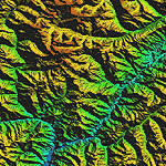
Highly detailed terrain mesh of the Tirich Mir and Pamir areas, N36-39 E71-74. The files in this package are based on Shuttle Radar (SRTM) Version 2 data but with many of the void areas, especially the most significant sections, filled with elevation data generated from topographic maps by Jonathan de Ferranti. While Jonathan's work is unrelated to flight simulation he kindly gave me permission to compile his data for use in FS. The result is a wonderful improvement in detail and accuracy over any existing mesh file, freeware or commercial, based on SRTM or DTED data alone.
Due to the large area of the Himalayas I've compiled the source data as two separate series: the "Himalayan Peaks" series covers prominent mountains and ranges in higher detail and locally overrides any existing LOD9 terrain mesh. In addition, a LOD9 "base mesh" series covering the entire Himalayas will be available for those who do not yet have an add-on terrain mesh of these beautiful mountains.
| Filename: | Himalayan_Peaks_LOD10_Mesh_Volume_8__Tirich_Mir_an.zip |
| License: | Freeware, limited distribution |
| Added: | 29th May 2010, 08:52:47 |
| Downloads: | 9,111 |
| Author: | Holger Sandmann, Jonathan de Ferranti |
| Size: | 47.94 MB |
| Category: Flight Simulator X - Scenery | |
| Horn Of Africa Mesh, part 1/3 |
|
Images related to this file:
File Description:

Part 1 of 3: Mesh (lod 1 to 9) of the "Horn Of Africa": Ethiopia, Erythrea, Djibouti and Somalia. (Re-upload)
| Filename: | Horn_Of_Africa_Mesh_part_13.zip |
| License: | Freeware, limited distribution |
| Added: | 10th June 2010, 08:57:38 |
| Downloads: | 2,253 |
| Author: | Marcel "Teutonique" Wislet |
| Size: | 82.73 MB |
| Category: Flight Simulator X - Scenery | |
| Horn Of Africa Mesh, part 2/3 |
|
Images related to this file:
File Description:
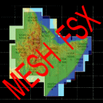
Part 2 of 3: Mesh (lod 1 to 9) of the "Horn Of Africa": Ethiopia, Erythrea, Djibouti and Somalia. (Re-upload)
| Filename: | Horn_Of_Africa_Mesh_part_23.zip |
| License: | Freeware, limited distribution |
| Added: | 10th June 2010, 08:59:50 |
| Downloads: | 2,094 |
| Author: | Marcel "Teutonique" Wislet |
| Size: | 88.72 MB |
| Category: Flight Simulator X - Scenery | |
| Horn Of Africa Mesh, part 3/3 |
|
Images related to this file:
File Description:
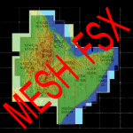
Part 3 of 3 : Mesh (lod 1 to 9) of the "Horn Of Africa": Ethiopia, Erythrea, Djibouti and Somalia. (Re-upload)
| Filename: | Horn_Of_Africa_Mesh_part_33.zip |
| License: | Freeware, limited distribution |
| Added: | 10th June 2010, 09:01:32 |
| Downloads: | 2,077 |
| Author: | Marcel "Teutonique" Wislet |
| Size: | 68.12 MB |
| Category: Flight Simulator 2004 - Scenery | |
| SRTM Terrain Mesh(LOD9) of China Middle (Part 4 of 6) |
|
File Description:
76m (LOD9) SRTM mesh of China. East(6 files), Middle(6 files) and west(6 files) all China 18 in TOTAL.
| Filename: | SRTM_Terrain_MeshLOD9_of_China_Middle_Part_4_of_6.zip |
| License: | Freeware |
| Added: | 24th August 2005, 22:18:36 |
| Downloads: | 4,019 |
| Author: | TANTRiS (Ho, Chong Yun) |
| Size: | 73.95 MB |
| Category: Flight Simulator 2004 - Scenery | |
| Ile d'Aix France Photo real |
|
File Description:
Photo scenery of "Ile d'Aix", small island between La Rochelle and Fort Boyard France.
Includes no mesh but provides customized autogen.
| Filename: | Ile_dAix_France_Photo_real.zip |
| License: | Freeware |
| Added: | 8th July 2006, 13:43:19 |
| Downloads: | 1,726 |
| Author: | Alain Nicco |
| Size: | 344.94 KB |
| Category: Flight Simulator 2004 - AFCAD Files | |
| Democratic Republic of Congo |
|
File Description:
ADE and SBuilder created files for selected airports and airstrips in the Democratic Republic of Congo to fit onto 76m mesh.
| Filename: | Democratic_Republic_of_Congo.zip |
| License: | Freeware, limited distribution |
| Added: | 19th February 2018, 19:03:17 |
| Downloads: | 234 |
| Author: | John Tennent |
| Size: | 128.86 KB |
| Category: Flight Simulator X - Scenery | |
| NWT Landscape - Canada |
|
File Description:
Elevation data (mesh-Lod10 - 38m), land cover, water polygons, rivers, stream lines, lanes and shorelines around airports of Northwest Territories, Canada.
| Filename: | NWT_Landscape__Canada.zip |
| License: | Freeware, limited distribution |
| Added: | 9th February 2011, 17:43:21 |
| Downloads: | 3,354 |
| Author: | Gilles Gauthier |
| Size: | 89.42 MB |


© 2001-2026 AVSIM Online
All Rights Reserved
Privacy Policy |