
Where Flight Simulation Enthusiasts Gather from Around the World!
AVSIM Library - Search Results

| Category: Prepar3D V5 - Scenery | |
| ETM12m v2 AO - Enhanced Terrain Mesh 12m v2 for ANGOLA vol.03 |

|
File Description:
This is an Enhanced Terrain Mesh SRTM 0,41 arc sec (12,50 meters) resampled at LOD 11 (FSX/P3D SDK). This replaces all my previous one terrain meshes. Mainly the area covered by this terrain mesh is related to the Angola. Scenery Add-On for FSX/P3D (All versions).
| Filename: | ETM12m_v2_AO__Enhanced_Terrain_Mesh_12m_v2_for_ANG.zip |
| License: | Freeware |
| Added: | 3rd October 2020, 17:03:47 |
| Downloads: | 218 |
| Author: | Giovanni Miduri |
| Size: | 131.42 MB |
| Category: Flight Simulator 2004 - Scenery | |
| Guatemala & Honduras SRTM Mesh Part 1 |
|
File Description:
This terrain mesh scenery was made to fit Jozef Kusters' Nicaragua mesh on its south-eastern edges. It covers Guatemala, western & northern Honduras (including Isl de la Bahia - Roatan), Belize and Salvador. Based on SRTM Data (3 arc/sec), generated with Matthew Styles's program "SRTM To BGL v1.04", sampled to LOD9 resolution (76m) with 5 interpolation passes. While tested under Fs2004, this mesh should also run in FS2002.
This part contains Guatemala-S.BGL. See guatemala_honduras_mesh_pt1.jpg for .BGL files coverage.
| Filename: | Guatemala__Honduras_SRTM_Mesh_Part_1.zip |
| License: | Freeware |
| Added: | 30th September 2003, 15:19:59 |
| Downloads: | 6,993 |
| Author: | Yohann Baptiste |
| Size: | 16.92 MB |
| Category: Flight Simulator 2004 - Scenery | |
| Polikhnitos |
|
File Description:
The default Polikhnitos airport isn't placed correctly and causes "plateaus" problems with high resolution mesh. A plateaus problems is when you have a default airport badly placed and mesh installed that has a higher resolution than the default mesh you will have airports at the bottom of a crater or on a "Ayers rock". This scenery fixes the problem and allows you to use meshes up to 38m. Not tested with higher resolution, I don't think meshes of 19m exist for that region.
| Filename: | Polikhnitos.zip |
| License: | Freeware |
| Added: | 14th July 2007, 10:20:16 |
| Downloads: | 619 |
| Author: | Jean-paul Marchetti |
| Size: | 896.7 KB |
| Category: Flight Simulator X - Scenery | |
| Northeast New Jersey 5 Meter Mesh Terrain |
|
Images related to this file:
File Description:
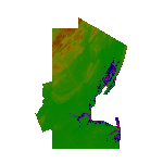
High Resolution Northeast New Jersey 5 Meter Mesh Terrain by Wally-Bob represents a significant improvement over FSX default 38 meter mesh terrain. The results are also dramatic compared to 10 meter compressed payware mesh as lossless compression compilation (read no data loss) is used. Lossless compiling produces renderings that have the Crispness of the Real World Terrain. Fly the Hudson River and view the Palisades as they are in real life, see the screen shots enclosed. High Quality 5 meter mesh terrain is a must have for mountainous areas especially where photo scenery is also used to render the virtual world. Manual includes FSX configuration and scenery installation tips. USGS LiDAR 1/9 Arc-Second source data.
| Filename: | Northeast_New_Jersey_5_Meter_Mesh_Terrain.zip |
| License: | Freeware, limited distribution |
| Added: | 26th February 2011, 21:35:52 |
| Downloads: | 1,101 |
| Author: | Walter Roberts |
| Size: | 135.89 MB |
| Category: Flight Simulator X - Scenery | |
| FSX British Columbia Airfields 1-3 For Default Scenery |
|
File Description:
60 British Columbia airfields/seaplane bases with surrounding scenery like lakes, landclass etc.. These sceneries are for the FSX default scenery, i.e. a scenery that does not have enhancements like Ultimate Terrain or ORBX which correct or add e.g. lakes, towns etc.
However, I do use additional freeware mesh sceneries, which are the "FSX Canada 19M Terrain Mesh" parts 1 and 2 by Raimundo Taburet (LOD 11) and the North America/Canada mesh from "FreeMesh X Global 1.0" (LOD 10). But in principle my sceneries should work with any mesh.
All files are named by their ICAO ID, so you can easlily remove any airfiled that you don't need or don't like.
| Filename: | FSX_British_Columbia_Airfields_13_For_Default_Scen.zip |
| License: | Freeware |
| Added: | 20th November 2020, 05:32:29 |
| Downloads: | 178 |
| Author: | Detlev J. Rohmer |
| Size: | 196.16 KB |
| Category: Flight Simulator 2004 - Scenery | |
| Greece SRTM Mesh Part 2 |
|
File Description:
This terrain mesh scenery covers Greece, including all Aegean sea islands, plus most parts of Albania and Macedonia up to 41°50'N. Some parts of Bulgaria and Turkey are also included in northern and eastern boundaries of the mesh. The greek island of Crete isn't part of this mesh because SRTM data isn't yet released for the whole island.
Based on SRTM Data (3 arcsec, 90m), generated with Matthew Styles's program "SRTM To BGL v1.04", sampled to LOD9 resolution (76m). While only tested with Fs2004, this mesh should also run with FS2002.
This part contains all bgl files except Greece-N.bgl, Greece-NE1.bgl and Greece-NE2.bgl. See Greece_Mesh_Part2-1.jpg for details.
| Filename: | Greece_SRTM_Mesh_Part_2.zip |
| License: | Freeware |
| Added: | 10th November 2003, 02:09:45 |
| Downloads: | 10,929 |
| Author: | Yohann Baptiste |
| Size: | 18.54 MB |
| Category: Flight Simulator 2004 - Aircraft Repaints, Textures and Modifications | |
| Alaska Air Cargo Boeing 737-700C WL (N709AS) |
|
Images related to this file:
File Description:

TDS Boeing 737-700C(WL) Alaska Air Cargo (N709AS). Alaska Airlines is the seventh largest American airline and is based in the Seattle suburb of SeaTac, Washington. Model design by Hiroshi Igami. Flight dynamics design by Nick Wilkinson and David Biggar. Master textures by Kyle Schurb.
| Filename: | Alaska_Air_Cargo_Boeing_737700C_WL_N709AS.zip |
| License: | Freeware, limited distribution |
| Added: | 27th July 2014, 02:49:06 |
| Downloads: | 676 |
| Author: | Danny Cummings |
| Size: | 8.25 MB |
| Category: Flight Simulator 2004 - AI Flight Plans | |
| Air Arctic - Summer 2014 |
|
Images related to this file:
File Description:

Air Arctic is a Fairbanks, Alaska based, FAR Part 135 air operator located on the East Ramp of the Fairbanks International Airport flying seasonal charters in far North Alaska. Flights from FlightAware for the week of 10 - 16 August, 2014. Update of my Winter 2010-11 plans.
| Filename: | Air_Arctic__Summer_2014.zip |
| License: | Freeware |
| Added: | 10th September 2014, 17:43:41 |
| Downloads: | 514 |
| Author: | Steve Lewis |
| Size: | 8.87 KB |
| Category: Flight Simulator 2004 - Scenery | |
| Centre Bush Aerodrome - NZCB |
|
Images related to this file:
File Description:
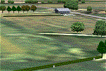
Small New Zealand aerodrome, 22nm north of Invercargill, Southland. Made to fit Christian Stock's NZ 20m mesh.
| Filename: | Centre_Bush_Aerodrome__NZCB.zip |
| License: | Freeware |
| Added: | 17th April 2012, 22:13:32 |
| Downloads: | 162 |
| Author: | Godfrey Tier |
| Size: | 476.1 KB |
| Category: Flight Simulator 2002 - Scenery | |
| Seattle, WA - High Resolution Terrain Mesh |
|
File Description:
Seattle, Washington area. The modest terrain in the Seattle area provides a nice example of a less obvious benefit of high resolution terrain mesh. The rendering of many small features missing entirely in the default mesh provides much richer detail and a greater sense of realism. (30m source -> 38.2m final).
| Filename: | Seattle_WA__High_Resolution_Terrain_Mesh.zip |
| License: | Freeware, limited distribution |
| Added: | 4th July 2002, 13:32:39 |
| Downloads: | 3,621 |
| Author: | Steve Greenwood |
| Size: | 3.75 MB |


© 2001-2026 AVSIM Online
All Rights Reserved
Privacy Policy |