
Where Flight Simulation Enthusiasts Gather from Around the World!
AVSIM Library - Search Results

| Category: Flight Simulator X - Utilities | |
| FS Earth 5.0 for Google Earth |

|
File Description:
This program acts as an interface between Flight Simulator X and Google Earth, letting to follow a flight in real time, over the satellite images generated by Google Earth. Flights can be saved, and many options are available for fine tuning the performance, as well as the map's style (zoom, tilt, orientation). Works on a single computer running FSX and Google Earth all together or, for best experience, can be used on two networked computers running respectively FSX (master) and Google Earth (slave). AI and Multiplayer traffic is also displayed in Google Earth, with course prediction and other information. Requires Flight Simulator X and Google Earth. The program running in trial mode works only around Anchorage, Alaska, (PANC / ANC) for a maximum of five minutes per flight session. Version 5.0 has improved compatibility with latest releases of Google Earth and several additional improvements. A version for FS2004 is available also.
| Filename: | FS_Earth_50_for_Google_Earth.zip |
| License: | Shareware, time limited |
| Added: | 19th July 2007, 00:46:27 |
| Downloads: | 1,104 |
| Author: | Luciano Napolitano |
| Size: | 2.44 MB |
| Category: Flight Simulator 2004 - Utilities | |
| FS Earth 5.2 for Google Earth and FS2004 |
|
File Description:
This program acts as a link between Flight Simulator 2004 and Google Earth, letting to follow a flight in real time, over the satellite images generated by Google Earth. Flights can be saved, and many options are available for fine tuning the performance, as well as the map's style (zoom, tilt, orientation). Works on a single computer running FS2004 and Google Earth all together or, for best experience, can be used on two networked computers running respectively FS2004 (master) and Google Earth (slave). AI and Multiplayer traffic is also displayed in Google Earth, with course prediction and other information. Requires Flight Simulator 2004 and Google Earth. The program running in trial mode works only around Anchorage, Alaska, (PANC / ANC) for a maximum of five minutes per flight session. Version 5.2 has new aircraft icons & labels and improves the compatibility with Windows Vista. A version for FSX is available also.
| Filename: | FS_Earth_52_for_Google_Earth_and_FS2004.zip |
| License: | Shareware, time limited |
| Added: | 4th September 2008, 19:11:30 |
| Downloads: | 1,241 |
| Author: | Luciano Napolitano |
| Size: | 3.59 MB |
| Category: Flight Simulator 2004 - Scenery | |
| Geneer AKR Stations A thru G v3.0 |
|
Images related to this file:
File Description:

Version 3.0! Seven fictional seaplane bases with helicopter support (three new from v2.0) located south of Juneau, Alaska. Scenery completely redesigned in Gmax for compatible use with Glacier Bay v2, Tongas Fjords, and Misty Fjords by Holger Sandman. All but one spot included one or more helipads, and are intended for cargo distribution and supplies, these seven AKR Stations were also intended to serve as tourism spots for hunting, fishing, skiing, camping, etc. Just fun little spots to hop in a floatplane. No AI traffic in this version, however afcads do accommodate for ai traffic.
All Objects fully designed and completely redone using higher resolution 32bit textures. Optional DXT textures included. Also includes new AFCAD files, animated hangar doors. No AI traffic tracks included with this release, but AFCAD designed to support AI. This v3.0 package is a Full Install (w/ effect file).
| Filename: | Geneer_AKR_Stations_A_thru_G_v30.zip |
| License: | Freeware, limited distribution |
| Added: | 15th June 2010, 22:28:01 |
| Downloads: | 818 |
| Author: | EdGeneer Cox |
| Size: | 45.66 MB |
| Category: Flight Simulator 2004 - Scenery | |
| Vancouver Island and Inner Passage float bases in BC, Canada |
|
File Description:
This is a series of float bases to the east of the northern part of Vancouver Island. They are all zipped together because: first, they are all in the same geographical area and if you like one you may like them all; second it means I only write one set of notes; and third I only upload once. I was looking to fill in the gap between what Holger Sandmann and his cohorts have done with Alaska, and Vancouver and Vancouver Island to the south, and there are these 16 float bases in a stretch of 180 miles between the northern part of Vancouver Island and the mainland coast. And if you leave out the relatively isolated Rivers Inlet to the north then they are all within a 140 mile stretch. Some are on the east coast of Vancouver Island, but most are on islands between the mainland and the island.
| Filename: | Vancouver_Island_and_Inner_Passage_float_bases_in_.zip |
| License: | Freeware |
| Added: | 3rd August 2008, 06:03:09 |
| Downloads: | 1,875 |
| Author: | Roger Wensley & Jim Turner |
| Size: | 6.85 MB |
| Category: Flight Simulator X - Scenery | |
| CYQQ (2010) Version 2 for FS9, FSX and Prepar3D |
|
Images related to this file:
File Description:
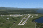
CYQQ (2010) portrays Canadian Forces Base Comox (Vancouver Island, British Columbia, Canada) (CYQQ), the Comox Valley Air Terminal and surrounding area. It is fully compatible with Ultimate Terrain Canada/Alaska for FS2004, Ultimate Terrain X - Canada for FSX and ORBX's FTX NA Blue. CYQQ (2010) includes over 100 "hand-crafted" buildings and other structures and 10 different vintage aircraft on static display, as well as aircraft and traffic files for a realistic AI scenario that causes a variety of military aircraft that come and go. (Use BC Regional AI - also available from this file library - for scheduled traffic.) Civilian AI is now routed so as not to transit military aprons.
Aside from the new approach lighting, generally, this new version is visually identical to its predecessor - even though quite different internally. As well, to the extent possible, it is compatible with Prepar3Dv2.
| Filename: | CYQQ_2010_Version_2_for_FS9_FSX_and_Prepar3D.zip |
| License: | Freeware, limited distribution |
| Added: | 20th June 2014, 11:39:47 |
| Downloads: | 11,046 |
| Author: | Don Grovestine |
| Size: | 33.19 MB |
| Category: Flight Simulator X - Aircraft Repaints, Textures and Modifications | |
| Fokker 100 Repaint Mega Pack Part One |
|
Images related to this file:
File Description:
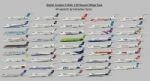
This is a repaint pack for the Digital Aviation Fokker 100. I have included 44 repaints of airlines from all over the world. There are some fictional and some real repaints included, so you can fly with this aircraft everywhere! The following airlines are included: China Eastern, Skyways, Merpati Nusantara, Carpatair, Belleair, Air France by Regional, Dutch Antilles Express, Korean Air, Montenegro Airlines, Skywest, Spanair, South African Airways, ANA, Tunisair, Nigerian Eagle, Aerolineas Argentinas, Royal Jordanian, Fly Be, United, S7, TAME, PIA Pakistan International, Precision Air, Thai International Airlines, Alaska Air, Olympic Air, Delta, Air Baltic, TAM, Kenya Airways, Iberia, Lan, British Airways, Air Canada, Alitalia, Philippine Airlines, SAS, Lufthansa, Air Caraibes, Continental, UTair, Air China, Dragonair and Turkish Airlines!
IMPORTANT: This is part one of the repaint pack, you will need part two, in order to have all repaints: DA_Fokker100_repaintmegapack_part_TWO.zip
By Sebastian Szucs
| Filename: | Fokker_100_Repaint_Mega_Pack_Part_One.zip |
| License: | Freeware, limited distribution |
| Added: | 11th May 2010, 21:31:44 |
| Downloads: | 7,163 |
| Author: | Sebastian Szucs |
| Size: | 84.6 MB |
| Category: Flight Simulator X - Aircraft Repaints, Textures and Modifications | |
| Fokker 100 Repaint Mega Pack Part Two |
|
Images related to this file:
File Description:
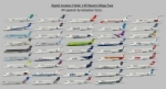
This is a repaint pack for the Digital Aviation Fokker 100. I have included 44 repaints of airlines from all over the world. There are some fictional and some real repaints included, so you can fly with this aircraft everywhere! The following airlines are included: China Eastern, Skyways, Merpati Nusantara, Carpatair, Belleair, Air France by Regional, Dutch Antilles Express, Korean Air, Montenegro Airlines, Skywest, Spanair, South African Airways, ANA, Tunisair, Nigerian Eagle, Aerolineas Argentinas, Royal Jordanian, Fly Be, United, S7, TAME, PIA Pakistan International, Precision Air, Thai International Airlines, Alaska Air, Olympic Air, Delta, Air Baltic, TAM, Kenya Airways, Iberia, Lan, British Airways, Air Canada, Alitalia, Philippine Airlines, SAS, Lufthansa, Air Caraibes, Continental, UTair, Air China, Dragonair and Turkish Airlines!
IMPORTANT: This is part two of the repaint pack, you will need part one, in order to have all repaints: DA_Fokker100_repaintmegapack_part_ONE.zip
By Sebastian Szucs
| Filename: | Fokker_100_Repaint_Mega_Pack_Part_Two.zip |
| License: | Freeware, limited distribution |
| Added: | 11th May 2010, 23:12:36 |
| Downloads: | 6,588 |
| Author: | Sebastian Szucs |
| Size: | 89.97 MB |
| Category: Flight Simulator X - Utilities | |
| FS Earth 5.2 for Google Earth and FSX |
|
Images related to this file:
File Description:
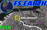
This program acts as a link between Flight Simulator X and Google Earth, letting to follow a flight in real time, over the satellite images generated by Google Earth. Flights can be saved, and many options are available for fine tuning the performance, as well as the map's style (zoom, tilt, orientation). Works on a single computer running FSX and Google Earth all together or, for best experience, can be used on two networked computers running respectively FSX (master) and Google Earth (slave). AI and Multiplayer traffic is also displayed in Google Earth, with course prediction and other information. Requires Flight Simulator X and Google Earth. The program running in trial mode works only around Anchorage, Alaska, (PANC / ANC) for a maximum of five minutes per flight session. Version 5.2 has new aircraft icons & labels and improves the compatibility with Windows Vista. A version for FS2004 is available also.
| Filename: | FS_Earth_52_for_Google_Earth_and_FSX.zip |
| License: | Shareware, time limited |
| Added: | 3rd May 2010, 07:38:23 |
| Downloads: | 2,702 |
| Author: | Luciano Napolitano |
| Size: | 3.46 MB |
| Category: Flight Simulator 2004 - Scenery | |
| Point Ellis cannery V1, for Holger Sandmann's Tongass Fjord scenery |
|
Images related to this file:
File Description:
This is a revised version of Point Ellis cannery, originally posted in 2007. It is unsurprisingly just east of Point Ellis, on the east side of the southern end of Chatham Strait in southern Alaska. It is marked on the chart of the area, and if you are chartless then there is a piece of the chart here. This scenery is designed specifically for use in the Tongass Fjord scenery, and probably doesn't work with just Ultimate Terrain. The cannery has an identifying code so it will show up on a gps as "PECA". There is no interaction with atc as there are no designated water runways, so the "PECA" on the gps just acts as a waypoint. There will be further posts for use with Tongass Fjords, Misty Fjords, and Glacier Bay, and I still find these scenery areas by Holger and his crew the most satisfying in FS9.
| Filename: | Point_Ellis_cannery_V1_for_Holger_Sandmanns_Tongas.zip |
| License: | Freeware, limited distribution |
| Added: | 6th November 2014, 21:55:48 |
| Downloads: | 239 |
| Author: | Roger Wensley |
| Size: | 3.86 MB |
| Category: Flight Simulator X - Flight Plans | |
| Chas mod of Stearmandriver RNP RNAV Approach into PAJN Rwy 26 for 737NGX |
|
Images related to this file:
File Description:
Modded StearmanDriver(SD) RNP RNAV Rwy 26 into PAJN, Juneau, Alaska. SD gave us a cool little route that while not LATLONG nor Fixname accurate, it couldn't be without legal and occupational liabilities...and it worked, but if you look at his FixNames and the LATLONG from the PAJN.txt file for the 737 NGX...it did work pretty nicely...at least as nicely as the charted RNAV course into Rwy 8. So I created my own procedure LATLONG rightly or wrongly in a multi-step procedure as follows:
1. I took the raw info provided by SD and flew to each of his waypoints,(if you look, almost all of his FIXs were rounded off...to avoid company or legal problems) noting safe altitude, starting out at 7000ft, creating user waypoints in my GTN750, looking around for first, vertical, then horizontal safety...keeping in mind that Ultimately...I would not be using this data for my Duke, but for the Procedure page of my PMDG 737 NGX..which you already saw me fly with SD's fixes.
2. I took my Turbine Duke up and noted the REAL LATLONG as reported by slewing and world map...transposed those numbers into the format that PMDG's procedures needed DDD.mm fractional minutes. I converted using http://www.directionsmag.com/site/latlong-converter/
3.I created my own mid-point user waypoints from the west CHRTRN,and the NNE CHRTS so we could have approaches from those directions.
4. I put my Duke into autopilot, knowing the lateral info...my flightplan was correct, but I would have to handle the Vnav manually. Turns out its rather manageable with the following info: CHRTRN 5000FT - MARMN 3500FT - TRDWL 2500FT - SALMN 1500 - LEMNN 500 - PAJN5 50
My MOD OF SDs RNP RNAV PAJNRwy 26, will be up on Avsim as ChasModRNP RNAV PAJN Rwy 26.zip
Contact:[email protected] - Support: http://forum.avsim.net/topic/466094-any-interest-in-updated-se-alaska-rnav-rnp-approach-procedures-including-juneau/
| Filename: | Chas_mod_of_Stearmandriver_RNP_RNAV_Approach_into_.zip |
| License: | Freeware |
| Added: | 8th May 2015, 11:35:16 |
| Downloads: | 340 |
| Author: | Chas Reed |
| Size: | 144.78 KB |


© 2001-2026 AVSIM Online
All Rights Reserved
Privacy Policy |