
Where Flight Simulation Enthusiasts Gather from Around the World!
AVSIM Library - Search Results

| Category: Flight Simulator X - AFCAD Files | |
| Fly-N-D Landing Strip Airport (92NJ), NJ |

|
File Description:
Located 01 miles E of Kingwood Township, New Jersey on 121 acres of land, Fly-N-D Landing Strip Airport is a private turf field with a 2200' runway. There is no hard surface runway so setting your mesh as high as possible will lead to the best effects of landing on terrain. No transient storage or services are offered, and the airfield is not lit, so daytime VFR operations are recommended only.
Scenery constructed with use of satellite images/streetview/aerial photos - the author has not been there in person.
This scenery is meant to be used in conjunction with MegaScenery Earth New Jersey/Delaware 001. It is not required, but apron use is minimized to allow satellite scenery to show through as much as possible, and objects are placed based on the MSE textures - lack of it may make scenery look out of place.
| Filename: | FlyND_Landing_Strip_Airport_92NJ_NJ.zip |
| License: | Freeware |
| Added: | 23rd March 2011, 13:33:27 |
| Downloads: | 174 |
| Author: | Drew Sikora |
| Size: | 474.94 KB |
| Category: Flight Simulator X - Scenery | |
| France Vendee (86) - LF8523 Atlantic Airpark V2 |
|
Images related to this file:
File Description:
Version 2 because the version V1 didn't include chasnay.bgl file ...
A french scenery just for fun = Atlantic Aeropark near Chasnais and Lucon towns in Vendee country in France.
There are few aeropark in France. I created airport and some houses with planes for 4.75 precision mesh. There is a little problem with flat tile but it was too long to correct this. Never mind it's not very problematic.
It's just for fun to fly in Vendee ...
You can use library for your own scenery if you want. You can update this scenery but, please, make this free for FSX community. See http://www.atlanticairpark.com/ for map and details on real world.
For installation, you just unzip in addon scenery path
and you have to declare in parameters of fsx the scenery repertory (as usual). Vladimir Corre. Contact: [email protected]
| Filename: | France_Vendee_86__LF8523_Atlantic_Airpark_V2.zip |
| License: | Freeware |
| Added: | 3rd October 2015, 18:31:57 |
| Downloads: | 461 |
| Author: | Vladimir Corre |
| Size: | 1.29 MB |
| Category: X-Plane - Scenery | |
| WW32 Susi Air Nevere v1.0.0 |
|
Images related to this file:
File Description:
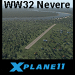
This is an X-Plane 11 scenery for Nevere Airstrip (WW32) in Nevere, Papua, Indonesia. This is one of the destinations for "PT ASI Pujiastuti Aviation", operating as Susi Air, an Indonesia airlines established in late 2004 by Mrs. Susi Pudjiastuti. This scenery was tested and is operational (as of January 08, 2017) in "X-Plane 11 Public Beta #5 64 bit", Windows 10 Home. It was also tested but is partially operational (as of January 08, 2017) in "X-Plane 10.51 64 bit", Windows 10 Home. The XP10.51 mesh presents no river, hence there is no water for the sealane water runway 11/29 to work properly. It will look weird because of the absence of teh river. Despite this issue with the rwy 11/29, the other two runways (10/28 dirty and 02/20 grass) both work nicely and are very much usable.
| Filename: | WW32_Susi_Air_Nevere_v100.zip |
| License: | Freeware |
| Added: | 9th January 2017, 15:02:07 |
| Downloads: | 60 |
| Author: | Rui Mesquita |
| Size: | 2.9 MB |
| Category: X-Plane - Scenery | |
| WXPN Susi Air Pulau Nurseen Airstrip v1.0.0 |
|
Images related to this file:
File Description:

This is an X-Plane 11 scenery for Pulau Nurseen Airstrip (WXPN) in the Island of Nurseen, Indonesia. This is a fictitious airfield, located in a tiny isolated island. This fictitious airfield may serve as a stopover for flights between Java and Papua, for the Susi Air scenery package. This is one of the destinations for "PT ASI Pujiastuti Aviation", operating as Susi Air, an Indonesia airlines established in late 2004 by Mrs. Susi Pudjiastuti. This scenery was tested and is operational (as of January 17, 2017) in "X-Plane 11 Public Beta #5 64 bit", Windows 10 Home. It was also tested and is not really operational (as of January 17, 2017) in "X-Plane 10.51 64 bit", Windows 10 Home. XP10's mesh is different, and presents problems in placing the runway over the water, instead of the land, plus some terrain elevations issues as well. Sorry, XP11 only.
| Filename: | WXPN_Susi_Air_Pulau_Nurseen_Airstrip_v100.zip |
| License: | Freeware |
| Added: | 18th January 2017, 05:00:53 |
| Downloads: | 45 |
| Author: | Rui Mesquita |
| Size: | 2.65 MB |
| Category: X-Plane - Scenery | |
| WIPB Susi Int'l Pangandaran Beach Airstrip v1.0.0 |
|
Images related to this file:
File Description:

This is an X-Plane 11 scenery for the Susi Int'l Pangandaran Beach Airstrip (WIPB) in Pangandaran, West Java, Indonesia. This is a real private airfield, 9nm east of the Susi Air's headquarters at WICN/WI1A airport. This airfield is one of the destinations for "PT ASI Pujiastuti Aviation", operating as Susi Air, an Indonesia airlines established in late 2004 by Mrs. Susi Pudjiastuti. This scenery was tested and is operational (as of January 20, 2017) in "X-Plane 11 Public Beta #8 64 bit", Windows 10 Home. It was also tested and is partially operational (as of January 20, 2017) in "X-Plane 10.51 64 bit", Windows 10 Home. The issue with XP10 is the mesh again: there is a road crossing the airfield, by the end of rwy 28. If you can live with that, it's still operational in XP10, as a courtesy.
| Filename: | WIPB_Susi_Intl_Pangandaran_Beach_Airstrip_v100.zip |
| License: | Freeware |
| Added: | 21st January 2017, 18:45:03 |
| Downloads: | 40 |
| Author: | Rui Mesquita |
| Size: | 1.74 MB |
| Category: Flight Simulator 2002 - Miscellaneous Files | |
| Los Angeles Terminal Area Chart |
|
File Description:
The rendition of Los Angeles´ KLAX airport is one of the most detailed in FS2002 and a great starting point to explore the West Coast. The library hosts a few awesome landclass and mesh files for this area that offer an "as real as it gets" VFR experience if used with this chart. The 1:250.000 scaled chart is scanned in high resolution (8400*4700 pixel). It covers a much smaller area, but offers considerably more detail than the LA sectional. You may use this chart "as is" without any other software, but it will develop its full potential if used as moving map with SimSystem´s FSFlightMax or FSGarmin. It wouldn´t have been possible to offer this chart without Richard Harvey and his love to flightsimming, so please consider this file to be "donationware" and make a however small contribution to the Richard Harvey Endowed Scholarship.
| Filename: | Los_Angeles_Terminal_Area_Chart.zip |
| License: | Check within download |
| Added: | 30th March 2003, 15:27:19 |
| Downloads: | 1,472 |
| Author: | Uwe Rademacher |
| Size: | 28.03 MB |
| Category: Flight Simulator 2002 - Scenery | |
| British Farm Strips: Eastbach, Milson, & Nayland |
|
File Description:
Three interesting small English farm strips. Nayland is in Suffolk, near Colchester - the main 600m grass strip has a gradient of 8% in its first half:
probably the closest you'll get in Britain to one of the French alpine runways like Courchevel or Megève. Milson is in rural Shropshire on the side of a shallow valley; it has both a helipad & a 450m grass strip - most of which is on a fairly gentle 3.5% slope apart from the last 70 feet which rises up more steeply. The two runways at Gloucestershire's Eastbach Farm, on the edge of the Forest of Dean, are also on a slight slope but most of the excitement comes from their short length (250m & 350m respectively) - ideal for microlights and STOL planes. All three airfields are compatible ONLY with LAGO's TerraMesh Part 13 of England & Wales - no other mesh will work.
| Filename: | British_Farm_Strips_Eastbach_Milson__Nayland.zip |
| License: | Freeware, limited distribution |
| Added: | 31st March 2003, 13:05:02 |
| Downloads: | 1,298 |
| Author: | James Belk |
| Size: | 2.73 MB |
| Category: Flight Simulator 2002 - Scenery | |
| British Columbia Bush Scenery: Grant Narrows & Rambo's Hideout |
|
File Description:
The larger runway at Grant Narrows has a 15 degree bend, and the shorter runway is on a slope that involves an unconventional downhill landing & an uphill take-off (STOL planes only!). Both strips are bumpy, and require Holger Sandmann's mesh of the Lower Mainland of Southern British Columbia (bcmesh9c.zip) for the required effect. A dock is provided down on the lake shore for visitors on floats. The landing strips are fictional, set in an area of wilderness on the shores of Pitt Lake - but only 20 miles from downtown Vancouver. The first Rambo movie was filmed in the hills just to the east in the Golden Ears Provincial Park: if you fly north from Grant Narrows you'll find Rambo's airstrip hideout just a couple of miles past the end of the lake - the real life location of a popular fishing lodge. Also requires Gerrish Gray's trees (trees_v3.zip).
| Filename: | British_Columbia_Bush_Scenery_Grant_Narrows__Rambo.zip |
| License: | Freeware, limited distribution |
| Added: | 13th March 2003, 21:26:06 |
| Downloads: | 946 |
| Author: | James Belk |
| Size: | 1.74 MB |
| Category: Flight Simulator 2004 - Scenery Design | |
| ResampleTools V.095Beta |
|
File Description:
ResampleTools is a great little utility that helps you automate the import of Mesh or Photo Real scenery into
Flight Simulator 200x. The interface is a simple 4 or 6 step wizard depending
on what you are importing and the information you have about your source files.
FS Resample Tools can help you determine the extents of your bitmap source if
you don't already know them (all four corners in degrees) and will also
determine the CellX and CellY sample or pixel width from those corner extents among others.
This is a beta version and there will be no more updates as work on this tool stoped a while ago but the author has been kind enough to allow distribution to all who might enjoy using it,(note: this may have been replaced by Elronds "imagetool" also available soon in this library).
Works with FS2000/FS2002 and FS2004.
| Filename: | ResampleTools_V095Beta.zip |
| License: | Freeware, limited distribution |
| Added: | 21st September 2003, 18:50:03 |
| Downloads: | 1,621 |
| Author: | Elrond Elvish |
| Size: | 728.39 KB |
| Category: Flight Simulator 2004 - Scenery | |
| The Victoria Falls of the Zambezi River, Zambia/Zimbabwe |
|
File Description:
One of the main landmarks of Africa, the spectacular Victoria Falls of the Zambezi River are missing in out-of-the-box FS. With a local SRTM LOD9 mesh as a base (included) and the help of satellite imagery, maps, Ground2K4, and GMax, we did our best to model a realistic representation of the falls, the river, and the gorge, complete with custom waterfall and spray effects. The portion of the Zambezi covered in this project extends from E25 to E26.5 (more than 100km), with the falls at its center. Also included is a replacement landclass file for an area of about 20km on either side of the Zambezi River and an optional AI boat (by Lynn and Bill Lyons) cruising on the Zambezi above the falls. Tested with FS2004 only but most scenery enhancements (not the AI boat) should work just as well in FS2002.
| Filename: | The_Victoria_Falls_of_the_Zambezi_River_ZambiaZimb.zip |
| License: | Freeware, limited distribution |
| Added: | 8th May 2004, 02:45:30 |
| Downloads: | 19,147 |
| Author: | Holger Sandmann and Johan van Wyk, Aeroworx |
| Size: | 3.5 MB |


© 2001-2026 AVSIM Online
All Rights Reserved
Privacy Policy |