
Where Flight Simulation Enthusiasts Gather from Around the World!
AVSIM Library - Search Results

| Category: Flight Simulator 2004 - Scenery | |
| New York City Default Bridges and Objects v2.0 |

|
File Description:
I originally planned on "fixing" the George Washington Bridge, which was inadvertantly "sunk" by FSG's 38m mesh, and ended up repositioning and scaling a whole bunch of other default bridges and objects within about 50 miles of NYC. This addon was designed and tested for use with FS 9.1, FSG 38m mesh (available here at AVSIM), and Freeflow NE, UT/USA and USA Roads. It should also work with other road and water packages. I did not create any new scenery, I only repositioned default objects to their correct locations.
This should be the final version for a while. This version was tested with and adds compatibility for Megascenery NY and Aerosoft's Manhattan scenery. I also removed a few more objects that were placed in the water, and moved back to land a bunch of cranes around KEWR that were in the water.
Fixed stuff: All inappropriately placed NYC and Newark bridges (major, not autogen) up to Bear Mountain in the north and south to about the Verrazanno; Belmont Racing track; Shea Stadium; Meadowlands Stadium; World's Fair Tower; US Open Stadium. Added Meadowlands Race track and a few bridges around Newark, moved cranes around KEWR back to land, removed several objects in the water.
| Filename: | New_York_City_Default_Bridges_and_Objects_v20.zip |
| License: | Freeware |
| Added: | 10th November 2005, 16:48:46 |
| Downloads: | 6,561 |
| Author: | Thomas Perry |
| Size: | 558.69 KB |
| Category: Flight Simulator 2004 - Scenery | |
| Frozen rivers and lakes (and sea) for Alaska's winter |
|
Images related to this file:
File Description:
This "freezes" all lakes and rivers (and some sea) for winter flying and means they can be landed on with skis or wheels; it is meant for low level flying rather than high level jet flights. This edition covers all of Alaska, except for the Aleutian Islands, as the worst area to do this for is a string of islands. Terrible. Fiddly. It is reversible with an "untick" in the FS scenery library. I have spent some time making sure that the sea and the larger inlets along the southern coast do not get frozen too as they stay ice-free in winter. Along the north shore I went for the peak of the winter with sea ice all the way to the permanent polar cap; this is not totally realistic as there is usually a partially open lead along the coast, but anything else would be ...... fiddly. This is really for use with Ultimate Terrain, though it will work without it. But as UT is what gets all the lakes and rivers there and in the right place it would be a shame not to be using UT. There is a blurry transition between southern Alaska and Canada so you may need the recent Canada post too.
| Filename: | Frozen_rivers_and_lakes_and_sea_for_Alaskas_winter.zip |
| License: | Freeware, limited distribution |
| Added: | 8th September 2011, 11:53:51 |
| Downloads: | 681 |
| Author: | Roger Wensley |
| Size: | 493.23 KB |
| Category: Prepar3D V1-4 - Miscellaneous Files | |
| RNP Approach Procedures for Southeast Alaska, for use with the PMDG 737 NGX |
|
File Description:
These are updated RNP procedures used in Southeast Alaska in conjunction with the PMDG 737.
While similar procedures exist else ware, the goal of these was not to code the exact procedure that is used in real world ops. The reason is because the PMDG 737 isn't capable of flying radius fix legs, which are used extensively in RNP procedures. If the approach and departures are coded as they are in the real aircraft, the flight path is not accurate. All other procedures I have located out there exhibit this limitation, which leads to unstabilized approaches.
The goal with these procedures is to have the PMDG 737 fly the same flight path as the real world procedures. Many of the fixes loaded into the FMS are sudo waypoints but as many of the true fixes are utilized to the extent possible. This means, when you arrive at minimums for the RNP 05 at Petersburg or the RNP 29 at Sitka, very little maneuvering will be required. Installation is a little tedious but will be well worth is.
Included airports and procedures:
Juneau - PAJN
CHLKT1
GLAZZ1
RODMN1
RNAV (RNP) M 08
RNAV (RNP) M 26
Ketchikan - PAKT
ANN3
DOOZI2
UDENE3
RNAV (RNP) M 11
RNAV (RNP) M 29
Petersburg - PAPG
GORBY4
HURAS2
RNAV (RNP) M 05
RNAV (RNP) M 23
Sitka - PASI
RNAV (RNP) M 11
RNAV (RNP) M 29
Wrangle - PAWG
KAJBU5
RNAV (RNP) M 10
RNAV (RNP) M 28
| Filename: | RNP_Approach_Procedures_for_Southeast_Alaska_for_u.zip |
| License: | Freeware |
| Added: | 31st March 2018, 03:31:12 |
| Downloads: | 841 |
| Author: | Trevor Lahey |
| Size: | 10.78 KB |
| Category: Flight Simulator 2004 - Scenery | |
| Bethel: St Mary's area airfields in southwest Alaska close to the Yukon River |
|
Images related to this file:
File Description:
This presumes you have already installed Bethel PABE and Bethel Local Airfields. In the Yukon River area of Alaska to the north of Bethel there are small villages, served by flights from both Bethel and the nearer St Mary's PASM. St Mary's has a gravel runway like the other villages, but has a larger population and airport services including maintenance and fuel. This, plus the saving of an average one hundred miles of flying by a Cessna 205 when compared with flights from Bethel, means it acts as a distribution centre fed from Bethel by larger aircraft. Go to "http://vfrmap.com/" for free vfr maps of the area (see the attached). The ten village airfields included here are all to the north and west of St Mary's: Hooper Bay PAHP, Chevak VAK, Cape Romanzof PACZ (closed air force field servicing a radar station), Scammon Bay SCM, Sheldon Point SXP, Alakanuk AUK, Emmonak PAEM, Kotlik 2A9, Mountain Village MOU, and of course St Mary's PASM itself. With these airfields not everything is as it appears to be. For instance, Hooper Bay is not a new and modernised airfield, despite the asphalt runway and apron; the current version has dispensed with the aging asphalt and gone back to gravel. I have tended to go for the 2005 or so versions, which sometimes means a small runway amid or close to the housing; Kotlik was an early renewal for reasons of safety as much as anything else and has had (since 2003?) a new and longer runway located outside of the town. The second batch of airfields will be to the east of St Mary's.
| Filename: | Bethel_St_Marys_area_airfields_in_southwest_Alaska.zip |
| License: | Freeware, limited distribution |
| Added: | 29th April 2019, 17:07:24 |
| Downloads: | 227 |
| Author: | Roger Wensley |
| Size: | 11.53 MB |
| Category: Flight Simulator 2004 - Scenery | |
| Byron Bay, Cape Dyer, Cape Hooper, Dewar Lakes, and Durban Island adapted for the FSGenesis 76m North Canada Terrain Mesh |
|
Images related to this file:
File Description:
These are replacement bgl's to convert five northern Canada fields for use with the FSGenesis 76m terrain mesh for northern Canada. The five are Byron Bay CWBB, Cape Dyer CWFD, Cape Hooper CWFH, Dewar Lakes CWFL, and Durban Island CWFB. These are not stand-alone, and the presumption is that you have already downloaded and installed the previously posted sceneries. The installation consists solely of replacing the existing scenery bgl's with the new. There will be further posts of northern airfields in groups of five, alphabetically, and observations regarding the amendments and any further corrections that are required would be welcomed.
| Filename: | Byron_Bay_Cape_Dyer_Cape_Hooper_Dewar_Lakes_and_Du.zip |
| License: | Freeware, limited distribution |
| Added: | 3rd September 2017, 20:01:55 |
| Downloads: | 73 |
| Author: | Roger Wensley |
| Size: | 3.49 MB |
| Category: Flight Simulator 2004 - Scenery | |
| Edinburgh Island, FOX-2, Horton River, Igloolik, & Kimmirut, adapted for the FSGenesis 76m North Canada Terrain Mesh |
|
Images related to this file:
File Description:
These are replacement bgl's to convert five northern Canada fields for use with the FSGenesis 76m terrain mesh for northern Canada. The five are Edinburgh Island CWEI, the FOX-2 DEW line station, Horton River CWHR, Igloolik CYGT, and Kimmirut CYLC. These are not stand-alone, and the presumption is that you have already downloaded and installed the previously posted sceneries. This installation consists solely of replacing the existing scenery bgl's with the new. There will be further posts of northern airfields in groups of five, alphabetically, and observations regarding the amendments and any further corrections that are required would be welcomed.
| Filename: | Edinburgh_Island_FOX2_Horton_River_Igloolik__Kimmi.zip |
| License: | Freeware, limited distribution |
| Added: | 10th September 2017, 19:29:57 |
| Downloads: | 86 |
| Author: | Roger Wensley |
| Size: | 3.55 MB |
| Category: Flight Simulator 2004 - Scenery | |
| Private Strips - revisited |
|
File Description:
Herewith my previously uploaded collections of various Private/Extra/Grass/Microlight/Miscellaneous etc. airfields from around England and Wales, all now in one place and re-edited with parking and taxiways for the facilitation of ai aircraft.
Please note :- these sceneries have been designed for use in FS2004 with the original UK VFR Photographic scenery and mesh. They rely for details on the "usual" collections of library objects, specifically EZ-Scenery, UKVFR and Rwy12 libraries. Whilst other configurations will probably work, to a degree, you'll have to try them and see if they suit you.
See the enclosed ReadMe for further details.
| Filename: | Private_Strips__revisited.zip |
| License: | Freeware |
| Added: | 6th March 2021, 16:15:32 |
| Downloads: | 156 |
| Author: | Chris Eve |
| Size: | 2 MB |
| Category: Flight Simulator 2004 - Scenery | |
| Hauraki Gulf, v6 |
|
Images related to this file:
File Description:
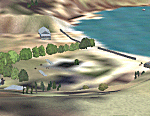
This replaces all my previous Pakatoa Island and Hauraki Gulf sceneries. You must have Christian Stock's NZ mesh in the form of "Mountains of New Zealand" and topo in the form of "Lakes and Rivers of New Zealand" (payware).
New additions...PAKIHI ISLAND: Small jetty and nearby buildings. TAKANGAROA ISLAND: House on Island. House & Jetty island north of Takangaroa Island. MOTUREKAREKA ISLAND: Wreck of the Rewa. PONUI ISLAND: Chamberlain's Bay Airstrip. Chamberlain's Donkey Farm. Third Bay Airstrip. Motunau Bay Jetty. KARAMURAMU ISLAND: Jetty and quarry. ROTOROA ISLAND: Rotoroa Jetty. MOTUIHE ISLAND: Motuihe Wharf.
| Filename: | Hauraki_Gulf_v6.zip |
| License: | Freeware |
| Added: | 17th April 2010, 16:10:12 |
| Downloads: | 218 |
| Author: | Godfrey Tier |
| Size: | 6.61 MB |
| Category: X-Plane - Scenery | |
| WA0B Susi Air Idedua Airstrip v1.0.0 |
|
Images related to this file:
File Description:

This is an X-Plane 11 scenery for Idedua Airstrip (WA0B) in Idedua, Papua, Indonesia. This is one of the destinations for "PT ASI Pujiastuti Aviation", operating as Susi Air, an Indonesia airlines established in late 2004 by Mrs. Susi Pudjiastuti. This scenery was tested and is operational (as of January 10, 2017) in "X-Plane 11 Public Beta #5 64 bit", Windows 10 Home. It was also tested and is partially operational (as of January 10, 2017) in "X-Plane 10.51 64 bit", Windows 10 Home. XP10's runway presents a much higher runway slope, given mesh issues.
| Filename: | WA0B_Susi_Air_Idedua_Airstrip_v100.zip |
| License: | Freeware |
| Added: | 13th January 2017, 20:10:39 |
| Downloads: | 97 |
| Author: | Rui Mesquita |
| Size: | 1.99 MB |
| Category: Orbiter - Miscellaneous Files | |
| Mars Softlanding Sites and Approach Paths V 1.02 |
|
File Description:
With this addon you can see where are located 6 softlanding sites on Mars.
You can also get experience (feel taste) of Mars approach and Mars landing.
Included scenarios brings you on approach path few hours before Mars landing (or swingby) of these spacecrafts: Nozomi orbiter, Mars Express orbiter, Beagle 2 lander, MER Spirit lander, MER Opportunity lander). For better experience some lander scenarios uses MER meshes from Ariane 5 MER addon. Other scenarios not requires any Orbiter addon installed, because they only uses DeltaGlider for simulation.
You can also use other or future mesh models for simulation (if will be available).
| Filename: | Mars_Softlanding_Sites_and_Approach_Paths_V_102.zip |
| License: | Freeware |
| Added: | 13th January 2004, 15:37:49 |
| Downloads: | 1,096 |
| Author: | Ales Holub |
| Size: | 16.04 KB |


© 2001-2026 AVSIM Online
All Rights Reserved
Privacy Policy |