
Where Flight Simulation Enthusiasts Gather from Around the World!
AVSIM Library - Search Results

| Category: Flight Simulator 2004 - Miscellaneous Files | |
| Ethiopia - Ras Dashen (Highest Mountains Package 003) |

|
File Description:
This is the flight package "003 Ethiopia Ras Dashen" of the series "Highest Mountains - of all Countries of the World". Flying around for sightseeing is one of the countless options you can do with MS Flight Simulator 2004. Mountain areas are a good choice for looking around, especially if you have a high quality mesh available for those areas. Why not travel to the highest mountain of each country of the world and have a flight from a near airfield up to the roof. With this flight package you will get a ready to fly programmed flight file, including a flight plan for GPS, an interactive map within the kneeboard using GoogleMaps showing the flight path while flying, a weather file generated with ActiveSky 6.5, GPS measured airfields, high quality mesh data for this area, a lot of GA traffic flying around, AI helicopters (not with this package) flying around and coming close to you and some other cool effects you will discover while flying.
| Filename: | Ethiopia__Ras_Dashen_Highest_Mountains_Package_003.zip |
| License: | Freeware |
| Added: | 6th October 2007, 13:55:52 |
| Downloads: | 446 |
| Author: | Gerhard Scheuerecker |
| Size: | 40.04 MB |
| Category: Flight Simulator X - Scenery | |
| Cape_Verde_Mesh |
|
File Description:
To improve performance, FSX updated with SP1 loads DEM files in threads and only
the closer terrain (about 10 NM from the point of view) is rendered in high
detail, while at far distances FSX shows up its default low resolution mesh,
if it is not available a multi-resolution one. This terrain mesh file was multilod compiled from 90m SRTM2 source data, reprocessed with 3DEM to remove voids and spikes, providing a 76.4m (LOD9) horizontal resolution topography intended
for use only in FSX updated with SP1.
It covers the Cape Verde, a group of islands in the North Atlantic Ocean, that consist of two small archipelagos, about 400 miles off the western coast of Senegal (Africa), including: Boa Vista, Brava, Maio, Mosteiros, Paul, Praia, Porto Novo, Ribeira Grande, Sal, Santa Catarina, Santa Cruz, Sao Domingos, Sao Filipe, Sao Miguel, Sao Nicolau, Sao Vicente and Tarrafal (Geographic coordinates: 16ºN/24ºW).
Authors:
Hely Heck Junior - Magrao ( [email protected] ) and Jose Lobo (
[email protected] ) TerraBrasilis: www.terra-brasilis.org
| Filename: | Cape_Verde_Mesh.zip |
| License: | Freeware |
| Added: | 21st June 2007, 16:26:23 |
| Downloads: | 4,335 |
| Author: | Hely Heck Jr. and José Lôbo |
| Size: | 1.55 MB |
| Category: Flight Simulator 2004 - Scenery | |
| Exploring Mt Rainier Natl Park v1.1 |
|
File Description:
Exploring Mt Rainier Natl Park v1.1
UPDATE! Includes missing textures which resulted in some users experiencing CTD and freezes. A complete remapping of Mount Rainier National Park in Washington State. Based upon commercial topographic maps, the designed scenery includes, every hiking trail drawn in meticulous detail including every real life switchback; every lake and small alpine pond 20 feet in diameter and over, modified landclass of alpine, forest & rock; every perennial and many intermittent creeks, all steams and rivers (many braided), a complete glacier mapping of every glacier with custom textures and ice fields on the mountain, a complete mapping of all rock faces and rock, moraine rock deposits, glacier outwash area, mudflows, roads, swamp and marsh areas. Includes some effects. Designed to compliment UT USA and any LOD 9 or 10 mesh. Works well with FS Genesis LOD 10 mesh and Birds Eye View Textures. By Bryan Wallis and Lou Frost.
| Filename: | Exploring_Mt_Rainier_Natl_Park_v11.zip |
| License: | Freeware, limited distribution |
| Added: | 18th February 2006, 23:14:40 |
| Downloads: | 4,152 |
| Author: | Bryan Wallis & Lou Frost |
| Size: | 11.61 MB |
| Category: Flight Simulator 2004 - Scenery | |
| Quebec sceneries Enhancements |
|
File Description:
The files in this package contain enhanced sceneries of the province of Quebec, Canada (for FS2004 only). It's update for some islands of St.Lawrence river with much more new enhanced sceneries (see file list in Files_List.txt). Must be used with new terrain mesh for parts of the province of Quebec : QC09_2k4a.zip to QC09_2k4d.zip in AVSIM library.
Les fichiers contenus dans cette archive sont une mise � jour des sc�¨nes des �®les du fleuve Saint-Laurent avec un ajout important de nouvelles sc�¨nes. Vous en trouverez la liste compl�¨te dans le fichier �«Liste_fichiers.txt�». Pour ces sc�¨nes, l'utilisation du nouveau mesh du Qu�©bec pour FS2004 est indispensable. Vous les trouverez dans la biblioth�¨que d'AVSIM. Ils sont archiv�©s en quatre (4) parties : QC09_2k4a.zip � QC09_2k4d.zip.
| Filename: | Quebec_sceneries_Enhancements.zip |
| License: | Freeware, limited distribution |
| Added: | 1st November 2009, 06:48:12 |
| Downloads: | 4,962 |
| Author: | Gilles Gauthier |
| Size: | 4.15 MB |
| Category: Flight Simulator X - Aircraft Repaints, Textures and Modifications | |
| Aerosoft F-16C 86-310 Digital Green Camo Alaska Aggressor repaint textures |
|
Images related to this file:
File Description:
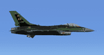
This is a fictional "Digital" repaint of the Alaska Green Splinter 86-310 using the blue Ghost Aggressor pattern as a model (Nellis Ghost Aggressor 84-1220 on Avsim). I had fun with the "paint bucket" feature in Photoshop and conjured up 4 fictional Digital paint schemes based on the 4 REAL F-16's and their current color schemes. I've posted them all on Avsim so pick YOUR favorite!
| Filename: | Aerosoft_F16C_86310_Digital_Green_Camo_Alaska_Aggr.zip |
| License: | Freeware |
| Added: | 30th January 2021, 02:55:09 |
| Downloads: | 83 |
| Author: | Daniel W Gregory |
| Size: | 13.33 MB |
| Category: Flight Simulator 2002 - Scenery | |
| Moser Bay |
|
File Description:
FS2002 Scenery - Moser Bay, Alaska.
Located at the south end of Kodiak Island this
is an enhancement of the default seaplane base.
This scenery is fictional but it is very loosly
based on what you would find there in reality.
There are five start locations, two on land and
three on water. Many custom objects were created
for this project. Photoreal textures with
seasonal and night lighting changes.
| Filename: | Moser_Bay.zip |
| License: | Freeware, limited distribution |
| Added: | 13th July 2002, 16:51:41 |
| Downloads: | 1,771 |
| Author: | Tom Fica |
| Size: | 3.34 MB |
| Category: Flight Simulator 2002 - AFCAD Files | |
| Seattle (KSEA) Pictures! |
|
File Description:
For anyone who is curious to exactly what my AFCAD files can do for your airports...take a look...This contains numerous pictures of the KSEA airports..Also has takeoffs/landings/taxi/gates and from the tower shots! It also makes a wonderful screensaver!If you downloaded my KSEA AFCAD file... this is what you airport Could look like... I use KSEA as my ALASKA AIRLINES' HUB!...enjoy...
| Filename: | Seattle_KSEA_Pictures.zip |
| License: | Freeware |
| Added: | 17th August 2002, 05:53:23 |
| Downloads: | 968 |
| Author: | Richard Mohammed |
| Size: | 5.03 MB |
| Category: Flight Simulator 2002 - Scenery | |
| Chelatna Lodge |
|
File Description:
Chelatna Lodge, Alaska
Located one hundred miles northwest of Anchorage on the southern border of Denali National Park. The lodge is perfectly situated overlooking eight- mile long Chelatna Lake.
It is the only full-service fly-out lodge in the area. Access is by air only, with a 1500ft gravel strip, plenty of tie-down space and three floatplane docks. Sound files for Lago's FSSoundScape are also included.
| Filename: | Chelatna_Lodge.zip |
| License: | Freeware, limited distribution |
| Added: | 9th January 2003, 01:12:45 |
| Downloads: | 1,596 |
| Author: | Tom Fica |
| Size: | 2.5 MB |
| Category: Flight Simulator 2004 - AFCAD Files | |
| Annette Island Airport, Annette, Alaska (PANT) Bush Flying Unlimited - Crossing runways |
|
File Description:
Version 1.1 of the AFCAD2 File for FS2004 PANT Annette Island, Alaska USA with crossing runways enabled. This version fixed an issue that sometimes caused the wrong star runway to be recognised as active. The original AFCAD2 file was designed by Chris Coarse for use with Bush Flying Unlimited North (Annette Island) Scenery by Brian Gladden. This will not work with the default scenery or any other PANT scenery package.
| Filename: | Annette_Island_Airport_Annette_Alaska_PANT_Bush_Fl.zip |
| License: | Freeware |
| Added: | 2nd January 2006, 21:55:09 |
| Downloads: | 459 |
| Author: | Brad Banister / Brian Gladden / Chris Coarse |
| Size: | 25.27 KB |
| Category: Flight Simulator 2004 - Miscellaneous Files | |
| GPS approach plates for SIRP scenery |
|
File Description:
These are two GPS approaches for those interested in the ability to get into some of the airstrips in the Stikine Icefield Research Project area, an outstanding scenery created by Ed Truthan. Located in Southeast Alaska, these are exciting airstrips that are not currently served by any instrument approaches (IAP).
With so few land based navaids available, the GPS system is quickly becoming the approach of choice in this region.
| Filename: | GPS_approach_plates_for_SIRP_scenery.zip |
| License: | Freeware |
| Added: | 28th March 2007, 02:36:40 |
| Downloads: | 367 |
| Author: | Brian Nuss |
| Size: | 410.95 KB |


© 2001-2026 AVSIM Online
All Rights Reserved
Privacy Policy |