
Where Flight Simulation Enthusiasts Gather from Around the World!
AVSIM Library - Search Results

| Category: Flight Simulator 2004 - Scenery | |
| New Terrain Mesh of the Province of Quebec in LOD09 (3/4) |

|
File Description:
The files in this package contain terrain mesh files of the province of Quebec (N45 to N53) to be used with my Quebec enhanced sceneries for FS2004 (Scenes_du_Quebec_2k4.zip). The public data sources are the Shuttle Radar Topography Mission (SRTM-3, 90m) and the Canadian Digital Elevation Data (CDED - 0.75s/arc - 23m). (QC09_2k4a.zip to QC09_2k4d.zip - 4 parts)
***********************
Les fichiers de ces archives contiennent les donnees d'elevation de terrain (mesh files - lod09), pour FS2004, du territoire de la province de Quebec sous le 53ieme degre de latitude nord. Ils ont ete crees pour etre utilises avec mes nouvelles scenes du Quebec contenues dans Scenes_du_Quebec_2k4.zip. Les donnees sources sont du domaine public et proviennent de la Shuttle Radar Topography Mission (SRTM-3, 90m) et des donnees numerique d'elevation du Canada (DNEC - 0.75s/arc -23 m). (QC09_2k4a.zip to QC09_2k4d.zip - 4 parties)
| Filename: | New_Terrain_Mesh_of_the_Province_of_Quebec_in_LOD0.zip |
| License: | Freeware, limited distribution |
| Added: | 27th January 2010, 18:15:12 |
| Downloads: | 7,498 |
| Author: | Gilles Gauthier |
| Size: | 29.35 MB |
| Category: Flight Simulator 2004 - Scenery | |
| New Terrain Mesh of the Province of Quebec in LOD09 (4/4) |
|
File Description:
The files in this package contain terrain mesh files of the province of Quebec (N45 to N53) to be used with my Quebec enhanced sceneries for FS2004 (Scenes_du_Quebec_2k4.zip). The public data sources are the Shuttle Radar Topography Mission (SRTM-3, 90m) and the Canadian Digital Elevation Data (CDED - 0.75s/arc - 23m). (QC09_2k4a.zip to QC09_2k4d.zip - 4 parts)
***********************
Les fichiers de ces archives contiennent les donnees d'elevation de terrain (mesh files - lod09), pour FS2004, du territoire de la province de Quebec sous le 53ieme degre de latitude nord. Ils ont ete crees pour etre utilises avec mes nouvelles scenes du Quebec contenues dans Scenes_du_Quebec_2k4.zip. Les donnees sources sont du domaine public et proviennent de la Shuttle Radar Topography Mission (SRTM-3, 90m) et des donnees numerique d'elevation du Canada (DNEC - 0.75s/arc -23 m). (QC09_2k4a.zip to QC09_2k4d.zip - 4 parties)
| Filename: | New_Terrain_Mesh_of_the_Province_of_Quebec_in_LOD0.zip |
| License: | Freeware, limited distribution |
| Added: | 27th January 2010, 18:17:08 |
| Downloads: | 7,857 |
| Author: | Gilles Gauthier |
| Size: | 20.94 MB |
| Category: Prepar3D V5 - Scenery | |
| CVX_ETM12m HPX for ANGOLA vers. 2.0 |
|
Images related to this file:
File Description:
Hydro Polys for lakes and river and coastline.It is imperative to have already installed the ETM12m v2 AO - Enhanced Terrain Mesh 12m v2 for ANGOLA vol.01/02/03/04/05/06/07/08/09/10/11/12. This is a work in progress. This release replace and delete the previous version 1.40 (Please remove it before install new version) .
| Filename: | CVX_ETM12m_HPX_for_ANGOLA_vers_20.zip |
| License: | Freeware |
| Added: | 16th February 2021, 19:59:39 |
| Downloads: | 116 |
| Author: | Giovanni Miduri |
| Size: | 11.82 MB |
| Category: Flight Simulator X - Scenery | |
| New Caledonia |
|
Images related to this file:
File Description:
A complete scenery of all islands with:
-New landclass
-New mesh on basis SRTM-v4
-New waterclass
-New layout of banks, roads, rivers
-Limits of the coral barrier.
-Generic objects (pylons, cranes, ships, boats and buildings)
-Airport replaced at its good altitude
-Some remarkable buildings (Djibaou Arts Center, Church, Amedee lighthouse)
-Additional buildings
| Filename: | New_Caledonia.zip |
| License: | Freeware, limited distribution |
| Added: | 12th September 2010, 18:24:47 |
| Downloads: | 3,257 |
| Author: | Marc Guitteny |
| Size: | 26.57 MB |
| Category: Flight Simulator 2004 - Scenery | |
| VFR Balice EPKK ext II V2 |
|
Images related to this file:
File Description:
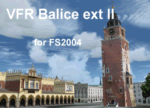
Very beautiful VFR scenery. Designed on ground textures of the old town Krakow in
the vicinity of EPKK Balice (Poland). This is an extension II of the base scenery VFR Balice with day and night textures. Almost one thousand 3D objects and photorealistic textures. Scenery does not contain EPKK airport itself and a mesh. EPKK airport can be
downloaded from www.pl-vacc.org
| Filename: | VFR_Balice_EPKK_ext_II__V2.zip |
| License: | Freeware, limited distribution |
| Added: | 6th May 2010, 18:50:18 |
| Downloads: | 2,076 |
| Author: | Lothar Tomczyk, Jakub Mista, Artur Apryjas |
| Size: | 42.01 MB |
| Category: Flight Simulator 2004 - Scenery | |
| Sitterdorf (LSZV) for Suisse 2004 |
|
File Description:
New airport for Suisse 2004. Works for FS2002 and fully compatible with FS2004. Includes 2 airport files depending of the mesh you use. Please read the doc. Features usual goodies of Suisse 2004 : seasonal textures, smoke effect, VAC chart, integrated ground texture, etc. Sitterdorf is a small private airfield far East of Switzerland. It has 2 minicars tracks and a small fun park.
| Filename: | Sitterdorf_LSZV_for_Suisse_2004.zip |
| License: | Freeware |
| Added: | 7th March 2004, 17:27:39 |
| Downloads: | 7,068 |
| Author: | Daniel Gauthier |
| Size: | 5.88 MB |
| Category: Flight Simulator 2004 - Miscellaneous Files | |
| MV challenge - Canadian Arctic 2 |
|
File Description:
FS2004 MV challenge - Canadian Arctic 2.
Pilot a very tough round trip with ten legs
and 17 landings, mostly on gravel strips,
around Baffin Island in northeastern Canada,
in a Twin Otter. The challenge includes
bad weather, poor visibility, limited navaids
and mostly night-flying.
Requires: add-on Twin Otter and DEW Line scenery.
Optional: add-on Nunavut mesh and approach plates.
Freeware
| Filename: | MV_challenge__Canadian_Arctic_2.zip |
| License: | Freeware, limited distribution |
| Added: | 19th February 2005, 15:49:15 |
| Downloads: | 1,078 |
| Author: | Michael Vone |
| Size: | 1.22 MB |
| Category: Orbiter - Miscellaneous Files | |
| Moon3D |
|
File Description:
Complete mesh of the Moon's surface gives impression of topography from low orbit. Default installation uses eight 2048 x 2048 surface textures, may not be compatible with older or lower spec graphics cards. Alternative "Low-res" 512 x 512 surface textures are included, see Doc/moon3d_README.txt for installation instructions.
Tested on Orbiter version 060929, Windows XP, nVidia FX5600XT graphics card (128Mb).
| Filename: | Moon3D.zip |
| License: | Freeware |
| Added: | 15th March 2007, 15:04:12 |
| Downloads: | 1,256 |
| Author: | Brian Jones |
| Size: | 14.36 MB |
| Category: Flight Simulator X - Scenery | |
| EGNG Samlesbury Airfield |
|
File Description:
Samlesbury Airfield nr Preston. Home to the Canberra, the EE Lighning and the ill fated TSR2 Project. Blended to fit Horizon GenX Scenery and Mesh the tabletop/cliff edge effect has been removed. Requires Runway12 libraries to display as included pictures. The included AI flight file has been supplied by Gerry Winskill and requires the Canberra file baccanb.zip by Bill 'Tornado' Holker
| Filename: | EGNG_Samlesbury_Airfield.zip |
| License: | Freeware, limited distribution |
| Added: | 19th October 2007, 09:35:02 |
| Downloads: | 1,124 |
| Author: | Tony Meredith |
| Size: | 753.76 KB |
| Category: Flight Simulator X - Scenery | |
| CYSV Saglek, New Foundland, Canada |
|
File Description:
This scenery as much as possible represents Saglek (CYSV), located at the north of New Foundland, Canada according to photographs found on the Web. This scenery is compatible with Mesh de M.Gilles Gauthier. Several originators took part in the design of this scenery: Regis Dassylva, Gerald Allaire, Gilles Gauthier and Jean-Pierre Fillion, all members of Concepteurs Virtual du Quebec.
| Filename: | CYSV__Saglek_New_Foundland_Canada.zip |
| License: | Freeware |
| Added: | 4th December 2009, 02:12:36 |
| Downloads: | 1,118 |
| Author: | Regis Dassylva |
| Size: | 8.5 MB |


© 2001-2026 AVSIM Online
All Rights Reserved
Privacy Policy |