
Where Flight Simulation Enthusiasts Gather from Around the World!
AVSIM Library - Search Results

| Category: Flight Simulator X - Scenery | |
| Davidstow Moor 2007 |

|
File Description:
Davidstow Moor 2007 for FSX. Blended to fit Horizon Scenery and Mesh.
This version contains limited runways suitable only for Microlights and small aircraft and no dispersal points. Scenery items from various authors associated with the Runway 12 project have been used to enhance the scenery. Details of the extra files required are included in the readme.
| Filename: | Davidstow_Moor_2007.zip |
| License: | Freeware, limited distribution |
| Added: | 5th December 2007, 17:59:19 |
| Downloads: | 731 |
| Author: | Tony Meredith |
| Size: | 1.29 MB |
| Category: Flight Simulator X - Scenery | |
| Valley Flying Field (WAVF) |
|
File Description:
Valley Flying Field by Bill and Phil specifically for FSX. WAVF is a small GA airfield in Lilliwaup, WA between the site for the future Emma Field and Lake Cushman.
Designed for use with Ultimate Terrain X (UTX), the FSX Mesh Resolution set to 10m, and some older (FS9) object libraries. See the readme for details.
| Filename: | Valley_Flying_Field_WAVF.zip |
| License: | Freeware, limited distribution |
| Added: | 5th September 2007, 00:52:11 |
| Downloads: | 1,202 |
| Author: | Phil Cayton and Bill Dick |
| Size: | 344 KB |
| Category: Flight Simulator 2004 - Gauges | |
| Apollo PVI (Pilot Vehicle Interface) /GPS |
|
File Description:
This gauge is modeled after the Apollo PVI for commercial jet aircraft. This gauge is written in XML and is designed to mesh with the default FS9GPS map input data. Compatible with FS2004 (FS9) ONLY! Size (pixel size) is the same as the FS9 default GPS so placement (or replacement) of the gauge is quick and easy.
| Filename: | Apollo_PVI_Pilot_Vehicle_Interface_GPS.zip |
| License: | Freeware |
| Added: | 24th December 2003, 05:34:07 |
| Downloads: | 5,093 |
| Author: | Keith Giveans |
| Size: | 97.88 KB |
| Category: Flight Simulator 2002 - Scenery | |
| Lake Elevation Corrections |
|
File Description:
The files in this package contain an update correcting some lake elevation for Quebec terrain mesh (FS2002) created from SRTM-3 : about 400 lakes in Manicouagan region, 21 in Gaspesia Peninsula and 20 on Anticosti Island. The coastline is corrected near by Magpie on Quebec North-Shore. Four river courses are corrected or created on Anticosti Island.
| Filename: | Lake_Elevation_Corrections.zip |
| License: | Freeware, limited distribution |
| Added: | 24th April 2003, 16:11:29 |
| Downloads: | 4,025 |
| Author: | Gilles Gauthier |
| Size: | 872.4 KB |
| Category: Flight Simulator X - Scenery | |
| SICILY VFR X - Lakes and Reservoir. |
|
File Description:
This scenery is a remodelling of the basic FSX Sicily lakes based on Google Earth's representation. Some lakes exists in FSX (but low resolution). I have workerd on them, add more not represented, with FSX KML v1.10 Beta by Innova Software.
This add-on scenery is full compatible with SICILY VFR - Terrain Mesh SRTM3 version 2.
| Filename: | SICILY_VFR_X__Lakes_and_Reservoir.zip |
| License: | Freeware |
| Added: | 14th February 2008, 22:59:44 |
| Downloads: | 2,796 |
| Author: | Giovanni Miduri |
| Size: | 2.77 MB |
| Category: Flight Simulator 2004 - Scenery | |
| Anchorage to Valdez Trnn, Terrain |
|
File Description:
The files here display more scenery for default Fs2004 from Anchorage to Valdez. I wanted to make the flight from reading the report by Mac Af Uhr but wanted little better scenery. The terrain is Ocean and Inland waterbodies, Mesh, few flatten files. It might really be described “Freeware-quality” but I was trying to have it good…
| Filename: | Anchorage_to_Valdez_Trnn_Terrain.zip |
| License: | Freeware |
| Added: | 16th September 2005, 10:17:54 |
| Downloads: | 1,026 |
| Author: | Pierre G. Shlimon |
| Size: | 2.34 MB |
| Category: Flight Simulator 2004 - Scenery | |
| Karipur VOCL |
|
Images related to this file:
File Description:
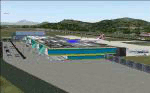
Karipur-VOCL for FS2004.
This contains the Airport of Calicut, Kerala, India
Karipur is a new International airport in Kozhikode or Calicut.
It handles planes to Middle East and Domestic.
This file contains the real airport.
Requeres South India Mesh and EZ library for small objects
to show up.
Terminal made in gmax and small objects added with EZ.
| Filename: | Karipur_VOCL.zip |
| License: | Freeware, limited distribution |
| Added: | 1st October 2010, 17:44:35 |
| Downloads: | 1,167 |
| Author: | Anstin Antony |
| Size: | 2.21 MB |
| Category: Flight Simulator 2002 - Scenery | |
| LightWeight Mesh Terrain for Europe and the Mediterranean (Part 3 of 4) |
|
File Description:
Framerate and download friendly mesh that covers all of the British Isles with the exception of the Shetlands, the northern tip of France, most of Belgium, all of the Netherlands, Denmark, Estonia, Latvia and Lithuania and parts of Norway, Sweden, Poland, the Czech Republic, Slovakia, Belarus and Russia (including Moscow). It is bounded by W20-E20-N60-N50.
| Filename: | LightWeight_Mesh_Terrain_for_Europe_and_the_Medite.zip |
| License: | Freeware |
| Added: | 25th July 2002, 16:25:27 |
| Downloads: | 10,633 |
| Author: | Svante Wendel |
| Size: | 13.17 MB |
| Category: Flight Simulator 2004 - Scenery | |
| Rangitata Island Aerodrome - NZRI |
|
Images related to this file:
File Description:

Rangitata Island Aerodrome is a small airfield located on Rangitata Island, halfway between Timaru and Ashburton, (South Island, New Zealand). Home to the Geraldine Flying Group, De Havillands over New Zealand collection,New Zealand Microlight heritage museum, Shadows of Hawks WWI replica collection and the Ross Brodie Memorial museum and library.
Made to fit Christian Stock's NZ 20m mesh.
| Filename: | Rangitata_Island_Aerodrome__NZRI.zip |
| License: | Freeware |
| Added: | 24th November 2013, 02:16:00 |
| Downloads: | 274 |
| Author: | Godfrey Tier |
| Size: | 1.66 MB |
| Category: Flight Simulator 2004 - Scenery | |
| CTH3 Canada, Quebec, Les Grandes-Bergeronnes |
|
Images related to this file:
File Description:
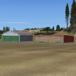
This is the scenery Les Grandes Bergeronnes (CTH3), which represents the reality. Les Grandes Bergeronnes is a small village located on Northern bank of the St-Laurent river of Quebec at Canada. This scenery is designed with FSDS and it accepts Mesh of Gilles Gauthier. This scenery functions for both FS-2004 and FS-X.
| Filename: | CTH3_Canada_Quebec_Les_GrandesBergeronnes.zip |
| License: | Freeware |
| Added: | 2nd January 2010, 19:29:43 |
| Downloads: | 379 |
| Author: | Regis Dassylva |
| Size: | 2.32 MB |


© 2001-2026 AVSIM Online
All Rights Reserved
Privacy Policy |