
Where Flight Simulation Enthusiasts Gather from Around the World!
AVSIM Library - Search Results

| Category: Flight Simulator 2002 - Scenery | |
| Alaska Bush Scenery: Stony River Bend & Old Stony |

|
File Description:
Here's your big chance to take-off and land using a curved airstrip. Stony River Bend is located just west of Merrill Pass, very close to Tom Fica's cabin at Two Lakes (part of his 'Merrill Pass' scenery add-on). The bumpy dirt runway - becoming slightly overgrown and prone to waterlogging - is marked out with wooden posts (lit at night) and presents a unique challenge: one that I haven't really sorted out just yet! There's a small settlement just up a log-lined trail from the airfield with a gravel service track connecting with a basic NDB/DME facility to help out with night or low visibility approaches. Although Stony River Bend is fictional, it has been based loosely on a real life runway at Elk City in Idaho. Three miles downstream is another simple backwoods strip called Old Stony - the narrow gravel runway here is conventional, but it's probably in an even worse state of repair. Designed for use with Eddie Denney's FS2002 mesh of Alaska, but the scenery is usable without it.
| Filename: | Alaska_Bush_Scenery_Stony_River_Bend__Old_Stony.zip |
| License: | Freeware, limited distribution |
| Added: | 31st March 2003, 13:09:28 |
| Downloads: | 1,873 |
| Author: | James Belk |
| Size: | 2.04 MB |
| Category: Flight Simulator X - AFCAD Files | |
| North Shore Aerodrome v1.00 |
|
Images related to this file:
File Description:
North Shore Aerodrome AFCAD file features more default taxiways, runways, more parking, fuel parking, buildings, cars, people, fences, static aircraft, etc to make it look more realistic.
This will work with default FSX scenery but was designed to fit in with RealNZ Supercity X and the freeware 75m mesh.
| Filename: | North_Shore_Aerodrome_v100.zip |
| License: | Freeware, limited distribution |
| Added: | 30th June 2010, 10:58:17 |
| Downloads: | 339 |
| Author: | Edward Boyte |
| Size: | 233.95 KB |
| Category: Flight Simulator X - Scenery | |
| Quebec Scenery - Lakes and River - Baie James Hydroelectric Complex Territory |
|
File Description:
Re-uploaded file. Lakes, shorelines and rivers of the province of Quebec, Baie James hydroelectric complex territory, Canada (for FSX only)(range : N52-N55, W66-W80). For best rendering, use terrain mesh for the same territory of the province of Quebec (Canada) in LOD10 (Qc38mBJ_FSX_*de2.zip - 2 files - AVSIM library).
| Filename: | Quebec_Scenery__Lakes_and_River__Baie_James_Hydroe.zip |
| License: | Freeware, limited distribution |
| Added: | 28th May 2010, 04:17:20 |
| Downloads: | 3,865 |
| Author: | Gilles Gauthier |
| Size: | 62.77 MB |
| Category: Flight Simulator 2004 - Scenery | |
| Pennsylvania 30 meter |
|
File Description:
Mesh Scenery for Microsoft Flight Simulator 2004 and 2002 covers the entire State of Pennsylvania. Compiled from NED 1 arc sec (30 meter) Data. Compression and conversion to bgl with MS Flight simulator SDK at LOD set to "Auto". Enjoy some nice VFR flying. Requires all 8 zips. 6 of 8.
| Filename: | Pennsylvania_30_meter.zip |
| License: | Freeware |
| Added: | 11th December 2003, 01:08:55 |
| Downloads: | 2,680 |
| Author: | Phil Cruikshank |
| Size: | 5.3 MB |
| Category: Flight Simulator 2004 - Flight Plans | |
| Flight Tours - Alberta Rockies |
|
File Description:
These three flights will take you in and about the beautiful Rocky Mountains of Alberta. For one of the flights you'll need a plane equipped with skis. I suggest downloading and installing Barry Blaisdell's Dash 6 Longnose Skybus (d6skyb42.zip). I also suggest downloading and installing Holger Sandmann's BC mesh.
| Filename: | Flight_Tours__Alberta_Rockies.zip |
| License: | Freeware |
| Added: | 23rd January 2005, 20:56:48 |
| Downloads: | 898 |
| Author: | Gerry Bibaud |
| Size: | 297.16 KB |
| Category: Flight Simulator X - Scenery | |
| Galactica Scenery PHNL |
|
File Description:
FSX Scenery: BSG Galactica at PHNL .
This scenery adds:
- 1 stock aircraft carrier offshore at Honolulu. (the same type carrier as San Diego)
- Landable BSG Galactica above the carrier at 27,500 feet , use port landing bay
* Battlestar Galactica Mesh and Textures by Coxxon
* conversions for MS-FSX By Bruce Fitzgerald
| Filename: | Galactica_Scenery_PHNL.zip |
| License: | Freeware |
| Added: | 18th March 2007, 01:33:08 |
| Downloads: | 1,625 |
| Author: | Bruce Fitzgerald |
| Size: | 1.45 MB |
| Category: Flight Simulator X - Scenery | |
| Town of Nantes - France |
|
File Description:
The town of Nantes (around 120 Km2) in photorealistic textures in 2m/pixel, full seasons and specific autogen.
It is made up of a new local mesh, various buildings, churches, and reference marks visual.
All specifics objects are made in Gmax with FsX textures.
Take off from Nantes Altantique (LFRS).
| Filename: | Town_of_Nantes__France.zip |
| License: | Freeware, limited distribution |
| Added: | 30th July 2007, 12:42:52 |
| Downloads: | 6,972 |
| Author: | marc-henri Guitteny |
| Size: | 79.52 MB |
| Category: Flight Simulator 2004 - Scenery | |
| Kavak, Venezuela |
|
File Description:
Scenery for a remote airfield in Venezuela omitted from Flight Simulator, serving a tourist village for those "get away from it all" holidays. Designed to work with Andy Weir's South America mesh (it looks a bit silly without it) and uses some Rwy12 scenery objects which may be optionally installed.
| Filename: | Kavak_Venezuela.zip |
| License: | Freeware |
| Added: | 14th November 2005, 05:57:07 |
| Downloads: | 1,150 |
| Author: | John Hinson |
| Size: | 57.96 KB |
| Category: Flight Simulator X - Original Aircraft | |
| McDonnell Douglas DC-10 Version2.0 |
|
Images related to this file:
File Description:
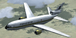
FSX native model, needs FSX ServicePack1 or 2. Version2, this time with custom panel and virtual cockpit. Panel and Gauges build with and for FSX SP2. External model KC10 boom changed to door animation. FSX conversion of Erick Cantus beautiful FS9 WIP mesh with new. By Thomas Ruth and Erick Cantu.
| Filename: | McDonnell_Douglas_DC10_Version20.zip |
| License: | Freeware |
| Added: | 23rd April 2012, 23:20:19 |
| Downloads: | 14,092 |
| Author: | Thomas Ruth, Eric Cantu |
| Size: | 104.21 MB |
| Category: Flight Simulator 2004 - Scenery | |
| Antilles 2004 |
|
File Description:
This scenery package aims at improving the visual depiction of the Caribbean. It covers 17 islands and 16 airports from Montserrat down to Tobago. It provides totally new island coastlines, mesh, landclass, roads, rivers, visual details for VFR flying, animated scenery, custom airports as well as accurate navaids and ATC frequencies.
| Filename: | Antilles_2004.zip |
| License: | Freeware, limited distribution |
| Added: | 9th February 2004, 04:40:22 |
| Downloads: | 25,443 |
| Author: | FS Antilles Group |
| Size: | 10.04 MB |


© 2001-2026 AVSIM Online
All Rights Reserved
Privacy Policy |