
Where Flight Simulation Enthusiasts Gather from Around the World!
AVSIM Library - Search Results

| Category: Flight Simulator X - Scenery | |
| PAKO - Nikolski Air Station - Alaska, USA |

|
File Description:
Nikolski Air Station (IATA: IKO, ICAO: PAKO, FAA LID: IKO) is an unattended airport located in Nikolski on Umnak Island in the Aleutians West Census Area of the U.S. state of Alaska. This former military airport is now owned by the Aleut Corporation. Scheduled commercial airline passenger service is subsidized by the Essential Air Service program. Current service to Nikolski is provided by PenAir using a Grumman Goose G-21A.
This airport has one runway 8/26 which is 3,512 feet long and 135 feet wide with a gravel surface. Custom models were added.
| Filename: | PAKO__Nikolski_Air_Station__Alaska_USA.zip |
| License: | Freeware |
| Added: | 28th August 2013, 12:12:38 |
| Downloads: | 995 |
| Author: | Wayne Roberts |
| Size: | 147.64 KB |
| Category: Flight Simulator 2004 - Scenery | |
| Alaska North Slope 6; Oliktok POLI |
|
Images related to this file:
File Description:
Oliktok is a DEW station Air Force base to the east of the Colville River delta, 160 miles east of Barrow and 12 miles from Harmon Helmericks house and dirt strip in the delta on Anachlik Island. (See my previous post, made after reading his book about northern Alaska flying). The runway is just over 4,000 feet of gravel and aligned 03-21. The large hangar is still there, and so are the majority of the DEW buildings closer to the beach. There are now also some oil production facilities and living quarters nearby on the point, but these are not included in this scenery as to make them convincingly (and there is no point in making them unconvincingly!) would be 100+ times as laborious as making the airstrip. And as Sid has memorably said, "If you can't taxi up to it, then xxxx it". So this scenery is dated way before the north slope was changed from a wilderness to an industrial complex. The AI is one day a C-130, on another a Cessna, and on a third a Reeve Aleutian DC-6B.
| Filename: | Alaska_North_Slope_6_Oliktok_POLI.zip |
| License: | Freeware, limited distribution |
| Added: | 30th June 2016, 20:36:34 |
| Downloads: | 282 |
| Author: | Roger Wensley |
| Size: | 2.42 MB |
| Category: Flight Simulator 2004 - Aircraft Repaints, Textures and Modifications | |
| Alaska Airlines Boeing 737 MAX 8 |
|
Images related to this file:
File Description:
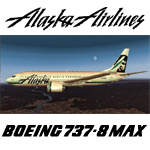
Alaska Airlines texture set for the TDS Boeing 737 MAX 8 (not included, must download base package). Model developed by Tenkuu Developers Studio, features high resolution textures, dynamic flexing wings, nose gear steering, rudder lock, ground spoilers, low speed aileron locks at high speed, fully animated control surfaces, fully independent suspension, trim animation, opening passenger doors, rolling wheels, animated thrust reversers with reverser block doors, detailed textures, full night lighting, ground service vehicles and more. Model design by Hiroshi Igami. Flight dynamics design by Nick Wilkinson, with assistance from David Biggar. Master textures and paint kit by Kyle Schurb, Stian Svensen & Carlos Eduardo Salas. Painted by Triadi Sudarmawan for the great TDS model. Also works in FSX
| Filename: | Alaska_Airlines_Boeing_737_MAX_8.zip |
| License: | Freeware |
| Added: | 7th September 2014, 13:52:53 |
| Downloads: | 806 |
| Author: | Triadi " Achonk " Sudarmawan |
| Size: | 4.58 MB |
| Category: Flight Simulator 2004 - Aircraft Repaints, Textures and Modifications | |
| Alaska Airlines Bombardier CRJ-701 (N215AG) |
|
Images related to this file:
File Description:

I am proud to present this Bombardier CRJ-701 in the excellent Project Opensky CRJ-700 V3 model. This airframe, bearing registration N215AG, is the first of 3 Bombardier CRJ-700's to wear the Alaska Airlines' Smiling Eskimo livery. This is a detailed repaint with custom textures. All windows are custom, hand-painted, 3D with window shades. Night textures are custom (windows) as well. All repainted textures in this package are 32-bit with no mipmaps for best clarity and quality. This is a complete installation package; version 2008.1.1 of the Project Opensky CRJ-700 V3 model is included.
| Filename: | Alaska_Airlines_Bombardier_CRJ701_N215AG.zip |
| License: | Freeware, limited distribution |
| Added: | 7th June 2011, 01:30:43 |
| Downloads: | 982 |
| Author: | Jeffrey S. Bryner, Project Opensky / Freesky Project |
| Size: | 8.16 MB |
| Category: Flight Simulator X - Aircraft Repaints, Textures and Modifications | |
| Alaska Virgin Concept Boeing 737-MAX9 |
|
Images related to this file:
File Description:
Tenkuu Developers Studio - Boeing 737 MAX9 Alaska Virgin Merge Concept by Gus Rodriguez. FSX Only.
Model Builder : Hiroshi Igami
FDE Designer : Nick Wilkinson
Master Painter : Kyle Shurb, Stian Svensen & Carlos Eduardo Salas
Supported by TDS staffs and people who helped
For further information and support, please visit our facebook group page at:
https://www.facebook.com/groups/TDS.SkySpirit.B737NG/
| Filename: | Alaska_Virgin_Concept_Boeing_737MAX9.zip |
| License: | Freeware |
| Added: | 26th June 2017, 18:22:20 |
| Downloads: | 300 |
| Author: | Gus Rodriguez |
| Size: | 7.79 MB |
| Category: Flight Simulator X - AI Aircraft | |
| Alaska Airlines OC B737-298CAdv N745AS |
|
Images related to this file:
File Description:

Alaska Airlines OC B737-298CAdv N745AS - FAIB_B737-200_N //
Flightplans may be available on AVSIM/Flightsim.com.
This works for both FS9 and FSX. Tested in FSX. FSX & FS9 model used.
For FSX users make sure you have UNCHECKED "Aircraft casts shadows on the ground" under the Aircraft - Exterior Settings in FSX to make any FS9-based model visible during the day!
Texture quality; FSX Native: DDS DXT5 with alpha. FS9 Native: BMP DXT3 with alpha.
FSX Light Fix included in the DDS night texture.
Custom Light Map. Custom Shadows, Highs, Weathering as usual...
Included repaint is for the following model; FAIB_B737-200_N from FAIB, this is the N normal model, no logo light winglet model.
Model is available on AVSIM, FlightSim.com or on the author/developers site.
You need the basekit for this to work!!
Do make sure you copy the texture folder(s) in the respective folder.
| Filename: | Alaska_Airlines_OC_B737298CAdv_N745AS.zip |
| License: | Freeware, limited distribution |
| Added: | 26th August 2012, 14:31:48 |
| Downloads: | 239 |
| Author: | Stephan Faessler / ImpulseAI |
| Size: | 2.15 MB |
| Category: Flight Simulator 2004 - Aircraft Repaints, Textures and Modifications | |
| Alaska Airlines Boeing 737-200 Package |
|
File Description:
This is a texture set that includes 2 Alaska Airlines textures for the Tinmouse II 737-200. These are TEXTURES ONLY! You will need to download tinmouse2_b732_v1.zip and tm2_v1_patch2.zip. Includes a Combi and a Combi with a Gravel Kit. Please read included documentation. Thank you and enjoy
| Filename: | Alaska_Airlines_Boeing_737200_Package.zip |
| License: | Freeware |
| Added: | 13th July 2006, 04:01:06 |
| Downloads: | 2,726 |
| Author: | Great West Flightsim Designs/Ron Waite |
| Size: | 8.3 MB |
| Category: Flight Simulator X - Aircraft Repaints, Textures and Modifications | |
| ERA Alaska, de Havilland Twin Otter |
|
Images related to this file:
File Description:
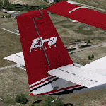
Repaint of the Aerosoft Twin Otter - Modern Version in ERA Alaska colors. It should work for other versions if you want it to but no guarantees. I did not test it in anything but the modern version. This is a fictional scheme created by me and not based on any real life schemes. You must have the Aerosoft Twin Otter Modern Version installed in your aircraft directory, these are texture files only. Basic installation instructions are included.
| Filename: | ERA_Alaska_de_Havilland_Twin_Otter.zip |
| License: | Freeware |
| Added: | 24th July 2011, 08:12:18 |
| Downloads: | 643 |
| Author: | Rick Bubier |
| Size: | 1.47 MB |
| Category: Flight Simulator X - Aircraft Repaints, Textures and Modifications | |
| ERA Alaska, DHC-6 Twin Otter |
|
Images related to this file:
File Description:
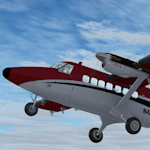
Repaint of the Aerosoft Twin Otter - Modern Version in ERA Alaska colors. It should work for other versions if you want it to but no garauntees, I did not test it in anything but the modern version. This is a fictional scheme created by me and not based on any real life schemes. You must have the Aerosoft Twin Otter Modern Version installed in your aircraft directory, these are texture files only. Basic installation instructions are included.
| Filename: | ERA_Alaska_DHC6_Twin_Otter.zip |
| License: | Freeware |
| Added: | 17th July 2011, 13:19:52 |
| Downloads: | 734 |
| Author: | Rick Bubier |
| Size: | 1.04 MB |
| Category: Flight Simulator X - Scenery | |
| PABT PATA UTO 6A8 (Alaska) Upgrades |
|
Images related to this file:
File Description:
This scenery upgrades PABT, PATA, UTO and 6A8 in Alaska. Upgrades include taxiways, hangers, airport buildings, aircraft and ground vehicles, helipads and other objects. It also updates the 2 water runways at PABT as start points which in FSX they aren't start points. The water runway area is updated with marina objects, a float plane dock, float plane support shops and buildings and a private residence with a private dock for boats and float planes. The helipads were an addition because I use Flight 1's heli-traffic and have helo traffic flying back and forth. Future upgrades to several of the small airports in the area will include AI helo and bush plane traffic. Read the text file for info and installation instructions. 4 pictures are included of each airports upgrades. Please enjoy these upgrades and check the Avsim library for future upgrades coming soon. Savageagle.
| Filename: | PABT__PATA__UTO__6A8__Alaska__Upgrades.zip |
| License: | Freeware |
| Added: | 17th November 2011, 07:57:51 |
| Downloads: | 1,629 |
| Author: | Tim Durham |
| Size: | 835.17 KB |


© 2001-2026 AVSIM Online
All Rights Reserved
Privacy Policy |