
Where Flight Simulation Enthusiasts Gather from Around the World!
AVSIM Library - Search Results

| Category: Flight Simulator X - Utilities | |
| AI Flight Planner Version 2 FS9 Compatible |

|
Images related to this file:
File Description:

AI Flight Planner is a fully-integrated, comprehensive AI flight planning system for both FS9 and FSX. It can use either TTools-format text files or compiled MSFS traffic files as source data. Among its unique features are: departure and arrival times may be specified using local time, airports specified using either ICAO or IATA codes, similar legs in weekly flight plans created automatically, comprehensive error checking and traffic file validation and conversion. Version 2 adds a full range of flight plan and repaint installion capabilities as well as several other new functions. These new capabilities were developed in cooperation with AIG (Alpha-India Group). While intended to meet AIG's specific requirements, AIFP version 2 remains a general purpose tool that may be used to install anyone's flight plans and repaint packages. This re-release of Version 2 is to facilitate future updates from http://stuff4fs.com. Current users of Version 2 will be automatically updated.
| Filename: | AI_Flight_Planner_Version_2_FS9_Compatible.zip |
| License: | Freeware, limited distribution |
| Added: | 19th August 2011, 00:28:50 |
| Downloads: | 16,322 |
| Author: | Don Grovestine |
| Size: | 1.56 MB |
| Category: Flight Simulator X - Scenery | |
| Aeropuertos de Isla San Andrés y de Isla Providencia (SKSP & SKPV), Colombia. |
|
File Description:
The delivery includes TWO airports: 1- Gustavo Rojas Pinilla (SKSP) on San Andrés Island, 2- El Embrujo (SKPV) on Providencia Island; both belonging to Colombia (Caribbean Area).
The delivery includes conditioning of the runways and taxiing of the airport facilities using original objects from the FSX Acceleration Pack.
The height of the terrain of the islands was also conditioned, and various objects that force you to take a low-altitude plane or helicopter ride for observation and discovery.
In Providencia you can try a landing approaching by the sea very close to the tropical forest (includes app positions to use gps in flight planner); In the same way, dare to take off on Route 35 without running into the treetops, trusting in your ability.
In San Andrés there will be many tourists on the runway headwaters taking photos of your aircraft arriving or departing from the airport !! They are waiting for you!
| Filename: | Aeropuertos_de_Isla_San_Andrs_y_de_Isla_Providenci.zip |
| License: | Freeware |
| Added: | 8th January 2021, 23:31:13 |
| Downloads: | 882 |
| Author: | Cristóbal Laje Ros |
| Size: | 23.63 MB |
| Category: Flight Simulator X - Scenery | |
| SLET - El Trompillo Airport - Santa Cruz de la Sierra, Bolivia |
|
File Description:
El Trompillo Airport (IATA: SRZ, ICAO: SLET) is located in the south part of Santa Cruz de la Sierra, Bolivia, about 2 km (1.25 miles) away from the central plaza. Airport type:(Public / Military).
After a series of improvements, in June 3, 2014 Airport regained its status as an international airport by converting to Santa Cruz de la Sierra in Bolivia the only city with two international airports, international airport suitable as retention and/or support times of high demand in the Viru Viru Airport (ICAO: SLVR) can not supply completely.
The airport operates 24 hours and resides at an elevation of 1,371 ft (418 m) above mean sea level. Have one runway designated 15/33 with an asphalt surface measuring 8,967 by 114.82 ft (2,733 m by 35 m), El Trompillo Tunnel for vehicles, passes under the runway and connects the 4th ring (considered the most important highway in the city).
Compatible with both FSX and P3D.
| Filename: | SLET__El_Trompillo_Airport__Santa_Cruz_de_la_Sierr.zip |
| License: | Freeware |
| Added: | 19th November 2015, 09:49:14 |
| Downloads: | 1,848 |
| Author: | Marcos A. Rivas Torrez |
| Size: | 16.68 MB |
| Category: Flight Simulator X - Scenery | |
| CYDA - Dawson Airport - Yukon, Canada |
|
Images related to this file:
File Description:
FSX Scenery - Dawson City Airport (IATA: YDA, ICAO: CYDA) is located 8 nautical miles (15 km; 9.2 mi) east of Dawson City, Yukon, Canada, in the Klondike River valley, and is operated by the Yukon government. It has a terminal building and like most airports in its class, the runway is not paved. The gravel runway is 5,006 ft (1,526 m) long and at an elevation of 1,215 ft (370 m). A number of studies have recommended moving the airport or realigning the runway as it is in a narrow mountain valley. The airport is classified as an airport of entry by Nav Canada and is staffed by the Canada Border Services Agency (CBSA). CBSA officers at this airport can normally handle aircraft with up to 15 passengers, but are equipped to handle daily Boeing 737 charters between Dawson City and Fairbanks (Fairbanks International Airport) during the peak summer tourism season. For your flying pleasure by John B. Loney, Jr.
| Filename: | CYDA__Dawson_Airport__Yukon_Canada.zip |
| License: | Freeware, limited distribution |
| Added: | 7th April 2016, 17:20:42 |
| Downloads: | 907 |
| Author: | John B. Loney, Jr. |
| Size: | 13.92 MB |
| Category: Flight Simulator X - Missions | |
| Discover FSX Flights (FMCH - FMCZ) 160 NM |
|
File Description:
Flight 12 (FMCH - FMCZ)
With all the many airports and various terrains on FSX, I have decided to contribute to the wonderful FSX flight community by providing pre-selected
Flight plans which i have created using pre-selected VOR's , NDB's and way points, with careful selection of realistic departure and arrival tracks.
Weather your flying commercial Jets, or props or cargo, I am sure there is something here for you..check it out (Just place the included PLN file in your
saved routes folder) and Load it from the FSX flight planner and it will show up on your aircraft GPS and Flight Managment display, Pilots are strongly
recommended to adhere to altitude and speed restrictions, as that will make the flight more comfortable for both pilots and passengers, and will allow for
the enjoyment of the scenery and flight. I have included a Paint version of the flight plan with notes. The route is designed to be as as realistic as
possible, so pilots and aircraft are expected to follow strict departure and arrival stations.
Included here is my first flight : (Prince Said Ibrahim international / Comoros islands (FMCH) - Pamandazi / mayotte (FMCZ) (169 - nm)
Recommended departure time (05:00 AM DAwn)
Recommended Aircraft CantuEMB120.zip by Mr.Eric Cantu availabe at Avsim.com
recommended Weather (fair on departure) (grey and rainy on arrival)
Recommended call sign (Yankee 1 Foxtrot)
Flight number 12
Flight Time 33 minutes
Situation orientation (Fictional) : A struggling Morani based aviation company makes its bucks on a single boeing 707 servicing mombasa,
as well as two Embraer120 servicing the adjacent islands and airports, Flight 12 is a twice a week flight to Pamandzi (160 nm South of Morani / 30 mins hop)
Due to the timing of the flight (4:45 AM), its infamous with the pilots and passangers who despise getting this flight,but work is work and life goes on.
The residents of Dzaoudzi (arrival airport)
always look forward for flight 12's arrival as it brings home relatives, friends, the once in a while tourists as well as mail and supplies.
Your the captain of this flight today , Flight 12 to Pamandzi is now boarding, please display your boarding slips at the door and walk directly to the
aircraft.Goodmorning captain, coffee?
| Filename: | Discover_FSX_Flights__FMCH__FMCZ__160_NM.zip |
| License: | Freeware |
| Added: | 24th September 2007, 13:06:33 |
| Downloads: | 3,498 |
| Author: | Ali Zied |
| Size: | 375.37 KB |
| Category: Flight Simulator 2004 - Scenery | |
| 13 Northern Ontario Airfields in Canada |
|
Images related to this file:
File Description:
These are 13 airfields in northwest Ontario, Canada. They were previously posted individually, but not on Avsim. There is a screenshot of Google Earth showing their names and locations. There are also updates to two previously posted airports, Red Lake CYRL and Sioux Lookout CYXL, and AI with the supply flights that are vital for these isolated outposts. Pickle Lake is a northern airfield that is connected to the rest of Canada by an all-weather road, and a large number of the supply flights originate from there. In fact these flights are the primary reason for the small towns existence. This will be followed by a posting of a similar number of northern Manitoba airfields. You may wonder about the numbers of fuel tanks at these airfields. These are not for the airfield use, they are for the settlement to be able to generate electricity and also to provide heating in the winter. If you find an error email me please, and note that my email address has been changed to rogwens at Gmail dot com.
| Filename: | 13_Northern_Ontario_Airfields_in_Canada.zip |
| License: | Freeware, limited distribution |
| Added: | 6th April 2021, 18:03:40 |
| Downloads: | 160 |
| Author: | Roger Wensley |
| Size: | 43.84 MB |
| Category: Prepar3D V1-4 - Scenery | |
| Valdez Alaska USA N61.06.53 W146.19.52 and Tatitlek Alaska USA N6052.00 W146.41.37 |
|
File Description:
Valdez Alaska USA N61.06.53 W146.19.52 The town is positioned at the head of a fjord on the eastern side of the Prince William Strait (at the end of the Valdez bay). It is surrounded by the Chugach mountains with many glaciers and peaks up to 2100 m above sea level. Although the northernmost port in North America is free of ice all year round. It is also the northernmost point of the Pacific coastal forest located in the 107-meter hill southwest of the town called Blueberry Hill. Valdez has an ICAO PAVD airport that in the scenario in addition to the city of Valdez you will also find a small village called Tatitlek Alaska USA N6052.00 W146.41.37 with related ICAO 7KA airport airports infrastructures have been improved with the addition of a port for landing ships and seaplanes on Valdez and Tatitlek. Important VFR point for approaching airport and seairport PAVD and 7KA.
Within the downloaded package you will find readme files for scenery installation. Good fly VFR. Pasquale Marrulli.
| Filename: | Valdez_Alaska_USA_N610653_W1461952_and_Tatitlek_Al.zip |
| License: | Freeware |
| Added: | 21st May 2018, 22:35:56 |
| Downloads: | 230 |
| Author: | Pasquale Marrulli |
| Size: | 3.27 MB |
| Category: Flight Simulator X - Aircraft Repaints, Textures and Modifications | |
| FSX/P3D Alisarda DC-9-32 1982 |
|
Images related to this file:
File Description:
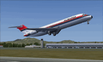
This is a repaint of the DC-9-32 in Alisarda colors. The freeware Eagle Rotorcraft Simulations' (George Arana) DC-9-30 native FSX conversion with VC, of Erick Cantu's DC-9-30, is needed for this repaint (Link provided). The textures are 32bit DDS. It was tested on FSX-SE, but should work on FSX & P3Dv3.
In 1977 Alisarda leased two DC-9 series 32s with 105 seats from Airfinco SA in Switzerland, which maintained their Swiss registration. The first aircraft delivered was HB-IKB on 13/4/1977, followed by HB-IKC on 13/10/1977. With the extra aircraft at their disposal, Alisarda started a scheduled service between Cagliari (in Sardinia) and Milan in 1978, and flights were operated from these two airports to Geneva, Zurich, Paris, and Düsseldorf. The two DC-9s, HB-IKB and HB-IKC, were eventually bought from Airfinco SA and re-registered as I-SARW and I-SARZ respectively. In turn, they were eventually replaced by two newly delivered MD-82s with 172 seats, in 1984.
| Filename: | FSXP3D_Alisarda_DC932_1982.zip |
| License: | Freeware |
| Added: | 21st January 2020, 17:48:36 |
| Downloads: | 57 |
| Author: | Ted Giana |
| Size: | 3.26 MB |
| Category: Flight Simulator 2004 - Original Aircraft | |
| Yamamoto Shootdown by Lockheed P-38G with AI Aircraft and Scenery |
|
File Description:
Re-Upload. This package provides a new P-38G modified specifically for recreating the mission that resulted in the interception and shootdown of Admiral Yamamoto over Bougainville Island in 1943 in accord with available documentation (links provided). The panel, mixture controls, capacity of the external tanks and the flight dynamics have been tailored to provide accurate power settings and performance to closely match the historical flight. Included are detailed documentation of the new aircraft, and the P-38 fuel settings used by the Army Air Corps before Charles Lindbergh suggested a "correction" in 1944 which greatly improved cruise fuel efficiency. To add to the realism, also included are AI aircraft (Zeros, Bettys, SBDs and C-47s) from CFS2.
New airports, scenery, and extensive scenario documentation to help the simulator pilot successfully "intercept" and "shoot down" the Admiral's Mitsubishi G4M 'Betty' are provided by experienced real world fighter pilot and Adversary Instructor Jim Daigneau, who also provided overall technical support and mission testing.
David C. Copley's outstanding P-38G has been modified as described above and is included, with his permission.
| Filename: | Yamamoto_Shootdown_by_Lockheed_P38G_with_AI_Aircra.zip |
| License: | Freeware, limited distribution |
| Added: | 2nd June 2010, 02:05:43 |
| Downloads: | 2,000 |
| Author: | Dave Bitzer |
| Size: | 25.21 MB |
| Category: Flight Simulator 2004 - Scenery | |
| VEAT Argatala, India |
|
Images related to this file:
File Description:
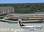
Googly scenery for VEAT Argatala, India - one of the airports that Microsoft seem to have, um, "forgotten" in FS2004. In the real world it is regularly served by Boeings and Airbii of Alliance Air, Indian Airlines, Jet Airways and Kingfisher Airlines (and smaller aircraft), using the 6000 foot runway with little room for manoevre. These scenery files add aprons, taxiways, buildings and other airport features to Flight Simulator's bland representation and allow you, and "AI" traffic, to land, taxi, park and take off realistically. The scenery does not purport to be ultra-accurate. Based on high-detail satellite imagery from Google Earth, the layout is proportianally correct but the added airport features, such as buildings, are built from default Microsoft objects and add-on libraries so will not look like the real thing. You are not obliged to download and install any additional scenery libraries, but to enjoy this scenery in its entirety, you may wish to. It will work fine, with or without. Details of optional additional scenery library downloads are provided within.
[File re-uploaded at request of AVSIM]
| Filename: | VEAT_Argatala_India.zip |
| License: | Freeware |
| Added: | 14th May 2010, 04:49:05 |
| Downloads: | 1,658 |
| Author: | John Hinson |
| Size: | 65.16 KB |


© 2001-2026 AVSIM Online
All Rights Reserved
Privacy Policy |