
Where Flight Simulation Enthusiasts Gather from Around the World!
AVSIM Library - Search Results

| Category: Prepar3D V5 - Scenery | |
| Lokpriya Gopinath Bordoloi International Airport Guwahati VEGT P3Dv5 |

|
Images related to this file:
File Description:
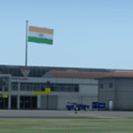
Lokpriya Gopinath Bordoloi Airport (IATA: GAU, ICAO: VEGT), also known as Guwahati Airport and formerly as 'Borjhar Airport', is the primary airport of the North-Eastern states of India. It is the 11th busiest airport in India. It is located at Borjhar, 26 km (16 mi) from Dispur, the capital city of the state of Assam and 28 km (18 mi) from Guwahati and is named after Late Gopinath Bordoloi, a freedom fighter and the first Chief Minister of Assam after India's independence. The airport is managed by Airports Authority of India and also serves as an Indian Air Force base.
Special Thanks to Ron Baruah for his VEGT Terminal Models, MFSG and MisterX for Vehicle Libs, Mayukh Deb for MD Libs and Taxi Lighting, Sriharsha K for Gate Signboards and Lightpoles and many more!
Compatible with Prepar3D v5.
| Filename: | Lokpriya_Gopinath_Bordoloi_International_Airport_G.zip |
| License: | Freeware |
| Added: | 15th June 2021, 18:55:37 |
| Downloads: | 273 |
| Author: | Saurabh Bansal |
| Size: | 257.18 MB |
| Category: Flight Simulator X - Scenery | |
| YBSS Bacchus Marsh AU |
|
Images related to this file:
File Description:
Bacchus Marsh Airfield is located approx 40km WNW of Melbourne, Victoria, Australia. It was never included in the original FSX.
This package incorporates a choice of blending into either the fsx default landscape or the Orbx AU landscape. This airport has been modeled from photographs freely available off the internet.
A folder is enclosed to give comparisons of detail at ground level. In Display Settings, set texture resolution as desired.
All hangars are my generic ones and chosen for similarity in shape, colour and size to the real ones on the ground. The package includes about 100 FSDS custom made scenery objects ranging from hangars to ground litter and many in
between, useful for also installing in other rural airports via a scenery editor. It includes some grass and tussocks vegetation to help give the visual of a rural airfield.
| Filename: | YBSS_Bacchus_Marsh_AU.zip |
| License: | Freeware |
| Added: | 10th September 2016, 03:26:23 |
| Downloads: | 728 |
| Author: | Robert Budd |
| Size: | 9.36 MB |
| Category: Flight Simulator 2004 - AI Flight Plans | |
| PassionAir ( Ghana ) - Winter 2018/2019 |
|
Images related to this file:
File Description:

Flightplans for PassionAir ( Ghana ) Winter 2018/2019. PassionAir is a Ghanaian airline that started scheduled domestic operations in Ghana in August 2018. With a vision of creating an exceptional travelling experience, the airline seeks to provide the Ghanaian aviation market with timely, safe and secure schedules between Accra and the main cities. It is PassionAir's goal to be the airline of choice, providing competitive service within Ghana and the West African region as a whole.
PassionAir provides scheduled domestic operations from its Accra hub to Kumasi, Takoradi and Tamale. The focus is to consolidate aviation traffic between the main cities and then stimulate traffic to the other domestic airports. The product lines provided includes the schedule and charter operations offering competitive rates utilizing our efficient Dash 8 Q400 fleet. Passengers can expect to experience excellent customer service that depicts the proverbial Ghanaian hospitality. By Kamil Fryzol.
| Filename: | PassionAir__Ghana___Winter_20182019.zip |
| License: | Freeware |
| Added: | 25th December 2018, 21:12:17 |
| Downloads: | 247 |
| Author: | Kamil Fryzol |
| Size: | 13.73 KB |
| Category: Flight Simulator 2004 - Aircraft Repaints, Textures and Modifications | |
| US Airways NC "7000th Airbus" Airbus A321-231 (N552UW) |
|
Images related to this file:
File Description:

I am proud to present this Project Airbus (pa321) Airbus A321-231 which has the unique distinction of being the "7000th Airbus". This airframe was just delivered earlier this month (December) to US Airways. It is registered as N552UW. The "7000th Airbus" logo is situated on the right side of the port main entry door. The A321 is the medium-haul workhorse for US Airways and flies into most major US airports serviced by US Airways including; KCLT, KPHX, KLAX, KSFO, KORD, KMCO, KSAN as well as several Caribbean destinations. This is a detailed repaint with custom textures. The repainted textures in this package are 32-bit with no mipmaps for best clarity and quality. This is a complete install package. The Project Airbus A321-211 model and air files are included. Uses default 737-400 panel and sounds. Please see Readme.txt for more details.
| Filename: | US_Airways_NC_7000th_Airbus_Airbus_A321231_N552UW.zip |
| License: | Freeware, limited distribution |
| Added: | 26th December 2011, 05:06:02 |
| Downloads: | 845 |
| Author: | Jeffrey S. Bryner, Project Airbus |
| Size: | 8.88 MB |
| Category: Civil Flight Simulators - Looking Glass Flight Unlimited 3 | |
| Flight Unlimited III Seattle Region expansion up to Vancouver |
|
Images related to this file:
File Description:
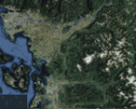
With this zip you get the opportunity to expand the Seattle region of your FU3 flight simulator up to Vancouver. The original region has 100 tiles (10x10) and the new region will hold 180 textured tiles (10x18). After all installation steps are done you will have a low resolution area from Coupeville Nolf up to Vancouver, but still better than OT texture. Everyone who's interested can obtain this set of megatiles with proper elevation and a basic scenery layout each one may take this to a more refined level later. Whether one elects to keep the basic textures or replace them with good orthophotos the terrain is there and new airports can be shared and used by everyone with an expanded high-res region. You will need 6 other files from the AVSIM library to prepare your game for this expansion, see readme file inside workfolder.
| Filename: | Flight_Unlimited_III_Seattle_Region_expansion_up_t.zip |
| License: | Freeware, limited distribution |
| Added: | 27th January 2011, 22:00:03 |
| Downloads: | 162 |
| Author: | Andre Meystre |
| Size: | 95.9 MB |
| Category: Flight Simulator 2004 - Gauges | |
| Airport ID Gauge |
|
Images related to this file:
File Description:
Do you ever wonder what airports you are flying over and do not wish to consult a Map or the GPS (if your aircraft has one)?
This little gauge, which can be easily added to virtually any panel, will display the ICAO code, the Airport Name and the Airport's location as you pass nearby. The display can be fixed on a panel or can be installed as a pop-up window called by a panel icon. Complete instructions and sample setups using the default Cessna 172 are included. This gauge is designed to be used in the 2D cockpit environment has been tested in FS2004 but may work in FSX also. XML script by the late Roelof Kruijer - packaged by David "Opa" Marshall for your flying enjoyment. Please unzip to a temporary folder and follow the instructions which are in .Doc and .PDF formats.
| Filename: | Airport_ID_Gauge.zip |
| License: | Freeware |
| Added: | 2nd February 2011, 01:53:40 |
| Downloads: | 2,074 |
| Author: | Roelof Kruijer and David "Opa" Marshall |
| Size: | 400.69 KB |
| Category: Flight Simulator 2004 - Scenery | |
| Coromandel Photoscenery Compilation *updated* |
|
File Description:
This is a compilation of the various addons developed for the Coromandel region of the North Island, New Zealand.
The basis of this scenery is the simply stunning Godzone Photoscenery developed by Robin Corn and the autogen created for it by Ian Warren. Their combined efforts have produced a wonderfully beautiful and realistic scenery for VFR flying. Lawrie Roache has produced some simply stunning renditions of the airports in the Coromandel area -
Thames (NZTH), Coromandel (NZCX), Pauanui Beach (NZUN), and Whitianaga (NZWT), which were created specifically to fit with the Coromandel Photoscenery by Robin Corn. Charl du Toit has finished and perfected the area with his adjustments to the photo-terrain.
This is simply a compilation (with permission) and re-release of the many fine sceneries these men have produced.
This updated version includes a newer version of the photoscenery and some bug-fixes.
| Filename: | Coromandel_Photoscenery_Compilation_updated.zip |
| License: | Freeware, limited distribution |
| Added: | 5th October 2012, 02:42:03 |
| Downloads: | 821 |
| Author: | Robin Corn, Ian Warren, Lawrie Roache, Charl du Toit, Ephram Matheson |
| Size: | 52.28 MB |
| Category: Flight Simulator 2002 - Utilities | |
| Weather Center 2.1 Novice Edition |
|
File Description:
Weather Center 2.1 is an advanced weather generation add-on module for Microsoft Flight Simulator 2000/2002. Weather Center 2.1 features a completely re-engineered weather generation core that produces some of the most realistic, generated weather environments ever seen in Flight Simulator! The new, unique "I-Field" algorithm translates automatically downloaded Internet data into a dynamic weather environment based not only on the data from the nearest reporting airport (like Weather Center 1), but on all nearby airports, which all provide some piece of the overall weather scene generated around the aircraft! The Novice edition includes a 15-minute demo period each time it is started, during which all the Expert features are enabled. After the demo period expires, there is no requirement to upgrade to the Expert edition; however, the Novice edition continues to function indefinitely with a simpler weather generation algorithm with most new core features disabled.
| Filename: | Weather_Center_21_Novice_Edition.zip |
| License: | Freeware |
| Added: | 6th June 2003, 19:36:17 |
| Downloads: | 1,779 |
| Author: | Keith Kile |
| Size: | 5.83 MB |
| Category: Flight Simulator 2004 - AFCAD Files | |
| EGAC EINN Project V3 Final Versions |
|
File Description:
This is the last and final installment for the Shannon / Belfast City Projects.
Basically these default AFCAD's have been amended to accommodate more traffic and larger traffic in some cases. More parking has been added to the airports and also runway lenghts increased.
EINN: Airport resurfaced from Asphalt to Tarmac. Two parallel runways now designated 2L and 2R and 20L and 20R. 2L is for landings only and 2R departures. 20L Departures and 20R Landings.
EGAC: More parking added and runway extended from 5800Ft to 8000ft so now the airport can handle 747 AI if required. Taxi problem with V2 of jets taxiing down runway 4 for 22 departure fixed. 3 helicopter pads also added.
You can also download the Harland and Wolf Shipyard from www.ifsd.ie as well as other Irish airport scenery, this is the best Irish scenery anywhere, so well worth a look.
Enjoy
| Filename: | EGAC_EINN_Project_V3_Final_Versions.zip |
| License: | Freeware |
| Added: | 8th March 2004, 16:08:32 |
| Downloads: | 1,260 |
| Author: | René Bruun |
| Size: | 9.71 KB |
| Category: Flight Simulator 2004 - Miscellaneous Files | |
| Active ILS - KIAH (G Bush Intercontinental/Houston Airport) |
|
File Description:
As most know initiating the ILS at certain airports for AI Traffic is not a function at this time when using AFCAD2. If you add a new ILS runway to an airport such as KIAH (G Bush Intercontinental/Houston Airport 8L/26R) only the user aircraft can use this runway when visibility falls below 3 miles. ATC will no longer use this runway for AI Traffic because FS9 sees it as a visual runway and will now vector your AI Traffic back to 8R/26L which is also a Terminal departure runway. This file adds all NAVAIDS for making 8L/26R a Precision Instrument Runway by adding all the radar fixes for both the ILS approach portion and the proper missed approach procedures, altitudes and intersections as per current published plates. All AI Aircraft will now continue to use 8L/26R when Airport conditions are less than 3 miles.
| Filename: | Active__ILS__KIAH_G_Bush_IntercontinentalHouston_Airport.zip |
| License: | Freeware, limited distribution |
| Added: | 19th June 2004, 07:15:30 |
| Downloads: | 2,031 |
| Author: | Jim Vile |
| Size: | 41.99 KB |


© 2001-2026 AVSIM Online
All Rights Reserved
Privacy Policy |