
Where Flight Simulation Enthusiasts Gather from Around the World!
AVSIM Library - Search Results

| Category: Flight Simulator 2004 - Utilities | |
| Destination Finder for FS9 v1.1 |

|
File Description:
In this program, you enter the ICAO code of your start airport, the distance you wish to fly, and the heading on which you wish to fly. The program will search through all the stock airports in FS9, and will compile a list of airports nearest to your desired destination. For extra flexibility, you can also leave the heading and/or the distance unspecified. Alternatively, the program can now read your aircraft’s position in all versions of FS, and use that as the starting point of the search. You can optionally specify a maximum and/or minimum length for the runway, whether the runway must have an ILS, a maximum elevation for the destination airport, the runway surface (hard or soft or water) and whether the airport should be civil or military or either. The program can be useful for planning your own flight or for drawing up AI flightplans. It is a standalone program, and uses FS9 airport and runway data, but, with that limitation in mind, it can equally be used with other versions of FS. Version 1.1 has a much improved formula for calculating longitude and latitude over longer distances, and is now very accurate over all distances. Version 1.1 also incorporates a number of new features suggested by user feedback. The upgrade is recommended for all users. Needs the .NET Framework 2.0.
| Filename: | Destination_Finder_for_FS9_v11.zip |
| License: | Freeware |
| Added: | 24th January 2008, 00:17:07 |
| Downloads: | 4,880 |
| Author: | Martin Gleeson |
| Size: | 1.69 MB |
| Category: Flight Simulator X - Aircraft Repaints, Textures and Modifications | |
| Project Airbus A321 FD-FMC version 1.20 <b>FSX and P3D</b> |
|
Images related to this file:
File Description:
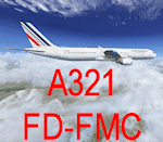
A321 FD-FMC is a freeware FMC project, only for FSX and P3D, based on Project Airbus A321 aircraft with enhanced VC, which provide real vertical navigation feature and all Airbus autopilot advanced modes (all knobs like real Airbus : Push-pull). FD-FMC has a unrealistic interface, to be easy to use, but it offers true vertical navigation in N1 mode with adaptive pitch control. Aircraft pack include an airport database (more than 200 airports) and new airports procedure files are created each month and can be downloaded. This database include real SID, STAR and approach procedures. FD-FMC manages altitude and speed constraint, holding pattern, DME-ARC, ILS/LOC/RNAV approaches, autolanding, LOC back course mode, multiple gradient approaches. You can set easily all performance in FMC pages, for Take off, climb, descent and approach. VC fully functional, with all system (Bleeds system, fuel system, Fly by wire). All switches working. ND with Radar terrain (TAWS) and basic TCAS (traffic). All real airbus autopilot mode works and reported on the PFD's FMA : THR CLB, CB, SRS, DES THR IDLE, etc ......Flight can be saved (update automatically FSX flight plan file) and all FMC data are saved.
Flight begin in cold and Dark; Real Start engine procedure.....Please, read the install manual and user manual English and French). A very advanced Airbus panel. FD-FMC is copyright Francois Dore.
| Filename: | Project_Airbus_A321_FDFMC_version_120_bFSX_and_P3D.zip |
| License: | Freeware |
| Added: | 4th April 2016, 21:46:09 |
| Downloads: | 2,575 |
| Author: | Francois Dore - Project Airbus |
| Size: | 327.24 MB |
| Category: Flight Simulator X - Scenery | |
| California Central Coast Scenery for FSX with Megascenery Earth (Default Mesh Terrain) |
|
Images related to this file:
File Description:
Revised 1/7/10 for upload to Avsim.COM. CCFSXMSFix is incorporated so not required.
This is an earlier version of CCC Megascenery Earth scenery that doesn't require FSGenesis Mesh Terrain. See CCFSXMSG.ZIP for the FSGenesis Mesh version.
This scenery covers the California coastal region from N36���°10' (Coalinga) to N34���°25' (Santa Barbara) and from the coast East to W119���°40'. It is a version of my previous California Central Coast scenery redesigned and expanded to work with MegaScenery Earth from PC Aviator Inc. Many airstrips in the area covered by this scenery have been added or enhanced for a total of 27 airports/airstrips in the area. Several areas of interest such as the Santa Barbara marina, Morro Bay, etc. are also included for a total of 41 points of interest. All airports/airstrips and related structures have been adjusted and realigned to conform to actual positions and dimensions as indicated by the MegaScenery satellite textures. In addition, there are 6 invisible water runways for use by AI floatplane traffic. MegaScenery California-13, -14 and -15 are required for this scenery to make sense. I also used California-12, -28 and -29 when constructing the scenery but they could be considered optional.
| Filename: | California_Central_Coast_Scenery_for_FSX_with_Mega.zip |
| License: | Freeware |
| Added: | 7th January 2010, 21:28:45 |
| Downloads: | 1,560 |
| Author: | Al Wheeler |
| Size: | 8.12 MB |
| Category: Flight Simulator 2004 - Scenery | |
| Denver (KDEN), Colorado, Photo-Scenery |
|
Images related to this file:
File Description:

Denver (KDEN), Colorado, Photo-Scenery for FS9 & FSX.
This package covers Denver, the capital of Colorado which is also nicknamed Mile-High City because its elevation is one mile (5.280 ft). The sixth RW (16R/34L) of Denver Int'l. Airport (KDEN) is the longest commercial RW in the US with a length of 16.000ft. This allows fully loaded B747's to take off in Denvers mile-high altitude during hot summer days, when density altitudes can approach 9.000(!) ft.
KDEN is a major hub for United Airlines and the headquarters for Frontier Airlines. The airports distinctive white tent-like fabric roof is designed to be reminiscent of the snow-covered peaks of the Rocky Mountains which you can see on approach or departure.
Other important airports covered by this region are Centennial Airport (KAPA), Buckley AFB (KBKF) and Rocky Mountain Metropolitan Airport (KBJC). Extends my Mt.Evans/Georgetown package to the east and provides another 3.500 sq km in 4.7m/pix quality.
High resolution versions for FS9 and FSX (much sharper, but larger and multiple downloads) are available at www.blueskyscenery.com/GNB_SouthEast.html
. The screenies are taken from the high-res versions, so expect this version to be slightly more blurry. YourDonation@Work: Dedicated to Mark and Charles. Thanks!
| Filename: | Denver_KDEN_Colorado_PhotoScenery.zip |
| License: | Freeware, limited distribution |
| Added: | 31st October 2009, 11:24:39 |
| Downloads: | 7,283 |
| Author: | Gottfried Razek, blueskyscenery.com |
| Size: | 95.21 MB |
| Category: Flight Simulator X - Scenery | |
| Moscow City X DEMO |
|
Images related to this file:
File Description:
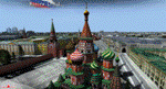
Moscow City X DEMO is a very detailed model of Moscow metropolitan area in Russia, together with lite sceneries of 7 airports (UUWW Vnukovo, UUDD Domodedovo, UUBW Zhukovski, UUMO Ostafyevo, UUBM Myachkovo and UUMB Kubinka), many heliports and thousands of buildings. This product is fully compatible with FSX/FSX:SE/P3Dv1/P3Dv2/P3Dv3/P3Dv4 and FSW by Dovetail.
It's a fully functional DEMO version of the commercial payware product, copmatible with both UUEE Moscow Sheremetyevo X by Drzewiecki Design and UUDD Moscow Domodedovo FSX/P3D by MDesign. It features same airport layout as in the full version but with limited 3D objects and low resolution textures. Using this free demo ensures no problems with online (VATSIM, IVAO, multiplayer etc.) flying in case some users use the payware scenery and some don't.
Moscow is the capital city and the most populous federal subject of Russia. It's the second most populous city in Europe after Istanbul and the 8th largest city proper in the world, as well as the largest amongst high income economies.
It's equipped with an automatic installer, which means that the scenery will be automatically added to the Flight Simulator Scenery Library.
Please uninstall all previous versions of the airports included in this package that you may have installed before. Please make also sure that no duplicated AFCAD files are installed!
Enjoy your virtual flying with Drzewiecki Design!
| Filename: | Moscow_City_X_DEMO.zip |
| License: | Freeware, limited distribution |
| Added: | 23rd August 2017, 01:37:04 |
| Downloads: | 4,127 |
| Author: | Drzewiecki Design |
| Size: | 18.56 MB |
| Category: Flight Simulator X - Utilities | |
| FS2004/FSX Flight Analyzer, Logbook Utility V4.09 |
|
Images related to this file:
File Description:
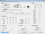
FS2004/FSX Flight Analyzer Utility V4.09
Flight Data Recorder - Logbook.
NOW WITH STATISTICS TOP 5 AIRPORTS, CITIES AND COUNTRIES.
Very easy to use, just make a flight plan in the simulator or in this utility.
What this program do:
- quickly change the settings of FSX/Fs2004, such as time, date, fuel, weight, traffic etc.
- start a failure sytem, such as gear, flaps, engine, etc.
- freeze the time, so you can fly in a for everlasting sunset.
- runway detecting system to see wich runways are in use.
- flight analyzing/data recording from departure to parking at the gate.
- When flight analysis is finished you can print a report, the report is automaticly saved as pdf File.
- graphical landingchart.
- record all your flights
- quickly look to your FSX display settings (only FSX) and change them even before the flight simulator is running.
- After a flight is finished FsQC saves your flight automaticly as 'FsQC last Flight', so you can continue the next day or hour.
Flight analysis start recording at the moment when you begin taxiing.
It gives you huge information such as:
- takeoff- and landing-weight.
- takeoff- and landing-roll in m. and ft.
- separate fuel consumption in taxi, climb, cruise and descent.
- maximum banking in flight.
- which speed you using the flaps and gear.
- when autopilot on or off.
- vertical speed on touchdown.
- reverser set after landing.
- wich speed you cancel reverser.
- bouncing at landing.
- graphical landingchart.
- and lots of more.
You can better look the example of the pdf document located in the 'Flight Reports' folder.
Logbook records:
- fuel consumption.
- payload.
- distance.
- number of different airports.
- flight hours.
- landings.
- flaps.
- speed.
- and lots of more.
- quickly show touchdown wind information in a picture.
- quickly show the graphical landing chart.
- Now with statistics: top 5 Countries, Cities and Airports
Requirements:
Computer with vista or higher and internet access.
Microsoft .net framework 4.6 or higher.(free download on microsft.com)
Flightsimulator FSX or 2004 and FSUIPC installed.
Note: requires paid activation for full use.
Register and you have 1 month free.
Program fully works without registration at airport Athens and Iraklion (Greece)
| Filename: | FS2004FSX_Flight_Analyzer_Logbook_Utility_V409.zip |
| License: | Shareware, time limited |
| Added: | 3rd March 2019, 00:20:37 |
| Downloads: | 250 |
| Author: | Evander Tholen |
| Size: | 3.35 MB |
| Category: Flight Simulator X - Missions | |
| FSX World explorer Marco Polo |
|
File Description:
One of the most disputed world explorers was, no doubt, Marco Polo. Even today, the descriptions of his life and adventures in China are considered a mixture of his own experiences and tales from his father end uncle. Nevertheless it's worthwhile to try and follow his travels which brings us to places we might otherwise never see! It is only logical to select an Italian plane for this project: Manuele Villa's beautiful FIAT G.18V. The default FSX Chinese airports are not sufficient to cover Maro Polo's travels within China, therefore it is necessary to install Winfried Orthmann's scenery china_airports_1,_2,_3, and _4!
| Filename: | FSX_World_explorer_Marco_Polo.zip |
| License: | Freeware |
| Added: | 18th September 2019, 16:42:31 |
| Downloads: | 98 |
| Author: | Nis Verkijk |
| Size: | 44.68 KB |
| Category: Flight Simulator 2004 - Aircraft Repaints, Textures and Modifications | |
| Air Inuit Boeing 737-200 |
|
Images related to this file:
File Description:
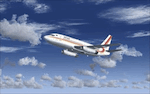
This is a repaint for the Aerosim Boeing 737-200ADV, of the Air Inuit Boeing 737-200C. Air Inuit is a Canadian airline serving many northern towns and cities, where,a s the name suggests, the people of the Inuit live. Air Inuit has only one jetliner, and it is this Boeing 737-200C, which seems adapted structurally for the airports it operates from. Because of this the repaint isn't 100% accurate, since with this repaint I can not alter the model itself, only the paintjob that is "pasted onto" the model by FS. The repaint itself, however, is quite accurate. I wish you many happy landings!
| Filename: | Air_Inuit_Boeing_737200.zip |
| License: | Freeware |
| Added: | 29th April 2010, 10:14:01 |
| Downloads: | 272 |
| Author: | Benjamin van Soldt, Aerosim |
| Size: | 2.74 MB |
| Category: Flight Simulator X - AI Aircraft | |
| FS9/FSX - BC Regional AI (Update 1) |
|
Images related to this file:
File Description:
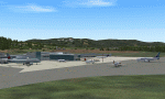
BC Regional AI implements the mid-2008 schedules of the regional airlines operating in British Columbia, Canada. It includes all the aircraft files you need to implement the AI scheme, together with the TTools-format source files and the compiled traffic files for both FS9 and FSX. Simply install BC Regional AI and, thanks to the efforts of a number of aircraft modelers and repainters, see CYYJ and most other BC airports come to life. Update 1 corrects a couple of problems in the original release that prevented certain AI aircraft from appearing. (This is a re-release of an earlier add-on that was corrupted during Avsim's "troubles".)
| Filename: | FS9FSX__BC_Regional_AI_Update_1.zip |
| License: | Freeware, limited distribution |
| Added: | 9th May 2010, 11:33:20 |
| Downloads: | 2,303 |
| Author: | Don Grovestine |
| Size: | 9.44 MB |
| Category: Fly! II - TerraScene | |
| Parkersburg (Ohio Project) TerraScene Project Pack |
|
File Description:
This is a TerraScene 2.1 Project pack for southeastern Ohio and portions of adjoining states. It covers all of global tile 198,158 with Parkersburg, WV in the west and Clarksburg (Benedum) in the east. The Ohio portion is in the NE area of the tile, above the Ohio River, including rolling hills, small towns like Marietta and a, number of small county airports. This pack includes updated Tiger Census (2000) shapefile data, adding new water areas, new highways, and other details. All scenery data files are included: USGS data, shapefiles, and a complete water mask. Requires TerraScene 2.1 and Fly!II patched to v230 or later.
| Filename: | Parkersburg_Ohio_Project_TerraScene_Project_Pack.zip |
| License: | Freeware |
| Added: | 11th May 2010, 00:52:03 |
| Downloads: | 312 |
| Author: | Randall Rocke |
| Size: | 62.89 MB |


© 2001-2026 AVSIM Online
All Rights Reserved
Privacy Policy |