
Where Flight Simulation Enthusiasts Gather from Around the World!
AVSIM Library - Search Results

| Category: Flight Simulator X - Scenery | |
| Ancona City - Ancona, Italy |

|
File Description:
The filmmakers FSX they have not taken into account the city's Italian,
therefore, I decided to make some Italian cities such as the city of Ancona
The scenarios are always built airports, but few are interested in the VFR flight
where the details of the land and the cities are important for the flight.
In the package you will find the file AnconaCity.bgl that will be placed at the
addon scenery folder and subfolder scenery automatically when FSX scenery you will find it
in the scenario.
| Filename: | Ancona_City__Ancona_Italy.zip |
| License: | Freeware |
| Added: | 16th July 2015, 16:49:32 |
| Downloads: | 1,232 |
| Author: | Pasquale Marrulli |
| Size: | 9.04 KB |
| Category: Flight Simulator X - Scenery | |
| SNVC, SNCZ, SNUB - Ponte Nova, Vicosa, Uba - Minas Gerais, Brazil (1 of 3) |
|
File Description:
This package contains images of real photos of the city of Vicosa, Ponte Nova and Uba,
including its airports(ICAO SNVC,SNCZ and SNUB respectively) and the highway that connects these three cities.
The complete scenery was divided into three files:
Ponte_Nova_Vicosa_Uba_1_de_3
Ponte_Nova_Vicosa_Uba_2_de_3
Ponte_Nova_Vicosa_Uba_3_de_3.
Este pacote contem imagens fotoreais das cidade de Vicosa, Ponte Nova e Uba,
incluindo seus aeroportos(ICAO SNVC,SNCZ e SNUB respectivamente) e a rodovia que liga estas 3 cidades.
O cenario completo esta dividido em 3 arquivos:
Ponte_Nova_Vicosa_Uba_1_de_3
Ponte_Nova_Vicosa_Uba_2_de_3
Ponte_Nova_Vicosa_Uba_3_de_3.
| Filename: | SNVC_SNCZ_SNUB__Ponte_Nova_Vicosa_Uba__Minas_Gerai.zip |
| License: | Freeware |
| Added: | 26th January 2016, 09:06:09 |
| Downloads: | 650 |
| Author: | Jefferson Palhano |
| Size: | 391.83 MB |
| Category: Flight Simulator X - Scenery | |
| SNVC, SNCZ, SNUB - Ponte Nova, Vicosa, Uba - Minas Gerais, Brazil (2 of 3) |
|
File Description:
This package contains images of real photos of the city of Vicosa, Ponte Nova and Uba, including its airports(ICAO SNVC,SNCZ and SNUB respectively) and the highway that connects these three cities. The complete scenery was divided into three files: Ponte_Nova_Vicosa_Uba_1_de_3 Ponte_Nova_Vicosa_Uba_2_de_3 Ponte_Nova_Vicosa_Uba_3_de_3.
Este pacote contem imagens fotoreais das cidade de Vicosa, Ponte Nova e Uba, incluindo seus aeroportos(ICAO SNVC,SNCZ e SNUB respectivamente) e a rodovia que liga estas 3 cidades. O cenario completo esta dividido em 3 arquivos: Ponte_Nova_Vicosa_Uba_1_de_3 Ponte_Nova_Vicosa_Uba_2_de_3 Ponte_Nova_Vicosa_Uba_3_de_3.
| Filename: | SNVC_SNCZ_SNUB__Ponte_Nova_Vicosa_Uba__Minas_Gerai.zip |
| License: | Freeware |
| Added: | 26th January 2016, 09:24:44 |
| Downloads: | 533 |
| Author: | Jefferson Palhano |
| Size: | 382.46 MB |
| Category: Flight Simulator X - Scenery | |
| SNVC, SNCZ, SNUB - Ponte Nova, Vicosa, Uba - Minas Gerais, Brazil (3 of 3) |
|
File Description:
This package contains images of real photos of the city of Vicosa, Ponte Nova and Uba, including its airports(ICAO SNVC,SNCZ and SNUB respectively) and the highway that connects these three cities. The complete scenery was divided into three files: Ponte_Nova_Vicosa_Uba_1_de_3 Ponte_Nova_Vicosa_Uba_2_de_3 Ponte_Nova_Vicosa_Uba_3_de_3.
Este pacote contem imagens fotoreais das cidade de Vicosa, Ponte Nova e Uba, incluindo seus aeroportos(ICAO SNVC,SNCZ e SNUB respectivamente) e a rodovia que liga estas 3 cidades. O cenario completo esta dividido em 3 arquivos: Ponte_Nova_Vicosa_Uba_1_de_3 Ponte_Nova_Vicosa_Uba_2_de_3 Ponte_Nova_Vicosa_Uba_3_de_3.
| Filename: | SNVC_SNCZ_SNUB__Ponte_Nova_Vicosa_Uba__Minas_Gerai.zip |
| License: | Freeware |
| Added: | 26th January 2016, 09:26:19 |
| Downloads: | 779 |
| Author: | Jefferson Palhano |
| Size: | 329.81 MB |
| Category: Flight Simulator X - AFCAD Files | |
| Tanzania Airstrips |
|
File Description:
Simple improvements to several airstrips around Tanzania serviced by Coastal Aviation. The AFCADS add parking, taxiways, and generic buildings to the airports included using ADE176. They all now have enough parking to support your aircraft and any AI package you may have flying there. I used Google Earth to get a general representation of the airport layout beyond just the runway, but I didn't spend much time making sure they were totally accurate. Included are HTAR, HTKI, HTMA, HTMY, HTSN, HTST, HTTG, and HTUK.
| Filename: | Tanzania_Airstrips.zip |
| License: | Freeware |
| Added: | 29th January 2019, 18:38:53 |
| Downloads: | 491 |
| Author: | Brad Banister |
| Size: | 59.1 KB |
| Category: Prepar3D V1-4 - Scenery | |
| Dynamic Lights for NSTU Pago Pago for P3Dv5 |
|
File Description:
Dynamic Lights for Pago Pago Airport. Has been designed to work with NSTU ORBX scenery, however may work with other versions too. You need SODE and P3Dv4.5 + Hotfix 3 or P3Dv5. You can choose yellow and orange variations by just using SODE menu. No need to close the simulator. If you have comments or need help, just dropp me an email to: [email protected]
Changelog:
- Added compatibility for P3Dv4.5 HF3 and P3Dv5
- Added add-on xml method for effects
- Very minor adjustment to lights
| Filename: | Dynamic_Lights_for_NSTU_Pago_Pago_for_P3Dv5.zip |
| License: | Freeware, limited distribution |
| Added: | 17th April 2020, 18:14:30 |
| Downloads: | 91 |
| Author: | Walter Almaraz |
| Size: | 9.07 KB |
| Category: Prepar3D V5 - Scenery | |
| Giallo Airport HLGL |
|
Images related to this file:
File Description:
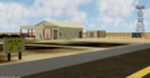
Giallo Airport located in Wahat district approximately 40 km south of Giallo city and it is owned by the Waha Oil Company.
There are active flights between other oil fields like Waha, Nafoora oil field and Samah Oil field And to main airports (Tripoli,Benghazi and Labraq) by Air Libya and Petro Air.
____________________________________________________________________________
Features:
- Super-accurate layout and precise marking according to the latest satellite images.
- Photo background blends perfectly with ORBX Global.
- Hight detailed terminal and buildings ,high quality custom ground textures.
- Dynamic Apron Lights.
| Filename: | Giallo__Airport__HLGL.zip |
| License: | Freeware |
| Added: | 25th May 2022, 23:19:40 |
| Downloads: | 107 |
| Author: | Hamza Swaid |
| Size: | 82.54 MB |
| Category: Flight Simulator 2004 - Miscellaneous Files | |
| FS2004 MV challenge - Windward STOL |
|
File Description:
Pilot a long day's worth of scheduled
short STOL flights in the Caribbean
Windward islands through very variable
weather, with the fabulous Twin Otter of
Winair (Windward Islands Airlines). Use
two famous airports with difficult
short-takeoff-and-landing operations:
St. Barthélemy and Saba. The total time
in the air should be about 6½ hours, for
22 flights demanding lots of maneuvering.
Included are: startup FS2004 flights with
flight plans; maps and instructions.
Requires: add-on Twin Otter and scenery. Freeware by Michael Vone
| Filename: | FS2004_MV_challenge__Windward_STOL.zip |
| License: | Freeware, limited distribution |
| Added: | 11th February 2004, 14:10:31 |
| Downloads: | 2,006 |
| Author: | Michael Vone |
| Size: | 1.7 MB |
| Category: Flight Simulator 2004 - AFCAD Files | |
| Belfast City, Northern Ireland (EGAC) |
|
File Description:
Part of my work on updating default airports in Ireland.
The runway 4-22 has been extended from 5882ft to 7000 ft and a new taxi way added to get to runway 22. New parking has been added for Aer Arann, British Airways, British Midland etc. I have also included ficitional flight plans for British Airways in the MRAI installer format. www.mostrealistai.com Installer required from this site. Now Belfast has A319s, 737s, 757 and 767S flying in regularly.
Also Harland and Wolf Shipyard scenery available from www.ifsd.ie.
| Filename: | Belfast_City_Northern_Ireland_EGAC.zip |
| License: | Freeware |
| Added: | 7th March 2004, 00:04:58 |
| Downloads: | 1,197 |
| Author: | René Bruun |
| Size: | 24.24 KB |
| Category: Flight Simulator 2002 - Scenery Design | |
| Taxiway Signs for HongKong and Macau |
|
File Description:
FS2002 Scenery--HongKong International Airport Chek Lap Kok (VHHH) and Macau Intl (VMMC). Features taxiway signs for the default sceneries of VHHH and VMMC, which are illuminated at night. Night lighting central
lines also added. The signs might be not exactly designed as in reality, but the taxiways numbering is correct so the signs are pretty helpful. Taxiway map, AFCAD files + AFInstaller and flight plans of both airports for your convenience included. AFCAD files have been corrected and all textures are new. By Yves Camus.
| Filename: | Taxiway_Signs_for_HongKong_and_Macau.zip |
| License: | Freeware |
| Added: | 11th September 2004, 21:04:10 |
| Downloads: | 583 |
| Author: | Yves Camus |
| Size: | 456.43 KB |


© 2001-2026 AVSIM Online
All Rights Reserved
Privacy Policy |