
Where Flight Simulation Enthusiasts Gather from Around the World!
AVSIM Library - Search Results

| Category: Flight Simulator 2002 - Scenery | |
| Confederation Bridge |

|
File Description:
A depiction of the bridge which spans Northumberland Strait between New Brunswick and Prince Edward Island, Canada.
| Filename: | Confederation_Bridge.zip |
| License: | Freeware, limited distribution |
| Added: | 9th March 2003, 01:27:13 |
| Downloads: | 993 |
| Author: | Garvin Barnicoat |
| Size: | 21.91 KB |
| Category: Flight Simulator X - Scenery | |
| Davao International Airport 2016 |
|
Images related to this file:
File Description:
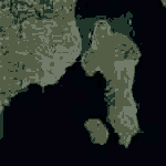
Davao International Airport 2016 with Photoreal scenery of Davao City and the Island garden city of Samal.
| Filename: | Davao_International_Airport_2016.zip |
| License: | Freeware |
| Added: | 11th December 2016, 06:50:30 |
| Downloads: | 3,015 |
| Author: | Emilio Comiling |
| Size: | 467 MB |
| Category: Flight Simulator X - AFCAD Files | |
| FGAB - Annobon Airport, San Antonio de Pale, Equatorial Guinea |
|
Images related to this file:
File Description:

FSX AFCAD -
FGAB - Annobon Airport, San Antonio de Pale
Equatorial Guinea
- FSX New Airport - Created with ADE -
Airport Design Editor. Updates the airport
serving this offshore island for AI
traffic - specifically the World of AI
packages. There is no default FSX airport
on this island.
Airport update by Reggie Fields.
| Filename: | FGAB__Annobon_Airport_San_Antonio_de_Pale_Equatori.zip |
| License: | Freeware |
| Added: | 13th November 2009, 22:55:33 |
| Downloads: | 374 |
| Author: | Reggie Fields |
| Size: | 1016.07 KB |
| Category: Flight Simulator 2002 - Utilities | |
| Ground2K Version 2 |
|
File Description:
Ground2K V2.0
Replaces V1.0 and V1.2 patch (+ V1.5 patch)
New :
- known bug corrections
- coastline feature
- local re-mesh option
For the 'old' users:
- rename or save ...ResourceGround2K.ini
- uninstall Ground2K
- install Ground2K V2.0 in the same root folder
- delete new ...ResourceGround2K.ini, and rename or reload your saved Ground2K.ini file.
Note : the path to Ground2K.exe must not contain space(s)
| Filename: | Ground2K_Version_2.zip |
| License: | Freeware |
| Added: | 17th March 2003, 21:44:12 |
| Downloads: | 3,394 |
| Author: | Fumey Christian |
| Size: | 4.16 MB |
| Category: Flight Simulator 2004 - Scenery | |
| FQIA - Inhaca Airport - Maputo Province, Mozambique |
|
Images related to this file:
File Description:

A Gmax representation of Inhaca Airport (FQIA), Inhaca Island, Mozambique with photoreal textures.
Inhaca island is a small island situated about 32 km east of Maputo, the capital of Mozambique. Transairways provide daily flights from Maputo airport to Inhaca airport, typically with smaller (18 seat) aircraft and the flight lasts no more than about 15 minutes.
The airport consist of a very small terminal building and two runways. Runway 18/36 (asphalt) measuring 650m and runway 10/28 (grass) which also measures 650m.
| Filename: | FQIA__Inhaca_Airport__Maputo_Province_Mozambique.zip |
| License: | Freeware, limited distribution |
| Added: | 12th September 2015, 00:12:07 |
| Downloads: | 362 |
| Author: | Kobus van Wyk, Aeroworx |
| Size: | 1.25 MB |
| Category: Flight Simulator 2002 - Scenery | |
| Maupiti Airport, Island of Maupiti, French Polynesia |
|
File Description:
This scenery has three airports on the small island of Maupiti. The main airport is enhanced with a hut styled terminal, and subdued night lighting, including the runway. There is a sea plane pier in the bay behind the airport, complete with boat docks, and sail boats. There is also a dirt airstrip on the mountain top to challenge the best Ultralight pilots. Maupiti is the furthest main Society Island from Tahiti, and is just a short hop from its' sister island, Bora Bora.
| Filename: | Maupiti_Airport_Island_of_Maupiti_French_Polynesia.zip |
| License: | Freeware |
| Added: | 30th September 2002, 16:33:36 |
| Downloads: | 2,690 |
| Author: | Bill Melichar |
| Size: | 745.69 KB |
| Category: Flight Simulator 2004 - Miscellaneous Files | |
| Royal Flush Aerobatic Display Flights for Matthias Neusinger's Recorder Module |
|
File Description:
Here's FIVE flights to practice your formation flying using Matthias Neusinger's flight recording addon for FS9. Get the recorder software here: http://www.neusinger.net/recorder The recorder enables you to record a flight and fly as "number two" (or any number of positions) in playback so that you can practice formation flying and aerobatics. Just unzip these files into your FS9 "Flights" directory and use the recorder's playback function. You can either fly along or simply enjoy the ride.
NOTE You'd do best if you have the Lago "Emma Field" installed and the Long Island Classics freeware Christen Eagle II, if not, the take off and landing may be rough ;)
| Filename: | Royal_Flush_Aerobatic_Display_Flights_for_Matthias.zip |
| License: | Freeware |
| Added: | 12th September 2006, 18:16:31 |
| Downloads: | 581 |
| Author: | Chris Brisland |
| Size: | 1.58 MB |
| Category: Flight Simulator X - AFCAD Files | |
| PHKO- Kona International Airport at Keahole |
|
File Description:
I recently flew to PHKO on United 3 which is the only Boeing 777 that visits PHKO. United does a a daily service to PHOG from Chicago but a fully loaded 777 is not able to takeoff from PHOG's short runways to make the return trip, and so to make the service profitable it must fly a 15 min flight to PHKO where the runway is substantially long enough for the 777 and it can be fully loaded. I used Google maps to map out the parking, and kept the mainland carriers to one terminal, and the inter-island carriers to the other just like in reality.- axiom
| Filename: | PHKO_Kona_International_Airport_at_Keahole.zip |
| License: | Freeware |
| Added: | 31st July 2007, 00:12:49 |
| Downloads: | 1,052 |
| Author: | Krystian Chowaniec |
| Size: | 149.91 KB |
| Category: Navigation and ATC - Navigation | |
| Caribbean and Puerto Rico VI TAC Chart Chunks for Moving Map Application |
|
File Description:
The chart chunks are from the latest Puerto Rico Virgin Islands TAC and World Aeronautical charts at the original scale, formatted in the WGS84 lat/long geographic coordinate system for GPS, moving map application for flight simulation use. Coverage is the Bahamas, Cuba, Jamaica, Haiti, the Dominican and the Guadeloupe island areas. See the Miami sectional chart chunks download which compliment this region. The chart chunks were converted to the JPEG format for compatibility and size. Included is also the projection files and world files. Note: This type of map is an equal grid and no further calibration is needed, only the two points referenced in the world file.
| Filename: | Caribbean_and_Puerto_Rico_VI_TAC_Chart_Chunks_for_.zip |
| License: | Freeware |
| Added: | 12th March 2010, 21:08:08 |
| Downloads: | 478 |
| Author: | David Myers |
| Size: | 52.33 MB |
| Category: Flight Simulator X - Aircraft Repaints, Textures and Modifications | |
| "US Navy SNJ-5" AT-6 Texan (N276RB) |
|
Images related to this file:
File Description:

This is a repaint for the payware A2A Simulations AT-6 Texan. This repaint depicts the restored SNJ-5 BuNo. 91008 registered as N276RB to B & B Warbird Aviation Inc. This aircraft was originally produced in 1943 as an AT-6D with the USAAF serial number 44-81471 before being re-designated and re-assigned to the US Navy. The aircraft was restored in the 1980's, and was owned for a time by Robert Baranaskas (Warbirds Over Long Island), before being sold to its current owner/pilot, Buzz Cortese. The aircraft is a common site at airshows on the east coast/New England region of the United States.
| Filename: | US_Navy_SNJ5_AT6_Texan_N276RB.zip |
| License: | Freeware |
| Added: | 30th May 2016, 11:17:41 |
| Downloads: | 262 |
| Author: | John Terrell |
| Size: | 33.3 MB |


© 2001-2026 AVSIM Online
All Rights Reserved
Privacy Policy |