
Where Flight Simulation Enthusiasts Gather from Around the World!
AVSIM Library - Search Results

| Category: Flight Simulator X - Flight Plans | |
| Mediterranean Island Hopping (MEDIH) - Set1 |

|
File Description:
A series of flights exploring the islands of the Mediterranean. This first set contains two groups, starting with the Balearic Islands of Spain and continuing to Corsica, Sardinia, Sicily, and Malta. Appropriate airlines are used, along with airport and other sceneries, with full details of downloads required. All flight plans are included, with full Briefings for each flight, containing background information and tips for the pilot. A set of screenshots is also included.
| Filename: | Mediterranean_Island_Hopping_MEDIH__Set1.zip |
| License: | Freeware |
| Added: | 11th June 2012, 13:14:16 |
| Downloads: | 1,186 |
| Author: | Gordon Wilkinson |
| Size: | 45.87 MB |
| Category: Flight Simulator X - Scenery | |
| FHSH - St. Helena Island **UPDATE ** |
|
Images related to this file:
File Description:
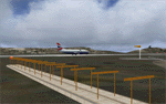
These files update the "FSX_St_Helena_Ascension_Tristan-da-Cunha.zip" project to its current, real-world status. They update the St. Helena (FHSH) localizer from the previous 15-degree offset to the present 5-degree offset, remove the glideslope from the ILS, and update the naming of the approach plates.
| Filename: | FHSH__St_Helena_Island_UPDATE_.zip |
| License: | Freeware |
| Added: | 22nd May 2016, 14:32:17 |
| Downloads: | 3,284 |
| Author: | Carlyle Sharpe |
| Size: | 274.34 KB |
| Category: Flight Simulator 2004 - AI Flight Plans | |
| Maya Island Air Winter 05 |
|
File Description:
Maya Island Air is one of the nationwide carriers in Belize servicing most popular destinations within the country with several BN2B Islander, C208B Grand Caravan and GA8 Gippsland Airvans
| Filename: | Maya_Island_Air_Winter_05.zip |
| License: | Freeware |
| Added: | 6th October 2005, 22:01:23 |
| Downloads: | 656 |
| Author: | Alf B. Meier |
| Size: | 7.52 KB |
| Category: Flight Simulator 2002 - Scenery | |
| Gillot 2003 - Reunion Island Airport |
|
File Description:
Gillot2003 is a scenery of Roland Garros airport, located on the
Reunion island. This scenery has been made with Gmax and the scenery
SDK from Microsoft.
| Filename: | Gillot_2003__Reunion_Island_Airport.zip |
| License: | Freeware |
| Added: | 13th January 2003, 13:35:12 |
| Downloads: | 3,826 |
| Author: | Yannick Mille |
| Size: | 3.11 MB |
| Category: Flight Simulator 2004 - Scenery Design | |
| Ketchikan and Revillagigedo Island, Alaska |
|
File Description:
This package DOES NOT contain finished FS scenery products! Instead, the three bitmaps (N55.2-56.1 W130.6-131.9) are meant to be used for FS landscape scenery design with Ground2K4 (by Christian Fumey) or similar utilities. Source data are public domain Landsat 7 TM satellite images, at 15-m and 30-m ground resolution. I used professional GIS software for the geographic transformation to lat/long-WGS84 projection, and photo processing software for channel merging and image enhancements. Each image has been tested in Ground2K4 for accurate placement. Note: these images have been ECW-compressed and need special (free) software for decompressing (instructions included).
| Filename: | Ketchikan_and_Revillagigedo_Island_Alaska.zip |
| License: | Freeware, limited distribution |
| Added: | 8th March 2004, 13:55:52 |
| Downloads: | 259 |
| Author: | Holger Sandmann |
| Size: | 16.13 MB |
| Category: Flight Simulator X - Scenery | |
| FSX Scenery Island of Saba |
|
File Description:
Scenery of Saba Island
Redisign of all coasts and land class
SABA airport
Citys : The Bottom, St John's, Windwardside, Hell's Gate
Harbour : Fort Bay
Roads and traffic adjust with land class
| Filename: | FSX_Scenery_Island_of_Saba.zip |
| License: | Freeware |
| Added: | 3rd October 2008, 01:27:15 |
| Downloads: | 5,729 |
| Author: | Valladier Jean louis |
| Size: | 1.62 MB |
| Category: Flight Simulator X - Scenery | |
| Merritt Island, FL Airport (KCOI) |
|
Images related to this file:
File Description:
Merritt Island is located on the east coast of Florida in the vicinity of Cape Canaveral and Cocoa Beach. Scenery in this package is based on Virtual Earth (Bing) and Google Earth imagery. This is a complete redo of the default FSX KCOI layout, surrounding landclass, FBO and hangers. Also includes placement of library objects and a library of new airport buildings.
| Filename: | Merritt_Island_FL_Airport_KCOI.zip |
| License: | Freeware |
| Added: | 17th April 2010, 19:47:04 |
| Downloads: | 1,689 |
| Author: | Art Poole |
| Size: | 1.14 MB |
| Category: Flight Simulator X - Scenery | |
| Cat Island - The Bahamas (MYCB) |
|
Images related to this file:
File Description:
This scenery adds runway and taxi paths and parking to accommodate AI traffic. It also includes custom scenery objects; placement of library objects and landclass changes. It is based on Google Earth imagery and photos taken by Harrington Mallory and is optimized for use with UTX-TAC.
| Filename: | Cat_Island__The_Bahamas_MYCB.zip |
| License: | Freeware |
| Added: | 3rd December 2012, 14:29:49 |
| Downloads: | 1,186 |
| Author: | Art Poole |
| Size: | 1.16 MB |
| Category: Flight Simulator 2004 - Scenery | |
| Nikolski (IKO), Nelson Lagoon (Z73), & Perryville (AK5) - Alaska, USA |
|
Images related to this file:
File Description:
These are villages in Alaska, spread out east and west of Dutch Harbor in the Aleutians and the peninsula, served by Grant Aviation regional flights from Dutch Harbor, Cold Bay, or King Salmon.
Nikolski is 115 miles west of Dutch Harbor at the western end of Umnak Island, which is just west of Unalaska, the large island adjacent to Dutch Harbor. Nikolski is small, with a population of perhaps only 20 now, and the main claim to fame is the wrecked Reeve Aleutian DC3 at the end of the runway. The runway is 3,500 feet of gravel aligned 08-26. Nelson Lagoon is on the north shore of the peninsula, 55 miles north of Sand Point and on a long spit of land that curves around to make the lagoon. There is no access except by boat or plane for the population of around 50. The airfield is a mile east of the village with a gravel runway 08-26, 4,000 feet long. Perryville is on the south shore of the peninsula, 65 miles east of Sand Point. The population is around 115, and the airfield is southwest of the town with the 3,500 feet of gravel runway aligned 02-20 beside the shore. There is a hangar on the apron, but no terminal building.
| Filename: | Nikolski_IKO_Nelson_Lagoon_Z73__Perryville_AK5__Al.zip |
| License: | Freeware, limited distribution |
| Added: | 14th March 2015, 13:27:53 |
| Downloads: | 258 |
| Author: | Roger Wensley |
| Size: | 11.45 MB |
| Category: Flight Simulator X - Aircraft Repaints, Textures and Modifications | |
| NHSL AW139 9Y-MRL (FSX/P3D) |
|
Images related to this file:
File Description:
For use in FSX use v2.0 by Carlos Palacio. For P3D v4/5 use the updated v2.1 by Marco Ferrarello. depicts the sole AW139 in NHSL's fleet. semi-fictional as the real-life bird a standard long nose, offshore configured aw139 and not an extended long nose SAR aw139.
| Filename: | NHSL_AW139_9YMRL_FSXP3D.zip |
| License: | Freeware |
| Added: | 11th March 2025, 22:44:48 |
| Downloads: | 44 |
| Author: | Andre Noreiga |
| Size: | 25.96 MB |


© 2001-2026 AVSIM Online
All Rights Reserved
Privacy Policy |