
Where Flight Simulation Enthusiasts Gather from Around the World!
AVSIM Library - Search Results

| Category: Flight Simulator X - Scenery | |
| Atlantic Island The Friendship City (Fictional) |

|
Images related to this file:
File Description:
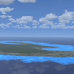
FSX Fictitious island in the middle of the Caribbean near Yucatan.
| Filename: | Atlantic_Island_The_Friendship_City_Fictional.zip |
| License: | Freeware |
| Added: | 5th June 2013, 07:17:21 |
| Downloads: | 208 |
| Author: | Gustavo Manjarres |
| Size: | 147.49 KB |
| Category: Flight Simulator 2004 - Scenery | |
| FHSH - Saint Helena International Airport - Ascension Island |
|
Images related to this file:
File Description:
FHSH, Saint Helena International Airport, located in Ascension Island, South Atlantic.
| Filename: | FHSH__Saint_Helena_International_Airport__Ascensio.zip |
| License: | Freeware |
| Added: | 29th April 2016, 16:02:35 |
| Downloads: | 560 |
| Author: | Alberto Thomas |
| Size: | 194.26 KB |
| Category: Flight Simulator 2002 - Scenery | |
| Kume Island Airport Version 1.0 |
|
File Description:
It is Kume island airport (Okinawa Japan) Scenery created using GMAX.
| Filename: | Kume_Island_Airport_Version_10.zip |
| License: | Freeware |
| Added: | 28th September 2002, 13:02:11 |
| Downloads: | 2,481 |
| Author: | Kazuhiro Miyazaki |
| Size: | 4.58 MB |
| Category: Flight Simulator 2002 - Aircraft Repaints, Textures and Modifications | |
| Lingoaer 747-400 |
|
File Description:
This will enable pilots of Lingoaer fly ultra long haul flights.
| Filename: | Lingoaer_747400.zip |
| License: | Freeware |
| Added: | 22nd July 2003, 00:56:56 |
| Downloads: | 57 |
| Author: | Daniel Counahan |
| Size: | 905.34 KB |
| Category: Prepar3D V1-4 - AFCAD Files | |
| KNUW Naval Air Station Whidbey Island |
|
File Description:
P3D v4.5 ADE file for KNUW Naval Air Station Whidbey Island
| Filename: | KNUW_Naval_Air_Station_Whidbey_Island.zip |
| License: | Freeware |
| Added: | 26th September 2020, 19:53:01 |
| Downloads: | 174 |
| Author: | Willem Van der Voort |
| Size: | 70.01 KB |
| Category: Flight Simulator X - Scenery | |
| FMCV - Ouani - Comores |
|
File Description:
This scene represents the island of Anjouan (Comoros) and its airport.
| Filename: | FMCV___Ouani___Comores.zip |
| License: | Freeware |
| Added: | 26th December 2010, 22:42:54 |
| Downloads: | 1,878 |
| Author: | CLAUZE Norbert |
| Size: | 1.02 MB |
| Category: Flight Simulator 2004 - Flight Plans | |
| World Flight 51-60 |
|
File Description:
These are the flights 51 to 60. It goes from Houston (Texas) over Amarillo (Texas), Denver (Colorado), Salt Lake City (Utah), Las Vegas (Nevada), Los Angeles (California), San Francisco (California), Honolulu (Hawaii), Johnston Island, Wake Island to Japan.
| Filename: | World_Flight_5160.zip |
| License: | Freeware |
| Added: | 12th February 2007, 21:25:35 |
| Downloads: | 511 |
| Author: | Klaus Hullermann |
| Size: | 42.65 KB |
| Category: Flight Simulator X - Scenery | |
| YTTI Troughton Island, Western Australia |
|
File Description:
YTTI Troughton Island - ShoreAir operates Troughton Island airstrip as an alternate to Mungalalu-Truscott. It has a 980m x 30m unsealed runway. Troughton Island sits 6 metres above sea level on a natural reef. Troughton is managed by two people who spend one month at a time on the island. During that time they are almost completely isolated from the outside world. Although they are isolated they are not alone; previous occupants of the island brought in quails and children's pythons that were once pets that escaped their cages during a cyclone. Now there is a healthy population of snakes living off the quails. Today Troughton Island is maintained as an emergency landing area for aircraft that are unable to reach Truscott. It also serves as a landing area if Truscott is inaccessible due to weather conditions. The Bureau of Meteorology has a weather station on Troughton island. Mungalalu-Truscott aerodrome supports all the FPSO (floating production storage and offloading facility) operations in the WA and NT waters of the Timor Sea, while the alternate aerodrome at Troughton Island is 20 nautical miles north of the main air route to Timor Sea facilities. REQUIRES Blencowe_LibraryKit.zip
REQUIRES blencowe_librarykit_309494.zip (Available HERE)
| Filename: | YTTI_Troughton_Island_Western_Australia.zip |
| License: | Freeware |
| Added: | 28th February 2013, 14:01:54 |
| Downloads: | 279 |
| Author: | Alan Blencowe |
| Size: | 2.37 MB |
| Category: Flight Simulator 2004 - Scenery | |
| Norfolk Island International Airport, YSNF. V-2 ( includes landclass fix). |
|
File Description:
WELKAM TU NORFUK AILEN.
Welcome to Norfolk Island International Airport.
Norfolk Island is a beautiful and popular holiday destination in the Pacific Ocean, between New Zealand and Australia.
Norfolk Air has scheduled flights to and from both Australia and New Zealand to the Island, and the airport is also used as a stepping stone for International GA flights.
This scenery is a total ground-up rebuild of my old YSNF scenery, and as such, requires you delete my older scenery totally from the sim before installing this one. It also contains the landclass fix for Norfolk which turns Microsoft's erronous "Water" island into an island with actual land. Contains a few small custom items (textures included). Requires some EZ Scenery Object Sets ( see INSTALL instructions for details).
| Filename: | Norfolk_Island_International_Airport_YSNF__V2__inc.zip |
| License: | Freeware, limited distribution |
| Added: | 24th April 2009, 23:59:03 |
| Downloads: | 2,326 |
| Author: | Lawrie Roache |
| Size: | 2.65 MB |
| Category: Flight Simulator 2004 - Scenery | |
| Cape Hooper CWFH and FOX-4 DEW Line Station in Nunavut, Canada |
|
Images related to this file:
File Description:
Cape Hooper is around 60 miles north of Kivitoo (FOX-D) and 140 miles south of Clyde River CYCY on the northeast-facing coast of Baffin Island. FOX-4 is still in use as a new and mostly-unmanned North Warning System site was established there in 1990 before the DEW line station was closed in 1991. Actually the DEW line station was not "closed" as such, they just stopped using it. The site of FOX-4 is on the top of a bump at the end of one of many long promontories that stick out into the Davis Strait between Baffin Island and Greenland, close to the far eastern end that is called Cape Hooper. There is a gravel runway to the west, down at 65' ASL; it is only just over 3,000' long and most material was delivered by sea to the beach at the southern end of the runway. The runway is signed as
"324T - 144T" as this is Northern Domestic Airspace where all runways are signed "true" and not "magnetic"; it is 013/193 magnetic with a huge magnetic variation of 48.9 degrees in this area where the magnetic field is mostly vertical, and so useless for navigation.
| Filename: | Cape_Hooper_CWFH_and_FOX4_DEW_Line_Station_in_Nuna.zip |
| License: | Freeware |
| Added: | 11th July 2011, 00:28:40 |
| Downloads: | 416 |
| Author: | Roger Wensley |
| Size: | 1.65 MB |


© 2001-2026 AVSIM Online
All Rights Reserved
Privacy Policy |