
Where Flight Simulation Enthusiasts Gather from Around the World!
AVSIM Library - Search Results

| Category: Flight Simulator 2004 - Scenery | |
| St. Kitts International Airport (Bradshaw), Caribbean |

|
File Description:
This scenery depicts the Robert L. Bradshaw International airport on the Island of St. Kitts in the Caribbean. It contains the modern new terminal, along with the distinctive green glass tower, and outer buildings. It is a small airport which is located in a valley between two mountain ranges near the southern end of the Island. The scenery has been updated to work in FS2004 by changing the location slightly, removing the hills which are no longer necessary, since FS has now done a great job with the new terrain. The tarmac area is now more representational of the airport, since the scenery tarmacs now override the default FS tarmacs, taxiways, and lines. The airport now has a cleaner layout, and the taxiway extending to the runway end now fits in perfectly. More trees have been added to prevent the stark look of the old scenery. This airport needs an afcad, since there are some A1 aircraft which park in the middle of the taxiway. This scenery will not work in FS2002.
| Filename: | St_Kitts_International_Airport_Bradshaw_Caribbean.zip |
| License: | Freeware |
| Added: | 23rd August 2003, 15:27:31 |
| Downloads: | 4,299 |
| Author: | Bill Melichar |
| Size: | 3.57 MB |
| Category: Flight Simulator 2004 - AFCAD Files | |
| WIKK/WIKP/WIDK Depati Amir, Pangkal Pinang, Indonesia |
|
Images related to this file:
File Description:
Googlyafcad A&F Data file for Depati Amir, based on Google Earth satellite data. It is a domestic airport located on the east coast of the island on Bangka serving the serving the largest town on the island, Pangkal Pinang, which is also the capital of the province
Bangka-Belitung.
The facilities in Flight Simulator 2004 only allow for general aviation traffic, but the
airport is regularly served by Boeing jets of Adam Air, Batavia Air and Sriwijaya Air as
well as smaller prop-driven craft of airlines like Merpati Nusentara. These files will
allow you and your "AI" traffic to land, taxi, park and take off in a realistic manner.
Like many airports in Indonesia, the ICAO code has changed in recent years. Microsoft
Flight Simulator 2004 uses the old code (WIKK) but this changed first to WIPK (in error)
and now WIDK. These files allow you to continue using the old code or change to the new
one. [File re-uploaded at request of AVSIM]
| Filename: | WIKKWIKPWIDK_Depati_Amir_Pangkal_Pinang_Indonesia.zip |
| License: | Freeware |
| Added: | 29th May 2010, 09:30:30 |
| Downloads: | 755 |
| Author: | John Hinson |
| Size: | 69.96 KB |
| Category: Flight Simulator X - Scenery | |
| Gold Coast Airport (YBCG) |
|
File Description:
The Gold Coast Airport (formerly known as Coolangatta) is a busy international airport located some 100 ks south of Brisbane and 850 ks north of Sydney. This scenery contains and accurate depiction of the terminal, control tower, hangers and the very distinctive lighthouse at Coolangatta (with beacon) plus night lighting of the apron. In addition many buildings have been added to Coolangatta and Surfers some of which are original but many are stock buildings. The scenery has been reduced in complexity to attempt to be reasonably frame rate friendly. All models are GMAX or FSDS3.0. Extensive coastline changes has added beaches as far south as Byron Bay and the canal network behind Surfers Paradise, Bond Uni, Currumbin and Coolangatta. Recent upgrades of the airport to a 2500 metre runway have been reflected as well as a widened apron. Therefore it may look a little different from the current Google Earth image but it is accurate. The airport will now handle direct flights from Asia and typical planes landing might include Airbus 343 or similar wide bodied aircraft.
| Filename: | Gold_Coast_Airport_YBCG.zip |
| License: | Freeware |
| Added: | 12th July 2007, 15:08:44 |
| Downloads: | 6,175 |
| Author: | John Ross |
| Size: | 12.16 MB |
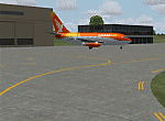
| Category: Flight Simulator X - Aircraft Repaints, Textures and Modifications | |
| US Navy P-8A "Poseidon" of VP-40 "Fighting Marlins" at NAS Whidbey Island, WA |
|
Images related to this file:
File Description:
This is a repaint of PMDG's excellent 737NGX series. These textures represent a P-8A Poseidon of the United States Navy as it could appear as a memeber of VP-40, "Fighting Marlins" at NAS Whidbey Island, WA. This scheme is presently fictitious. VP-40 has not received any Poseidons as of yet. When they do it may or may not appear as these textures represent. The textures are those of an artist interpretation and resulting rendition. THESE ARE TEXTURES ONLY! You need the PMDG "737 NGX 800/900 Base Pack" payware package.
| Filename: | US_Navy_P8A_Poseidon_of_VP40_Fighting_Marlins_at_N.zip |
| License: | Freeware, limited distribution |
| Added: | 9th September 2012, 20:59:42 |
| Downloads: | 1,055 |
| Author: | Russel R. Smith & PMDG |
| Size: | 31.77 MB |
| Category: Flight Simulator 2004 - Scenery | |
| Kivitoo, Paulatuk, Qikiqtarjuak, Rowley Island, & West Baffin, adapted for FSGenesis 76m North Canada Terrain Mesh |
|
Images related to this file:
File Description:
These are replacement bgl's to convert five northern Canada fields for use with the FSGenesis 76m terrain mesh for northern Canada. The five are Kivitoo CWFK, Paulatuk CYPC, Qikiqtarjuak CYVM, Rowley Island CWFR, and West Baffin CWFW. These are not stand-alone, and the presumption is that you have already downloaded and installed the previously posted sceneries. This installation consists solely of replacing the existing scenery bgl's with the new. This is the last post of adapted northern airfields (unless more are discovered needing revision) and observations regarding and any further corrections that are required would be welcomed.
| Filename: | Kivitoo_Paulatuk_Qikiqtarjuak_Rowley_Island__West_.zip |
| License: | Freeware, limited distribution |
| Added: | 18th September 2017, 22:28:33 |
| Downloads: | 87 |
| Author: | Roger Wensley |
| Size: | 3.02 MB |
| Category: Flight Simulator X - Aircraft Repaints, Textures and Modifications | |
| Northeast 'Yellowbird' Boeing 727-200 <p>FS2004/FSX</p> |
|
Images related to this file:
File Description:
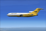
This is a repaint of the TDS 727-200 in the Northeast 'Yellowbird' livery. Northeast flew both the 727-100s and 727-200s. Northeast was a major U.S. carrier with a long history, based in Boston. It was formed in 1931 and was merged into Delta in 1972. This aircraft was tested on FSX-SE only but should work in the boxed FSX and FS2004. You need the TDS 727-200 base pack for this repaint. The textures are 32bit & DXT3.
| Filename: | Northeast_Yellowbird_Boeing_727200_pFS2004FSXp.zip |
| License: | Freeware |
| Added: | 13th February 2017, 04:43:32 |
| Downloads: | 268 |
| Author: | Ted Giana |
| Size: | 9.86 MB |
| Category: Flight Simulator 2004 - Scenery | |
| Hadera 'Orot-Rabin' Power-Plant V2 |
|
File Description:
FS2004 Scenery - Orot-Rabin power plant near Hadera,
Israel (named after the late Israeli prime minister) is located
on the Mediterranean coast between Tel-Aviv and Haifa and
therefore is a well known landmark for VFR pilots. The
power plant is operated with coal and has an output of two
700mw + one 1,400mw turbines. A total of 2,800mw and
a 1,800 meter long unloading pier for coal ships. Made in
gmx. Enhanched with smoke effects and night lighting
for navigation.
| Filename: | Hadera_OrotRabin_PowerPlant_V2.zip |
| License: | Freeware |
| Added: | 18th November 2003, 16:55:19 |
| Downloads: | 6,785 |
| Author: | Seev Kahn |
| Size: | 687.86 KB |
| Category: Flight Simulator 2004 - Scenery | |
| 4AK6 - Wolf Lake - Anchorage, Alaska - USA |
|
Images related to this file:
File Description:
Wolf Lake 4AK6 is in Alaska, some 10 miles northeast of Wasilla, on the north side of Knik Arm. It is an airpark, with houses and hangars adjacent to a runway that is 3,800 feet of asphalt aligned 06-24. The runway is lit but the taxiways are not. There is a second runway that is around 2,500 feet long and aligned 36-18, which is grass and unlit. The C-130 is permanently parked, and seeing it land would have been interesting.
| Filename: | 4AK6__Wolf_Lake__Anchorage_Alaska__USA.zip |
| License: | Freeware, limited distribution |
| Added: | 15th October 2014, 13:38:39 |
| Downloads: | 371 |
| Author: | Roger Wensley |
| Size: | 7.32 MB |
| Category: Flight Simulator X - Scenery | |
| YMBE Mooliabeenie Siding, Western Australia (closed) |
|
File Description:
YMBE Mooliabeenie Siding is a disused 1,500 m (4,900 ft) long satelite airstrip which was used by the United States Army Air Corps during World War II and associated with the Caversham Airfield at Middle Swan. Like the Caversham Airfield, the Mooliabeenee Airfield was later used an auto racetrack. Local car clubs regularly use the site for motorkhana events. REQUIRES Blencowe_LibraryKit.zip
REQUIRES blencowe_librarykit_309494.zip (Available HERE)
| Filename: | YMBE_Mooliabeenie_Siding_Western_Australia_closed.zip |
| License: | Freeware |
| Added: | 28th February 2013, 13:56:01 |
| Downloads: | 195 |
| Author: | Alan Blencowe |
| Size: | 5.98 MB |
| Category: Flight Simulator X - Scenery | |
| San Giovanni Rotondo Puglia Italy Coordinate N 41°42 'E 15° 44' |
|
File Description:
San Giovanni Rotondo is an Italian municipality in the province of Foggia in Puglia Italy, rises 1256m above the
promontory of El Gargano, famous in the world for hosting the remains of St. Pius by Pietrelcina, cappuccino friar who
lived long in the homonym city. Geographic coordinates N 41° 42 'E 15° 44'. The scenery is an important VFR point at
1256m for those who want to fly over the Gargano. Within the package you will find instructions for installing the scenery.
| Filename: | San_Giovanni_Rotondo_Puglia_Italy_Coordinate_N_414.zip |
| License: | Freeware |
| Added: | 2nd September 2017, 18:12:17 |
| Downloads: | 369 |
| Author: | Pasquale Marrulli |
| Size: | 1.71 KB |
© 2001-2026 AVSIM Online
All Rights Reserved
Privacy Policy |