
Where Flight Simulation Enthusiasts Gather from Around the World!
AVSIM Library - Search Results

| Category: Flight Simulator 2004 - Aircraft Repaints, Textures and Modifications | |
| German Air Force VIP-Transporter, Airbus A340-313 (16+01) |

|
Images related to this file:
File Description:

This is a repaint of the new long-range VIP transport aircraft A340-313 (16+01) of The Special Air Mission Wing of the German Federal Ministry of Defense, utilizing the A343 model from Overland/Simmer Sky's payware 'World Airlines' packages.
| Filename: | German_Air_Force_VIPTransporter_Airbus_A340313__16.zip |
| License: | Freeware |
| Added: | 4th January 2010, 19:23:50 |
| Downloads: | 357 |
| Author: | Kay Lindemann |
| Size: | 3.02 MB |
| Category: Flight Simulator X - Scenery | |
| TNCM - Princess Juliana Intl Update |
|
File Description:
This is an update for TNCM-Princess Juliana Intl(princess_juliana_intl_scenery.zip). In this file contains the missing textures for the Trucks and signs. Im sorry it took me this long to figure out i didnt provide them in the first place.
| Filename: | TNCM__Princess_Juliana_Intl_Update.zip |
| License: | Freeware |
| Added: | 18th January 2009, 12:44:11 |
| Downloads: | 11,005 |
| Author: | Derek Souza |
| Size: | 2.02 MB |
| Category: Prepar3D V1-4 - Scenery | |
| KPAH, Paducah KY |
|
Images related to this file:
File Description:
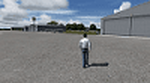
This package covers KPAH, Barkley Field airport in Paducah KY. It has two runways, 4-22 which is 6500 feet long and 14-32 which is 5499 feet long. It has scheduled airline service using CRJ's to Chicago each day. On one side of the field is the GA component with Midwest Aviation as the FBO. On the other side of the field is the airline terminal. All of the buildings are custom made from Google Maps including the new large armed forces reserve center. I also modeled the Nexrad radar which is on the field. I hope you enjoy!
| Filename: | KPAH_Paducah_KY.zip |
| License: | Freeware |
| Added: | 23rd June 2017, 01:09:14 |
| Downloads: | 442 |
| Author: | Shannan Landreth |
| Size: | 27.1 MB |
| Category: Flight Simulator 2004 - Scenery | |
| El Jadida GMMJ Sassane Island Airbase Artificial Base Fictional |
|
File Description:
Hi,
I am always working hard to create a fictional air base of the OTAN. But, my purpose
is always for childrens which believe in extraterrestrials kinds. This is a hard boring work with an inclusion of ils and many many kinds of things.
I am very like to increase my work for terrabuilding and mesh or scenery. But this is simply freeware to enter in this domain creating for play and fictional scenery or aircraft.
| Filename: | El_Jadida_GMMJ_Sassane_Island_Airbase_Artificial_B.zip |
| License: | Freeware |
| Added: | 2nd December 2005, 04:32:45 |
| Downloads: | 227 |
| Author: | DOUKKALI HASSAN |
| Size: | 953.14 KB |
| Category: Flight Simulator X - Scenery | |
| Whale Island Scenery: "Islands of the Bay of Plenty" |
|
File Description:
This scenery was created from a digital Orthorectified aerial mosaic owned by Environment Bay of Plenty (The Bay of Plenty Regional Council). The imagery has been de-sampled for use in Flight Simulator X and utilizes the default terrain mesh. The textures are intended for summer daylight flying only, although due to the sparse nature of White Islands' Evegetation, the Islands appearance remains relatively consistent throughout the year.
It includes autogen trees, a landable helicopter pad on the top of the Island, Radio masts, and the Department of Conservation (DOC) hut in the south western bay of the island.
| Filename: | Whale_Island_Scenery__Islands_of_the_Bay_of_Plenty.zip |
| License: | Freeware, limited distribution |
| Added: | 9th May 2007, 08:42:59 |
| Downloads: | 1,496 |
| Author: | Tim Barnes |
| Size: | 7.05 MB |
| Category: Flight Simulator X - Aircraft Repaints, Textures and Modifications | |
| Boeing 747-400 Qantas Airways - "Phillip Island" (VH-OEB) |
|
File Description:
New color scheme for Qantas Boeing747-400. Textures only for payware PMDG boeing 747-400X for FSX. Enhanced bumpmap to have some texture on fuselage surface. Enhanced Specular effects. Changed Manual covers in VC.
| Filename: | Boeing_747400__Qantas_Airways__Phillip_Island_VHOE.zip |
| License: | Freeware |
| Added: | 25th October 2008, 03:22:40 |
| Downloads: | 2,899 |
| Author: | jathedar singh |
| Size: | 2.94 MB |
| Category: Flight Simulator 2004 - Scenery | |
| Gjoa Haven CYHK, on King William Island, Nunavut, Canada, |
|
Images related to this file:
File Description:
Gjoa Haven is a village of 1,200 or so inhabitants at N 68 38 W 95 51 on the southeast corner of King William Island, around 155 miles north of the Arctic Circle. It's Inuit name is Uqsuqtuuq; the Gjoa Haven name was given by the Norwegian explorer Roald Amundsen when he spent two years there from 1903 to 1905 during his exploration of the northwest passage from east to west. His boat was called Gjoa and the cove was named Gjoa Harbour, in Norwegian. The village has been added in this scenery with approximately the right shape; though the coastline with Ultimate Terrain does have the small cove that serves as a harbor the coast shape is wrong. The airfield runway is 4,400 feet of gravel 100 feet wide at 154 feet above sea level. There is no LL100 available, only JetA1, delivered once a year by ship along with all the other requirements of the town. There is also a nearby CAM-B remotely operated defence radar station with its three protective domes. The old terminal building is still there, albeit repainted and spruced up, along with the far larger and newer one alongside it.
One of the screen shots shows Gjoa Haven as it appears for at least 8 months of the year, with snow on the ground and sea ice all around. If you want the ice then download my recent post of All Canada frozen lakes, rivers, and the northern seas, reversible with an untick in the FS scenery library.
| Filename: | Gjoa_Haven_CYHK_on_King_William_Island_Nunavut_Can.zip |
| License: | Freeware, limited distribution |
| Added: | 19th February 2011, 15:42:51 |
| Downloads: | 551 |
| Author: | Roger Wensley |
| Size: | 2.68 MB |
| Category: Flight Simulator X - Scenery | |
| Juancho E. Irausquin Airport, TNCS, Caribbean island of Saba |
|
File Description:
This airport is shown as SABA in FSX. Juancho E. Irausquin Airport (IATA: SAB, ICAO: TNCS) is the only airport on the Caribbean island of Saba. It is well known among professional pilots for the way in which airplanes must approach or take off from the airport.
| Filename: | Juancho_E_Irausquin_Airport_TNCS_Caribbean_island_.zip |
| License: | Freeware |
| Added: | 19th May 2011, 21:21:36 |
| Downloads: | 3,165 |
| Author: | Anwar Gonzalez |
| Size: | 3.87 KB |
| Category: Flight Simulator X - Scenery | |
| YLEA Leeman, Western Australia (Snag Island) airstrip and town |
|
File Description:
YLEA Leeman - formerley Snag Island is a tiny fishing village which is ideal for fishermen and holiday makers eager to get away from the more commercialised centres. Calling itself the 'Home of Western Australia's Dhufish' the settlement boasts huge and dramatic white sand dunes, good beach and offshore fishing, safe beaches for surfing, swimming and sailboarding, and superb displays of wildflowers in the spring. Leeman is home to a crayfish (lobster) fishing fleet which plies the fishing grounds off the coast in the season. The industry developed in the 1950s and has since become one of the most important on the Central West coast. It is also a dormitory suburb for the nearby sand mining town of Eneabba. REQUIRES Blencowe_LibraryKit.zip
REQUIRES blencowe_librarykit_309494.zip (Available HERE)
| Filename: | YLEA_Leeman_Western_Australia_Snag_Island_airstrip.zip |
| License: | Freeware |
| Added: | 28th February 2013, 13:54:58 |
| Downloads: | 229 |
| Author: | Alan Blencowe |
| Size: | 1.39 MB |
| Category: Flight Simulator 2004 - Scenery | |
| Ontario Small Fields in Canada: #05 Pelee Island (CYPT) |
|
Images related to this file:
File Description:
This is the fifth in a series of small airfields in southern Ontario Canada, Pelee Island CYPT, an airfield on the island in Lake Erie and the southernmost airfield in Canada. The airfield has an asphalt runway of 3,300 feet, aligned 09/27 in FS9 while today in real life it is 10/28 due to the wandering magnetic pole. There is also a second runway, 36/18 and around 1,500 feet of gravel. There is a small terminal building which now has blue cladding; here it is still in the dirty yellow of the original colour scheme.
This version is based upon what appears to be a "lost" 2005 scenery of Pelee Island. When I started to make Pelee Island I discovered that in fact I already had a version installed; my memory can be excused, as I installed it in 2005. I modified the scenery to include parking, taxiways that connected, revised runway markings, new windsocks, new signage, larger apron, parked cars and planes, revised landclass, AI, etc. My intention was to instruct you to download and install the original and then incorporate my changes. Problem: it does not appear to exist for download; perhaps it was washed away when the Avsim site crashed. I have included it in this post. If anyone knows who made it please let me know.
| Filename: | Ontario_Small_Fields_in_Canada_05_Pelee_Island_CYP.zip |
| License: | Freeware, limited distribution |
| Added: | 5th August 2015, 18:52:25 |
| Downloads: | 171 |
| Author: | Roger Wensley |
| Size: | 4.39 MB |


© 2001-2026 AVSIM Online
All Rights Reserved
Privacy Policy |