
Where Flight Simulation Enthusiasts Gather from Around the World!
AVSIM Library - Search Results

| Category: Flight Simulator 2004 - AI Aircraft | |
| Catovair Beech 1900D |

|
File Description:
Catovair is a new small airline in Mauritius. It flies a single Beech 1900D between Mauritius and Rodriguez island. This is a repaint for the AI mdoel by Henry Tomkiewicz. by Daan 'dustEagle' Callaerts
| Filename: | Catovair_Beech_1900D.zip |
| License: | Freeware, limited distribution |
| Added: | 14th May 2006, 22:55:55 |
| Downloads: | 1,073 |
| Author: | Daan Callaerts |
| Size: | 160.21 KB |
| Category: Flight Simulator 2004 - AI Aircraft | |
| Lake Taupo Floatplanes Cessna 206 |
|
File Description:
ZK-DXC is a Cessna 206 Floatplane operating from Lake Taupo in the middle of the North Island of New Zealand.
Textures only. This repaint is based on Henry Tomkiewicz's payware model and paintkit.
| Filename: | Lake_Taupo_Floatplanes_Cessna_206.zip |
| License: | Freeware |
| Added: | 5th January 2006, 14:37:12 |
| Downloads: | 250 |
| Author: | Steve Jenks |
| Size: | 165.55 KB |
| Category: Flight Simulator 2004 - AI Aircraft | |
| Air Fiordland Cessna 207 |
|
File Description:
ZK-NPA is a Cessna 207 operated by Air Fiordland for scenic flights in the lower South Island of New Zealand.
Textures only. This repaint is based on Henry Tomkiewicz's payware model and paintkit.
| Filename: | Air_Fiordland_Cessna_207.zip |
| License: | Freeware |
| Added: | 27th December 2005, 01:19:06 |
| Downloads: | 346 |
| Author: | Steve Jenks |
| Size: | 139.51 KB |
| Category: Flight Simulator 2004 - AI Aircraft | |
| Cessna C28B Grand Caravan PH-JAS |
|
File Description:
The PH-JAS is used for para droppings at the island of Texel (EHTX).
Enjoy the plane; for AI use only (no para's includid). Model and used paintkit by Henry Tomkeiwicz and Tony Fosler.
| Filename: | Cessna_C28B_Grand_Caravan_PHJAS.zip |
| License: | Freeware |
| Added: | 5th June 2007, 01:02:14 |
| Downloads: | 212 |
| Author: | Henry Tomkeiwicz, Frans Fransen |
| Size: | 156.73 KB |
| Category: Flight Simulator 2004 - Scenery | |
| Pantelleria LICG v2 |
|
Images related to this file:
File Description:
The small Pantelleria Airport (LICG). For more realism, it's advised to use the photoreal scenery of Italy Island. File includes: Txy B, parking civil and military, military hangar, helipads and the new ILS rwy26.
| Filename: | Pantelleria_LICG_v2.zip |
| License: | Freeware |
| Added: | 17th March 2014, 05:26:14 |
| Downloads: | 388 |
| Author: | Francesco Mura |
| Size: | 32.7 MB |
| Category: Flight Simulator X - Scenery | |
| Rinjani Volcano - Indonesia |
|
File Description:
This scenery will bring to life Rinjani Volcano on the island of Lombok in Indonesia. Indonesia has the highest concentration of active volcanoes of any country in the world. See readme for full instructions.
| Filename: | Rinjani_Volcano__Indonesia.zip |
| License: | Freeware |
| Added: | 6th January 2011, 18:11:04 |
| Downloads: | 2,333 |
| Author: | Kym Burton |
| Size: | 256.14 KB |
| Category: Flight Simulator 2004 - Scenery | |
| Madeira 76m SRTM Terrain Mesh |
|
File Description:
USGS SRTM 3 arc-second, resampled to LOD9 (76 meters).
This is a terrain mesh scenery of the Island of Madeira west of Morocco, Africa.
Included are the islands of Madeira and Porto Santo.
| Filename: | Madeira_76m_SRTM_Terrain_Mesh.zip |
| License: | Freeware, limited distribution |
| Added: | 4th April 2004, 16:48:40 |
| Downloads: | 13,099 |
| Author: | Andreas Trawny |
| Size: | 522.21 KB |
| Category: Flight Simulator 2004 - Scenery | |
| Hall Beach CYUX in Nunavut, Canada |
|
Images related to this file:
File Description:
Hall Beach is on the Melville Peninsula, part of the mainland of Canada, south and west of Baffin Island. It is around 40 miles south of Igloolik and 50 miles west of Rowley, both of them my previous posts. The airfield was built to support the construction and operation of a main DEW line radar station and to support the rest of the associated chain. Because of the employment opportunities this brought, a village developed nearby. The airfield continues in regular use and the runway, though still gravel, is 5,400' long and 150' wide and lighted; the alignment is 124T and 304T as this is in northern domestic airspace and bearings are given as 'true" and not "magnetic". There are scenery folders for the village, roads, grass, etc, and AI for two airlines with regular service to Hall Beach.
| Filename: | Hall_Beach_CYUX_in_Nunavut_Canada.zip |
| License: | Freeware, limited distribution |
| Added: | 22nd November 2011, 14:33:08 |
| Downloads: | 456 |
| Author: | Roger Wensley |
| Size: | 3.83 MB |
| Category: Flight Simulator X - Scenery | |
| Montserrat Island - Leeward Islands, Lesser Antilles, Caribbean Sea |
|
Images related to this file:
File Description:
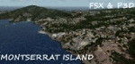
A representation of Montserrat using photo-real scenery along with hand placed autogen.
Montserrat is a British overseas territory located in the Leeward Islands, part of the chain of islands called the Lesser Antilles in the Caribbean Sea. Its capital city of Plymouth was destroyed by an eruption of the previously dormant Soufriere Hills volcano in 1995. Between 1997 and 2005, Montserrat had been accessible only by helicopters or boats.
The airport's name was changed in July 2008 to honour John Osborne, long-standing Chief Minister of Montserrat and the airline FlyMontserrat has its headquarters on the airport property.
For the best results of this scenery, PWSceneries Volume 5 has to be installed. Features included are custom photo scenery covering the entire island, hand placed autogen, detailed 3D Objects and custom buildings. Works in FSX and P3D.
| Filename: | Montserrat_Island__Leeward_Islands_Lesser_Antilles.zip |
| License: | Freeware |
| Added: | 24th September 2015, 10:59:37 |
| Downloads: | 835 |
| Author: | Kenje Thomas |
| Size: | 132.48 MB |
| Category: Flight Simulator 2004 - Scenery | |
| Georgian Bay Airfields CYEM & CNR4 in Ontario, Canada |
|
Images related to this file:
File Description:
These are two airfields in Ontario around Georgian Bay, which is off the east side of Lake Huron in the Great Lakes. Manitoulin East Muni CYEM is at the northern end of the Bay in an area of coves and lakes, on what is actually an island that is almost but not quite connected to the mainland in several places. There is no immediately adjacent town and the field serves the county area. The runway is 3,500 feet of asphalt aligned 02-20 with PAPI at both ends. The second airfield is Tobermory CNR4, which is just south of the small town and ferry terminal of the same name on the northern end of the peninsula that forms Georgian Bay. The runway is 3,180 feet long and aligned 12-30; there is no longer a 450 feet displacement to the 30 threshold.
| Filename: | Georgian_Bay_Airfields_CYEM__CNR4_in_Ontario_Canad.zip |
| License: | Freeware, limited distribution |
| Added: | 12th August 2018, 19:31:18 |
| Downloads: | 138 |
| Author: | Roger Wensley |
| Size: | 17.45 MB |
© 2001-2026 AVSIM Online
All Rights Reserved
Privacy Policy |