
Where Flight Simulation Enthusiasts Gather from Around the World!
AVSIM Library - Search Results

| Category: Prepar3D V1-4 - Scenery | |
| CYYG - Charlottetown Airport - Prince Edward Island, Canada |

|
File Description:
Charlottetown Airport, Prince Edward Island, Canada (IATA: YYG, ICAO: CYYG), is located 3 NM (5.6 km; 3.5 mi) north of Charlottetown, Prince Edward Island, Canada. The airport is currently run by the Charlottetown Airport Authority, is owned by Transport Canada and forms part of the National Airports System. The airport is classified as an airport of entry by NAV CANADA and is staffed by the Canada Border Services Agency.
| Filename: | CYYG__Charlottetown_Airport__Prince_Edward_Island_.zip |
| License: | Freeware |
| Added: | 10th October 2015, 11:31:26 |
| Downloads: | 466 |
| Author: | Robert Catherall |
| Size: | 821.4 KB |
| Category: Flight Simulator 2004 - Scenery | |
| Western Australia 11 airports |
|
File Description:
The FS2004 is missing. I created 11 additional airports in Western Australia for gold, diamonds, and other mines all are new developed mines that are missing in FS2004. The airports are Port Hedland, Wodgina -YWGA * Gudai-Darri Mine - YKDD * Carosue Dam Gold Mine - YSCD * Eliwana - YEWA * Yamarna - YYRN * Koolan Island Center - YKLC * Koolan Island (old) - YKLI * Gruyere - YGRM * Iron Bridge Mine - YIBO * Ginbata/Roy Hill Mine - YGIA * Degrussa - YDGU *
| Filename: | Western_Australia_11_airports.zip |
| License: | Freeware |
| Added: | 17th September 2021, 15:48:50 |
| Downloads: | 172 |
| Author: | Stuart John Gilbert II |
| Size: | 15.42 MB |
| Category: Flight Simulator 2004 - AFCAD Files | |
| Annette Island Airport, Annette, Alaska (PANT) Bush Flying Unlimited - Crossing runways |
|
File Description:
Version 1.1 of the AFCAD2 File for FS2004 PANT Annette Island, Alaska USA with crossing runways enabled. This version fixed an issue that sometimes caused the wrong star runway to be recognised as active. The original AFCAD2 file was designed by Chris Coarse for use with Bush Flying Unlimited North (Annette Island) Scenery by Brian Gladden. This will not work with the default scenery or any other PANT scenery package.
| Filename: | Annette_Island_Airport_Annette_Alaska_PANT_Bush_Fl.zip |
| License: | Freeware |
| Added: | 2nd January 2006, 21:55:09 |
| Downloads: | 459 |
| Author: | Brad Banister / Brian Gladden / Chris Coarse |
| Size: | 25.27 KB |
| Category: Flight Simulator 2004 - Scenery | |
| Mactan-Cebu International Airport |
|
File Description:
Cebu City is the second metropolitan area of the Republic of the Philippines. Cebu Island is a vacationer's paradise with its white beaches, sea food galore, the famous Cebu Lechon, and of course, San Miguel Beer.The city is served by Mactan-Cebu International Airport located on Mactan Island which is about 7 miles from the City. This scenery will get you there in MS Flight Simulator 2004.
Welcome to Cebu City!
| Filename: | MactanCebu_International_Airport.zip |
| License: | Freeware |
| Added: | 28th February 2004, 18:54:39 |
| Downloads: | 11,180 |
| Author: | Emmanuel Aquino, Jr. |
| Size: | 4.56 MB |
| Category: Prepar3D V1-4 - Scenery | |
| Bahamas Scenery Pack 3-1: N & W Bahamas, Turks and Caicos + Eleuthera and Cat Island |
|
File Description:
This release replaces/updates Bahamas Scenery Pack 2-3. It includes everything in 2-3 (i.e., N and E Bahamas and Turks and Caicos) plus the first part of the Eastern Bahamas: Eleuthera and Cat Island! Other improvements include: * Added road traffic to all areas of the Bahamas * Improved coastlines around Grand Bahama and Bimini island.* Updated land class maps to improve appearance with Orbx Global Base scenery.
| Filename: | Bahamas_Scenery_Pack_31_N__W_Bahamas_Turks_and_Cai.zip |
| License: | Freeware |
| Added: | 1st June 2020, 18:49:14 |
| Downloads: | 2,035 |
| Author: | Gregory Goodwin |
| Size: | 25.65 MB |
| Category: Prepar3D V1-4 - Scenery | |
| PWAK Wake Island Airfield - Micronesia, Pacific Ocean |
|
File Description:
This scenery updates PWAK Wake Island Airfield located in the Micronesia region of the Pacific Ocean. The airport has been extensively modified to reflect its current configuration and specifications. Also included are optional landclass files for Wake Island and Kwajalein Atoll, as well as a slightly modified PKWA Bucholz Army Airfield on Kwajalein Atoll which just adds some aircraft parking. Please see the Readme file for more information and installation instructions.
| Filename: | PWAK_Wake_Island_Airfield__Micronesia_Pacific_Ocea.zip |
| License: | Freeware |
| Added: | 30th May 2021, 06:56:27 |
| Downloads: | 347 |
| Author: | David Midgett |
| Size: | 1023.94 KB |
| Category: Flight Simulator X - Aircraft Repaints, Textures and Modifications | |
| Ajira Airlines Boeing 737-700W * Fictional * |
|
Images related to this file:
File Description:

Fictional repaint of the PMDG 737-700NGX WL in Ajira Airways livery from the TV show "Lost."----"Ajira Airways Flight 316 was a scheduled passenger flight from Los Angeles, California, United States to Guam, a U.S. territory in the western Pacific. It was due to reach Guam via a stop in Honolulu, Hawaii, United States, on a Boeing 737 owned and operated by Ajira Airways and piloted by Frank Lapidus. It was chosen by Eloise Hawking as a flight for the Oceanic Six to use to return to the Island. The plane crash-landed on Hydra Island in 2007. While some members of the Oceanic Six were teleported onto the Island in 1977 (Jack, Kate, Hurley, and Sayid), most of the passengers survived the crash, though some with minor or severe injuries. 14 days later, Frank flew the plane off Hydra Island with Kate, Claire, Richard, Sawyer, and Miles on board." - Lostpedia
| Filename: | Ajira_Airlines_Boeing_737700W__Fictional_.zip |
| License: | Freeware |
| Added: | 17th June 2014, 08:51:43 |
| Downloads: | 108 |
| Author: | Ray Reyes |
| Size: | 9.5 MB |
| Category: Flight Simulator X - Scenery | |
| SCIP - Isla de Pascua & Mataveri Intl - Easter Island |
|
Images related to this file:
File Description:
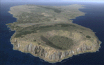
This project rebuilds Easter Island / Isla de Pascua. Mataveri Intl (SCIP) is completely overhauled, and all airport objects are aligned from satellite imagery. Landclass polygons and coastlines were meticulously hand-drawn directly from satellite imagery to provide the most detailed and accurate scenery available for this region. AI road and boat traffic is activated for the region. Accurate coastlines and road data, as well as corrected land and waterclass are provided based on the latest available satellite imagery. GA flights use default aircraft and include an option to add Chilean Air Force planes around the island. Numerous Moai (Easter Island heads) have been placed around the island according to satellite imagery. Scenery was created using Airport Design Editor X v1.61.5298, SBuilderX 3.13, and the FSX Object Placement Tool. Scenery objects were added and modified from stock FSX scenery to resemble as closely as possible the actual airports. The FSX apron lights included are from the terrific set created by Jim Dhaenens.
| Filename: | SCIP__Isla_de_Pascua__Mataveri_Intl___Easter_Islan.zip |
| License: | Freeware |
| Added: | 12th July 2014, 08:17:55 |
| Downloads: | 5,736 |
| Author: | Carlyle Sharpe |
| Size: | 5.33 MB |
| Category: Flight Simulator 2004 - Scenery | |
| MYER Rock Sound International, Eleuthera Island, Bahamas |
|
File Description:
Googly scenery for Rock Sound International (ICAO: MYER), a grand-sounding but
quiet airport located on Eleuthera Island, Bahamas. Eleuthera is a long
and thin island east of Nassau and has three commercial airports, the busiest
being Governor's Harbour. Rock Sound is at the southern end and is served twice
daily by Dash 8 turboprops of Bahamasair, along with occasional flights by
operators such as Southern Air Charter. The airport has seen busier days and
was once even served from Europe by Alitalia.
Microsoft have only provided general aviation facilities at this airport in
Flight Simulator 2004 and this scenery seeks to redress the situation
so that you and your "AI" traffic can use the airport realistically.
The scenery does not purport to be ultra-accurate. Based on high quality
satellite imagery from Google Earth, the layout is proportionally correct but the
added airport features, such as buildings, are built from default Microsoft objects
and add-on libraries so will not look exactly like the real thing.
You are not obliged to download and install any additional scenery libraries,
but to enjoy this scenery in its entirety, you may wish to. It will work fine,
with or without.
| Filename: | MYER_Rock_Sound_International_Eleuthera_Island_Bah.zip |
| License: | Freeware |
| Added: | 13th October 2008, 11:01:56 |
| Downloads: | 1,468 |
| Author: | John Hinson |
| Size: | 61.42 KB |
| Category: Flight Simulator X - Scenery | |
| Nevis Island - Federation of Saint Kitts and Nevis |
|
Images related to this file:
File Description:
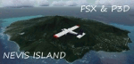
A representation of Nevis using photo-real scenery along with hand placed autogen. Vance W. Amory International Airport serves the island of Nevis in the Federation of Saint Kitts and Nevis. The airport has a single runway of about 1,220 meters. The airport is available to most aircraft, being an international airport. For this scenery to be well presented, PWSceneries Volume 5 has to be installed. Included are instructions to the necessary changes. Includes photo-scenery of the entire island along with hand placed autogen and the Airport facilities.
Features included with the package are custom photo scenery covering the entire island hand placed autogen and detailed 3D Objects and custom buildings. Works in FSX and P3D.
| Filename: | Nevis_Island__Federation_of_Saint_Kitts_and_Nevis.zip |
| License: | Freeware |
| Added: | 24th September 2015, 10:51:00 |
| Downloads: | 530 |
| Author: | Kenje Thomas |
| Size: | 85.28 MB |


© 2001-2026 AVSIM Online
All Rights Reserved
Privacy Policy |