
Where Flight Simulation Enthusiasts Gather from Around the World!
AVSIM Library - Search Results

| Category: Flight Simulator 2004 - AFCAD Files | |
| KNYC - New York City Airport (Fictional) - New York, USA |

|
File Description:
This is a fictional Airport located 2 miles south of Manhattan in the New York Bay (in between Liberty Island and Governors Island. It has a 12000ft runway and 23 parkings and 2 helipads. The Airport is capable to handle planes up to A380. It's usage is more for General Aviation (VIP) and Business People, so not for Commercial Airlines.
IATA: NYC
ICAO: KNYC
| Filename: | KNYC__New_York_City_Airport_Fictional__New_York_US.zip |
| License: | Freeware |
| Added: | 26th April 2015, 11:24:07 |
| Downloads: | 67 |
| Author: | Mike Sutter |
| Size: | 405.33 KB |
| Category: Flight Simulator 2004 - Scenery | |
| Pemba Airport (HTPE) v1 |
|
Images related to this file:
File Description:
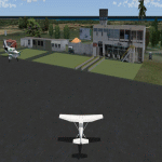
his is Pemba Airport (Also called Karume Airport- not to be confused with Karume International on the island next door.). This is the second Airport on the Zanzibar Islands, and is the main Airport of the Island of Pemba. Build using Sketchup, Sbuilder and ADE. Requires RWY12 object library if you want to see scenery objects appear. You can find rwy12 library in avsim or flightsim
| Filename: | Pemba_Airport_HTPE_v1.zip |
| License: | Freeware |
| Added: | 26th January 2019, 22:34:29 |
| Downloads: | 327 |
| Author: | Emmanuel Mwandosya |
| Size: | 4.38 MB |
| Category: Flight Simulator 2004 - Scenery | |
| Pitcairn Islands - Complete Scenery |
|
File Description:
This project is a complete & much more accurate scenery rendition of the Pitcairn Islands archipelago than the default scenery in FS2004.
The scenery includes all 4 islands redesigned, with detailed coastlines, Landclass with the only settlement, Adamstown represented, and accurate Waterclass representing the shallow reef banks bright colors.
A fictional AFCAD for each island was also made, with all 4 having a water landing area either along the coast or inside the lagoons. Ducie Island has a small sand strip as well.
Some scenery objects were added, mostly on Pitcairn Island, to recreate both the island's jetty & the Old Radio/Weather station.
Enjoy everyone!
| Filename: | Pitcairn_Islands__Complete_Scenery.zip |
| License: | Freeware, limited distribution |
| Added: | 5th August 2019, 06:36:31 |
| Downloads: | 285 |
| Author: | Leonardo Santos |
| Size: | 12.15 MB |
| Category: Flight Simulator X - Missions | |
| HelicopterLighthouseMissionsVol11.zip |
|
File Description:
Four lighthouse tours: Abaco Island, Anticosti Island, Crooked Island, and the Grand Turk.
These missions were programmed in Windows 10 (64bit)for FSX Acceleration and will also work in FSX Steam, P3D V2,V3,V4,V5,and V6. However, several of these tours have specific requirements of Orbx scenery which is detailed in the .txt instructions.
Photos of all the lites are included in each mission set. Once again, be sure to read the instructions in the .txt files. These missions have been thoroughly tested and should work as described. Due to large topographic differences in P3DV5 and V6, there will be peculiarities, but the missions will still work.
| Filename: | HelicopterLighthouseMissionsVol11zip.zip |
| License: | Freeware |
| Added: | 13th October 2024, 22:21:18 |
| Downloads: | 26 |
| Author: | helomissionman |
| Size: | 27.84 MB |
| Category: Flight Simulator X - Missions | |
| HelicopterLighthouseMissionsVol74.zip |
|
File Description:
Six lighthouse tours: Bodie Island, Cape Egmont, Crossover Island, Navassa Island, Roncali, and Thatcher Island.These missions were programmed in Windows 10 (64bit)for FSX Acceleration and will also work in FSX Steam, P3DV3,V4,V5,and V6. However, several of these tours have specific requirements of Orbx scenery which is detailed in the .txt instructions.Photos of all the lites are included in each mission set. Once again, be sure to read the instructions in the .txt files. These missions have been thoroughly tested and should work as described. Due to large topographic differences in P3DV5 and V6, there will be peculiarities, but the missions should still work.
| Filename: | HelicopterLighthouseMissionsVol74zip.zip |
| License: | Freeware |
| Added: | 3rd January 2026, 14:43:42 |
| Downloads: | 9 |
| Author: | Helomissionman |
| Size: | 50.56 MB |
| Category: Flight Simulator X - Missions | |
| HelicopterLighthouseMissionsVol75.zip |
|
File Description:
Six lighthouse tours: Canal Island, Curtis Island, Newport News, Palau, Trial Island, and Wood Island.These missions were programmed in Windows 10 (64bit)for FSX Acceleration and will also work in FSX Steam, P3DV3,V4,V5,and V6. However, several of these tours have specific requirements of Orbx scenery which is detailed in the .txt instructions.Photos of all the lites are included in each mission set. Once again, be sure to read the instructions in the .txt files. These missions have been thoroughly tested and should work as described. Due to large topographic differences in P3DV5 and V6, there will be peculiarities, but the missions should still work.
| Filename: | HelicopterLighthouseMissionsVol75zip.zip |
| License: | Freeware |
| Added: | 12th January 2026, 14:44:40 |
| Downloads: | 9 |
| Author: | Helomissionman |
| Size: | 41.72 MB |
| Category: Flight Simulator X - Scenery | |
| DL_NFI.zip |
|
File Description:
The Scenery includes a Fotoreal orientation of the "Nordfriesischen Inseln" in the north of Germany (North Sea) including the island Helgoland for the FSX.
The Scenery is based on Google Earth Satellite images.
Islands:
Sylt, Amrum, Föhr, Lageness, Hooge, Pellworm, Nordstrand and Helgoland .
Textures are partially with LOD 14 (2,4 m/pix) . The island Sylt is in LOD 13 (4.7 m/pix) .
Shore lines are included for Sylt (West coast) und Amrum (West coast).
In addition 6 Objects:
- Lighthouse from Hörnum (Sylt)
- Lighthouse from Kampen ( Sylt)
- Lighthouse from Amrum
- A ballon on the beach of Kampen (Sylt).
- Sheeps on the little island auf Hooge ( who can find them ?)
| Filename: | DL_NFIzip.zip |
| License: | Freeware |
| Added: | 4th October 2008, 20:36:37 |
| Downloads: | 7,291 |
| Author: | Dietmar Loleit |
| Size: | 12.65 MB |
| Category: Flight Simulator 2004 - Scenery | |
| Sachs Harbour CYSY in Northwest Territories, Canada |
|
Images related to this file:
File Description:
Sachs Harbour is on the southwest coast of Banks Island on the north side of Amundsen Gulf, around 240 miles northeast of Tuktoyaktuk and 180 miles northwest of Ulukhaktok. The village is the only permanent settlement on the island, and is located where it is to benefit from the harbour shelter provided by offshore land. The population is only 130 or so folks, who live on hunting and fishing with some tourism. One claim to fame is that the island is home to threequarters of the world's population of muskoxen and the second is the largest goose colony in North America. The airfield is on the plateau just above the village at 282 feet ASL. The gravel runway 084T/264T (true bearings in Northern Domestic Airspace) is 4,000' long and 100' wide and lit. The apron is on the south side at the centre of the runway and there is a new terminal building; there is JetA fuel available and perhaps 100LL in drums. To the west of the airfield are the deserted buildings of what was once a Department Of Transport weather station. Aklak Airlines flights (operated by Kenn Borek) fly to Sachs Harbour from Inuvik three times a week in summer and twice a week at other times; the AI will be included in the post of a revised Aklavik, and Inuvik revised and Tuktoyaktuk should be fully installed BEFORE Sachs Harbour.
| Filename: | Sachs_Harbour_CYSY_in_Northwest_Territories_Canada.zip |
| License: | Freeware, limited distribution |
| Added: | 14th May 2012, 17:20:09 |
| Downloads: | 395 |
| Author: | Roger Wensley |
| Size: | 6.16 MB |
| Category: Flight Simulator X - Scenery | |
| Extreme Southwestgreenland |
|
File Description:
Everybody who flies in Greenland knows, how incorrect the default scenery is.
This is a new terrain mesh scenery which covers Westgreenland - from Lat N 65 to N 62.
As SRTM data do not cover above N 60 - no Greenland mesh scenery has been produced. Like Extreme Westgreenland this is the one of the most detailed Greenland terrain mesh released up to release date of this scenery.
This great package covers more than 60.000 sq. km. area. This includes:
- LOD11 Mesh (terrain/elevation)
- Redesigned coastline
- Redesign lakes
| Filename: | Extreme_Southwestgreenland.zip |
| License: | Freeware, limited distribution |
| Added: | 26th November 2007, 04:29:14 |
| Downloads: | 4,080 |
| Author: | Ulrik Motzfeldt |
| Size: | 62.32 MB |
| Category: Fly! II - TerraScene | |
| Myrtle Beach (Carolinas Project) TerraScene Project Pack |
|
Images related to this file:
File Description:
This TerraScene 2.1 Project pack covers all of global tile 199,153, continuing the coastline from Georgetown, SC through Myrtle Beach. Inland you will find Conway, Marion and Florence to the west. Hartsville covers the NW, with Lake Moultrie to the SW. This pack includes updated Tiger Census (2000) shapefile data, adding new water areas, new highways, and other details. All scenery data files are included: USGS data, shapefiles, and a complete custom water mask. Requires TerraScene 2.1 and Fly!II patched to v230 or later.
| Filename: | Myrtle_Beach_Carolinas_Project_TerraScene_Project_.zip |
| License: | Freeware |
| Added: | 3rd June 2010, 22:41:45 |
| Downloads: | 176 |
| Author: | Randall Rocke |
| Size: | 51.74 MB |


© 2001-2026 AVSIM Online
All Rights Reserved
Privacy Policy |