
Where Flight Simulation Enthusiasts Gather from Around the World!
AVSIM Library - Search Results

| Category: Flight Simulator 2004 - Scenery | |
| Dillingham Airfield, HI |

|
File Description:
FS2004 Scenery-Dillingham Airfield, Oahu, HI (PHDH) is a general aviation joint-use facility on the north shore of Oahu near the community of Waialua. The airfield has one 5,000' by 75' runway, a State-operated UNICOM (air traffic advisory) facility, several hangars, and a tie down area for recreation aircraft, but no other facilities. Air traffic is limited to daytime operations by small single-engine and light twin-engine aircraft, sailplanes, ultra-lights aircraft, and helicopters. Traditionally, the airfield has been used mainly for recreation, such as glider soaring, hang-gliding, parachuting, and sky jumping. A taxiway extension will be built in 2005. Created with EZ Scenery. PLEASE READ THE README FILE!
| Filename: | Dillingham_Airfield_HI.zip |
| License: | Freeware, limited distribution |
| Added: | 29th May 2007, 04:02:32 |
| Downloads: | 2,022 |
| Author: | John B. Loney, Jr. |
| Size: | 802.31 KB |
| Category: Flight Simulator X - Scenery | |
| Kopaida Airfield, Greece |
|
Images related to this file:
File Description:
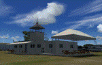
"Kopaida" airfield is a grass private strip, 105km NW of Athens located in the Kopaida drained lake plains between the towns of Aliartos, Kastro and Orchomenos and west of Yliki lake. It is a pure general aviation field and a hub of activity for numerous sport planes, gliders and motor gliders. The field includes a small tower and canteen and several owners of GA aircraft house them in the roomy hangar and also keep a mobile home or RV in the premises. The scenery includes a region and landclass bgl that will force a large area of the Kopaida plains around the airport to display US field textures. This was done because the US fields textures are rectangular and aligned N-E and W-E, in a similar way as the actual fields around the airport. A small photo background is used for the airfield itself. The photo background includes seasonal variations with slight colour variances as well as some autogen trees and shrubs. Custom GA traffic is also included. There is one trike doing circuits and TnGs and a Turbo Porter flying the circuit, simulating a skydiving sortie. The Turbo Porter used is the great freeware one created by Tim (Piglet) Conrad. I have also included a repaint for the F-GHVH, the Porter used by the GFFC, which sports a flashy "Alien" graffiti scheme.
*For FSX SP2 / Acceleration / P3D v1.00*
| Filename: | Kopaida_Airfield_Greece.zip |
| License: | Freeware |
| Added: | 3rd June 2014, 21:23:30 |
| Downloads: | 1,472 |
| Author: | Vassilios Dimoulas |
| Size: | 25.01 MB |
| Category: Flight Simulator 2004 - Scenery | |
| Martindale Army Airfield |
|
Images related to this file:
File Description:
Everything your need to get Martindale Army Airfield (KDMA) in San Antonio, Texas running, including a basic scenery, FS9 tested flight plans as well as FS9 and FSX repaints for John Youngs AI UH-60s representing Co C 2-149. See the readme for a list of commonly available scenery libraries needed.
| Filename: | Martindale_Army_Airfield.zip |
| License: | Freeware |
| Added: | 1st October 2015, 08:36:19 |
| Downloads: | 501 |
| Author: | Brent Newman |
| Size: | 6.48 MB |
| Category: Flight Simulator X - Scenery | |
| CYBA - Banff Airfield |
|
File Description:
Welcome to Beautiful Banff - CYBA :)
Banff is the largest town in Banff National Park, in Alberta's Rockies, Canada. It is also the first incorporated municipality located within a national park in Canada. At 1,463 m (4,800 ft), it is the town with the highest elevation in Canada.
It is surrounded by mountains, notably Mount Rundle, Sulphur Mountain, Mount Norquay, and Cascade Mountain and situated above Bow Falls near the junction of the Bow and Spray Rivers. Banff is located 126 km (78 mi) west of Calgary and 58 km (36 mi) east of Lake Louise, on the Trans-Canada Highway. The Town is a member of the Calgary Regional Partnership.
I have put a little " winter life" in this awesome airfield. 2 fuel parking, Helipad and more....
Hope you'll enjoy the scenery on final landing! ;)
No A.I set up!
| Filename: | CYBA__Banff_Airfield.zip |
| License: | Freeware |
| Added: | 11th March 2009, 01:08:10 |
| Downloads: | 1,846 |
| Author: | Daniel Louvet |
| Size: | 384.91 KB |
| Category: Flight Simulator X - Scenery | |
| Montpellier-Candillargues Airfield |
|
File Description:
This is an accurate version of Montpellier-Candillargues Airfield and made only for FSX, do not use in P3D: taxiways and taxi signs updated to the latest charts, fuel station, support vehicle roads and many other scenery improvements and objects added, airport views are from the roof of the control tower (when in tower view).
| Filename: | MontpellierCandillargues_Airfield.zip |
| License: | Freeware |
| Added: | 14th April 2020, 16:50:46 |
| Downloads: | 418 |
| Author: | Guilhem Moulin |
| Size: | 4.24 KB |
| Category: Flight Simulator 2004 - Scenery | |
| Sleap Airfield - Shropshire |
|
Images related to this file:
File Description:
Sleap Airfield - Home of the Shropshire Aero Club not far from Wem - North Shropshire - England
A fairly accurate representation of this small airfield which used to be an RAF wartime airfield in both WWI and WWII. Now a private flying club
| Filename: | Sleap_Airfield__Shropshire.zip |
| License: | Freeware |
| Added: | 9th May 2010, 08:16:52 |
| Downloads: | 475 |
| Author: | Barrie Larks |
| Size: | 3.35 MB |
| Category: Flight Simulator 2004 - Scenery | |
| EDBW - Airfield Werneuchen |
|
Images related to this file:
File Description:
In 1945 the airfield was occupied by the Red Army and afterwards used by the 16th Air Army. During the early 1950 s the airfield was expanded under utilisation of the existing infrastructure. By building a 2500m long concrete runway, the necessary conditions to allow the deployment of the IL-28 and Jak-28 bomber squadrons, were created.
Since 1971 the airfield was further expanded, amongst other things special arms depots of the type Granit 2 were built. Simultaneously the reconnaissance aircraft MiG-25 was based in Werneuchen.
In 1991 the airfield was left by the GSSD and afterwards in civil use. Today there are a concrete plant and a solar park in the northern part. The runway was shortened to 1500m.
This scenery shows the airfield situation in a period some when between 2012 and 2013.
| Filename: | EDBW__Airfield_Werneuchen.zip |
| License: | Freeware |
| Added: | 4th June 2014, 13:29:43 |
| Downloads: | 623 |
| Author: | Frithjof Koch, Matthias Ewald, Volker Loew |
| Size: | 7.56 MB |
| Category: Flight Simulator 2004 - Scenery | |
| Cottbus Military Airfield |
|
Images related to this file:
File Description:
The airfield Cottbus is the one field of a row of military airfield sceneries, in particular of the helicopter places of the former NVA. In the scenery are included the airfield and the technical supplies.
The airfield was put into operation in 1952 in duty of the NVA. It accommodated at first the 1th fighter group and since 1982 the 3th Combat Helicopter Wing. Helicopters of the type MI-8T, MI-8TB, MI-9 and MI-24 were in duty till 1990.
| Filename: | Cottbus_Military_Airfield.zip |
| License: | Freeware |
| Added: | 8th August 2011, 21:39:00 |
| Downloads: | 893 |
| Author: | Volker Loew, Frithjof Koch |
| Size: | 6.83 MB |
| Category: Flight Simulator 2004 - Scenery | |
| Opotiki Airfield NZOP |
|
File Description:
Welcome to Opotiki, a small general aviation airfield just south of Whakatane, on the east coast of the North Island of New Zealand.
Requires some EZ Scenery object sets (see INSTALL instructions for details).
| Filename: | Opotiki_Airfield__NZOP.zip |
| License: | Freeware, limited distribution |
| Added: | 29th March 2008, 03:51:09 |
| Downloads: | 786 |
| Author: | Lawrie Roache |
| Size: | 1.45 MB |
| Category: Flight Simulator X - Scenery | |
| Silkeborg airfield EKCR |
|
Images related to this file:
File Description:
A photoreal scenery with an smaller airfield EKCR, and has a grass runway 1050x30 m. The airfield are laying in the middle part of
Jutland about 10 km southwest of the city
Silkeborg in Denmark
By Otto Knudsen.
| Filename: | Silkeborg_airfield_EKCR.zip |
| License: | Freeware |
| Added: | 23rd August 2018, 00:12:41 |
| Downloads: | 370 |
| Author: | Otto Knudsen |
| Size: | 33.83 MB |


© 2001-2026 AVSIM Online
All Rights Reserved
Privacy Policy |