
Where Flight Simulation Enthusiasts Gather from Around the World!
AVSIM Library - Search Results

| Category: Flight Simulator X - Scenery | |
| RAF Harrowbeer |

|
File Description:
The former RAF Harrowbeer Airfield is situated in the Parish of Buckland Monachorum, Devon. It is approximately nine miles NNE of the city of Plymouth and approximately six miles South of Tavistock, and also sits within the boundary of Dartmoor National Park. Although sited near the Village of Yelverton, it was called 'Harrowbeer' in order to distinguish it from RNAS Yeovilton. The Airfield was under the control of '10 Group' Flying Spitfires, Typhoons, Bristol Blenheims, Lysanders and Boulton Paul Defiants in its time.
| Filename: | RAF_Harrowbeer.zip |
| License: | Freeware |
| Added: | 28th March 2009, 19:07:28 |
| Downloads: | 482 |
| Author: | Chris Smith |
| Size: | 1.26 MB |
| Category: Flight Simulator X - Scenery | |
| CCS6 - Courtenay (Smit Field) |
|
File Description:
Courtenay Airport is located 2.5 Nm west of Courtenay on the beautiful Vancouver island, BC
It is actually a private airfield. It has been enhanced to accomodate up to 3 lights aircrafts. It is a short grass airfield and VFR conditions a must, specifically when inbound for Rwy 04 due to the ground layout.
I have added some visual reference you may use when inbound ;)...don't worry, you can't miss it! LOL
Hope youll have a good time in Courtenay Airport.
| Filename: | CCS6__Courtenay_Smit_Field.zip |
| License: | Freeware |
| Added: | 10th April 2009, 01:43:48 |
| Downloads: | 736 |
| Author: | Daniel Louvet |
| Size: | 3.03 MB |
| Category: Flight Simulator X - Scenery | |
| TKB Object Library 2 |
|
File Description:
Introducing my second scenery objects library for the enjoyment of the Sim community. There are a variety of buildings which I am sure will be useful to you.
MY usual thanks to Peter Broom for checking out the models before publishing and of course the author’s for their books that I referenced to ensure I got my models reasonably accurate, British Military Airfield Architecture by Paul Francis and Graham Buchan Innes and his British Airfield Buildings Vols 1 & 2.
| Filename: | TKB_Object_Library_2.zip |
| License: | Freeware |
| Added: | 2nd October 2017, 18:59:40 |
| Downloads: | 273 |
| Author: | Terry Boissel |
| Size: | 6.14 MB |
| Category: Flight Simulator X - Scenery | |
| Hamilton Airport YHML Vic, Australia |
|
Images related to this file:
File Description:

A highly detailed rendition of Hamilton airport located in western Victoria, Australia. The airport features custom made 3D objects using photos of the actual airport. Also includes approximately 40 sq km of photoreal ground textures around the airport which are designed to blend best with the FTX Australia textures. Hamilton airport is a small regional airfield with regular passenger transport to Adelaide and Melbourne provided by Sharp Airlines. The airfield is also used as a base for firefighting during summer.
| Filename: | Hamilton_Airport_YHML_Vic_Australia.zip |
| License: | Freeware |
| Added: | 12th August 2011, 13:15:04 |
| Downloads: | 2,054 |
| Author: | Anthony Lynch |
| Size: | 87.09 MB |
| Category: Flight Simulator 2004 - Scenery | |
| Grafenwohr AAF (Army Air Field) ETIC |
|
File Description:
Detailed yet framerate friendly scenery of Grafenwohr Army Air Field in Bavaria, Germany. ICAO-designation ETIC. Based on satellite photo's and photo's found on the web, also Jeppesen and DOD charts were used.
Grafenwoehr AAF is one of several US Army airfield in Germany, and home to several C-12 and UH-60A's and also used as trainingfield for USAFE C-130's.
For the three to show up around the airfield you need to have installed:
Gerrish Gray’s trees_v3.zip
| Filename: | Grafenwohr_AAF_Army_Air_Field_ETIC.zip |
| License: | Freeware, limited distribution |
| Added: | 27th August 2005, 13:26:27 |
| Downloads: | 2,588 |
| Author: | Marcel Ritzema |
| Size: | 386.64 KB |
| Category: Flight Simulator 2004 - Scenery | |
| St Andre-Avellin CAA2 in Quebec Canada |
|
Images related to this file:
File Description:
St Andre-Avellin is a new airfield in Quebec Canada, 35 miles east of Ottawa and 10 miles north of the Ottawa River, and just northwest of the village of the same name. There is a 03/21 grass runway that is 2,870 feet long and slopes up towards the north. To show this slope I have not "placed" a grass runway (which would immediately flatten the slope) and anway there is not so much traffic that the grass would be notably marked. Because of the lack of an FS-recognised runway I have not made parking or a traffic file as AI would not work; anyway this airfield with constant activity would not reflect reality. There are no facilities at the airfield except a hangar for the owner and space to park.
| Filename: | St_AndreAvellin_CAA2_in_Quebec_Canada.zip |
| License: | Freeware, limited distribution |
| Added: | 9th April 2011, 20:49:47 |
| Downloads: | 168 |
| Author: | Roger Wensley |
| Size: | 816.9 KB |
| Category: Flight Simulator 2004 - Scenery | |
| AirFolies Casorezzo airfield, Italy - Revision 1 for VFR flights |
|
Images related to this file:
File Description:

Complete revision of previous "Casorezzo" scenery, realized on the real coordinates of the airfield including some buildings to real image. This review includes photo-realistic terrain multi-seasons/night. It requires the use of the "dva51" libraries and the "TreePlanter" system for vegetation; it is also realized with West Europe Elevation Meshes by Daniele Lanfranchi. Information: It represents the airfield "Air Folies" for ultralight of Casorezzo (MI), for trikes and other ultralights. Scenery contains a terrain 7x8 km, from Olcella (NW) to Parabiago west (NE), from Marcallo con Casone (SW) to Vittuone west (SE).
The airfield is located at 20 km NWW Milan, in the municipality of Casorezzo (N45.533199, E8.900685); grass runway of 280 m; Code: MICA. Enjoy!
Presentation video available here: http://youtu.be/8CfXr_hVWPU
| Filename: | AirFolies_Casorezzo_airfield_Italy__Revision_1_for.zip |
| License: | Freeware |
| Added: | 10th March 2015, 17:18:56 |
| Downloads: | 306 |
| Author: | Aldo Della Vedova - Daniele Lanfranchi |
| Size: | 76.45 MB |
| Category: Flight Simulator X - Scenery | |
| X3LR - RAF Langar - Langar, Nottinghamshire, England |
|
File Description:
RAF Langar (ICAO X3LR) is a former Royal Air Force station located near the village of Langar, Nottinghamshire, England. The airfield is located approximately 6 miles (9.7 km) east-southeast of Radcliffe on Trent and about 100 miles (160 km) north-northwest of London, England.
Opened in 1942 during World War II, it was used by both the Royal Air Force and United States Army Air Forces. During the war it was used primarily as troop carrier transport airfield. After the war it was provided to the Royal Canadian Air Force which used it as an operational base until 1963.
Today the airfield is the location for the British Parachute Schools, who use the original control tower for their headquarters. The former Avro industrial complex is used by private industry.
| Filename: | X3LR__RAF_Langar__Langar_Nottinghamshire_England.zip |
| License: | Freeware |
| Added: | 19th March 2016, 12:18:06 |
| Downloads: | 229 |
| Author: | Terry Boissel |
| Size: | 1.88 MB |
| Category: Flight Simulator X - Scenery | |
| ACG RAF Wattisham 1991 - Seasonal Edition |
|
Images related to this file:
File Description:
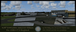
Seasonal version of our RAF Wattisham 1991 scenery. This version is only compatible with Orbx FTX England, it is not compatible with the default FSX seasons but can still be used if one wishes. It is also (with a bit of work) compatible with FSX Steam Edition and P3D V2.1.
Free 3rd party software called SODE is 100% required for seasonal changes, it will not function without it.
This is a full scenery the Wattisham we released in January is not required.
| Filename: | ACG_RAF_Wattisham_1991__Seasonal_Edition.zip |
| License: | Freeware, limited distribution |
| Added: | 14th June 2015, 18:53:13 |
| Downloads: | 1,144 |
| Author: | Pete Beeby, John Young, Stephen Legg, Airfield Construction Group |
| Size: | 342.2 MB |
| Category: Flight Simulator 2004 - Scenery | |
| Manching-v1_fs2004 |
|
Images related to this file:
File Description:
This airfield, located about 30 NM in the north of Munich near Ingolstadt (Bavaria,
South Germany), is used among other objectives for military aircraft functional test
and evaluation during development and production phase.
| Filename: | Manchingv1_fs2004.zip |
| License: | Freeware |
| Added: | 11th April 2011, 06:33:32 |
| Downloads: | 921 |
| Author: | Klaus Jone |
| Size: | 558.8 KB |
© 2001-2026 AVSIM Online
All Rights Reserved
Privacy Policy |