
Where Flight Simulation Enthusiasts Gather from Around the World!
AVSIM Library - Search Results

| Category: Flight Simulator X - Scenery | |
| Nr. Felding airfield EKNF |

|
Images related to this file:
File Description:
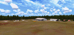
Nr. Felding airfield EKNF.
This is a small local airfield, located few
miles southeast of the city Holstebro in the
west of Jutland. It content of a grass run-
way 930 x 30 meters, a hangar, garage and
some tree cottages. The airfield is used
mainly by sailplanes,but also traffic of
ultra-light aircraft and GA aircraft.
| Filename: | Nr_Felding_airfield_EKNF.zip |
| License: | Freeware |
| Added: | 6th July 2018, 02:54:10 |
| Downloads: | 133 |
| Author: | Otto Knudsen |
| Size: | 30.23 MB |
| Category: Flight Simulator X - Scenery | |
| LFHC French airfield scenery |
|
File Description:
Scenery of LFHC, Perouge-Meximieux for FSX. This airfield is located about 30 km north east of Lyon for GA and gliders.
| Filename: | LFHC_French_airfield_scenery.zip |
| License: | Freeware |
| Added: | 3rd March 2019, 00:18:19 |
| Downloads: | 307 |
| Author: | Jean-Pierre Kozerawski |
| Size: | 5.41 MB |
| Category: Prepar3D V1-4 - Scenery | |
| Broadford Airfield, Scotland : EGEI |
|
Images related to this file:
File Description:

Isle of Skye (Broadford) Airfield (also known as Ashaig Airstrip or Broadford Aerodrome) is a small airfield on the Isle of Skye, Scotland, with a single runway. It is next to the hamlet of Ashaig, near the village of Broadford. The airport was constructed by the Corps of Royal Engineers and opened in 1972 to serve as a gateway to the Isle of Skye. Loganair operated a scheduled service from the airfield to Glasgow from 1972. However this service was discontinued in 1988. No commercial services have existed since then, and the airfield is usually deserted although the airport is occasionally used by NHS Highland and the Scottish Ambulance Service for transferring patients to hospitals in Inverness or Glasgow. Discussions were started in 2012 regarding the reinstatement of the airfield for commercial use but, as yet, this has not happened.
| Filename: | Broadford_Airfield_Scotland__EGEI.zip |
| License: | Freeware |
| Added: | 3rd November 2019, 18:31:13 |
| Downloads: | 675 |
| Author: | Andy Kewley |
| Size: | 178.5 MB |
| Category: Prepar3D V1-4 - AFCAD Files | |
| KGRF Gray Army Airfield |
|
File Description:
P3D v4.5 ADE file for KGRF Gray Army Airfield
| Filename: | KGRF_Gray_Army_Airfield.zip |
| License: | Freeware |
| Added: | 10th November 2020, 23:15:34 |
| Downloads: | 97 |
| Author: | Willem Van der Voort |
| Size: | 74.78 KB |
| Category: Flight Simulator 2004 - Scenery | |
| Graskop Airfield, South Africa |
|
Images related to this file:
File Description:
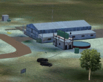
Graskop Airfield does not appear in the default FS2004, neither is the town included which is a pity as the airfield lies right on the edge of a gorge where bungee jumping and even a Gorge-lift (elevator) or a slide across the gorge can be enjoyed by the adrenaline junkies. Added to this, the airfield (and town of Graskop) is merely 10km from the world famous God's Window (also featured in the film, "The Gods must be Crazy").
This package will add a custom (Gmax & Sketchup) made Graskop Airfield, Mpumalanga, South Africa with photoreal textures and ground textures. The included Landclass file will also add the town.
The small airfield has been recreated with custom true to life models and photoreal textures. While being a very small airfield with only one hangar and a large antenna tower, the importance of the airfield far outweighs its size. The airfield plays a vital role in the fight against wildfires as there are water bombers based at the airfield during critical times. In real life the runway is quite challenging, being sloped quite significantly and very narrow, with a one-way-in one-way-out landing and takeoff procedure. Due to the limits within flightsim, the slope could not be replicated but all the other challenges are there.
The asphalt runway is aligned 15/33 and only 800m long by 8.5m wide and sits at an elevation of 4 854ft.
| Filename: | Graskop_Airfield_South_Africa.zip |
| License: | Freeware, limited distribution |
| Added: | 3rd September 2021, 00:55:30 |
| Downloads: | 165 |
| Author: | Kobus van Wyk & Morne van Wyk |
| Size: | 4.13 MB |
| Category: Flight Simulator 2004 - Scenery | |
| Leon Airfield - Washington, USA |
|
File Description:
Leon Airfield, (not related to the author) is situated along the nice Kanawha river in Washington State. It is within walking distance of my 'Bill's Cabin' scenery 'Kll6.zip'. Sounds are included for those who have Lago sounds.
| Filename: | Leon_Airfield__Washington_USA.zip |
| License: | Freeware |
| Added: | 7th March 2004, 17:18:05 |
| Downloads: | 1,695 |
| Author: | Leon Louis |
| Size: | 1.15 MB |
| Category: Flight Simulator 2004 - Scenery | |
| Port Azure Airfield (MKAC) |
|
File Description:
This scenery file will install the fictional Azure Airfield on the southern coast of Jamaica. This airfield is a base of operations for Margarita Air Club, and offers a good alternative arrival/departure point for Kingston, Jamaica.
Airport offers 5000' paved runway with ILS/DME to RWY 9 and amphibious support. Be sure to visit Stu's Flight School.
Includes AFCAD2 file and LAGO FSE file.
| Filename: | Port_Azure_Airfield_MKAC.zip |
| License: | Freeware, limited distribution |
| Added: | 31st March 2004, 17:15:35 |
| Downloads: | 1,320 |
| Author: | Todd Lucas |
| Size: | 2.42 MB |
| Category: Fly! II - Scenery | |
| Michael Army Airfield (KDPG) |
|
File Description:
TerraModels Scenery Development System by Allen Kriesman was used to create the scenery for Michael Army Airfield (KDPG) - Dugway Proving Ground, Utah. Biber Salsa models were also used to create this scenery. The taxiways were added using the program by Peter Jacobson. No custom models were created for this scenery.
| Filename: | Michael_Army_Airfield_KDPG.zip |
| License: | Freeware |
| Added: | 12th April 2004, 01:31:18 |
| Downloads: | 73 |
| Author: | Wayne Roberts |
| Size: | 142.26 KB |
| Category: Flight Simulator 2004 - Scenery | |
| Tarrant Rushton Disused Airfield |
|
File Description:
This is a fairly basic representation of the disused Tarrant Rushton airfield about 18 miles northwest of Bournemouth/EGHH(50.51.00N/02.04.30W).This is sometimes used as a Visual Reporting Point by local traffic
Although the concrete runways were removed many years ago the outlines and the perimeter track are still plainly visible from the air. There are also some hangars remaining.
Made with FSSC by Derek Leung.
| Filename: | Tarrant_Rushton_Disused_Airfield.zip |
| License: | Freeware |
| Added: | 31st May 2004, 03:02:36 |
| Downloads: | 320 |
| Author: | Dave Fagan |
| Size: | 433.92 KB |
| Category: Flight Simulator 2004 - Scenery | |
| Tarrant Rushton Disused Airfield |
|
File Description:
TARRANT RUSHTON Disused.50.51.00N/02.04.30W.
This is a fairly basic representation of the disused Tarrant Rushton airfield about 18 miles northwest of Bournemouth/EGHH.This is sometimes used as a Visual Reporting Point by local traffic
Although the concrete runways were removed many years ago the outlines and the perimeter track are still plainly visible from the air. There are also some hangars remaining..Made using Derek Leung'sFSSC.
| Filename: | Tarrant_Rushton_Disused_Airfield.zip |
| License: | Freeware |
| Added: | 31st May 2004, 03:10:50 |
| Downloads: | 382 |
| Author: | Dave Fagan |
| Size: | 433.92 KB |


© 2001-2026 AVSIM Online
All Rights Reserved
Privacy Policy |