
Where Flight Simulation Enthusiasts Gather from Around the World!
AVSIM Library - Search Results

| Category: Flight Simulator 2004 - Scenery | |
| FS9 Allakaket 6A8 in Alaska |

|
Images related to this file:
File Description:
Allakaket is on the Koyukuk River in Alaska, 40 miles southwest of Bettles. The population is just over 100, with a school that was opened in 1957 for both Allakaket and the nearby Alatna on the other side of the river. There was a very serious flood in 1964 with almost all of the village being underwater, and this resulted in the establishment of an additional housing area further inland and explains the thinly scattered housing in the original village site. The airfield was established in 1978 and has a gravel runway aligned 5-23 (or 05-23 if you are not American) that is just over 4,500 feet in length. Both the runway and the taxiway are marked with lit cones. The village airfield is served by Wright Air and Warbelows Air, both of them being based in Fairbanks and included in the revised AI for PANN that is included here. There are occasional other larger freight flights as required as there is no road access to the village and the river is too shallow to allow large freight barges; hence the runway length.
A note here about my scenery making. There will not be many more to follow this as I am almost at the end of the photos I either took or found for scenery purposes, plus I expect to move on from FS9 at some point during next year.
| Filename: | FS9_Allakaket_6A8_in_Alaska.zip |
| License: | Freeware, limited distribution |
| Added: | 23rd November 2019, 20:29:35 |
| Downloads: | 124 |
| Author: | Roger Wensley |
| Size: | 3.78 MB |
| Category: Microsoft Flight Simulator (2020) - Scenery Design | |
| MSFS 2020 object library with 200+ models ranging from towers hangars to cones (v10 12 extra models) |
|
Images related to this file:
File Description:
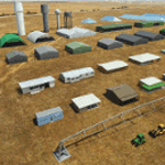
Object libraries for scenery developers (version 10 - improvements on curved surfaces + 10 lights(improved) + 3 windsocks + 3 animals + 5 animated people + 10 fuel_area +stable +fire_tower + 28 new fences + church + sheds). All objects in these libraries will be used in my own sceneries and the result of 100s hrs of effort. All objects from the real world. All objects use LOD (Level Of Detail) to keep frame rates high. Final long distance models have a large triangle added below ground to stop them disappearing in the distance. PBR materials used extensively. Included are 2 PDF files with photos of every object to make selection easy. Republish these files in any freeware scenery if required. READ "read me library instructions" before using.
---------------library1v10-cbj
Cones x4 Gables x3
Church x1
Fences (10 types farm chainlink x4 mesh x2 horse hand-rail paling cattle_grid) x94
Flag pole x1
Fuel_Signs_ x6
Fuel_area_pipes x2
Gas (petrol) station x3
Gliders x4
Glider trailers x4
Grain storage hoppers silos x 4
Power poles x2
Rail platforms station x5
Rail locomotive passenger_carriage grain_hoppers x5
Tower_forest_observation
Towers_radio x6
Weather station small x4
Windsock x3 Windsock-light x1
-------------library2v10-cbj
Animals - Cows x2 Sheep
Grain bunkers - large piles of grain covered with canvas x5
Hangars small airfield x15
Medical transfer station (building) x2
Obstacle-light x10
People x5 Men Women
Pivot irrigator x3
Sheds x10
Shelters x2
Terminals - small airfield x12
Water tanks x3
Towers water x4
Tractors farm x3
Water tanks x3
| Filename: | MSFS_2020_object_library_with_200_models_ranging_f.zip |
| License: | Freeware |
| Added: | 6th March 2022, 19:34:52 |
| Downloads: | 401 |
| Author: | COLIN JEFFERY |
| Size: | 198.25 MB |
| Category: Flight Simulator 2004 - Scenery | |
| Sisimiut (BGSS) on the west coast of Greenland |
|
Images related to this file:
File Description:
Sisimiut is on the west coast of Greenland. It is around 125 miles south of Aasiaat, and 80 miles west of Kangerlussuaq airport, which is currently the largest commercial airfield in Greenland. Sisimiut has a population of 5,500 and the main occupations are fishing, tourism, education, and a growing industrial base. It has the northernmost year-round ice-free port in Greenland, though icebergs floating down from the north are commonplace. The airport is across a bridge and along a two mile road on the north side of an inlet, northwest of the town. The runway is 2,600+ feet of asphalt almost 100 feet wide and lit, aligned 20/02 and at 33 feet ASL, with the apron and terminal building at the eastern end. The building is identical to the one at Aasiaat. Air Greenland run regular flights with a Dash-8, Dash-7, or Twin Otters; within FS9 it is impossible to land an Ai Dash-7 on a runway less than 3,000 feet long, so I used a Dash-8. There was no way to replicate both the parking facing away from the terminal AND the "through" taxiing to complete the circle back to the runway; after parking correctly the AI Air Greenland plane will reverse before heading out to take off. The surrounding area is rock with some scruffy grass and low bushes, and there is no grass around the runway; the airfield has compacted gravel instead.
| Filename: | Sisimiut_BGSS_on_the_west_coast_of_Greenland.zip |
| License: | Freeware, limited distribution |
| Added: | 28th April 2012, 22:03:35 |
| Downloads: | 856 |
| Author: | Roger Wensley |
| Size: | 3.71 MB |
| Category: Flight Simulator 2004 - Scenery | |
| Placerville Airport (KPVF) California |
|
File Description:
This is a scenery upgrade for Placerville Airport, California (KPVF). This is part Four of a series of small airstrip and minor airfield scenery enhancements which are based on real world data from Google Earth (Not this one though, Google earth did not have a detailed image of KPVF so I had to use what was available on the net, which was not much!). Built using EZ_Scenery, Lee Swordy's AFCAD and SBuilder. You must have rwy12 and EZ scenery libraries installed for the buildings to show. Both libraries of objects are free. EZ Library is available from this URL http://www.abacuspub.com/pub/AbacusEZLibraries.exe. Rwy12 from Avsim and additional EZ Custom libraries from Avsim also. Search under Scenery design.
| Filename: | Placerville_Airport__KPVF_California.zip |
| License: | Freeware |
| Added: | 21st March 2006, 23:26:12 |
| Downloads: | 643 |
| Author: | Kim Gowney |
| Size: | 242.76 KB |
| Category: Flight Simulator X - Scenery | |
| CAK3 - Delta Heritage Airpark |
|
File Description:
Welcome to Delta Heritage Airpark!
"Delta" is an uncontrolled aerodrome located south of Vancouver in Delta, British Columbia. It's the home of RAAC Chapter 85, the Boundary Bay Flying Club and COPA Flight 5.
I have redevelopped the club, reorganised the tarmac for proper access to hangar and other building, including the famous roundabout for aircraft traffic, added the 50 ft obstable for RWY 25 and of course many Gliders as well as the farm life. Got to go back and see if there is farmers around there though...;)
Anyway, hope you'll enjoy your stop-over in Delta Heritage in your Light aircraft....as it is a "grass" airfield of 2600ft long! ;)
| Filename: | CAK3__Delta_Heritage_Airpark.zip |
| License: | Freeware |
| Added: | 15th March 2009, 12:58:56 |
| Downloads: | 1,176 |
| Author: | Daniel Louvet |
| Size: | 1.79 MB |
| Category: Flight Simulator X - Scenery | |
| Vietnam War project - base pack |
|
Images related to this file:
File Description:
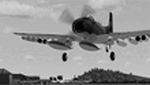
FSX Vietnam War Project - base pack version 0.9. FSX SP1/SP2 needed - Acceleration Pack optionnal, recommended.
About 100 new and redone airfields from SEA (Cam Ranh, Bien Hoa, Phu Cat, Nakhon Phanom, Korat...). French and English documentation (50 pages). Requires Vietnam War project AI airplanes (VnW_AI.zip).
TAD for each airfield. Additional sceneries. 25 flight plans to help you flying over the area.
Included : Al Simms Vietnam war objects, Jim Dhaenens Radars, lights and shelters, Guy Diotte static airplanes.
2 Objects libraries needed : read the quick installation guide.
Visit the project web site : http://vietnamwar.project.free.fr/
To contact us : [email protected]
FSX Vietnam War project: Jacques Godfrin - Xavier Carre
| Filename: | Vietnam_War_project__base_pack.zip |
| License: | Freeware, limited distribution |
| Added: | 11th April 2010, 07:57:17 |
| Downloads: | 2,047 |
| Author: | Jacques Godfrin, Xavier Carre, Vietnam War project |
| Size: | 76.47 MB |
| Category: Flight Simulator 2004 - Scenery | |
| Weaver MT54 Montana USA |
|
Images related to this file:
File Description:
I made this because I downloaded and tried the Glacier Park scenery by Blue Sky Scenery and then discovered that the airfield runways are not always correctly positioned or aligned. So I moved the Weaver runway over and added a couple of buildings. That's it, almost the same as I did for Whitefish. If I find some more airfields in this area with similar problems then I'll do more of the same. Weaver is a private field 4 miles south of Glacier Park International at 2,929 feet ASL and around 45 miles south of the Canadian border. There are no large towns close by; the nearest would be Missoula, which is some 90 miles further south.
| Filename: | Weaver_MT54__Montana_USA.zip |
| License: | Freeware, limited distribution |
| Added: | 26th May 2010, 03:18:46 |
| Downloads: | 203 |
| Author: | Roger Wensley |
| Size: | 14.23 MB |
| Category: Flight Simulator 2004 - AFCAD Files | |
| LLMG Meggido, Israel |
|
Images related to this file:
File Description:
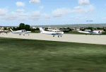
Googlyafcad A&F Data for Meggido, based on Google Earth satellite data.
Unfortunately, Microsoft have provided no facilities at this airport in Flight Simulator 2004 other than a runway and this file will allow you and your "AI" traffic to land, taxi, park and take off in a realistic manner.
Meggidio airfield was built in 1942 by the British Forces and was used by the Israeli Air Force (under the name Shachar 7) until turned over to general aviation, gliding and crop spraying use in the 1970s. There are proposals to transform it into a commercial airport with international flights to develop tourism. [File re-uploaded at request of AVSIM]
| Filename: | LLMG_Meggido_Israel.zip |
| License: | Freeware |
| Added: | 20th June 2010, 10:49:59 |
| Downloads: | 498 |
| Author: | John Hinson |
| Size: | 47.28 KB |
| Category: Flight Simulator X - Scenery | |
| JY43 Hill Top Airport NJ |
|
Images related to this file:
File Description:
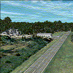
I was flying around the FSX world looking for a real world sloping airstrip just begging to be modeled with a touchdown tire squealing, smoking rubber - that kind of hardened surface sloping runway after I finally figured out how to persuade the FSX SDK to compile one. The Airfield Candidate shall have high density LiDAR elevation and high resolution Orthoimagery data available for public download. I was flying a Beechcraft Baron 58 over Wanaque Reservoir in Northeast NJ of all places when I happened upon a photo scenery runway on a sloping hill top without the usual FSX flattened airport plateau effect and FSX textured runway. They have missed this one ! Hello JY43. - Wally-Bob
| Filename: | JY43_Hill_Top_Airport_NJ.zip |
| License: | Freeware, limited distribution |
| Added: | 9th March 2011, 23:20:14 |
| Downloads: | 1,074 |
| Author: | Walter Roberts |
| Size: | 67.74 MB |
| Category: Flight Simulator 2004 - Original Aircraft | |
| Horten H-VII |
|
Images related to this file:
File Description:
Horten H-VII, experimental flying wing and trainer. Based on the experiences of the smaller H-Vc, the two-seated H-VII made its first flight in May 1943. The H-VII was powered by two Argus AS-10-SC engines driving two-bladed constant-speed propellers via extension shafts. The aircraft had a fully retractable twin nosewheel undercarriage. The aircraft could reach a max. speed of 340 km/hr. The paintings were in Luftwaffe camouflage, assigned to the RLM-no.8-226
This extraordinary aircraft probably suffered the same fate as the H-Vc and was burned after US troops occupied the Goettingen airfield in april 1945. By Andreas Becker.
| Filename: | Horten_HVII.zip |
| License: | Freeware |
| Added: | 20th June 2011, 21:03:51 |
| Downloads: | 650 |
| Author: | Andreas Becker |
| Size: | 12.81 MB |


© 2001-2026 AVSIM Online
All Rights Reserved
Privacy Policy |