
Where Flight Simulation Enthusiasts Gather from Around the World!
AVSIM Library - Search Results

| Category: Flight Simulator X - Scenery | |
| Istanbul Hezarfen Airfield - LTBW |

|
Images related to this file:
File Description:
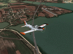
A detailed re-creation of the Istanbul Hezarfen airfield and surroundings, for FSX (SP2).
Hezarfen Airfiled is the main light GA airfield of Istanbul and is a nice start location VRF flights and flight lessons. The scenery contains detailed and realistic scenery and autogen placement and some photoreal texture components. By Sunay KILIC.
| Filename: | Istanbul_Hezarfen_Airfield__LTBW.zip |
| License: | Freeware, limited distribution |
| Added: | 1st November 2009, 21:16:17 |
| Downloads: | 3,713 |
| Author: | Sunay KILIC |
| Size: | 26.71 MB |
| Category: Flight Simulator X - AFCAD Files | |
| Omaha Eppley Airfield 2009 |
|
File Description:
Omaha Eppley Airfield current (2009) layout. Includes the lengthened runway 14L-32R with associated ILS and runway lights and markings. Includes all new and revised taxiways and taxisigns. Designed with ADE (v1.45) and includes files for Cross-Wind and normal runway operations. Includes rebuilt roadways to keep airport vehicles off of the taxiways. Additional cargo parking including Suburban Air Freight and Baron Aviation Services (FedEx Feeder) parking. Correct airline gate parking including Delta's move to the South Terminal as well as Continental's gate changes in the North Terminal. Current FAA Airport Diagram is included.
| Filename: | Omaha_Eppley_Airfield_2009.zip |
| License: | Freeware |
| Added: | 3rd November 2009, 19:55:41 |
| Downloads: | 479 |
| Author: | Steve Lewis |
| Size: | 693.34 KB |
| Category: Flight Simulator X - Scenery | |
| Turkey Eskisehir Inonu Airfield |
|
Images related to this file:
File Description:
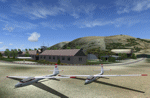
VFR scenery of Turkey Eskisehir Inonu Airfield and surroundings for FSX (SP2).
Inonu Airfield, also known as Turkish Aeronautical Association Inonu Training Center is the main glider training center of Turkey. The scenery contains detailed and realistic scenery and autogen placement and some photoreal texture components. By Sunay KILIC.
| Filename: | Turkey_Eskisehir_Inonu_Airfield.zip |
| License: | Freeware, limited distribution |
| Added: | 3rd November 2009, 19:58:56 |
| Downloads: | 1,886 |
| Author: | Sunay KILIC |
| Size: | 20.69 MB |
| Category: Flight Simulator X - Scenery | |
| LSPD - Dittingen Airfield Switzerland |
|
File Description:
The Dittingen Airfield is located in the northwest of Switzerland, about 20km away from LFSB - Basle-Mulhouse and missing in default FSX. It has one grass runway of 620m length. Dittingen Airfield is famous for it's glider activity and it's airshow which is hold every 2nd year (The last was in August 2009). Further, in real life, it is quite difficult to fly to Dittingen. This airport was designed with ADE 9x and default FSX-objects.
| Filename: | LSPD__Dittingen_Airfield_Switzerland.zip |
| License: | Freeware |
| Added: | 12th December 2009, 02:33:59 |
| Downloads: | 1,929 |
| Author: | Lukas Koeng |
| Size: | 82.83 KB |
| Category: Flight Simulator X - Scenery | |
| "Aires de Vega" Airfield |
|
Images related to this file:
File Description:
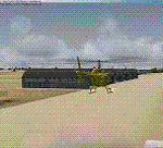
"Aires de Vega" Airfield, in Don Benito (Badajoz, Spain).
| Filename: | Aires_de_Vega_Airfield.zip |
| License: | Freeware, limited distribution |
| Added: | 25th August 2010, 15:55:36 |
| Downloads: | 759 |
| Author: | Jose Enrique Arino |
| Size: | 133.36 KB |
| Category: Flight Simulator X - AFCAD Files | |
| Layton's Airfield (28NJ), NJ |
|
File Description:
Layton's Field perhaps no longer exists in actual aviation databases - it's not, for example, listed over at skyvector.com. But you can find it via a Google search. It is coded 28NJ within FSX, although the real 28NJ is a heliport at the Taj Mahal in Atlantic City. It is a single grass turf strip 1692 feet in length and 60 feet wide. There are no services or parking available - if you want to practice touch and go turf landings that's about the extent of the usefulness of this airport. Even if you never use it, this will at least prevent you from flying over the location and seeing a default 3000 foot grass strip (with threshold markings, no less) sticking oddly out amongst the rest of the scenery.
Scenery constructed with use of satellite images/streetview, the author has not been there in person.
This scenery is meant to be used in conjunction with MegaScenery Earth New Jersey/Delaware 004. It is not required, but apron use is minimized to allow satellite scenery to show through as much as possible, and objects are placed based on the MSE textures - lack of it may make scenery look out of place.
| Filename: | Laytons_Airfield_28NJ_NJ.zip |
| License: | Freeware |
| Added: | 11th October 2010, 08:29:30 |
| Downloads: | 206 |
| Author: | Drew Sikora |
| Size: | 327.04 KB |
| Category: Flight Simulator X - Scenery | |
| Mariental Airfield Fyml, Namibia |
|
Images related to this file:
File Description:
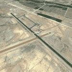
Correctly placed airfield for Mariental Namibia, Fyml. Photoscenery not included.
| Filename: | Mariental_Airfield_Fyml_Namibia.zip |
| License: | Freeware |
| Added: | 20th November 2010, 14:50:24 |
| Downloads: | 491 |
| Author: | Johan Kotze |
| Size: | 2.34 KB |
| Category: Flight Simulator X - Scenery | |
| Kiev-Chaika Airfield UKKJ |
|
Images related to this file:
File Description:
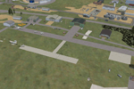
Airport and minor scenery files for Kiev-Chaika Airfield (aka Kyiv Chaika Aerodrome, aka Kiev West), ICAO code UKKJ, not present by default in FSX. This airfield and sports complex is host to the Chaika Air Club (links in readme), regularly hosts drifitng and sport bike events, and has even been used for a mass by Pope John Paul II. Airfield, race courses, and enclosed industrial area all modeled, using default buildings and a few custom ground textures.
| Filename: | KievChaika_Airfield_UKKJ.zip |
| License: | Freeware, limited distribution |
| Added: | 8th June 2011, 18:16:38 |
| Downloads: | 575 |
| Author: | Chris Thompson |
| Size: | 1.1 MB |
| Category: Flight Simulator 2004 - Scenery | |
| LPBE Beja civil airfield |
|
File Description:
This freeware scenery was created using pictures taken at the internet, details from APAU (http://roteiro.apau.org/zp_beja.html, VFR manual (http://www.nav.pt/ais/VFRs/beja%20ulm.pdf - it is supposed you download the file) as well as real measures by Google Earth; this ULM certified airfield at south Alentejo and closer to Beja AB, despite technical information, have, in fact, two paralel rwys in good shape.
This scenery is to be used EXCLUSIVELLY with Portugal Terrain from PTSIM (http://www.ptsim.com). For Microsoft FS2004 (ACOF). NOT tested for FSX
| Filename: | LPBE_Beja_civil_airfield.zip |
| License: | Freeware |
| Added: | 14th June 2013, 20:58:26 |
| Downloads: | 519 |
| Author: | Joao A. Graca Ferreira |
| Size: | 5.64 MB |
| Category: Flight Simulator 2004 - Scenery | |
| Tindouf East airfield - DA0G |
|
File Description:
Simple enhancement of DA0G to add taxiways and apron, inclides generic orbjects from the FS9 stock library.
| Filename: | Tindouf_East_airfield__DA0G.zip |
| License: | Freeware |
| Added: | 2nd September 2013, 19:45:23 |
| Downloads: | 306 |
| Author: | Michael J Lawrence |
| Size: | 2.9 KB |


© 2001-2026 AVSIM Online
All Rights Reserved
Privacy Policy |