
Where Flight Simulation Enthusiasts Gather from Around the World!
AVSIM Library - Search Results

| Category: Flight Simulator X - Scenery | |
| KLGB Long Beach Modernized Terminal |

|
File Description:
DOWNLOAD THIS VERSION AND NOT ANY OTHER ONES BY ROHAN PATEL
THIS IS THE AIRPORT AFTER ALL MODERNIZATION PROJECTS HAVE BEEN COMPLETED
DOWNLOAD THIS VERSION AND NOT ANY OTHER ONES BY ROHAN PATEL
The airport I chose is Long Beach Airport. This airport has been around for many years and has had everything from the Air Force One to the 787 Dreamliner land here! The airport is located between downtown Los Angeles and Orange County and offers a great landing for tourists that do not want to land in the fifth busiest airport in the world, Los Angeles International.
The reason why I decided to create this airport was because it is my home airport and I am located only about five miles from it. Also, there is no good freeware FSX scenery for this airport.
Features included!:
- Modern Terminal with correct gate placements
- changed and edited roads and other buildings around airport
- added the jetBlue offices on the airport
- Cars added (all over the place!!!)
- trees added near drop off (California Palm trees)!
- baggage cars and other airport cars added.
- buses and car parking lots added
- "spring street" flight schools and private terminal added.
- Vehicles, AI aircraft, grave yard aircraft, and many other static joys throughout the airport!
- "Runup" aircraft near runway 34R.
- Boeing C-17 facility (no aircraft C17 there)
- updated taxi ways and heliports
- Airport Service vehicle roads updates and made with help from Google Earth.
- Accurate fence, jetblast fence, and boarders of airport.
- Cargo terminals added for ups and dhl
- Private (gulfstream and other private) jet spots added.
- Flight Schools such as Long Beach Flight Academy (one I go to!!!) accurately made.
- New taxi ways and terrain
- Aflite fuel truck spaces added
- Correct runway lengths of 25L
- More items you just need to see to believe!!!
Distribution limits (MUST CONTACT ME FOR REDISTRIBUTION).
| Filename: | KLGB_Long_Beach_Modernized_Terminal.zip |
| License: | Freeware, limited distribution |
| Added: | 14th December 2012, 01:37:48 |
| Downloads: | 2,589 |
| Author: | Rohan Patel |
| Size: | 3.98 MB |
| Category: Flight Simulator 2004 - Scenery | |
| Chilko Lake CAG3 & Scum Lake CAW3 in British Columbia Canada |
|
Images related to this file:
File Description:
Chilko Lake and Scum Lake are both on the eastern side of the Coast Mountains of British Columbia. Chilko Lake CAG3 is around 30 miles south of Puntzi Mountain and at the northern end of the lake, serving Tsylos Park Lodge, which caters for trekking, horse riding, mountain biking, fishing etc. The runway is 3,200 feet of gravel aligned 18-36 and unlit, at 3,850 feet ASL (above sea level). Scum Lake is around 30 miles southeast of Puntzi Mountain and 25 miles northeast of Chilko Lake. Don't ask me about the name. The airstrip appears to serve a small village and is noted as "private", so perhaps also a lodge operation. The runway is 3,500 feet of gravel aligned 03-21, unlit and at 3,921 feet ASL. I have posted these as a separate scenery, but I suggest that you just add it to your previously created "BC airfields" and avoid the inevitable doubling up of common textures etc. Plus that way you will have just one FS9 library post to do and new airfields will not need yet another posting. Up to you. If you find a defect, email me.
| Filename: | Chilko_Lake_CAG3__Scum_Lake_CAW3_in_British_Columb.zip |
| License: | Freeware, limited distribution |
| Added: | 21st November 2020, 18:24:29 |
| Downloads: | 117 |
| Author: | Roger Wensley |
| Size: | 11.85 MB |
| Category: Flight Simulator X - Aircraft Repaints, Textures and Modifications | |
| CropDusterX Compatibility Mod for Alabeo's Pawnee |
|
Images related to this file:
File Description:
This package modifies Alabeo's Piper Pawnee for a seamless use with Lorby-SI's CropDusterX, a dynamic, not mission based crop-dusting module (both payware, to be purchased separately).
Both external and VC models were modified as follows :
- Lightbar display added just behind the cowling (the bar can be toggled close to the windshield to improve readibility of the dot lines in some harsh lighting conditions)
- Control panel for the Satloc equipment added in the VC for easy and immersive use
- Dusting agent level window (right in front of the control stick) changes with the load carried by the Pawnee
- Dusting works only if :
- electrical power is available
- spray system switch is on
- spray shut-off valve is open
- spray fan brake is released
- airspeed above 50 kn
Alabeo's load simulating gauge is desactivated to allow CDX to run smoothly.
This mod also includes small changes/fixes by yours truly :
- The radio requires electrical power and radio switch on to emit/receive comms
- the spray fan between the landing gear spins if the airspeed is above 50 kn and that the fan brake is released
| Filename: | CropDusterX_Compatibility_Mod_for_Alabeos_Pawnee.zip |
| License: | Freeware |
| Added: | 28th November 2020, 20:11:02 |
| Downloads: | 431 |
| Author: | Rémi "Kekelekou" Hugouvieux |
| Size: | 18.83 MB |
| Category: Flight Simulator 2004 - Scenery | |
| Ivujivik CYIK in Hudson Bay, Quebec, Canada |
|
Images related to this file:
File Description:
Ivujivik is a village of 350 or so inhabitants at N62 25 W78 on the northeastern corner of Hudson Bay. The village does not feature in FS9 but is included in this scenery with approximately the right shape (the coast, even with UT, is not exactly right) so just think of it as a hand-made auto-generated village which gives the airfield a reason. The runway is 3,500 feet of gravel 100 feet wide, which should be enough. I also added the roads, deleted the stock airfield background and added a new background, plus of course there is the scenery file and the AFCAD and AI. You may note that the terminal has the elevation written on the sign as 126', while on the winter photo it is written on the older & bigger sign as 130'. I thought this is because satellite radar has fixed the elevations of all airfields more accurately than before, as Rockcliffe too has gone from 192' to 188'; the alternative explanation is that global warming has raised sea level by 4'. Wow! That's a thought. I presume the new sign was made smaller as a cost saving.
| Filename: | Ivujivik_CYIK_in_Hudson_Bay_Quebec_Canada.zip |
| License: | Freeware, limited distribution |
| Added: | 31st October 2010, 07:41:20 |
| Downloads: | 458 |
| Author: | Roger Wensley |
| Size: | 2.07 MB |
| Category: Flight Simulator 2004 - Utilities | |
| Fuel and Payload Calculator B737NG and B757 ** Update ** |
|
Images related to this file:
File Description:
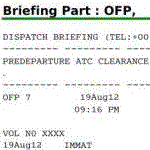
This file contains a spreadsheet template in OpenDocument format to prepare your flight ! Prepare your route, then, using planning tables and filling the fuel and weight form, prepare your payload estimation in this document. A copy of some tables (weights and limitations) for the B737 NG are embedded. A fuel calculator is also embbeded. It will provide automatic fuel load suggestion for each flight once you have completed your flight level and time of flight (based on linear interpolation of a real world flight planning table). Of course you can erase any suggestion with your own value. When it is done, go to the dispatcher briefing tab. Sign it to complete it automatically with some captain notes. In the end, export the dispatcher briefing as a selection in PDF if you wish. Fully reliable when used with your aircraft tables, this document uses the fuel planning methodology described in a PMDG manual and has been validated against a real B737-800 dispatcher briefing. The file contains two templates with automatic fuel load calculation (one for the 737NG, the other for the 757) and two templates without the linear interpolation module (for the Avro RJ and for the B727).
| Filename: | Fuel_and_Payload_Calculator_B737NG_and_B757__Updat.zip |
| License: | Freeware |
| Added: | 11th February 2013, 20:29:55 |
| Downloads: | 594 |
| Author: | Geoffrey Fernandez |
| Size: | 3.46 MB |
| Category: Flight Simulator X - Aircraft Repaints, Textures and Modifications | |
| GMG Airlines Boeing 737-800 |
|
Images related to this file:
File Description:

GMG Airline was established in 1997 and started domestic operations on 6 April 1998. International services were launched six years later on 8 September 2004, with a service from Chittagong to Kolkata.
GMG began regular flights to Bangkok, Delhi and Kathmandu on 20 October 2006. It started services to Kuala Lumpur on 24 January 2007. The airline started its operation to the Middle East with daily flights to Dubai on 1 February 2008. In July 2010, GMG initiated flights to Jeddah and Riyadh.
The airline also served Abu Dhabi and Karachi as well as domestic stations Jessore and Sylhet
A GMG Airlines Bombardier Dash 8 In February 2008 the airline added a leased Boeing 747-300 to the fleet starting wide-body operations, this proved to be a White Elephant in an era which saw Global economic problems and an unprecedented peak in oil prices, thus causing a substantial loss to the carrier, the 747 was eventually phased out after just five months of service.On 17 June 2009, the largest conglomerate of Bangladesh, BEXIMCO took a 50% stake in the airline, re-branding it and raising service standards to a higher level. For the PMDG 737NGX-800
| Filename: | GMG_Airlines_Boeing_737800.zip |
| License: | Freeware |
| Added: | 27th November 2016, 22:04:14 |
| Downloads: | 136 |
| Author: | MacHelix1, PMDG |
| Size: | 19.32 MB |
| Category: Flight Simulator 2004 - Scenery | |
| New Alternate Roads for FlightOne "USRoads" |
|
File Description:
USA Roads" is a software add-on for MS Flight Simulator 2004 (FS9) marketed by Flight One Software, Inc. and Scenery Solutions. It replaces the default roads and highways which are sparse and only approximate in location, with correctly placed roads, down to the street level.
It has been said by some that "US Roads" look unrealistic, like looking at a Road-Map, because the roads are too bright and clean. In real life the roads are darker and partially concealed by vegetation. I have spent hours looking at aerial photos on the net, and was surprised at how "US Roads" looks very realistic, especially when comparing FS "top-down" views with map-type color photos. The light color roads are very prominent in the pictures, as are the clean lines. In my new "Alternate US Roads", I have modified the various roads using different methods, including actual road photographs, changes in road color and brightness, and the use of irregular transparency to soften the lines and give the illusion of vegetation partially obscuring the roadse. Most textures use images adapted from "US Roads" by kind permission of the author. Extract to a temporary file, and follow the ReadMe!
| Filename: | New_Alternate_Roads_for_FlightOne_USRoads.zip |
| License: | Freeware |
| Added: | 14th July 2004, 10:50:27 |
| Downloads: | 4,263 |
| Author: | Frank Bergson |
| Size: | 1.69 MB |
| Category: Flight Simulator X - Scenery | |
| Mesh South America / MeSA B13 |
|
File Description:
FSX Mesh South America Project:
This terrain mesh file is a part of a whole project covering all the Continent
of South America and some islands, divided in tiles identified in a map by its
column (letters) and rows (numbers).
Those files were multi-LOD compiled from 90m SRTM2 source data, reprocessed
with 3DEM to remove voids and spikes, providing a 76.4m (LOD9) horizontal
resolution topography intended for use only in FSX updated with SP1.
Although not well documented, to improve performance, the updated FSX loads DEM
files in threads and only the closer terrain (about 5-10 NM from the point of view)
is rendered in high detail, while at far distances FSX shows up its default low
resolution mesh, when there is not a third part terrain mesh compiled in all
others intermediate level of details (multi-LOD).
THIS FILE:
FSX_MeSA_B13 (Column B x Row 13)
covers the area inside the boundaries:
N = 50º 37,5' S; S = 56º 15' S;
W = 82º 30' W; E = 75º 0' W;
AUTHORS:
Hely Heck Junior - Magrao ( [email protected] )
and Jose Lobo ( [email protected] )
TerraBrasilis: www.terra-brasilis.org
| Filename: | Mesh_South_America__MeSA_B13.zip |
| License: | Freeware |
| Added: | 11th June 2007, 22:12:07 |
| Downloads: | 1,160 |
| Author: | Hely Heck Jr. and José Lôbo |
| Size: | 1.82 MB |
| Category: Flight Simulator X - Scenery | |
| Mesh South America / MeSA C04 |
|
File Description:
FSX Mesh South America Project:
This terrain mesh file is a part of a whole project covering all the Continent
of South America and some islands, divided in tiles identified in a map by its
column (letters) and rows (numbers).
Those files were multi-LOD compiled from 90m SRTM2 source data, reprocessed
with 3DEM to remove voids and spikes, providing a 76.4m (LOD9) horizontal
resolution topography intended for use only in FSX updated with SP1.
Although not well documented, to improve performance, the updated FSX loads DEM
files in threads and only the closer terrain (about 5-10 NM from the point of view)
is rendered in high detail, while at far distances FSX shows up its default low
resolution mesh, when there is not a third part terrain mesh compiled in all
others intermediate level of details (multi-LOD).
THIS FILE:
FSX_MeSA_C04 (Column C x Row 04)
covers the area inside the boundaries:
N = 0º 0' S; S = 5º 37,5' S;
W = 75º 0' W; E = 67º 30' W;
AUTHORS:
Hely Heck Junior - Magrao ( [email protected] )
and Jose Lobo ( [email protected] )
TerraBrasilis: www.terra-brasilis.org
| Filename: | Mesh_South_America__MeSA_C04.zip |
| License: | Freeware |
| Added: | 12th June 2007, 01:41:01 |
| Downloads: | 1,310 |
| Author: | Hely Heck Jr. and José Lôbo |
| Size: | 63.67 MB |
| Category: Flight Simulator X - Scenery | |
| Mesh South America / MeSA C08 |
|
File Description:
FSX Mesh South America Project:
This terrain mesh file is a part of a whole project covering all the Continent
of South America and some islands, divided in tiles identified in a map by its
column (letters) and rows (numbers).
Those files were multi-LOD compiled from 90m SRTM2 source data, reprocessed
with 3DEM to remove voids and spikes, providing a 76.4m (LOD9) horizontal
resolution topography intended for use only in FSX updated with SP1.
Although not well documented, to improve performance, the updated FSX loads DEM
files in threads and only the closer terrain (about 5-10 NM from the point of view)
is rendered in high detail, while at far distances FSX shows up its default low
resolution mesh, when there is not a third part terrain mesh compiled in all
others intermediate level of details (multi-LOD).
THIS FILE:
FSX_MeSA_C08 (Column C x Row 08)
covers the area inside the boundaries:
N = 22º 30' S; S = 28º 7,5' S;
W = 75º 0' W; E = 67º 30' W;
AUTHORS:
Hely Heck Junior - Magrao ( [email protected] )
and Jose Lobo ( [email protected] )
TerraBrasilis: www.terra-brasilis.org
| Filename: | Mesh_South_America__MeSA_C08.zip |
| License: | Freeware |
| Added: | 12th June 2007, 14:20:06 |
| Downloads: | 1,236 |
| Author: | Hely Heck Jr. and José Lôbo |
| Size: | 30.37 MB |


© 2001-2026 AVSIM Online
All Rights Reserved
Privacy Policy |