
Where Flight Simulation Enthusiasts Gather from Around the World!
AVSIM Library - Search Results

| Category: Flight Simulator 2004 - Aircraft Repaints, Textures and Modifications | |
| United Airlines (Post CO merger) Boeing 777-222 |

|
Images related to this file:
File Description:

Project Opensky 777-200 V2. Model features High resolution textures, Dynamic flexing wings, Body gear steering, Nose gear steering, Rudder lock, Ground spoilers, Low speed aileron locks at high speed, Fully animated control surfaces, Fully independent suspension, Trim Animation, Opening Passenger Doors, Animated tilting boogies, Rolling wheels, Animated thrust reverser's with reverser block doors, Detailed textures, Full night lighting, Crash affects, Ground Service Vehicles And more. Model Designer Hiroshi Igami/Yosuke Ube. Flight Dynamics Designer Warren C. Daniel/Brandon D Henry. Tested by Project Open Sky Members..The VC model can be downloaded from www.freeskyproject.com. United Airlines and Continental merged in late 2010 with the Continental globe livery being retained Under the United name. This download includes the most up to date model and FDE updates of the posky 777V2 series.
| Filename: | United_Airlines_Post_CO_merger_Boeing_777222.zip |
| License: | Freeware, limited distribution |
| Added: | 17th February 2011, 20:50:18 |
| Downloads: | 5,179 |
| Author: | Stephen Groom | Project Opensky |
| Size: | 12.19 MB |
| Category: Flight Simulator 2004 - Scenery | |
| Gang Ranch CAY2 in British Columbia Canada |
|
Images related to this file:
File Description:
Gang Ranch is on the eastern side of the Coast Mountains of British Columbia, around 50 miles west of Green Lake and 5 miles west of the Fraser River that runs north-south at that latitude (51 degrees 30 minutes north, in round figures). The airfield is among some farm fields and difficult to spot (this will depend on your personal textures and settings) and the ranch buildings are scattered and a mile or two away, the nearest being the owner's house. The runway is gravel, only 1,800 feet long and aligned 08-26 at 2,150 feet above sea level. There is no lighting. I have posted it as Gang Ranch CAY2, but I suggest that you just add it to your previously created "BC airfields" (if you did that) and avoid the inevitable doubling up of common textures etc. Plus that way you will have just one FS9 library post to do and new airfields will not need yet another posting. Up to you. If you find a defect, email me.
| Filename: | Gang_Ranch_CAY2_in_British_Columbia_Canada.zip |
| License: | Freeware, limited distribution |
| Added: | 19th November 2020, 19:44:55 |
| Downloads: | 101 |
| Author: | Roger Wensley |
| Size: | 8.98 MB |
| Category: Prepar3D V1-4 - Scenery | |
| Valdez Alaska USA N61.06.53 W146.19.52 and Tatitlek Alaska USA N6052.00 W146.41.37 |
|
File Description:
Valdez Alaska USA N61.06.53 W146.19.52 The town is positioned at the head of a fjord on the eastern side of the Prince William Strait (at the end of the Valdez bay). It is surrounded by the Chugach mountains with many glaciers and peaks up to 2100 m above sea level. Although the northernmost port in North America is free of ice all year round. It is also the northernmost point of the Pacific coastal forest located in the 107-meter hill southwest of the town called Blueberry Hill. Valdez has an ICAO PAVD airport that in the scenario in addition to the city of Valdez you will also find a small village called Tatitlek Alaska USA N6052.00 W146.41.37 with related ICAO 7KA airport airports infrastructures have been improved with the addition of a port for landing ships and seaplanes on Valdez and Tatitlek. Important VFR point for approaching airport and seairport PAVD and 7KA.
Within the downloaded package you will find readme files for scenery installation. Good fly VFR. Pasquale Marrulli.
| Filename: | Valdez_Alaska_USA_N610653_W1461952_and_Tatitlek_Al.zip |
| License: | Freeware |
| Added: | 21st May 2018, 22:35:56 |
| Downloads: | 230 |
| Author: | Pasquale Marrulli |
| Size: | 3.27 MB |
| Category: Flight Simulator 2004 - Scenery | |
| Grande Cache CEQ5 in Alberta, Canada |
|
Images related to this file:
File Description:
Grande Cache is at 4,117 feet above sea level, just under 90 miles south of Grande Prairie and 220 miles west of Edmonton. It is among the eastern foothills of the Rockies. The town was established to accommodate employees of a coal mine and their families in the early 1970's. There was a financial roller coaster ride for the coalmine during the next few years and despite the opening of a wood chip plant and a federal prison the town was eventually downgraded to a hamlet by a vote in 2018, as it was essentially bankrupt and had a population of less than 4,500. The airport, some 10 miles east of the town, had two aprons, one for GA and scheduled flights and another, the eastern one, for fire fighting planes. I say "had" as it was closed in January 2017. However, the fire fighting area appears to have been maintained (tanks repainted, for instance) and is presumably able to support operations if required. The date for this scenery is 2009.
| Filename: | Grande_Cache_CEQ5_in_Alberta_Canada.zip |
| License: | Freeware, limited distribution |
| Added: | 29th September 2021, 03:59:20 |
| Downloads: | 89 |
| Author: | Roger Wensley |
| Size: | 7.49 MB |
| Category: Flight Simulator 2004 - Scenery | |
| Cape Dorset CYTE, Baffin Island, Nunavut, Canada |
|
Images related to this file:
File Description:
Cape Dorset is a village of 1,300 or so inhabitants at N 64 13 W 76 31 on Dorset Island, off the southwest corner of Baffin Island. It's Inuit name is Kinngait, which means "High Mountains"; watch out if you fly there in low clouds. The village (again) does not feature in FS9 but is included in this scenery with approximately the right shape, or shapes as there are separate parts. The airfield runway is just under 4,000 feet of gravel 100 feet wide at 158 feet above sea level. There is a double gradient to it, but unfortunately this cannot be replicated in FS.
Cape Dorset had a Hudson Bay Company store as long ago as 1913, and is now known as a centre for Inuit art. I added the roads, a new airfield background, a pond between apron and runway, plus of course there is the scenery file and the AFCAD and AI, which has two planes visiting, a First Air HS748 and a Canadian North Dash 8-100, as per real life.
| Filename: | Cape_Dorset_CYTE_Baffin_Island_Nunavut_Canada.zip |
| License: | Freeware, limited distribution |
| Added: | 9th December 2010, 18:45:06 |
| Downloads: | 1,015 |
| Author: | Roger Wensley |
| Size: | 2.75 MB |
| Category: Flight Simulator X - AFCAD Files | |
| PAOT - Wien Meml - Kotzebue, Alaska |
|
Images related to this file:
File Description:
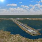
This AFCAD of the airport Wien Meml - Kotzebue (PAOT), Alaska, fixes some issues for Scenery Solution's UTX Alaska users who want to use mesh and texture resolutions better than 38 m and 1 m, respectively. Unfortunately this discloses some additional problems with lagoons surrounding runway 09/27. Some of the ponds had been elevated over apron level, the fence Microsoft had drawn around the airport ran through (elevated) water and so on. Runway 27 has no direct connection to the mainland like it is realized by UTX and furthermore a lot of water polygons (including the lagoons) had 'forgotten' shore line vectors. Included corrections are: fixed main waterpolygons around the airport (according to Google Maps), fixed airport layout, including aprons, GA parking, additional airport buildings (default FSX objects), fixed Runway designators (now 09/27 resp. 18/36 instead of 08/26 and 17/37, Nov. 2013), added shoreline vectors (compatible to UTX textures) and some more.
Again, THIS AFCAD IS INTENDED FOR USERS OF UTX ALASKA ONLY and will likely look horrible in other environments as it partially amends missing features only.
| Filename: | PAOT__Wien_Meml__Kotzebue_Alaska.zip |
| License: | Freeware, limited distribution |
| Added: | 3rd February 2014, 14:30:10 |
| Downloads: | 410 |
| Author: | Axel Birsul |
| Size: | 1.09 MB |
| Category: Flight Simulator 2004 - Miscellaneous Files | |
| DHC-2 Beaver Smoke With Control Gauge |
|
File Description:
This xml gauge and effect package automatically controls the light smoke effect in the DHC-2 Beaver by simply accelerating the throttle. The DHC-2 Beaver will automatically emit a very light smoke effect at a Manifold Pressure reading of 32(+) or greater, depicting a hard running engine. Reducing the throttle level for cruising (MP30-32) or less for descents deactivates the smoke effect.
Even though this xml gauge and effect file works perfectly well by itself, when used in conjunction with my dhc2_fx.zip, all the bases are covered. Smoke automatically engages for cold air temps and with this xml gauge, smoke engages as a result of high manifold pressure (eg. when taking off or climbing). The two work together very nicely without any conflict.
Designed for the FS2004 DHC-2 wheeled Beaver by Steven Grant, Fred Choate, and Aaron Swindle. In the AVSIM library-- dhc2_04w.zip --
Also works with the DHC-2 De Havilland Beaver Amphibian v2 that was made for FS2002, but works equally well in FS2004. In the AVSIM library-- dhc2ampv2.zip --
The README file includes complete instructions.
| Filename: | DHC2_Beaver_Smoke_With_Control_Gauge.zip |
| License: | Freeware |
| Added: | 7th October 2003, 16:34:19 |
| Downloads: | 1,767 |
| Author: | Brent Hricziscse |
| Size: | 5.31 KB |
| Category: Flight Simulator 2004 - Miscellaneous Files | |
| ActiveSky Weather Adventures Vol. 2 - Fly the AT! |
|
File Description:
ActiveSky Weather Adventures Vol. 2 - Fly the AT! (Includes updated Vol. 1 - Winter's End) ***In addition to archives for AS2k4 users, saved flights with AS2k4 processed weather are included so people who don't own ActiveSky can fully enjoy these adventures and get a taste of what ActiveSky 2k4 has to offer! * Includes TWO Volumes of Weather Adventures * Volume 2 - Fly the AT! - Ten flights take you from Maine to Georgia along route of the Appalachian Trail - features three days of real-weather as a slow front approaches from the west - can YOU make it to Georgia before the thunder rolls in? * Volume 1 includes 10 flights highlighting weather phenomena such as a tornado outbreak in Texas and Oklahoma, a New England "nor'easter", and a massive upper-level low occupying the plains states! ***The ASWxAd-Kneeboard!*** A modification to FS9's kneeboard which allows viewing of original material describing these flights, radar and satellite loops, and annotated sectionals depicting flight plans and the AT! * This is the Automatic Installer version. A manual install is also available - ASAS2MAN.zip * Previous version had nearly 2000 downloads!
| Filename: | ActiveSky_Weather_Adventures_Vol_2__Fly_the_AT.zip |
| License: | Freeware, limited distribution |
| Added: | 4th June 2004, 14:14:58 |
| Downloads: | 2,798 |
| Author: | Scott Gridley |
| Size: | 22.04 MB |
| Category: Flight Simulator 2004 - Miscellaneous Files | |
| FS2004 Mobile Control Tower |
|
File Description:
Control the incoming and outgoing traffic on your RADAR screen (MARCIANO’s great Radar gauge) or with the excellent Ground and Traffic Radar included in the FSUIPC addon as AI planes fly around you.Rotating engine rotates the tower for a cockpit full 360ª View on 5 different levels or with the virtual view. Completely re-designing of the Main panel for a more professional look and new 7 panels for other views. Now listed as Mobile Tower in the FS2004 planes list with 1 to 5 levels variation. The tower moves easily and rapidly from one level to another without FS2004 reloading scenery textures while Traffic AI remains active. Revolutionary rotating and positioning engines by Rob Barendregt ! Precise and exact "GoodYear Blimp" view ideal for AFCAD designer. Serves also as mirador or observatiopn tower anywhere. This is a complete new Control tower and does not need the 2002 version which was downlaoded more than 11.500 times.
This sucessfull accesory is intended to be the most complete and useful FREEWARE Control Tower available at the moment for FS2004.Full Web support. by Ronald R. Cachemaille
| Filename: | FS2004_Mobile_Control_Tower.zip |
| License: | Freeware |
| Added: | 11th July 2004, 02:33:25 |
| Downloads: | 16,950 |
| Author: | Ronald R. Cachemaille |
| Size: | 12.03 MB |
| Category: Miscellaneous Files - Demos from Commercial Vendors | |
| MCR 01 ultralight, Switzerland |
|
File Description:
The MCR Sportster is a side by side two-seater airplane with incredible performance and capability. Fast and agile, the VLA was specially designed to reach top speed while providing the most enjoyable experience to pilots
The MCR Sportster is a very high performance aircraft, that can cruise as fast as 300 km/h with only a 100 hp engine, at very low cost.
Thanks to the highest level of technology available, and very light material, the Sportster has a very efficient direct control system that guarantees the same satisfaction as flying a fighter jet.
The MCR Sportster can be equipped with a choice of different power plants, but may also be fitted with other options such as :
Ballistic Recovery System parachute
Extended range wing tanks.
Toe operated Hydraulic brakes
The MCR Sportster is available in kit form in respect with the CNSK regulation (specific kit airworthiness certificate) or in the "experimental" category depending on the registration country.
Models, panel, sound, textures, gauges and animations by www.afs-design.de - Author: A.Meyer.
| Filename: | MCR_01_ultralight_Switzerland.zip |
| License: | Commercial demo |
| Added: | 11th August 2007, 22:43:57 |
| Downloads: | 1,808 |
| Author: | Andreas Meyer |
| Size: | 13.33 MB |


© 2001-2026 AVSIM Online
All Rights Reserved
Privacy Policy |