
Where Flight Simulation Enthusiasts Gather from Around the World!
AVSIM Library - Search Results

| Category: Flight Simulator 2004 - Aircraft Repaints, Textures and Modifications | |
| Aeroflight BEECH U-21A-BH KING AIR |

|
File Description:
Aeroflight BEECH U-21A-BH KING AIR Based on the C90/C90A/C90B/E90
by Henry Tomkiewicz,Repaint and Window Modifications by- Dale Caruso
This package four configurations... a Medical Transport, Utility/cargo version, both with a 2-3 window configuration, a seperate crew/pilot entry located by the pilot's window, and a double air door for ease of patient and cargo access, a 3-3 window configuration, and a 3-4 standard window configuration, The package includes 2 separate visual models which can be used to create the following variations:
1) 3-Bladed props on PT6A-20 engines with a single fuselage ventral fin.
2) 4-Bladed props on PT6A-20 engines with a single fuselage ventral fin.
Also included to match up better with the flight model is a modified version of Randy Burton's King Air Panel. The modification being the addition of cabin views with windows that are more in the order of the U65-90 side window shape.
Questions or comments always welcome at [email protected]
Dale
| Filename: | Aeroflight_BEECH_U21ABH_KING_AIR.zip |
| License: | Freeware |
| Added: | 17th March 2005, 23:33:03 |
| Downloads: | 2,211 |
| Author: | by Henry Tomkiewicz,Repaint and Window Modifications by- Dale Caruso |
| Size: | 8.21 MB |
| Category: Flight Simulator 2004 - AFCAD Files | |
| Metro Oakland Int'l (KOAK) with Active Crosswind Runways |
|
File Description:
A high spec AFCAD2 for the default FS2004 Metro Oakland Int'l Airport (KOAK). This afcad has been built from scratch using FAA Charts, various aerial photographs and information from the Airport Website. All runways feature real life lengths/widths and include overrun areas. All taxiways are named and all aprons are reworked to be as real as possible according to photos. All gates are named and have airlines assigned to them. As per real life, only Southwest Airlines will use Terminal 2, all other airlines being allocated to Terminal 1. The Fedex and UPS aprons are represented and can accomodate up to 20 cargo aircraft. The final parking area is random GA parking to the north of the airport. Overflow parking is also available for rush hour periods. This airport now features a tower view and also upgraded night and approach lighting. Finally, by using the crosswind runway technique, runways 9L/27R, 9R/27L and 11/29 can all be used simultaniously for take-off and landing. Runway 15/33 is closed as it is not used in real life. Enjoy!!
| Filename: | Metro_Oakland_Intl_KOAK_with_Active_Crosswind_Runw.zip |
| License: | Freeware, limited distribution |
| Added: | 30th July 2005, 06:15:21 |
| Downloads: | 2,529 |
| Author: | Lee Brompton |
| Size: | 80.4 KB |
| Category: Flight Simulator 2004 - Original Aircraft | |
| Piaggio P-166A |
|
File Description:
The second of the coming P-166 aircraft series. I'm going to built the whole family of these graceful twins.
The Piaggio P-166A is a light small twin. An Exotic two-engined prop that sold all over the world including America, UK, and Australia. Its origin is traced Back to the Piaggio P-136, a light anphibian, wich the P-166 keeps the wings, the engines and the tailplanes. The first P-166A flew in November 1957. The aircraft is still in production in a slightly modified turboprop version, the P-166D-P1.
This model is 788 Kbs with c.a. 23000 polygons in c.a.170 assemblies. (see something in common with the previous one? YES: 99%...) Features Clickable Dynamic VC with non-planar throttle quadrant. Detailed internals. Fully compatible with FS 2002 (pro edition)
Not said about the M version!! The flight Dynamics is based on real data, provided by Piaggio Itself: control surfaces, engines, weights, etc...
Paints:
1)FIAT - I-NCAS
2)AGIP Mineraria I-MINT
3)Papuan Airlines VH-PND
4)Northrop corp. - N7651E
| Filename: | Piaggio_P166A.zip |
| License: | Freeware |
| Added: | 1st November 2003, 19:12:21 |
| Downloads: | 4,938 |
| Author: | Mario Noriega |
| Size: | 7.72 MB |
| Category: Flight Simulator X - Missions | |
| Challenging Approach: Innsbruck, Austria, LOWI |
|
File Description:
This is the first in a series of missions on challenging approaches and landings. The mission begins with you are approaching SBG VOR, enroute to Innsbruck, Austria, LOWI. As you approach Rattenberg NDB, ATC commands 200 KIAS and 9500' to intercept RTT (Goal 1). You are also advised to enter a holding pattern at RTT, your fix, to allow time for snow removal from the runway. The pattern is standard right-hand turns with 1.5 minute legs and 200 knots at 9500'. The inbound track is 226°, while outbound is 46°. Winds are high, so you will have to compensate to stay aligned in the pattern and certify (Goal 2). Next up is to achieve a stabilized approach on the steep glide slope to runway 25 as Goal 2. The final goal is a safe full stop landing on runway 26 at elevation 1894' The descent is near 4° gradient and the runway VOR (111.1) is offset to the right, thus the “challengeâ€. Complete all three goals and you certify to fly to LOWI and receive a Reward.
| Filename: | Challenging_Approach_Innsbruck_Austria_LOWI.zip |
| License: | Check within download |
| Added: | 6th May 2023, 13:41:36 |
| Downloads: | 110 |
| Author: | Jake Rogers |
| Size: | 10.73 MB |
| Category: Flight Simulator X - AFCAD Files | |
| PAOT - Wien Meml - Kotzebue, Alaska |
|
Images related to this file:
File Description:
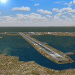
This AFCAD of the airport Wien Meml - Kotzebue (PAOT), Alaska, fixes some issues for Scenery Solution's UTX Alaska users who want to use mesh and texture resolutions better than 38 m and 1 m, respectively. Unfortunately this discloses some additional problems with lagoons surrounding runway 09/27. Some of the ponds had been elevated over apron level, the fence Microsoft had drawn around the airport ran through (elevated) water and so on. Runway 27 has no direct connection to the mainland like it is realized by UTX and furthermore a lot of water polygons (including the lagoons) had 'forgotten' shore line vectors. Included corrections are: fixed main waterpolygons around the airport (according to Google Maps), fixed airport layout, including aprons, GA parking, additional airport buildings (default FSX objects), fixed Runway designators (now 09/27 resp. 18/36 instead of 08/26 and 17/37, Nov. 2013), added shoreline vectors (compatible to UTX textures) and some more.
Again, THIS AFCAD IS INTENDED FOR USERS OF UTX ALASKA ONLY and will likely look horrible in other environments as it partially amends missing features only.
| Filename: | PAOT__Wien_Meml__Kotzebue_Alaska.zip |
| License: | Freeware, limited distribution |
| Added: | 3rd February 2014, 14:30:10 |
| Downloads: | 411 |
| Author: | Axel Birsul |
| Size: | 1.09 MB |
| Category: Flight Simulator 2004 - Scenery | |
| Santorini LGSR Big Scenery 2012 (airport and full island scenery) |
|
Images related to this file:
File Description:

This FS2004 project is about the greek Santorini island (located in the Aegean Sea 200 km southeast from Greece's mainland) and contain two main scenery parts:
1) the "Santorini (Thira) International Airport" (Iata: JTR, Icao: LGSR) where you'll find all buldings (airport and close sourroundings buildings), hundred of custom made detailed objects, static and animated vehicles, animated scenery parts and various effects.
2)the Santorini island scenery where you'll find real hand-made landmarks (churches, factories, windmills,harbors and more), boats/ferries, completely redesigned landclasses with custom (seasonal+night) ground textures, coastlines, roads, main towns with custom greek textures, extreme autogen density and a lot of objects.
Every scenery part (frame-rate friendly thanks to the low poly design) has photoreal textures and everything is placed in the right position (wich was found at spring 2012) and in according to the satellite image.English extendet handbook is included. Watch the screenshot and the demo video on the Albysim youtube chanel and enjoy all scenery features (in this free/demo edition some features are limited).
| Filename: | Santorini_LGSR_Big_Scenery_2012_airport_and_full_i.zip |
| License: | Check within download |
| Added: | 4th November 2012, 13:13:55 |
| Downloads: | 4,725 |
| Author: | Albysim Scenery Design (Alberto Di Bolzano) |
| Size: | 35.43 MB |
| Category: Flight Simulator X - Scenery | |
| Essweiler Gliderfield, Germany Ver. 1.0 |
|
Images related to this file:
File Description:
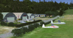
Essweiler is actually a classic glider field, but also engine aircrafts up to 2t are approved.
The field is situated in the region Rheinland-Pfalz/Germany at a hillside eastly of the village Essweiler, approximately 7,5 nautical miles north of the well known US-Airbase Ramstein.
The environment of the airfield is adapted by land classes. Surrounding villages and major roads are initially implemented.
As well the field is covered by a photo background, which includes four different images , each for one of the four seasons: spring, summer, autumn and winter. The buildings in this scenery should match quite good the originals. But also a lot of objects from three very popular freeware libraries are used.
If these libraries are not installed, many objects are not visible!
The following libraries are used:
1. FS-Piloten_Objektlibrary:
http://www.fs-piloten.de/thread.php?threadid=1063
2. FSX_FlightPortLib
http://www.flightport.de/libraries/flightport-library/
3: 3d People Library
http://library.avsim.net/download.php?DLID=192454
| Filename: | Essweiler_Gliderfield_Germany_Ver_10.zip |
| License: | Freeware |
| Added: | 29th November 2016, 19:15:50 |
| Downloads: | 607 |
| Author: | Wolfgang Allers |
| Size: | 168.18 MB |
| Category: Flight Simulator 2004 - Scenery | |
| Anaktuvuk Pass PAKP in Alaska |
|
Images related to this file:
File Description:
Anaktuvuk Pass is a village located 85 miles north of Bettles and just north of the Brooks Range, in a valley that is a route between north and south. The inhabitants are mainly Numamiut, a section of the Inupiat that existed in history (and until today) away from the coastal food supply of fish etc. The current population is around 350. The airport has one gravel runway, aligned 1-19 with PAPI at both ends, and 5,500 feet long as there is no connection to the outside world other than the runway for all necessities that are not available on the tundra. There are two aprons, with light planes and passengers at the northern end of the runway and the Everts cargo flights unloading at the mid runway apron. A note here about my scenery making. There will not be many more to follow this as I am almost at the end of the photos I either took or found for scenery purposes, plus I expect to move on from FS9 at some point during next year.
| Filename: | Anaktuvuk_Pass_PAKP_in_Alaska.zip |
| License: | Freeware, limited distribution |
| Added: | 25th November 2019, 17:51:38 |
| Downloads: | 243 |
| Author: | Roger Wensley |
| Size: | 8.59 MB |
| Category: Flight Simulator X - AFCAD Files | |
| UKOO - Odesa Intl. Odesa, Ukraine |
|
File Description:
Odesa International Airport(IATA: ODS, ICAO: UKOO) is an airport located 7 km (4.3 mi) southwest from the centre of Odesa, Ukraine.
It serves both domestic and international flights. Airport's runways either were or are co-used by the Ukrainian Air Force.
The airport was built in 1961. In 2009, the airport served 651,000 passengers.
The area of Odessa International airport is 570 hectares. The airport concerns to group of the largest airports of Ukraine and connects Odesa by airlines with many cities of Ukraine and CIS, Western Europe, Asia and Africa.
Technical service of airport is based on 2800 square meters area and represented by 4 parking places to provide technical service to 4 planes simultaneously. European standards classify the airport as "class 1".
In May 2007, the airport started construction work that includes extending the main runway. The airport has ILS CAT I status.
The airport charts can be found here.
This file has the right coordenates, with the apron and characteristics of the airport and buildings.
| Filename: | UKOO__Odesa_Intl_Odesa_Ukraine.zip |
| License: | Freeware |
| Added: | 19th October 2012, 23:37:31 |
| Downloads: | 3,044 |
| Author: | Anwar Gonzalez |
| Size: | 484.36 KB |
| Category: Civil Flight Simulators - Looking Glass Flight Unlimited 3 | |
| New Elevation data GeoTiles.tag for FU3 Seattle Region |
|
File Description:
The test elevation meshes for Switzerland and UK Region using the data from
NASA SRTM_V2 program ( 3 arc second resolution, about 90m grid ) was so successful that I have tried to do a new elevation file for the Seattle Region using the 1 arc second elevation from the same source ( US area only ) 30m grid resolution. Each elevation point ( 64m grid in FU3 ) is now converted from the UTM coordinate to the exact Lat/Long WGS84 coordinate and for this point the elevation data are picked up and stored.
The Geotiles.tag file residing in the /region/seattle/geos/ folder contains this data.
To benefit from this new elevation experience FIRST RENAME YOUR ORIGINAL GEOTILES.DAT FILE INTO XGEOTILES.DAT then copy the geotiles.tag from this zip into the geos folder of the Seattle region. Start FU3 and enjoy the new perfect fitted landscape. Best way is to start directly from the air and not from an airport then all airport are no more flat, have hills and holes. Models and runways are floating over the ground or are into the ground.
| Filename: | New_Elevation_data_GeoTilestag_for_FU3_Seattle_Reg.zip |
| License: | Freeware, limited distribution |
| Added: | 26th September 2006, 23:37:55 |
| Downloads: | 170 |
| Author: | Andre Meystre |
| Size: | 19.28 MB |


© 2001-2026 AVSIM Online
All Rights Reserved
Privacy Policy |