
Where Flight Simulation Enthusiasts Gather from Around the World!
AVSIM Library - Search Results

| Category: Flight Simulator 2004 - Scenery | |
| VAKE Kandla/Gandhidham, India |

|
Images related to this file:
File Description:
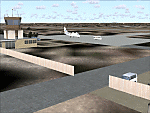
Googly scenery for VAKE Kandla/Gandhidham - a small domestic airport
in the state of Gujurat, India, for which little other than a runway is
provided in Flight Simulator 2004. These scenery files add taxiways, aprons,
buildings and other airport features, so that you and your "AI" traffic can
land, taxi, park and take off in a realistic manner.
Gandhidham is a small city about 5 miles from the seaport of Kandla, in the
Gulf of Kutch, and was developed in 1950 after the separation of Pakistan and
India left the key port of Karachi in Pakistan. The airport is served by daily
flights using turboprop aircraft of Air Deccan.
The scenery does not purport to be ultra-accurate. Based on high-detail satellite
imagery from Google Earth, the layout is proportionally correct but the added
airport features, such as buildings, are built from default Microsoft objects
and add-on libraries so will not look exactly like the real thing.
You are not obliged to download and install any additional scenery libraries,
but to enjoy this scenery in its entirety, you may wish to. It will work fine,
with or without.
[File re-uploaded at request of AVSIM]
| Filename: | VAKE_KandlaGandhidham_India.zip |
| License: | Freeware |
| Added: | 14th May 2010, 05:11:31 |
| Downloads: | 848 |
| Author: | John Hinson |
| Size: | 67.36 KB |
| Category: Flight Simulator 2004 - AFCAD Files | |
| Tallulah Vicksburg Regional |
|
File Description:
Tallulah Vicksburg Regional is only a small airport in louisiana,and in the real world I see no air traffic flowing in or out at all. In the FS9 world, I've brought it to life by using the best tools possible(AFCAD, and TTOOLS).
| Filename: | Tallulah_Vicksburg_Regional.zip |
| License: | Freeware |
| Added: | 25th February 2004, 03:41:23 |
| Downloads: | 265 |
| Author: | Dettrick Winters |
| Size: | 3.6 KB |
| Category: Flight Simulator X - AFCAD Files | |
| SAWH-Ushuaia International Airport-Argentina |
|
File Description:
Ushuaia International Airport (Spanish: Aeropuerto Internacional de Ushuaia) (IATA: USH, ICAO: SAWH) is located 4 km (2.5 mi) south[1] of the center of Ushuaia, a city on the island of Tierra del Fuego in the Tierra del Fuego
Province of Argentina.Ushuaia International Airport is fit to receive airplanes as large as the Boeing 747. Tower Air used to operate such types into the airport, and AeroliÂneas Argentinas operated 747-400s into the airport
during events of high passenger numbers (such as entire cruise-ship passenger payloads) until retiring this aircraft type in February, 2012. Two chartered Air France Concordes also visited in the past: F-BTSD arriving from
Buenos Aires and continuing to Santiago, Chile, in early 1999; the second arriving from Easter Island, Chile and continuing to Buenos Aires prior to the cessation of most Concorde charter flights on July 25, 2000. Condor and
LTU also offered charter flights from Germany and First Choice Airways from the United Kingdom. It also offers charter flights to Maputo, Mozambique.
This work is dedicate to Tiziano Fiori who lives in Trelew.
| Filename: | SAWHUshuaia_International_AirportArgentina.zip |
| License: | Freeware |
| Added: | 27th September 2012, 23:55:23 |
| Downloads: | 792 |
| Author: | Anwar Gonzalez |
| Size: | 58.72 KB |
| Category: Prepar3D V1-4 - Scenery | |
| The atolls of the Maldives Asia |
|
File Description:
The atolls of the Maldives are numerous and some atolls are also uninhabited. The most famous atolls are: The Male Atoll and Baros N4.18.26 E73.20.91 with the VRMM airport, the Gan atoll N0.41.36 E73.9.27with the VRMG airport, Hanimardhoo Atoll N 6.44.56 E73.10.06 with the VRMH airport, the Kaadedhahoo atoll N0.29.21 E72.59.41 with the VRMT airport and the Kadhdhoo N1.51.30 E73.31.15 with the VRMK airport. The aforementioned airports have been improved and the most important resorts have been created on the islands of Baros, Gan, Hanimaadhoo, Kaadedhahoo and Kadhdhoo, and small ports have been created with ships and boats. I remember that all the islands can be easily visited by seaplanes in their respective tiny ports. Good VFR flight. Within the downloaded package you will find readme files for scenery installation. Good fly VFR. Pasquale Marrulli.
| Filename: | The_atolls_of_the_Maldives_Asia.zip |
| License: | Freeware |
| Added: | 12th March 2018, 22:07:58 |
| Downloads: | 506 |
| Author: | Pasquale Marrulli |
| Size: | 8.56 KB |
| Category: Flight Simulator 2004 - AFCAD Files | |
| UK2000 London City V2 |
|
File Description:
A high quality AFCAD2 file for the UK2000 London City Airport. Built from scratch, using the latest CAA charts, this AFCAD2 compliments the addon scenery perfectly. This file gives you the current real life taxiway names and gate numbers at this airport. Airlines are allocated to the gates and all gates are used. This file gives you 24 usable parking positions at this airport, comprising 10 Gates and 14 GA ramps. New in this release, added gate assignments for airlines that have recently started to serve the airport. This file has been fully tested with no problems found. Requires the payware 'UK2000 Part 4' or 'UK2000 London City' package by G. Summons available at http://www.uk2000scenery.com - this file is not compatible with any other scenery for London City airport.
| Filename: | UK2000_London_City_V2.zip |
| License: | Freeware |
| Added: | 9th December 2005, 02:03:47 |
| Downloads: | 874 |
| Author: | Lee Brompton |
| Size: | 25.95 KB |
| Category: Flight Simulator X - Scenery | |
| YBNS Bainsdale airport Victoria Australia |
|
Images related to this file:
File Description:
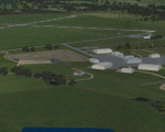
Airport YBNS Bairnsdale is a regional airport in Victoria Australia. It has 2 runways a long 1101m sealed and lit 04/22 and a 850m sealed 13/31 There is a gocart track and a disused drag strip next to the airport. There is a thriving aero club and training for light aircraft and helicopters. These files are for Flight Simulator X. Made using Airport Design Editor using some objects borrowed from Robert Budd's excellent Baccus Marsh. The standard airport bears only a passing resemblance to the real thing so this scenery is a big improvement and accurately reproduces real world. RECOMMENDED The scenery is designed to interface with ORBX FTX_AU scenery for Australia (payware). It will work without ORBX but will not interface as well with standard scenery.
| Filename: | YBNS_Bainsdale_airport_Victoria_Australia.zip |
| License: | Freeware |
| Added: | 10th April 2017, 06:36:06 |
| Downloads: | 566 |
| Author: | Colin Jeffery |
| Size: | 1.79 MB |
| Category: Flight Simulator 2004 - Scenery | |
| Maupiti airport, French Polynesia, NTTP |
|
File Description:
This is a whole new Maupiti. It contains the terminal, tower, helipad, boat docking area to get to the main island, and an afcad by Ray Smith, which makes the airport come alive at night with runway lighting, and blue marker lights around the tarmac. This island is often referred to as a mini version of Bora Bora, and it is just a short hop from there. It is the smallest airport in the Society Islands, and one of the smaller islands also. The airport is also located out on one of the motus, or coral reefs surrounding the island, and as with Bora Bora it is necessary to take a boat from the airport to the main island. Aircraft which use this airport are mainly Air Tahiti ATR's, or tourist helicopters.
| Filename: | Maupiti_airport_French_Polynesia_NTTP.zip |
| License: | Freeware |
| Added: | 4th June 2004, 13:40:33 |
| Downloads: | 9,679 |
| Author: | Bill Melichar |
| Size: | 1.45 MB |
| Category: Flight Simulator X - Scenery | |
| Rio Vista Municipal Airport, California (O88) |
|
Images related to this file:
File Description:
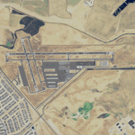
Rio Vista Municipal Airport, is located on the western edge of the city of Rio Vista in the heart of California's San Joaquin River Delta, about 260 mile northeast of San Francisco. Rio Vista Municipal Airport has an 4,200-foot long, 75-foot wide primary runway. There is also a 2,200-foot long, 60-foot wide secondary runway and a helipad. This is a major overhaul of the default airport, dramatically improving accuracy of taxiways, runways, aprons, structures and other scenery details. Designed so that anyone familiar with the actual airport will experience immediate recognition, the project includes several custom buildings and many custom scenery objects modeled on the actual airport. The surrounding area has been extensively modeled. Including, 324 accurately place wind turbines, 3690 houses, and a total count of 4740 scenery objects.
| Filename: | Rio_Vista_Municipal_Airport_California_O88.zip |
| License: | Freeware |
| Added: | 5th December 2011, 21:26:45 |
| Downloads: | 944 |
| Author: | John Hottel |
| Size: | 19.21 MB |
| Category: Flight Simulator 2004 - AI Flight Plans | |
| American Eagle Airlines - Summer 2012 |
|
Images related to this file:
File Description:

American Eagle Airlines Summer 2012.
10152 weekly flights.
Hubs :
Dallas-Fort Worth International Airport.
John F. Kennedy International Airport (New York).
LaGuardia Airport (New York).
Los Angeles International Airport.
Luis Mu������������±oz MarÃ���Ã���Ã���Ã��Ã�ÂÂn International Airport (San Juan).
Miami International Airport.
O'Hare International Airport (Chicago).
Autor: Michael 'Pushen' Babitskiy.
| Filename: | American_Eagle_Airlines__Summer_2012.zip |
| License: | Freeware, limited distribution |
| Added: | 30th May 2012, 23:13:19 |
| Downloads: | 1,182 |
| Author: | Michael Babitskiy,UnitedTrafficTeam |
| Size: | 207.52 KB |
| Category: Flight Simulator 2004 - Scenery | |
| CYXD - Edmonton City Centre - Alberta, Canada V1 |
|
Images related to this file:
File Description:
Edmonton is in central Alberta, Canada. The City Centre airport has had other names (Edmonton Municipal, Blatchford Field) and was the first licensed airfield in Canada, in 1929. The history of aviation in northern Canada would not be complete if Edmonton was not included as a chapter in its own right. Unfortunately progress takes little notice of past glory and CYXD has now been closed and will be "redeveloped", in sharp contrast to the thriving City Centre airport in Toronto. This version for FS9 includes in the AI a 737 of Western Pacific, an airline that became Canadian Airlines in a merger in 1987. So this CYXD is maybe in the middle eighties, or perhaps the middle nineties with a vintage 737 being used for short haul to Calgary for sentimental reasons. Scheduled flights were in fact stopped in 1995, with the field being used for GA, charter flights, and medical evacuations etc since then. I have included many of the surrounding buildings, as the "City Centre Airport" really is surrounded by and part of the neighbourhood.
| Filename: | CYXD__Edmonton_City_Centre__Alberta_Canada_V1.zip |
| License: | Freeware, limited distribution |
| Added: | 14th September 2014, 21:13:01 |
| Downloads: | 1,634 |
| Author: | Roger Wensley |
| Size: | 54.85 MB |


© 2001-2026 AVSIM Online
All Rights Reserved
Privacy Policy |