
Where Flight Simulation Enthusiasts Gather from Around the World!
AVSIM Library - Search Results

| Category: Flight Simulator 2004 - AI Flight Plans | |
| Aviastar-TU - Summer 2012 |

|
Images related to this file:
File Description:

Aviastar-TU Summer 2012.
35 weekly flights.
Hub - .../UUBW, Ramenskoye Airport (Russia).
Hub - DME/UUDD, Domodedovo International Airport (Russia).
Hub - VKO/UUWW, Vnukovo International Airport (Russia).
Autor: Michael 'Pushen' Babitskiy.
| Filename: | AviastarTU__Summer_2012.zip |
| License: | Freeware, limited distribution |
| Added: | 9th May 2012, 03:53:23 |
| Downloads: | 638 |
| Author: | Michael Babitskiy,UnitedTrafficTeam |
| Size: | 110.86 KB |
| Category: Flight Simulator X - Scenery | |
| LGKA-Aristotelis Airport, Greece |
|
Images related to this file:
File Description:
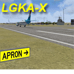
LGKA - ADE enhanced scenery, Aristotelis Airport Greece. FSX scenery only, no big frame-hits - uses only default scenery objects.
One night this winter, I tried to land at LGKA. The regional airport Aristotelis, since I was on my way to Turkey and finally Israel.
When I was cleared to land, with a visibility around 1 or 2 N.miles I couldn't find the airport even though the VOR and NDB guided me straight to it.
Suddenly the airport appeared as I passed over it. There was no lighting at the airport even though charts promised me lit runways. The airport was barren, desolate. So that meant work! With the aid of ADE I added runway lighting, added some buildings, a fuel trigger and other stuff to have a nice airport in NW Greece. Not completely 100% accurate where buildings are concerned, but just fun. It 's yours. if you want it. AVSIM upload only
| Filename: | LGKAAristotelis_Airport_Greece.zip |
| License: | Freeware, limited distribution |
| Added: | 13th April 2010, 18:18:50 |
| Downloads: | 3,059 |
| Author: | Joost Visser |
| Size: | 319.25 KB |
| Category: Flight Simulator X - Scenery | |
| Cedar Rapids Iowa USA Eastern Iowa Airport-KCID |
|
Images related to this file:
File Description:
Cedar Rapids Iowa USA Eastern Iowa Regional Airport for FSX. Several improvements have been made to the default airport. The default terminal buildings have been replaced with buildings created in FSDS; aircraft gates have been correctly coded using Airport Design Editor 1.70.6042; a new airport vehicle network has been built to prevent airport vehicles from entering the taxiways; extra fuel trucks have been added throughout the airport; the tower view has been changed to display from the roof of the control tower; static FedEx and UPS scenery objects have been placed throughout the airport; all taxiway signs are correctly placed and all taxiway designators are correctly named; there is the option to open both runways to AI traffic; optionally, a set of GA flight plans is included using all default FSX aircraft to liven up the GA area; and Jim Dhaenen's excellent ramp lights are also included. Please read the README FIRST.txt and installation.txt files to insure proper installation of all files.
| Filename: | Cedar_Rapids_Iowa_USA_Eastern_Iowa_AirportKCID.zip |
| License: | Check within download |
| Added: | 29th September 2017, 16:54:49 |
| Downloads: | 864 |
| Author: | Patrick Finch |
| Size: | 6.34 MB |
| Category: Flight Simulator X - Scenery | |
| Lafayette Louisiana USA Regional Airport |
|
Images related to this file:
File Description:
Lafayette Louisiana USA Regional Airport for FSX. Several improvements have been made to the default airport. The default terminal building has been replaced with a custom building created in FSDS; aircraft gates have been correctly coded using Airport Design Editor 1.70.6042; a new airport vehicle network has been built to prevent airport vehicles from entering the taxiways; extra fuel trucks have been added throughout the airport; the tower view has been changed to display from the roof of the control tower; static FedEx and UPS scenery objects have been placed throughout the airport; all taxiway signs are correctly placed and all taxiway designators are correctly named; there is the option to open both runways to AI traffic; the ILS for Runway 4R has been added; optionally, a set of GA flight plans is included using all default FSX aircraft to liven up the GA area; and Jim Dhaenen's excellent ramp lights are also included. Please read the README.txt file to insure proper installation of all files.
| Filename: | Lafayette_Louisiana_USA_Regional_Airport.zip |
| License: | Freeware, limited distribution |
| Added: | 2nd November 2017, 17:58:44 |
| Downloads: | 686 |
| Author: | Patrick Finch |
| Size: | 3.09 MB |
| Category: Flight Simulator 2004 - Scenery | |
| Airport Rostock - Laage, Germany |
|
File Description:
NEW VERSION, Modern, service-orientated, professional - that’s how passengers and visitors see the airport in Mecklenburg-Western Pommerania.
Quality and customer care are matters of course for 60 airport employees. Day after day they’re mastering their complex work flows (almost) with perfection.
Every business section of the airport like ground traffic service, passage, or traffic control is subject to a permanent quality management following Lufthansa standards. Not least it’s due to the German Air Force that the airport meets international standards.
Rostock-Laage is a popular airport. Both business travellers and tourists appreciate the individual atmosphere and the extensive service which is improved every day.
The Airport Rostock - Laage ( ETNL ) product features the following:
- NEW: static display of Eurofighter, Eurocopter Tiger
and Airbus A380
- accurate simulation of Fliegerhorst German
Bundeswehr: " Jagdgeschwader 73 Steinhof "
- 200 authentic objects
- with shelter for the Eurofighters, forest, streets,
hangars for civils and military air traffic
- new airport terminal and many more,
objects and textures by www.afs-design.de - Author: A.Meyer.
| Filename: | Airport_Rostock__Laage_Germany.zip |
| License: | Freeware, limited distribution |
| Added: | 23rd January 2009, 10:41:25 |
| Downloads: | 4,627 |
| Author: | Andreas Meyer |
| Size: | 5.15 MB |
| Category: Flight Simulator X - Scenery | |
| KVC - King Cove Airport - Alaska, USA |
|
Images related to this file:
File Description:
King Cove Airport (IATA: KVC, ICAO: PAVC, FAA LID: KVC) is a state-owned public-use airport located four miles (6 km) northeast of the central business district of King Cove, a city in the Aleutians East Borough of the U.S. state of Alaska.
King Cove Airport has one runway (7/25) with a gravel surface measuring 3,500 x 75 ft. (1,067 x 23 m). For the 12-month period ending December 31, 2005, the airport had 1,030 aircraft operations: 71% air taxi and 29% general aviation.
Changes: Increased parking apron and turn arounds at both ends of the runway. Also added additional parking and custom models. Changes were based on 2014 construction plans.Created with Airport Design Editor 9x by ScruffyDuck Software using current FAA documentation and Google Earth measurements, this package offers a replacement for FSX's stock airport. All these enhancements are as close to the real airport as I can get with stock library objects and custom buildings.
| Filename: | KVC__King_Cove_Airport__Alaska_USA.zip |
| License: | Freeware |
| Added: | 20th December 2014, 00:02:03 |
| Downloads: | 846 |
| Author: | Wayne Roberts |
| Size: | 446.46 KB |
| Category: X-Plane - Scenery | |
| BR SP SBST - Santos Airport v1.0.0 |
|
Images related to this file:
File Description:
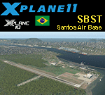
This is an X-Plane 11 and X-Plane 10 scenery package for Nero Moura Airport, also know as Santos Air Base, or BAST, (IATA: SSZ, ICAO: SBST), which is an airport and base of the Brazilian Air Force located in the city of Guarujá, state of São Paulo, in Brazil. The operation of civil aircraft for refueling may be possible upon authorization of the commander of Santos Air Base.
It includes corrected aprons, ramps, gates, taxiways, lighting system, city buildings, the Santos Harbour and Port area, ortho-photoscenery for the airfield area, and (XP11 only) airport ground services (like push back).
On June 22, 2015, the airport received a concession for a commercial airport in the city, named Guarujá Metropolitan Civil Aerodrome, to serve the Baixada Santista metropolitan area. The new structure will divide space with BAST and will have the widening of the airstrip.
This scenery was tested and is operational (as of January 24, 2018) in "X-Plane 11.11 64 bit", Windows 10 Home. It was also tested and is also operational (as of January 24, 2018) in "X-Plane 10.51 64 bit", Windows 10 Home.
| Filename: | BR_SP_SBST__Santos_Airport_v100.zip |
| License: | Freeware |
| Added: | 2nd February 2018, 00:11:48 |
| Downloads: | 72 |
| Author: | Rui Mesquita |
| Size: | 146.08 MB |
| Category: Flight Simulator 2004 - Scenery | |
| DTTG Gabes, Tunisia |
|
File Description:
Googly scenery for Gabes (ICAO: DTTG), a somewhat nondescript airport
shoe-horned into one of Tunisia's largest industrial cities. Famed for
its beaches, the city hosts cement, chemical and brick factories and an
oil refinery, resulting in poor levels of air pollution. The airport is
a joint military and civilian operation although military traffic appears
to be mostly helicopter activity and the civilian traffic consists of an
ATR of Sevenair calling in once in a blue moon.
Microsoft have only provided a runway at this airport in Flight Simulator
2004 and this scenery seeks to redress the situation so that you and your
"AI" traffic can use the airport realistically.
The scenery does not purport to be ultra-accurate. Based on high quality
satellite imagery from Google Earth, the layout is proportionally correct but the
added airport features, such as buildings, are built from default Microsoft objects
and add-on libraries so will not look exactly like the real thing.
You are not obliged to download and install any additional scenery libraries,
but to enjoy this scenery in its entirety, you may wish to. It will work fine,
with or without.
| Filename: | DTTG_Gabes_Tunisia.zip |
| License: | Freeware |
| Added: | 14th October 2008, 13:18:33 |
| Downloads: | 757 |
| Author: | John Hinson |
| Size: | 83.15 KB |
| Category: Flight Simulator X - Scenery | |
| EKKL-Kalundborg Airport X VFR Photo Scenery |
|
File Description:
Kalundborg Airport – named Kaldred is a small regional field in a comfortable distance from my other FOTOREAL airport EKRK-Copenhagen Airport Roskilde. In the period 1964-76, airfield operations was yearly 15.000-20.000, and in 1976 the heavier aircrafts with retractable gear made it necessary to change the Runway surface from grass to asphalt. In 1981, the closure of Skovlunde Airfield in the Greater Copenhagen Area moved traffic to other locations like EKRK-Roskilde, and investments was made to improve service and facilities at EKKL to attract new customers, being a the perfect hub for aircraft operations to many of the small Danish islands. For many years post and News papers were daily transported by road from print in Copenhagen to Kaldred and flown to EKSS-Samsø (my last released airport).
Today six Air companies reside in Kaldred, together with Kalundborg Flyveklub. Visit Kaldred, and be sure you will get a warm welcome, and as they say in Kalundborg Flying Club, there are always coffee in the clubhouse. Included in the zip file is a version for Ultimate Terrain Europe and Dan-Vfr plus the Default scenery. Enjoy.
| Filename: | EKKLKalundborg_Airport__X__VFR_Photo_Scenery.zip |
| License: | Freeware |
| Added: | 22nd May 2008, 09:17:33 |
| Downloads: | 2,056 |
| Author: | Jens Peter Bruun-Hansen |
| Size: | 22.54 MB |
| Category: X-Plane - Scenery | |
| BR CE - SNIG Iguatu Airport v1.0.0 |
|
Images related to this file:
File Description:
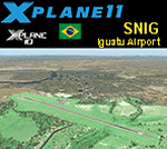
This is an X-Plane 11 and X-Plane 10 scenery package for Tomé da Frota Airport (IATA: IGT, ICAO: SNIG), which is the airport serving the city of Iguatu, state of Ceará, in Brazil.
It includes corrected aprons, ramps, gates, taxiways, lighting system, city buildings, ortho-photoscenery for the airfield area, and (XP11 only) airport ground services (like push back).
With an intense movement of small aircraft Iguatu Airport is of total importance for businessmen who have aircraft or use the air taxi. Sol Aviation flies from/to Fortaleza/SBFZ. Gol and Two airlines announced intention to fly to/from Fortaleza/SBFZ later in 2018.
This scenery was tested and is operational (as of January 26, 2018) in "X-Plane 11.11 64 bit", Windows 10 Home. It was also tested and is also operational (as of January 26, 2018) in "X-Plane 10.51 64 bit", Windows 10 Home.
| Filename: | BR_CE__SNIG_Iguatu_Airport_v100.zip |
| License: | Freeware |
| Added: | 2nd February 2018, 00:11:29 |
| Downloads: | 44 |
| Author: | Rui Mesquita |
| Size: | 8.3 MB |


© 2001-2026 AVSIM Online
All Rights Reserved
Privacy Policy |