
Where Flight Simulation Enthusiasts Gather from Around the World!
AVSIM Library - Search Results

| Category: Flight Simulator 2004 - Scenery | |
| Terrace CYXT in British Columbia, Canada - REVISED |

|
Images related to this file:
File Description:
This version includes the correct Piper Cub texture, unreported by all but one downloader (why?).
Terrace is fifteen miles east and inland from Prince Rupert, which is 500 miles north of Vancouver up the BC coast. It is at the point in the mountains where two fjords meet, one coming from Prince Rupert and the other from Kitimat. The airport is a couple of miles south of the town and on the south side of the Skeene River. There are two runways, and the main one is a recently-extended 7,500 feet long and lighted 33/15. The second is 5,373 feet of unlit 03/21. The apron has been enlarged to be able to accommodate a Boeing 737 so I have parked an Air Canada jet there, but the pics show the planes that do fly to Terrace, and these are Air Canada and Hawk Air Dash 8-300's. The original aircraft and the textures are down-loadable and and can be used for AI.
| Filename: | Terrace_CYXT_in_British_Columbia_Canada__REVISED.zip |
| License: | Freeware, limited distribution |
| Added: | 21st February 2010, 16:25:38 |
| Downloads: | 1,109 |
| Author: | Roger Wensley |
| Size: | 3.39 MB |
| Category: Flight Simulator X - Scenery | |
| Nelson Mandela statue in Bloemfontein, South Africa |
|
Images related to this file:
File Description:
Madibas statue in his honor, will work best with my Bloemfontein scenery here at AVSIM.
| Filename: | Nelson_Mandela_statue_in_Bloemfontein_South_Africa.zip |
| License: | Freeware |
| Added: | 16th December 2013, 00:05:45 |
| Downloads: | 585 |
| Author: | Frits Beyer |
| Size: | 1.28 MB |
| Category: Flight Simulator 2004 - Aircraft Repaints, Textures and Modifications | |
| Airbus A321-231 in new house colors |
|
Images related to this file:
File Description:
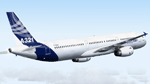
Highly detailed repaint of A321-231 F-WISS in Airbus house colors (fictional). Project Airbus presents the Airbus A321. Features include dynamic wingflex (with input from several new variables), drooping control surfaces, hardcoded double strobes, and over 20 other custom XML parts. Visit www.pairbus.com. Requires Project Airbus A321-231 IAE Model. Textures only. Requires base pack available here at Avsim. Thank you Project Airbus for creating such a beautiful bird. Painting this plane made much fun. Installer read me included.
| Filename: | Airbus_A321231_in_new_house_colors.zip |
| License: | Freeware |
| Added: | 12th June 2011, 08:40:33 |
| Downloads: | 1,337 |
| Author: | Thomas Eisenbach / Project Airbus |
| Size: | 6.13 MB |
| Category: Flight Simulator 2004 - Gauges | |
| Reduced Braking Effectiveness in Rain and Snow |
|
File Description:
If you want more realism and are tired of having the same braking effectiveness in rain and snow as on a dry runway then this is for you.
There are two gauges, "BrakingAction" and "BrakingAction_AntiSkid".
Use the gauge "BrakingAction" for aircraft which do not have an AntiSkid system; do not use it on aircraft with antiskid (e.g. airliners) - for those use "BrakingAction_AntiSkid".
The gauges will reduce braking effectiveness during rain, snow, and freezing rain. In addition, the "BrakingAction" gauge simulates blocked wheels if you stay on the brake for too long; blocked wheels will further reduce the braking effectiveness; in addition, blocked wheels will put wear on the tires on dry and rainy runways; this may lead to a blown tire.
NOTE: The gauges are made for users who either use the keyboard or an assigned button (or two for differential brakes) on the joystick for braking. The gauges will most likely not work with devices that allow a progressive braking input, i.e. that allow you to apply brake pressure anywhere between 0 and 100% (I guess there are rudder pedals that allow you to do that).
| Filename: | Reduced_Braking_Effectiveness_in_Rain_and_Snow.zip |
| License: | Freeware |
| Added: | 27th February 2015, 18:09:43 |
| Downloads: | 306 |
| Author: | Detlev J. Rohmer |
| Size: | 132.84 KB |
| Category: Flight Simulator 2004 - Scenery | |
| Lutselk'e CYLK in the Northwest Territories, Canada |
|
Images related to this file:
File Description:
Lutselk'e is a village on the southern shore of the Great Slave Lake, at the eastern end and about 120 miles east of Yellowknife. The Hudson Bay trading company established a post there in 1925, and the current school opened in 1960. The population is in the region of 330. There is no road access, but the government runs a freight shipping service during the ice-free period of the Summer. The airfield is a mile or so east of the village, with a runway of around 3,500 feet of gravel aligned 08-26 with PAPI at both ends and lit, with lights atop traffic cones. There are scheduled flights from Yellowknife by Air Tindi, included in the AI, as is a once a week freight flight by Buffalo Airways. You will need to have downloaded and installed my runway and taxiway lighting library from recent posts. A note here about my scenery making. There will not be many more to follow this as I am almost at the end of the photos I either took or found for scenery purposes, plus I expect to move on from FS9 at some point during next year.
| Filename: | Lutselke_CYLK_in_the_Northwest_Territories_Canada.zip |
| License: | Freeware, limited distribution |
| Added: | 9th December 2019, 18:04:52 |
| Downloads: | 104 |
| Author: | Roger Wensley |
| Size: | 3.25 MB |
| Category: Flight Simulator 2004 - Scenery | |
| Cache Creek CAZ5 in British Columbia Canada |
|
Images related to this file:
File Description:
Cache Creek is a small village of around 1,000 folks on the eastern side of the Coast Mountains of British Columbia, around 70 miles northeast of Pemberton and 40 miles west of Kamloops. The village is in a valley bottom and recently suffered from severe flooding due to the overflow of the river. The airfield is high above the town, with a runway aligned 15-33 and 3,280 feet of asphalt, without runway or taxiway lighting; hence "airfield" as opposed to "airport". I have posted it as Cache Creek CAZ5, but I suggest that you revise the name to perhaps "BC airfields" and just load my future airfield posts into the same scenery and texture folders to avoid the inevitable doubling up of common textures etc. Plus that way you will have just one FS9 library post to do and new airfields will not need yet another posting. Up to you. If you find a defect, email me.
| Filename: | Cache_Creek_CAZ5_in_British_Columbia_Canada.zip |
| License: | Freeware, limited distribution |
| Added: | 18th November 2020, 01:21:22 |
| Downloads: | 94 |
| Author: | Roger Wensley |
| Size: | 9.27 MB |
| Category: Flight Simulator 2004 - Scenery | |
| Whati CEM3 in the Northwest Territories, Canada |
|
Images related to this file:
File Description:
Whati is a village at the southern end of Lac La Martre, a smaller lake (only by Canadian standards, at over 40 miles long) halfway between the Great Slave Lake and the Great Bear Lake and around 100 miles north of Yellowknife. The North West Company established a trading post there in 1793, and this was the centre for local trading in the area for 100 years until a post was opened by the Hudson Bay Company on the Great Slave Lake. The current population is in the region of 520. There is no graded road access and access is by boat or air. The main local economy revolves around hunting and fishing, with efforts being made to increase tourism amid the wilderness and the wildlife. The airfield is just over a mile east of the village, with a runway of around 3,400 feet of gravel aligned 09-27 as of 2010, with PAPI at both ends and lit. There are scheduled flights from Yellowknife by Air Tindi, included in the AI, and some GA. The terminal building is similar to that of Lutselk'e, but with a different colour scheme and with solar panels on the roof. It appears that they repaint the sign on the front of the building with a different wording every time; the one I have used is one of three that have existed in the last few years. The photos I had originally were taken in the winter, with snow. Seeing it in the summer I discovered that my version of the building is not at the right level above the ground by about a foot, or 30cm. I was too lazy to make it again, which was the only way to get it right and still have it throw a shadow on the ground. This scenery modifies the lake shore, corrects levels for land and lake, and adds the village and a connecting road in addition to the airport. A note here about my scenery making. There will not be many more to follow this as I am almost at the end of the photos I either took or found for scenery purposes, plus I expect to move on from FS9 at some point during next year.
| Filename: | Whati_CEM3_in_the_Northwest_Territories_Canada.zip |
| License: | Freeware, limited distribution |
| Added: | 15th December 2019, 19:18:29 |
| Downloads: | 148 |
| Author: | Roger Wensley |
| Size: | 4.25 MB |
| Category: Flight Simulator 2004 - Scenery | |
| Lake Athabasca Airfields in Alberta & Saskatchewan Canada |
|
Images related to this file:
File Description:
These are four airfields around or near Lake Athabasca, in Alberta and Saskatchewan. Fort Chipewyan CYPY is at the southwestern end of the lake and the direct recipient of pollution that flows north from the Tar Sands to the south. The population of around 850 lives in one of the earliest European settlements in Alberta, founded as a trading post by Peter Pond of the Northwest Company in 1788 and named for the Chipewyan people who lived in the area. The airfield has one runway aligned 03-21 and 5,000 feet of asphalt, with PAPI at both ends. The landclass has been modified along with the grassed area of the airfield to create the village on the lakeshore. There are scheduled flights and GA flights in the AI for all four airfields. Charlot River CJP9 is on the northern shore at the western end of the lake, in Saskatchewan. It serves a nearby hydroelectric project and is used to transport technical staff in and out. There is no terminal building, only waiting pickup trucks and a generator building. There is one lit gravel runway aligned 04-22 and just over 3,200 feet long. Fond-du-Lac CZFD is on the northern shore in Saskatchewan, at the narrower eastern end. The population is around 900 and is a remotely situated "fly-in" village that has existed for over 150 years where "living off the land" is an accepted and normal way of life. The village has been created along with the airfield. The single runway is 3,800 feet of lit gravel aligned 10-28 with PAPI at the western end. Stony Rapids CYSF is east of the end of Lake Athabasca, on the Fond du Lac River. It has a population of around 250 and is only semi-connected to the rest of Canada by a rough gravel road. The runway is over 5,000 feet of gravel, aligned 06-24 with PAPI at both ends. The NorthSKlake is a flatten for an Ultimate Terrain lake that was at an incorrect elevation.
| Filename: | Lake_Athabasca_Airfields_in_Alberta__Saskatchewan_.zip |
| License: | Freeware, limited distribution |
| Added: | 7th August 2018, 12:39:52 |
| Downloads: | 175 |
| Author: | Roger Wensley |
| Size: | 20.36 MB |
| Category: Flight Simulator 2004 - Scenery | |
| Silver City CFQ5 in Yukon Territory Canada |
|
Images related to this file:
File Description:
Silver City is a ghost town in the Yukon Territory, Canada, amid the Rocky Mountains and around 35 miles northwest of Haines Junction. It is on the southern end of Kluane Lake and in the Kluane National Park and this probably explains it's (minimal) survival after what appears to have been the shutdown of mining for silver. There is little information readily available. The date of this scenery is, as usual, around 2010. There was no recent regular service by Yukon Air North or any other airline, and the primary user of the airfield adjacent to the lake is a company called Icefield Discovery Tours. Their activity is probably very similar to the company at Haines Junction and involves trips to the National Park amid mountains and glaciers. There is also another organisation at the airfield, the Kluane Lake Research Station of the Arctic Institute. They have four buildings there but it is unclear how much aerial activity they generate, or if in fact they fly at all for their work. The runway is 3,000 feet of unlit gravel, aligned north-south. This post will be followed by Burwash, which is at the far northwestern end of the lake. There is no video of the Silver City airfield on Youtube, and it is not the most exciting airfield in the world, but the location is enough in real life for a visit to be made. On YouTube there is a series of posts by Angle of Attack showing the preparation and then the flight of an old Cessna 172 from Homer to Oshkosh for the installation of modern instruments. Interesting for me as they visit or fly over airfields I have made: Homer, Merrill, Tok Junction, Burwash, Silver City, Haines Junction, Watson Lake, Fort Nelson, and Grande Prairie. But they fly in the winter so it all looks very different.
| Filename: | Silver_City_CFQ5_in_Yukon_Territory_Canada.zip |
| License: | Freeware, limited distribution |
| Added: | 22nd January 2022, 21:57:41 |
| Downloads: | 96 |
| Author: | Roger Wensley |
| Size: | 9.86 MB |
| Category: Flight Simulator 2004 - Scenery | |
| Puntzi Mountain CYPU in British Columbia Canada |
|
Images related to this file:
File Description:
Puntzi Mountain is near a village called Chilanko Forks, approximately midway between Bella Coola and Williams Lake and just north of the Chilcotin to Bella Coola Highway. It is what remains of a military base and which currently shows in FS9 as a town, reduced in my scenery version to what remains after the base was closed and cleared. All that remains of the base is now the runway, over 6,000 feet of asphalt aligned 04-22, unlit, at 2,985 feet above sea level, and with centre line markings that are almost invisible. The runway is used in the summer for whatever local fire-fighting operations are needed by ConAir and there are some buildings and fuel tanks for this. It is also used for local flights such as those for a lodge on Puntzi Lake to the north. I have added three AT-802 textures with additional tail numbers for use in the AI. These are to be added to an aircraft that you very likely already have and which was included in Don Grovestine's posting of Abbotsford CYXX. I have also included the revised config file that adds the planes to Don's original; save the original config under another name and replace it with mine. Put the three new texture folders in with the original, which is called "CYXX-AI_Air Tractor AT-802 (Wheels)". If you do not have Don's scenery I suggest you get it, as his work is worth having and like Greg Putz he puts in a lot more effort than I do. The L188 Electra should already be with you if you downloaded my Smithers CYYD scenery. If you find a defect, email me.
| Filename: | Puntzi_Mountain_CYPU_in_British_Columbia_Canada.zip |
| License: | Freeware, limited distribution |
| Added: | 20th November 2020, 05:33:01 |
| Downloads: | 169 |
| Author: | Roger Wensley |
| Size: | 10.33 MB |
© 2001-2026 AVSIM Online
All Rights Reserved
Privacy Policy |