
Where Flight Simulation Enthusiasts Gather from Around the World!
AVSIM Library - Search Results

| Category: Flight Simulator 2004 - AFCAD Files | |
| Puerto Vallarta, Mexico (MMPR) |

|
File Description:
AFCAD for the Puerto Vallarta Mexico Airport (MMPR) and Mesh released on August 19th, 2005 by José Luis Águila Boudib.
This AFCAD includes most gates and parking as close to real life as I could get it. I used some photos on the internet to get the real layout. Once you install this, the airport should come to life (provided you have the AI aircraft/schedules) with aircraft from AeroMexico, Mexicana, Aero California, Magnicharters and Azteca, as well US carriers like Delta, Continental, Alaska and American Airlines.
The G/A apron still needs expanding to look like the real MMPR, but I kept it within the fence in the scenery by Jose Luis.
| Filename: | Puerto_Vallarta_Mexico_MMPR.zip |
| License: | Freeware |
| Added: | 21st August 2005, 04:03:40 |
| Downloads: | 1,928 |
| Author: | Jeffrey S. Bryner |
| Size: | 3.47 KB |
| Category: Flight Simulator 2004 - Scenery | |
| UK Farm Strips Vol 3 |
|
File Description:
UK Farm Strips Scenery containing a further 20 private landing strips, all located within, and compatible with, the VFR GM Photoscenery coverage and prepared using the VFR Terrain Mesh. All strips reflect the topographical nature of the fields, so that users may experience the challenge of taking ofF from, and landing on, sloping runways. This scenery is not compatible with FS2002, or earlier versions. This third volume requires the presence of Vol 1 and Vol 2, since it uses objects provided with these initial versions, as well as a few additional objects.
Farms in this volume are spread across the counties of Beds, Cheshire, Gloucs, Hamps, Herts, Herts, Kent, etc. Statics now include a number of Microlights.
| Filename: | UK_Farm_Strips_Vol_3.zip |
| License: | Freeware |
| Added: | 11th September 2005, 22:50:07 |
| Downloads: | 1,596 |
| Author: | Gerry Winskill |
| Size: | 1.93 MB |
| Category: Flight Simulator X - Scenery | |
| FSX_MeSA_G08_Patch |
|
File Description:
This terrain mesh file should substitute the before one we uploaded with the same name, which presents a small area with some voids that were not detected in our tests.
Please, accept our apologies for this mistake.
It was multi-LOD compiled from 90m SRTM2 source data, reprocessed
with 3DEM to remove voids and spikes, providing a 76.4m (LOD9) horizontal
resolution topography intended for use only in FSX updated with SP1.
FSX_MeSA_G08_Patch (Column G x Row 08) covers the area inside the boundaries:
N = 22º 30' S; S = 28º 7.5' S;
W = 45º 0' W; E = 37º 30' W;
Authors:
Hely Heck Junior - Magrao ( [email protected] )
and Jose Lobo ( [email protected] )
TerraBrasilis: www.terra-brasilis.org
| Filename: | FSX_MeSA_G08_Patch.zip |
| License: | Freeware |
| Added: | 24th June 2007, 18:09:48 |
| Downloads: | 632 |
| Author: | Hely Heck Jr. and José Lôbo |
| Size: | 10.39 MB |
| Category: Flight Simulator X - Scenery | |
| Tonopah - KTPH |
|
File Description:
This file contains several BGL's which enhance the default FSX Tonopah, Nevada airport (KTPH).
Additional parking, scenery objects, and roads are added to the bland stock airport.
The "mesa" created by the stock airport backgound flatten is blended into the
surrounding terrain using "sloped flattens".
This scenery is not intended to re-create a perfect match to the real world but
to enhance the visual experience of flying into and out of the airport.
The files were tested with FSX-Acceleration\SP2 on WinXP Pro, DX9.
I used 10M mesh from the "FSX Usa 10 M terrains Project" when blending
the altitude data but the files should provide good results with the default FSX terrain.
| Filename: | Tonopah__KTPH.zip |
| License: | Freeware |
| Added: | 21st December 2007, 04:29:50 |
| Downloads: | 1,171 |
| Author: | Paul Strogen |
| Size: | 812.46 KB |
| Category: Flight Simulator 2004 - Scenery | |
| Hong Kong Kai Tak 1963 |
|
File Description:
This is Kai Tak airport as it was in 1963. Kowloon Bay has yet to be filled in, and the runway is only 8405 ft long. Includes mesh files by Holger Sandmann and charts of the era scanned by Chic Eather. Navaids backdated to the early 60's, except the IGS for runway 13 is included although not actually installed until 1974. Curving approach lights will help you find the runway. Chek Lap Kok airport has been removed. The IGS and other approaches created by Jim Vile. The AI aircraft will follow the curved approach to runway 13 in good weather or bad. Please note that Jim Vile has produced a modern version of this airport (kaitak98.zip).
| Filename: | Hong_Kong_Kai_Tak_1963.zip |
| License: | Freeware, limited distribution |
| Added: | 27th April 2006, 02:02:13 |
| Downloads: | 15,205 |
| Author: | Tom Gibson and Jim Vile |
| Size: | 5.74 MB |
| Category: Flight Simulator X - Scenery | |
| WA67 - Green Mountain Airport - Vancouver, Washington |
|
Images related to this file:
File Description: This is a revision of an airport originally included in my Oregon GA package.
This is a complete airport and can be installed alone, or you can add this
to the original and overwrite the older files. A member of the community
alerted me to elevation discrepancies; I had been using a 3rd party mesh when I
made this airport, which masked the discrepancy. This version will work
universally and also includes corrected approaches wherein I removed the default
ones and aligned these correctly to the current runway position; I added custom
runways lights to more accurately reflect reality and also made several relevant
detail changes.
| Filename: | WA67__Green_Mountain_Airport__Vancouver_Washington.zip |
| License: | Freeware, limited distribution |
| Added: | 6th January 2014, 16:28:32 |
| Downloads: | 637 |
| Author: | Rick Keller |
| Size: | 146.81 MB |
| Category: Flight Simulator 2004 - Gauges | |
| Apollo MX20 Multi-Function Display/GPS |
|
File Description:
This gauge is modeled after the Apollo MX20 Multi-Function Display. This gauge is written in XML and is designed to mesh with the default FS9GPS map input data. Compatible with FS2004 (FS9) ONLY!
Although I tried to make this gauge as close to the real Apollo MX20 as possible it is not considered to be an exact replica. It is limited to certain features that the FS9 data will provide. It does however have all the great features that the default FS9GPS offers and offers an alternative to the default GPS.
Size (pixel size) is the same as the FS9 default GPS so placement (or replacement) of the gauge is quick and easy.
| Filename: | Apollo_MX20_MultiFunction_DisplayGPS.zip |
| License: | Freeware |
| Added: | 24th December 2003, 05:29:16 |
| Downloads: | 9,187 |
| Author: | Keith Giveans |
| Size: | 156.91 KB |
| Category: Flight Simulator X - Scenery | |
| Crete Island, Version 2 |
|
Images related to this file:
File Description:
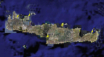
Crete is the bigger than the islands of the Greek archipelago and it is the south rampant of the Aegean sea. This scenery contains the following airports: LGIR, LGSA, LGOB, LGTL and 78 cities.
In this 2nd version I have used the mesh terrain of Yiannis Dermitzakis that offers a bigger realism to the costs. This has put under an obligation to reconstruct the entirety of the populations of the since costs they were located inside the sea. At the same time I have been able to redraw them populations with houses and real facilities that. I believe that I can offer a quite realistic scenery especially in the group of populations of the coast.
| Filename: | Crete_Island_Version_2.zip |
| License: | Freeware |
| Added: | 7th November 2009, 21:08:05 |
| Downloads: | 6,014 |
| Author: | Toni Agramont |
| Size: | 31.14 MB |
| Category: Flight Simulator 2004 - Scenery | |
| O12 - Grand Lake St. Marys Seaplane Base - Ohio, USA |
|
Images related to this file:
File Description:

Grand Lake St. Marys Seaport O12 rests in Ohio's largest inland lake at Celina, Ohio. Float and soar plane enthusiasts will find thermals (several are placed within about a 60 mile radius) and plenty of docks or moors around the lake for your Amphib and afcads. Grand Lake St. Marys Seaport O12 scenery is made to blend with autogen scenery and default mesh. I used custom made objects & default objects. Grand_thermals.BGL is the troublesome file with winds aloft for sail planning thermals. Some people may want to remove it for smoother landing at one of the airports. Airports: Lakefield KCQA - Mulholland OI99 - Fortman 1OH4 and Grand Lake St Marys O12. I pulled this from my old archives.
| Filename: | O12__Grand_Lake_St_Marys_Seaplane_Base__Ohio_USA.zip |
| License: | Freeware |
| Added: | 11th July 2015, 11:22:45 |
| Downloads: | 240 |
| Author: | Rick Connolly |
| Size: | 13.53 MB |
| Category: Flight Simulator 2004 - Scenery | |
| Puglia - Castel del Monte |
|
Images related to this file:
File Description:
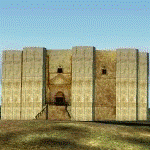
Re-Upload. I only upload this scenery that I downloaded from avsim before its crash. I'm not the original author but rather thank D. Benvenuti.
"NEW: more accurate dimensions (I hope within 1 meter or less)
Famous Frederick II castle in Puglia, near ANDRIA. It represented also in italian 1 eurocent coin.
For FS2002 and FS2004, best with Italy Landpack 4 and an accurate mesh scenery (such as Mauri's one).
Install it in an active scenery folder (or create a new one and make it active), casteldelmonte.bgl in the scenery folder and casteldelmonte.bmp in the texture one."
Made with EasyObiectDesign and AirportForWindows 2.60 - Copyright D.Benvenuti 2005 - Not for commercial use
| Filename: | Puglia__Castel_del_Monte.zip |
| License: | Freeware |
| Added: | 5th August 2011, 14:51:50 |
| Downloads: | 559 |
| Author: | D. Benvenuti |
| Size: | 115.77 KB |
© 2001-2026 AVSIM Online
All Rights Reserved
Privacy Policy |