
Where Flight Simulation Enthusiasts Gather from Around the World!
AVSIM Library - Search Results

| Category: Flight Simulator 2004 - Scenery | |
| Hazyview Airfield, Hazyview, South Africa |

|
Images related to this file:
File Description:
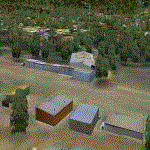
Hazyview is one of the gateway towns to the Kruger National Park and is located just to the West of Phabeni Gate, one of the main gates to use if you are travelling to Skukuza. The airfield in Hazyview is also called Numbi Airfield due to the location of the Numbi Hotel right next to the airfield.
Hazyview airfield is not included in the default scenery of FS2004. With this package, it has been faithfully produced in Gmax with photoreal textures on all the buildings and a photoreal ground as well. Even the Lowveld mall to the North of the airfield and right on the approach to Rwy 19 as well as the Building supplies store to the south and on approach to Rwy 01 is inlcuded with custom models and textures. Likewise, the buildings to the West of the runway (right at the edge of the runway) and the brickyard at the Northern end is modeled with custom models and textures. The two large cellphone antennas are also present in the airport scenery and custom made.
In real life, the runway is quite sloped and this was also recreated in the scenery under the limitations FS2004 presents with regards to non-flat airports.
The grass runway is aligned 01/19 and only 820m long. Take-off is on Rwy 01, with landings on Rwy 19.
| Filename: | Hazyview_Airfield_Hazyview_South_Africa.zip |
| License: | Freeware, limited distribution |
| Added: | 4th February 2022, 14:57:40 |
| Downloads: | 139 |
| Author: | Kobus van Wyk |
| Size: | 17.07 MB |
| Category: Flight Simulator X - AFCAD Files | |
| KOPF - Opa Locka - Miami, Florida 2013 |
|
File Description:
Opa-locka Airport (IATA: OPF, ICAO: KOPF, FAA LID: OPF), also known as Opa-locka Executive Airport, is a general aviation airport and joint civil-military airfield 10 miles (16 km) north of Downtown Miami, primarily in metropolitan
Miami, Florida, United States, with a portion within the city proper of Opa-locka.
The airport's control tower is manned from 7:00 AM to 9:00 PM. The airport has four fixed base operators. It is owned by Miami-Dade County and operated by the Miami-Dade Aviation Department.
The tenant military activity is Coast Guard Air Station Miami, operating HU-25 Guardian jet aircraft, the HC-144 Ocean Sentry[4] turboprop aircraft and HH-65 Dolphin helicopters for coastal patrol and air-sea rescue operations.
Much of CGAS Miami's facilities were originally built during World War II as part of the former Naval Air Station Miami.
DayJet previously provided an on-demand jet air taxi service from this airport to 44 airports in 5 states. The company filed for Chapter 7 bankruptcy liquidation in 2008.
The airport is currently served by several cargo and charter airlines who use the U.S. customs facility. Maintenance and modification of airliners up to Boeing 747 size are carried out by several aviation firms
This file has the right coordenates, apron and characteristics of the airport, airport vehicles and buildings, Airport charts included.
| Filename: | KOPF__Opa_Locka__Miami_Florida_2013.zip |
| License: | Freeware |
| Added: | 6th January 2013, 11:39:28 |
| Downloads: | 770 |
| Author: | anwar gonzalez |
| Size: | 3.96 MB |
| Category: Flight Simulator 2004 - Scenery | |
| New Night Textures - Newark Liberty Intl (KEWR) |
|
Images related to this file:
File Description:
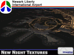
Some time ago, I purchased the Newark Liberty Intl (KEWR) by ImagineSim, but the night textures did not seem realistic. I set out to try to make them more so. This is the result of that work. Many of the scenery's night textures have been updated. The cargo areas for FedEx, UPS and UNITED Cargo now look much more realistic. The Marriott Hotel, the centerpiece of the airport and this scenery, looks considerably more realistic, as well as the terminals and the Continental Hanger and maintenance area. One of the nice unexpected results of this change is the light splash effect around the terminals; it definitely outlines the terminal area well. For those who own this scenery, I hope this enhances your flight experiences in and out of KEWR. For those who do not yet own this, but enjoy or would like to fly in and out of KEWR, it is now considered a legacy product by ImagineSim. As a result, the price was cut considerably and for a few shillings and this update, you'll have a nice addition to the airports in your FS2004 environment. I dedicate this work to all the controllers of VATSIM NYARTCC. I hope this brings more traffic your way. I want to thank ImagineSim for giving me permission to release these textures. See Readme.txt for installation instructions.
| Filename: | New_Night_Textures__Newark_Liberty_Intl_KEWR.zip |
| License: | Freeware, limited distribution |
| Added: | 27th October 2012, 03:48:59 |
| Downloads: | 2,291 |
| Author: | Jeffrey S. Bryner, Imagine Simulation |
| Size: | 1.97 MB |
| Category: Flight Simulator 2004 - Scenery | |
| Bethel PABE in southwest Alaska |
|
Images related to this file:
File Description:
There are four main northwestern Alaska towns which have good airports and are serviced by Alaska Airlines. From these airports local flights connect to nearby villages, "nearby" in Alaska meaning up to 200 miles away. The northernmost is Barrow. Southwest of Barrow is Kotzebue, then Nome, and the furthest south is this one, Bethel. The town of Bethel has a population of just over 6,000 and is 50 miles from the sea on the Kuskowim River, that splits and forks into many tributaries. Bethel Airport is close to the town and provides the only contact with the rest of Alaska, as there is no connecting highway system. There are scheduled flights by Alaska Airlines, ERA (now called Ravn) and Grant Aviation, plus others such as Ryan Air. There are cargo flights by Everts, Northern, and Lynden, and redistribution onwards to nearby villages by the smaller locally-based planes; all of these are included in the AI. There are two main runways, one just under 6,400 feet and another just under 3,900 feet, both of them aligned 19-1. The third runway is around 1,800 feet and mainly gravel, aligned 11-29. Parking at PABE is on three aprons, the northern for smaller commercial planes of Grant, ERA, Ryan etc, the central for larger planes of Alaska, Northern, Everts, and Lynden, and the southern for a large collection of GA; each apron has further hangars for maintenance companies and smaller operators. There is also another separate apron for the local military and Coastguard. There is not much photographic information available for PABE, and I have never been there; as a result it was impossible to make detailed photographic textures for some of the buildings. However, for most hangars I have made textures of at least the right colour etc based on the information I assembled and if it is green with white trim and side windows then that is how it now appears here. The exceptions are the Alaska Airlines terminal building which has complicated curved elements, and the two military hangars and workshops where I had to settle for an Alaska terminal building from another airport and the same for the military. There are numerous small villages in the vicinity of Bethel, all of them being beside either a river tributary or the coast. There are two Google Earth screenshots to show the villages that are served by the flights from Bethel and that are (mostly) included in the AI. Some of these airfields were not included in FS9 but AI will still operate in and out of Bethel. The smaller area screenshot shows the villages that are close to Bethel, and of these eight I have so far made six and they are included in this post: Napaskiak PKA, Napakiak WNA, Kwethluk KWT, Atmautluak 4A2, Nunapitchuk 16A, and Kasigluk Z09. I will work my way through the rest of the area.
| Filename: | Bethel_PABE_in_southwest_Alaska.zip |
| License: | Freeware, limited distribution |
| Added: | 8th March 2019, 00:37:58 |
| Downloads: | 305 |
| Author: | Roger Wensley |
| Size: | 32.02 MB |
| Category: Flight Simulator 2004 - Scenery | |
| Sioux Lookout CYXL in northern Ontario, Canada, updated |
|
Images related to this file:
File Description:
This greatly modifies my previous post of Sioux Lookout; it is stand-alone and does not require you to have the 2009 version. The AI provided with the post complements what was included with Dryden (March 2013). Sioux Lookout is in northern Ontario, 40 miles east of Dryden, and 145 miles northwest of Thunder Bay. The town is on the northeastern shore of a lake that I don't know the name of (I've been there, but has anyone COUNTED how many lakes Canada has?). It has a population of around 5,000. The main businesses are lumber, tourism, and health care. The airport is immediately adjacent to the northeastern corner of the town, and has 5,300' of asphalt which is aligned 16-34. There are two taxiways which curve and climb up to the apron which is 20 or 30 feet higher. When you taxi on them the knowledge that in reality you would be climbing makes sense of the curved routing. The apron is large and a mixture of asphalt and gravel. I did not make the terminal building and I have no photo or even a recollection of what it looks like, so you should first install Northwest Ontario Airports by Eric O'Link as he has a terminal building for CYXL that might be how it looks; some of his airfields collide with other and newer versions and I have kept only his CYXL and CYPL bgl's.
| Filename: | Sioux_Lookout_CYXL_in_northern_Ontario_Canada_upda.zip |
| License: | Freeware, limited distribution |
| Added: | 19th March 2013, 19:23:24 |
| Downloads: | 405 |
| Author: | Roger Wensley |
| Size: | 5.08 MB |
| Category: Flight Simulator 2004 - Aircraft Repaints, Textures and Modifications | |
| Macedonian Aviation Douglas DC-3 |
|
File Description:
Macedonian Aviation was formed as a charter operator in the summer of 1972 with a Dove and one DC-3 G-AMPO based at Luton and later, Southend Airports. By February 1973 the Dove had been sold and operations continued with the DC-3. Operations steadily grew and by December 1973 charter flights started to be flown in the oil rig support business from Aberdeen. With this work increasing Macedonian looked for further DC-3s to expand its operations, and in March 1974 it purchased British Island Airways' remaining three DC-3's. The first of these, G-AMHJ and G-AMRA were in service at Aberdeen Airport by May 1974 and G-AMPO was moved back to Southend to continue charter flights from there. The oil companies were beginning to insist on turbo-prop aircraft for the transportation of their personnel. Macedonian started negotiations to replace the DC-3's with Viscount or Heralds, but these negotians were unsuccessful so operations continued with the DC-3's. The third ex BIA DC-3 G-AMSV eventually arrived at Southend in September 1974 but this aircraft never entered service with Macedonian. In November 1974 all aircraft were flown back to Southend and Macedonian ceased all flying having been unable to raise any finance to support turbo-prop operations, and the DC-3's were sold. This repaint is of G-AMPO. Requires default Douglas DC-3.
| Filename: | Macedonian_Aviation_Douglas_DC3.zip |
| License: | Freeware |
| Added: | 14th April 2007, 18:28:39 |
| Downloads: | 240 |
| Author: | John Payne |
| Size: | 1.63 MB |
| Category: Flight Simulator 2004 - Scenery | |
| CYKF – Kitchener / Waterloo, Ontario, Canada Version 3.0 |
|
File Description: I have now overhauled the CYKF Airport and made it the lively place it is today. I used the Canada Flight Supplement and my real life knowledge of the airport as this is where I do my flight training.
After seeing the traffic in my Southwestern Ontario addon, CYKF 2.1 looked a little bare in comparison, so added more parking and traffic. There are now 35 parking spots and 2 gates. All parking spots and gates have been assigned codes, which like the airline codes for the larger airports will tell the GA aircraft where to park. I organized the different aprons into parking areas. The Waterloo Wellington flight centre is referred to as “North” parking. There are 3 other parking areas as well as the gates. Traffic includes weekly scheduled aircraft that will fly up to the cottage or down south on the weekend etc.
• 35 parking spots, 2 gates
• Extended runway 25/07 and added the new taxiway and renamed the others
• Changed the landclass for the runway 25/07 extension
• Updated the airport in AFCAD for AI to use the runway 25/07 extension
• Added 22 AI flightplans to the 3 already there. AI will model real life training and commercial operations of the airport
• AI use proper Canadian registration codes
• Tested the files to make sure it operates correctly including AI
| Filename: | CYKF__Kitchener__Waterloo_Ontario_Canada_Version_3.zip |
| License: | Freeware, limited distribution |
| Added: | 14th November 2003, 19:39:31 |
| Downloads: | 2,750 |
| Author: | David Voogd |
| Size: | 1.06 MB |
| Category: Flight Simulator X - Scenery | |
| Santa Cruz de la Sierra - Bolivia |
|
File Description:
Scenery Photoreal: Santa Cruz de la Sierra, Bolivia
Santa Cruz de la Sierra: (English: Holy Cross of the Mountain Range), commonly known as Santa Cruz, is the
capital of the Santa Cruz department in eastern Bolivia (17 45', South, 63 14', West)at 416 m above sea level.
The city of Santa Cruz is located not far from the easternmost extent of the Andes Mountains and they are
visible from some parts of the city its Situated too on the Pirai River.
The city of Santa Cruz and its metropolitan area are home to over 70% of the population of the department and
it is one of the fastest-growing cities in the world.
Airports: (NOT included in this package, just Scenery Photoreal of the city)
Viru Viru International Airport (IATA: VVI, ICAO: SLVR) in Santa Cruz de la Sierra, Bolivia is Bolivia's largest
international airport. Viru Viru handles domestic, regional, and international flights from Bolivia to
North America, South America and Europe and is the hub for Bolivia's biggest airline Boliviana de Aviacion (BoA).
The airport is able to handle the largest commercial jets.
El Trompillo Airport (IATA: SRZ, ICAO: SLET) is located in the south part of Santa Cruz, Bolivia, about 2 km
(1.25 miles) away from the central plaza. Airport type:(Public / Military).
Compatible with both FSX and P3D.
| Filename: | Santa_Cruz_de_la_Sierra__Bolivia.zip |
| License: | Freeware |
| Added: | 23rd June 2015, 17:09:33 |
| Downloads: | 1,713 |
| Author: | Marcos A. Rivas Torrez |
| Size: | 69.85 MB |
| Category: Prepar3D V1-4 - Miscellaneous Files | |
| RNP Approach Procedures for Southeast Alaska, for use with the PMDG 737 NGX |
|
File Description:
These are updated RNP procedures used in Southeast Alaska in conjunction with the PMDG 737.
While similar procedures exist else ware, the goal of these was not to code the exact procedure that is used in real world ops. The reason is because the PMDG 737 isn't capable of flying radius fix legs, which are used extensively in RNP procedures. If the approach and departures are coded as they are in the real aircraft, the flight path is not accurate. All other procedures I have located out there exhibit this limitation, which leads to unstabilized approaches.
The goal with these procedures is to have the PMDG 737 fly the same flight path as the real world procedures. Many of the fixes loaded into the FMS are sudo waypoints but as many of the true fixes are utilized to the extent possible. This means, when you arrive at minimums for the RNP 05 at Petersburg or the RNP 29 at Sitka, very little maneuvering will be required. Installation is a little tedious but will be well worth is.
Included airports and procedures:
Juneau - PAJN
CHLKT1
GLAZZ1
RODMN1
RNAV (RNP) M 08
RNAV (RNP) M 26
Ketchikan - PAKT
ANN3
DOOZI2
UDENE3
RNAV (RNP) M 11
RNAV (RNP) M 29
Petersburg - PAPG
GORBY4
HURAS2
RNAV (RNP) M 05
RNAV (RNP) M 23
Sitka - PASI
RNAV (RNP) M 11
RNAV (RNP) M 29
Wrangle - PAWG
KAJBU5
RNAV (RNP) M 10
RNAV (RNP) M 28
| Filename: | RNP_Approach_Procedures_for_Southeast_Alaska_for_u.zip |
| License: | Freeware |
| Added: | 31st March 2018, 03:31:12 |
| Downloads: | 839 |
| Author: | Trevor Lahey |
| Size: | 10.78 KB |
| Category: Miscellaneous Files - General Utilities | |
| Royal Europe Airlines v1.1 Business Edition, Virtual Airline Simulation |
|
File Description:
(to download you need REA version 1.0)
A must have for all viritual commercial Pilots:
Royal Europe Airlines v1.1 Business Edition
Works with all flightsimulators!
Get a flight assignment at REA and see how many passengers you'll get this flight.
After gate arrival report at REA and log your flight.
Check out how much money you can make in a week by flying for Royal Europe Airlines.
Then look at the total profit of REA and see if you can improve it next week!
(all data can be checked whenever you want)
New in v 1.1:
* Bugfixes
* Memmoryfix
* Multiple players
* A random number of passengers will fly with you each flight
* Each flight will now have ticketprices!
* REA finances including profit for this flight, fuelcosts, landingfee, etc..
* You can now enter a comment on your flight
* All data, wages, finances, flight, comments will be saved
* more.. (check it out)
Destinations :
Munich
Brussels
London Gatwick
Copenhagen
Berlin
London Heathrow
Paris
Maastricht Aachen Airport
Frankfurt
Zurich
Madrid
Dusseldorf
Salzburg
John F Kennedy New-York
Rome
(see documentation if you would like your personal airports in this game!).
* Viritual ticket prices (made from REAL ticket prices)
* Viritual passengers (more passengers more $$, less passengers, no good!!)
* Viritual money
* All saved, every time you fly. Total overview always availible...
Script tested on
WinXP home edition
1700MHz
256 mb memmory
64 MB 3dfx video
Min syst. requirements:
Win 98, 233 Mhz, 128 MB memmory, 16mb video
REA version 1.0 required
You can get version 1.0 at FS2002 files!
| Filename: | Royal_Europe_Airlines_v11_Business_Edition_Virtual.zip |
| License: | Freeware |
| Added: | 3rd January 2003, 21:02:57 |
| Downloads: | 289 |
| Author: | M.Heuts |
| Size: | 341.76 KB |


© 2001-2026 AVSIM Online
All Rights Reserved
Privacy Policy |