
Where Flight Simulation Enthusiasts Gather from Around the World!
AVSIM Library - Search Results

| Category: Flight Simulator X - Utilities | |
| AI Flight Planner Version 2 FS9 Compatible |

|
Images related to this file:
File Description:
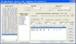
AI Flight Planner is a fully-integrated, comprehensive AI flight planning system for both FS9 and FSX. It can use either TTools-format text files or compiled MSFS traffic files as source data. Among its unique features are: departure and arrival times may be specified using local time, airports specified using either ICAO or IATA codes, similar legs in weekly flight plans created automatically, comprehensive error checking and traffic file validation and conversion. Version 2 adds a full range of flight plan and repaint installion capabilities as well as several other new functions. These new capabilities were developed in cooperation with AIG (Alpha-India Group). While intended to meet AIG's specific requirements, AIFP version 2 remains a general purpose tool that may be used to install anyone's flight plans and repaint packages. This re-release of Version 2 is to facilitate future updates from http://stuff4fs.com. Current users of Version 2 will be automatically updated.
| Filename: | AI_Flight_Planner_Version_2_FS9_Compatible.zip |
| License: | Freeware, limited distribution |
| Added: | 19th August 2011, 00:28:50 |
| Downloads: | 16,343 |
| Author: | Don Grovestine |
| Size: | 1.56 MB |
| Category: Flight Simulator X - Missions | |
| Discover FSX Flights (FMCH - FMCZ) 160 NM |
|
File Description:
Flight 12 (FMCH - FMCZ)
With all the many airports and various terrains on FSX, I have decided to contribute to the wonderful FSX flight community by providing pre-selected
Flight plans which i have created using pre-selected VOR's , NDB's and way points, with careful selection of realistic departure and arrival tracks.
Weather your flying commercial Jets, or props or cargo, I am sure there is something here for you..check it out (Just place the included PLN file in your
saved routes folder) and Load it from the FSX flight planner and it will show up on your aircraft GPS and Flight Managment display, Pilots are strongly
recommended to adhere to altitude and speed restrictions, as that will make the flight more comfortable for both pilots and passengers, and will allow for
the enjoyment of the scenery and flight. I have included a Paint version of the flight plan with notes. The route is designed to be as as realistic as
possible, so pilots and aircraft are expected to follow strict departure and arrival stations.
Included here is my first flight : (Prince Said Ibrahim international / Comoros islands (FMCH) - Pamandazi / mayotte (FMCZ) (169 - nm)
Recommended departure time (05:00 AM DAwn)
Recommended Aircraft CantuEMB120.zip by Mr.Eric Cantu availabe at Avsim.com
recommended Weather (fair on departure) (grey and rainy on arrival)
Recommended call sign (Yankee 1 Foxtrot)
Flight number 12
Flight Time 33 minutes
Situation orientation (Fictional) : A struggling Morani based aviation company makes its bucks on a single boeing 707 servicing mombasa,
as well as two Embraer120 servicing the adjacent islands and airports, Flight 12 is a twice a week flight to Pamandzi (160 nm South of Morani / 30 mins hop)
Due to the timing of the flight (4:45 AM), its infamous with the pilots and passangers who despise getting this flight,but work is work and life goes on.
The residents of Dzaoudzi (arrival airport)
always look forward for flight 12's arrival as it brings home relatives, friends, the once in a while tourists as well as mail and supplies.
Your the captain of this flight today , Flight 12 to Pamandzi is now boarding, please display your boarding slips at the door and walk directly to the
aircraft.Goodmorning captain, coffee?
| Filename: | Discover_FSX_Flights__FMCH__FMCZ__160_NM.zip |
| License: | Freeware |
| Added: | 24th September 2007, 13:06:33 |
| Downloads: | 3,499 |
| Author: | Ali Zied |
| Size: | 375.37 KB |
| Category: Flight Simulator 2004 - Aircraft Repaints, Textures and Modifications | |
| Paulistana Embraer ERJ-145LR |
|
File Description:
This repaint requires the previous instalation of Feelthere PIC ERJ-145LR payware model. It only works in MSFS2004. This is a repaint of Feelthere excellent ERJ-145LR model. It was painted in Paulistana Air Tour´s colors. Paulistana is a small fictional VA from Brazil.
Its main line of operation are short routes connecting Congonhas Airport, at São Paulo, to many small airports in the Southern states of Brazil. And that´s where our ERJ´s fit, together with our remaing Embraer 120 Brasília.
Come visit us at: http://paginas.terra.com.br/lazer/paulistana.
Essa repintura requer a prévia instalação do modelo pago Feelthere "PIC ERJ-145LR"
Só funciona no MSFS2004.
Esta é uma repintura do excelente modelo de um ERJ-145LR da Feelthere. Foi pintado nas cores da Paulistana Air Tour. Paulistana é uma pequena e fictícia VA brasileira.
Sua linha de operação principal são as pequenas rotas conectando Congonhas a diversos pequenos aeroportos no Sul/Sudeste brasileiros. Nessas rotas é que se encaixam nossos ERJ-145, juntamente com o nosso Brasília.
Visite-nos em: http://paginas.terra.com.br/lazer/paulistana
| Filename: | Paulistana_Embraer_ERJ145LR.zip |
| License: | Freeware, limited distribution |
| Added: | 20th December 2006, 21:11:17 |
| Downloads: | 439 |
| Author: | Carlos Alexandre Nader |
| Size: | 5.4 MB |
| Category: Flight Simulator 2004 - Utilities | |
| Find ICAO in BGL-files |
|
File Description:
Data about airports and navaids (among others) are contained in binary files - generally in ...\scenery\*.bgl files in FS9 as well as in FSX. Apart from simple modifications of such data, which are possible using the AFCAD 2 AddOn tool, changes of parameters at a specified location have to be made within one of the bgl files mentioned by disassembling, re-writing and re-compiling them. As there exist hundreds of these files in the simulation program, it is not easy to find the correct one for a modification of the corresponding data.
| Filename: | Find_ICAO_in_BGLfiles.zip |
| License: | Freeware |
| Added: | 22nd February 2007, 20:10:06 |
| Downloads: | 1,826 |
| Author: | Gerhard Berendt |
| Size: | 64.7 KB |
| Category: Flight Simulator 2004 - Sounds | |
| ATC Voices -Airport Names Set 8 |
|
File Description:
A collection of 28 additional and corrected airport names, for use with Flight Simulator 2004 and FS2002. Installation requires the EditVoicepack software by Lars Møllebjerg which is also available free download from the usual Flight Simulator download sites such as Avsim.
The airports represented here are:
64I: Lee Bottom (United States of America),
IWK: Wales (United States of America),
KCMX: Houghton Co Meml (United States of America),
KERR: Errol (United States of America),
KMPV: Knapp State (United States of America),
KMVL: Morrisville Stowe State (United States of America),
KSCX: Scott Municipal (United States of America),
KSHL: Sheldon Mun (United States of America),
KSIK: Sikeston Meml Mun (United States of America),
LDDP: Ploce (Croatia),
LDPV: Vrsar (Croatia),
LFLX: Deols/Chateauroux (France) - fix,
LIPV: Venice San Nicolo (Italy),
LSME: Emmen (Switzerland),
MDCR: Cabo Rojo (Dominican Republic),
OIBJ: Jam/Tohid (Iran),
OIBV: Lavan (Iran),
OISR: Lamerd (Iran),
RJSK: Akita (Japan),
RJSR: Odate-Noshiro (Japan),
UHPT: Tilichiki (Russian Federation),
ULAM: Naryan-Mar (Russian Federation),
VEJH: Jharsuguda (India),
WI72: Ellenboro (United States of America),
YAYR: Ayr (Australia),
YJAP: Jabiru (Australia),
YPAM: Palm Island (Australia), and
YWDH: Windorah (Australia).
| Filename: | ATC_Voices_Airport_Names_Set_8.zip |
| License: | Freeware |
| Added: | 8th July 2007, 20:55:00 |
| Downloads: | 2,009 |
| Author: | John Hinson |
| Size: | 20.92 KB |
| Category: Flight Simulator X - Flight Plans | |
| When The Land Trembles |
|
File Description:
At 8:46 A.M. a 6.2 in the Richter Scale Earthquake hit the western mountains of Guatemala, Central America.
Two Flight Routes have been set up by the Civil Defence and SAR authorities. They use
two airports to reconnoiter their respective areas. It has been reported that two mines
in the western Pine Mountains have been heavely hit and in Mine 1( Socrates Fer Coal Ltd ) there are some
wounded miners which must be picked up. Mine 2 (Ductil Ltd.Mine No.33) has been totally abandoned and
must be looked at for important documentation pertaining to security (?)
You can choose RED FLIGHT, where you will use a good transport aircraft, since you must pick up
the wounded and others---- or BLUE FLIGHT which is a " reconnaissance" flight out to a lake area and access
the damage as well as land and bring radio communications equipment to the communities.
Either way, this is dangerous stuff-----are your wits ready for such flying tasks?????----By the way, Dr. Lalita
Mazsis is counting on you to fly her safely....OH Boy!!!!!!!!------
| Filename: | When_The_Land_Trembles.zip |
| License: | Freeware, limited distribution |
| Added: | 19th October 2007, 21:11:11 |
| Downloads: | 675 |
| Author: | Gera Godoy C |
| Size: | 449.4 KB |
| Category: Civil Flight Simulators - Looking Glass Flight Unlimited 3 | |
| Channel Islands (add on region) |
|
File Description:
This is a kit to build a new region for the Flight Unlimited 3 game. You have just to move the /channel folder into the /region folder of the game but
the /maps folder has just the blank water tiles and no texture maps due to copyright restrictions. You will have to download the maps by yourself using Maps2BGL and building the tiles using the included automated script. The region includes Jersey, Guernsey and Alderney with 3 prepared airports.
No building or trees are placed, this is left to you and I hope to see a package uploaded at avsim a bit later. To fly in the Channel region you must use a copy of FU3 without the Seattle region or temporarily move the /Seattle folder out of the game (not delete, just move !!!)
This kit also demonstrate how to build a minimal region (8x8 tiles, 131kmx131km. You must learn to handle Maps2BGL to finish the Channel region installation.
A fast Internet connection is needed to download the maps also.
Tool references:
maps2bgl.zip (DLID=120356)
maps2bgl__how_to_.zip (DLID=121257)
| Filename: | Channel_Islands_add_on_region.zip |
| License: | Freeware, limited distribution |
| Added: | 22nd May 2008, 11:31:31 |
| Downloads: | 257 |
| Author: | André Meystre |
| Size: | 22.91 MB |
| Category: Flight Simulator X - Flight Plans | |
| Flying For Furs.....A Danger in the Mountain Gorges, Ravines, and Canyons of The Canadian West... |
|
File Description:
Joshua Buckhorn is getting ready for his trip into the Canadian Wester Fur Route. As a trader of furs and FBO owner things up here in North Washington
are hard in this year of 1949. Just 5 years ago he was flying a huge B-17 over Germany. Now a new life has brought him into the dangers on Bush Flying.
As always before these flights, new oil and spark plugs must be placed in the plane, tyres must be just right and the fuel tanks got to be full to the top.
It is 5:45 AM and a big breakfast is a must before the flight, eggs, grits, potatoes, ham, bacon and NO beans since the gas they produce will disrupt the fligh. And don´t forget the "P" Bottle.----I hope you know how to balance a plane with all those furs and hides you will acquire in this trip full of danger in approaches and take offs from, indeed, very dangerous fields. ( Bonus you get 4 new airports for future flights if the business pays off)..:)
| Filename: | Flying_For_FursA_Danger_in_the_Mountain_Gorges_Rav.zip |
| License: | Freeware, limited distribution |
| Added: | 22nd August 2008, 23:09:46 |
| Downloads: | 1,079 |
| Author: | Gera Godoy Canova |
| Size: | 365.52 KB |
| Category: Flight Simulator 2004 - AI Aircraft | |
| Isles of Scilly Skybus de Havilland Canada DHC-6 Twin Otter |
|
File Description:
This is a repaint of the excellent de Havilland DHC-6 Twin Otter AI Model V.2 by Henry Tomkiewicz. Isles of Scilly Skybus is a British airline which operates seasonal and year round domestic scheduled services to the Isles of Scilly from various airports in south west England. The airline's main operating base is Land's End Airport (LEQ), whilst their head office is located in nearby Penzance, both in the county of Cornwall. The airline was established in March 1984 and started operations in August 1984. Isles of Scilly Skybus originated as an air charter operator at Land's End aerodrome which operated high frequency services to the Isles of Scilly. Following the withdrawal of Brymon Airways routes to and from the islands the operator stepped in, initially operating services to Plymouth. This route was later dropped but with the addition of Twin Otter aircraft the route network expanded to its current make-up. It is wholly owned by Isles of Scilly Steamship Company who also run the passenger ferry, Scillonian III, and freight services from Penzance to the Islands.
| Filename: | Isles_of_Scilly_Skybus_de_Havilland_Canada_DHC6_Tw.zip |
| License: | Freeware |
| Added: | 13th October 2008, 14:52:24 |
| Downloads: | 584 |
| Author: | John O'Leary |
| Size: | 676.07 KB |
| Category: Flight Simulator 2004 - Scenery | |
| Sioux Lookout CYXL in northwest Ontario Canada |
|
File Description:
Sioux Lookout is a small town of some 5,000 folks in northwest Ontario, towards the Manitoba border, and a regional centre for surrounding villages. The airfield is some two miles east of the town. It originally had two runways but the smaller was abandoned recently as part of a planned long term improvement of the field, leaving just 34/16 with its 5,300 feeet of asphalt. Both Wasaya and Bearskin fly to Sioux Lookout; on the field there are two maintenance companies, Eagle and Allen, and hangers for the Ministry of Health, Bearskin Airlines, Wasaya, and the Nishnawbe Aski Police Service (NAPS). I think there is now another company too, but I have no information on them so I pretended this was two years ago. As well as the airfield scenery there is also a landclass file an "AFCAD" file for your AI aircraft. You should also download and install Northwest Ontario Airports by Eric O'Link, and preferably also have Ultimate Terrain; I have not tested this without UT and there is a small lake nearby.
| Filename: | Sioux_Lookout_CYXL_in_northwest_Ontario_Canada.zip |
| License: | Freeware |
| Added: | 26th November 2008, 13:08:04 |
| Downloads: | 853 |
| Author: | Roger Wensley |
| Size: | 2.66 MB |


© 2001-2026 AVSIM Online
All Rights Reserved
Privacy Policy |