
Where Flight Simulation Enthusiasts Gather from Around the World!
AVSIM Library - Search Results

| Category: Flight Simulator X - Scenery | |
| Victoria, Canada including US Southern Gulf Islands and San Juan Islands - Part 1 of 2 |

|
Images related to this file:
File Description:
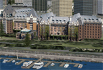
FSX-only version of Victoria, Canada area scenery including the Southern Gulf Islands and the San Juan Islands of the US. Includes automated installer and configurator by Scot Fraser.
Features:
-accurate shorelines, lakes and streams;
-landclass;
-FSX multi-LOD mesh with 10m maximum resolution;
-complete road network with moving traffic;
-railroads;
-utility corridors;
-marinas and ferry terminals;
-many static boats, including a custom model of the Canada Coast Guard ship Sir Wilfred Laurier;
-detailed models of major buildings and the Ogden Point Terminal;
-many bridges;
-nearly 300 marine lights; and corrected antennae locations.
Facilities include Don Grovestine's famous CYYJ (Victoria International Airport); 12 other Canadian land-based airports: Butler Field, Duncan (CAM3), Gaines, Hastings, Hudson Island, James Island, Thomas, Village Bay, Raven Field (CML2), Saltspring, Sidney Island, Whiskey Point; 20 US airports Blakely (38WA), Burden (61WA), Center Island (79WA), Clam Harbor (WA35), Crane Island, Decatur Shores (WN07), Decatur-Jones (WA18), Waldronaire (90WA), Orcas Island (KORS), Friday Harbour (KFHR), Lopez Island (S31), Pile Point, Roche Harbor (WA09), Shaw Island, Stuart Island Airpark (7WA5), Stuart Island West (2WA3), Wilding (6WA5), Windsock (4WA4); 12 floatplane facilities: Bedwell (CAB3), Fisherman's Bay (WA81), Friday Harbor (W33), Ganges (CAX6), Maple Bay, Mayne (CAW7), Port Washington (CAP8), Roche Harbor (W39), Rosario (W49), Shawnigan Lake (CAV8), Victoria Harbour (CYWH), Victoria International (CAP5) and Westsound, Orcas (WA83) - many with AI traffic; 9 heliports: Ganges (CAL7), Mayne (CBF5), Camel Point (CBF7), Jubilee (CBK8), Victoria General (CBW7) Madrona Bay (CBW9), Shoal Point (CBZ7), Mount Belcher (CMBH).
AI models include the DHC-2 floatplane in local liveries, a cruise ship model (by Mitsuya Hamaguchi) and two repaints, pilot boat, and small boats (by Larry Silsbee).
Ultimate Terrain X compatible (not required). Users of Vancouver+ for FSX will also get additional cruise ship traffic and additional floatplane and helicopter traffic. Full documentation. By Don Grovestine, Jon Patch and Holger Sandmann. Many other contributors: see documentation. Part 1 of 2 - you also need file vicenh7b.zip
| Filename: | Victoria_Canada_including_US_Southern_Gulf_Islands.zip |
| License: | Check within download |
| Added: | 29th January 2010, 21:23:17 |
| Downloads: | 23,161 |
| Author: | Don Grovestine, Jon Patch and Holger Sandmann |
| Size: | 56.8 MB |
| Category: Flight Simulator X - Scenery | |
| Victoria, Canada including US Southern Gulf Islands and San Juan Islands - Part 2 of 2 |
|
Images related to this file:
File Description:
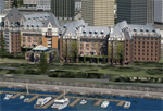
FSX-only version of Victoria, Canada area scenery including the Southern Gulf Islands and the San Juan Islands of the US. Includes automated installer and configurator by Scot Fraser.
Features:
-accurate shorelines, lakes and streams;
-landclass;
-FSX multi-LOD mesh with 10m maximum resolution;
-complete road network with moving traffic;
-railroads;
-utility corridors;
-marinas and ferry terminals;
-many static boats, including a custom model of the Canada Coast Guard ship Sir Wilfred Laurier;
-detailed models of major buildings and the Ogden Point Terminal;
-many bridges;
-nearly 300 marine lights; and corrected antennae locations.
Facilities include Don Grovestine's famous CYYJ (Victoria International Airport); 12 other Canadian land-based airports: Butler Field, Duncan (CAM3), Gaines, Hastings, Hudson Island, James Island, Thomas, Village Bay, Raven Field (CML2), Saltspring, Sidney Island, Whiskey Point; 20 US airports Blakely (38WA), Burden (61WA), Center Island (79WA), Clam Harbor (WA35), Crane Island, Decatur Shores (WN07), Decatur-Jones (WA18), Waldronaire (90WA), Orcas Island (KORS), Friday Harbour (KFHR), Lopez Island (S31), Pile Point, Roche Harbor (WA09), Shaw Island, Stuart Island Airpark (7WA5), Stuart Island West (2WA3), Wilding (6WA5), Windsock (4WA4); 12 floatplane facilities: Bedwell (CAB3), Fisherman's Bay (WA81), Friday Harbor (W33), Ganges (CAX6), Maple Bay, Mayne (CAW7), Port Washington (CAP8), Roche Harbor (W39), Rosario (W49), Shawnigan Lake (CAV8), Victoria Harbour (CYWH), Victoria International (CAP5) and Westsound, Orcas (WA83) - many with AI traffic; 9 heliports: Ganges (CAL7), Mayne (CBF5), Camel Point (CBF7), Jubilee (CBK8), Victoria General (CBW7) Madrona Bay (CBW9), Shoal Point (CBZ7), Mount Belcher (CMBH).
AI models include the DHC-2 floatplane in local liveries, a cruise ship model (by Mitsuya Hamaguchi) and two repaints, pilot boat, and small boats (by Larry Silsbee).
Ultimate Terrain X compatible (not required). Users of Vancouver+ for FSX will also get additional cruise ship traffic and additional floatplane and helicopter traffic. Full documentation. By Don Grovestine, Jon Patch and Holger Sandmann. Many other contributors: see documentation. Part 2 of 2 - you also need file vicenh7a.zip
| Filename: | Victoria_Canada_including_US_Southern_Gulf_Islands.zip |
| License: | Check within download |
| Added: | 29th January 2010, 21:21:49 |
| Downloads: | 23,164 |
| Author: | Don Grovestine, Jon Patch and Holger Sandmann |
| Size: | 59.08 MB |
| Category: Flight Simulator 2004 - Scenery | |
| North Haledon |
|
File Description:
North Haledon is a small town in Northern New Jersey, USA. This is Chopper Friendly scenery, folks. It wasn't designed to be flown over at 10,000 feet - although, if you like to fly heavy iron into the major New York/New Jersey airports, you'll notice that it replaces the terrain elevation of Northern New Jersey with all the hills and valleys that the default scenery left out. No, this is interactive scenery. Built to be explored low and slow. Want to perfect your landing skills in a huge playground of rooftops, irregular terrain, and tight spaces? This is the place. You won't find any unlandable surfaces or false crashes here - just hundreds of places to touch down ranging from beginner, through expert, to downright sick! There's a police station with landable helipad, four schools, ballfields, an optional forest fire (with a scenic lake nearby for refilling), too many highly detailed houses and buildings to count, and much more.
| Filename: | North_Haledon.zip |
| License: | Freeware, limited distribution |
| Added: | 25th April 2006, 02:48:26 |
| Downloads: | 1,924 |
| Author: | Mick Posch |
| Size: | 13.14 MB |
| Category: Flight Simulator X - Aircraft Repaints, Textures and Modifications | |
| Pacific Western Airlines 727-100 |
|
Images related to this file:
File Description:
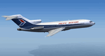
This is a repaint of the 727-100 in Pacific Western Airlines colors. The freeware 727-100 by Tenkuu Developers Studio (TDS) is needed for this repaint. Canadian airline Pacific Western was formed in 1945 under the name Central British Columbia Airways, and they initially only undertook contract work. In 1953 however, they started their first scheduled service and changed their name to Pacific Western Airlines. Over the years they acquired many smaller airlines, and by the 1980s they were Canada's third largest airline. Their route network consisted of domestic Canadian flights. They also operated charters to many countries, and had a vast network of cargo flights, in which they served 90 airports worldwide. In 1987 Pacific Western purchased CP Air, Canada's second largest carrier at the time, and they consequently named the new airline Canadian Airlines International. In 2000 they were taken over and merged into Air Canada. This repaint was tested on P3D v3. It should work on FSX & FSX-SE.
| Filename: | Pacific_Western_Airlines_727100.zip |
| License: | Freeware |
| Added: | 15th June 2018, 13:05:20 |
| Downloads: | 120 |
| Author: | Ted Giana |
| Size: | 9.75 MB |
| Category: Flight Simulator 2004 - AI Flight Plans | |
| South African Airways Group Winter 2005 |
|
File Description:
Here are the South African Airways Group (South African Airways, South African Express, South African Airlink) flightplans for the winter 2005 season. Each aircompany has its own file. The flightplans are based on the real schedule for the week between 21 and 27 november 2005. I've noticed that SA Express uses a DC-9 that I never found nowhere. I've decided to make a repaint of Aardvark DC-9-30 that you can found here on avsim. It's simply a try, it want not to be the real one... I hope however to had made a nice work. There are also some afcad files missing for two airports: FASZ (MalaMala) and FAHS (Hoedspruit) that are missing of parking, ramps etc... so the aircrafts disappear when touch the ground. I hope someone (maybe a southafrican one?) that knows the places can make ad AFCAD to share with us! Hope however that you will enjoy!!!
| Filename: | South_African_Airways_Group_Winter_2005.zip |
| License: | Freeware, limited distribution |
| Added: | 17th November 2005, 18:21:48 |
| Downloads: | 1,577 |
| Author: | Vittorio Tenerini |
| Size: | 31.55 KB |
| Category: Flight Simulator 2004 - Miscellaneous Files | |
| Active ILS - EHAM (Amsterdam - Schiphol Airport) |
|
File Description:
As most know initiating the ILS at certain airports for AI Traffic is not a function at this time when using AFCAD2. If you add a new ILS runway to an airport such as EHAM (Schiphol 18R/36L) only the user aircraft can use this runway when visibility falls below 3 miles. ATC will no longer use this runway for AI Traffic because FS9 sees it as a visual runway. This will cause ATC to vector all your AI Traffic back to (01L/19R old numbers) 18C/36C (new numbers) which is also a Terminal departure runway. This bgl file adds all NAVAIDS for making 18R/36L a Precision Instrument Runway. All AI Aircraft will now continue to use 18R when Airport weather conditions are less than 3 miles. Read the text file for all the enhancements added to EHAM *** 3rd Party Scenery Designers Special ILS bgl and FS2004 Default Scenery AFCAD included ***
| Filename: | Active_ILS__EHAM_Amsterdam__Schiphol_Airport.zip |
| License: | Freeware, limited distribution |
| Added: | 6th October 2004, 18:16:17 |
| Downloads: | 5,583 |
| Author: | Jim Vile |
| Size: | 43.27 KB |
| Category: Flight Simulator 2004 - Miscellaneous Files | |
| Go To any Airport Version 3 |
|
File Description:
Go To Any Airport Version 3.- Now 3 Airports Included.
Always wanted to return to your favourite local Airport from anywhere in the world? simply - with no fuss? Look no Further.
Start at your Designated Airport, [in this case London Gatwick or Innsbruck or Dublin in a 737], then Goto any Airport! - via the FS9 World menu and return to the Original Designated Airport - every time! - By Just turning the GPS/nav switch to GPS and Flight Director and autothrottle on whilst still on the ground.Click on the Autopilot and Nav Hold switch once above 1000ft - thats it !! . Set Weather and Altitude as required and Speed in autopilot and away you go. Use the FS9 ATC as You Travel, call into designated Airport when close and receive the curent ATIS and Runway approach in use.
HAVE FUN.
(This is different to the great circle direct routes that you can programme into the very good FS9 GPS - each and every time you start from a new airport).
| Filename: | Go_To_any_Airport_Version_3.zip |
| License: | Freeware |
| Added: | 7th March 2004, 17:42:32 |
| Downloads: | 433 |
| Author: | Alan Trussell |
| Size: | 26.95 KB |
| Category: Flight Simulator 2004 - AFCAD Files | |
| San Antonio International Airport (SAT/KSAT) |
|
File Description:
Accurate rendition of the KSAT airport. Includes accuarate gate numbering and locations for all airlines serving the airport as well as assigned cargo areas and parking for general aviation aircraft. This is my continuing series of doing airports that have been neglected by both MS and the community. Hopefully this will enhance flying into this airport for those of you that frequent it. Terminal space was mostly satisfactory even though not shaped correctly in some instances. Every gate, however, is present and correctly numbered and airlines assigned to the right gates based on the SAT airport website. American and Southwest seem to be the dominant carriers to this airport both offering extensive intra Texas service. I will be continuing to do mid sized aiports accross the US and then probably do some updates to my original Central America and Caribbean afcads. One for the St. Thomas airport in the US Virgin Islands should be up within 24 hours as well. Enjoy flying Texas!
| Filename: | San_Antonio_International_Airport_SATKSAT.zip |
| License: | Freeware |
| Added: | 29th June 2004, 19:35:00 |
| Downloads: | 2,368 |
| Author: | Jason Diaz |
| Size: | 146.83 KB |
| Category: Flight Simulator 2004 - Aircraft Repaints, Textures and Modifications | |
| Air Glaciers - HTAI Beech and Mike Cronin Pilatus |
|
File Description:
This package lets you have a Beech holiday in the mountains. Air Glaciers operates Beechcraft King Airs from Sion to various destinations closer to the sea. They are frequent visitors to Corsica across to Krk (Rijeka) from their mountain lair. This package contains three Beech King Air repaints based on the Henry Tomkiewicz AI King Air 200 (4-blade, strakes) and, one they've got you to Sion there are three Pilatus Turbo Porters (based on the Mike Cronin low-poly PC6) to carry you onward into the mountains.
The King Airs have accurate weekly flightplans (plus a few charters) and the Turbo Porters have very simple plans that service nearby airports. The effect at Sion is quite nice. If you want the Turbo Porters to service altiports you'll need to devise your own plans and find a way of landing AI on steep slopes! If you manage that, you can start on the choppers ...
Now I'm going on the piste ... (aka having a beer ...). Enjoy!
| Filename: | Air_Glaciers__HTAI_Beech_and_Mike_Cronin_Pilatus.zip |
| License: | Freeware, limited distribution |
| Added: | 18th February 2005, 20:17:51 |
| Downloads: | 1,755 |
| Author: | Matthew Ministry |
| Size: | 593.1 KB |
| Category: Navigation and ATC - Navigation | |
| Los Angeles ARTCC charts from AIRAC 0505 - Volume 3 of 5 |
|
File Description:
This collection of US Terminal Procedures has been assembled to provide a complete set of charts for flight simulation use within the Los Angeles ARTCC region, on behalf of VATSIM's Los Angeles ARTCC (ZLA), whose website can be found at http://www.laartcc.org
**THIS IS VOLUME 3 OF 5** Charts are in Adobe PDF format.
Volume 3 = ZLA_AIRAC0505_CA_OUTLYING.ZIP
Features procedure charts for all appropriate California airports outside the combined Southern California Terminal Radar Approach Control facility "SoCAL", but under the limited ATC responsibility of the Los Angeles Center facility, and includes amongst others:
KSBA - Santa Barbara Airport (Class C)
KPSP - Palm Springs Airport (TRSA)
KBFL - Bakersfield Meadows Field (Class D)
KCMA - Camarillo Airport (Class D)
KOXR - Oxnard Airport (Class D)
KSMX - Santa Maria Public / Hancock Field (Class D)
KSBP - San Luis County Regional (Class D)
KMHV - Mohave Airport (Class D)
KVCV - Victorville Airport (Class D)
KTRM - Jacqueline Cochran Regional Airport
L35 - Big Bear Airport
16 other California outlying fields in LA Center airspace.
| Filename: | Los_Angeles_ARTCC_charts_from_AIRAC_0505____Volume.zip |
| License: | Freeware |
| Added: | 15th May 2005, 18:05:53 |
| Downloads: | 498 |
| Author: | Mark Coldwell |
| Size: | 27.18 MB |


© 2001-2026 AVSIM Online
All Rights Reserved
Privacy Policy |