
Where Flight Simulation Enthusiasts Gather from Around the World!
AVSIM Library - Search Results

| Category: Flight Simulator 2004 - Scenery | |
| Jandakot Airport (YPJT) - Perth, Western Australia |

|
File Description:
Jandakot Airport for FS2004 only (FS2002 version also available). One of Australia's busiest general aviation airports. Package includes highly detailed photoreal scenery, accurate airport layout, immediate roads, lakes, tracks and other navigation points. Several reference points around Perth also included. All objects custom built for the scenery, all textures are photoreal. Pilot Activated Lighting functional (daytime), LOD models used throughout to assist performance. AFCAD and AI flight plans included. Please read user guide before installing. Designed by Westsim Design Group. http://www.westsim.com.au/
| Filename: | Jandakot_Airport_YPJT__Perth_Western_Australia.zip |
| License: | Freeware, limited distribution |
| Added: | 12th December 2003, 16:54:29 |
| Downloads: | 5,246 |
| Author: | Westsim Design Group - Jarrad Marshall, Derek Kippo and Leon Markich |
| Size: | 4.63 MB |
| Category: Flight Simulator 2004 - Scenery | |
| Melchior Ndadaye International Airport (HBBA) V1 |
|
Images related to this file:
File Description:
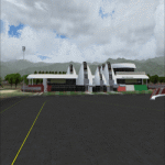
Hello FS9 sim fans who love flying in Africa, In my quest to bring you more African airports, I bring you Melchior Ndadaye International Airport (Fomerly Bujumbura International Airport) (IATA: BJM, ICAO: HBBA). This is Burundi's only internernational airport. Scenery was built using Sketchup, ADE,AFLT, SbuilderFs9. Trees Macros credit goes to Bill Melichar (tropical trees). Needs RWY12 object library for airport objects to show up. You can get RWY12 object library in AVSIM/Flightsim. See readme for install instructions
| Filename: | Melchior_Ndadaye_International_Airport_HBBA_V1.zip |
| License: | Freeware |
| Added: | 2nd January 2020, 20:24:57 |
| Downloads: | 627 |
| Author: | Emmanuel Mwandosya |
| Size: | 35.56 MB |
| Category: Microsoft Flight Simulator (2020) - Utilities | |
| Flightplan Visualizer 1.18 |
|
Images related to this file:
File Description:
Flightplan Visualizer (FV) version 1.18.0. Copyright 2018-2020 by Pelle F. S. Liljendal ([email protected]), all rights reserved.
FV comes with 787 pre-imported Commercial AI flightplans (+380 BizJet flightplans are available as a separate download). However you are able to import additional (AI) flightplans yourself. Once imported these (AI) flightplans can be visualized on a map-view, and the user will be able to search accross all these. Hence you can use the program as inspiration as to which routes to fly. E.g. you can search across all imported flightplans to find all flights in an A321 flying into/out from LDDU, or simply to look for all flights in a Boeing 747-8F.
Simply run the included installer to install the software. The program will be installed into "C:\Program Files (x86)\Flightplan Visualizer" and all datafiles will be installed into: "C:\Users\[UserName]\AppData\Roaming\FlightplanVisualizer". The program comes with a full manual explaining everything, and a 3 page quick manual to get you started. The first 3 times you run the program the quick manual will automatically open. The forum is hosted here: https://forum.aerosoft.com/index.php?/forum/919-flightplan-visualizer/
Version 1.18 Contains the following changes:
- GREATLY improved the search-legs feature (by a factor of +50).
- In the past the application was forced to 32 bit. This is no longer the case, hence if needed its able to allocate more memory than before. I have never heard of anyone getting an "out of memory" exception, buy anyway.
- In the settings form, the field for entering the path to where to look for the Make Runways -files, have been replaced with a (MRU) combo-box, remembering the last 5 paths entered. So now you don't need to remember these paths each time you want to change it (e.g. if you switch between a set of files generated for P3D and another generated for MSFS). Remark that when this path is changed, FV will automatically restart when saving the settings, as the MkRwy-data are only loaded at startup.
- Added new command-line argument /MkRwy="G:\FS\MakeRunways". If this argument is set, FV will try to locate the files generated by Pete Dowson's MakeRunway in the specified folder, no matter the value of the MkRwy-path set in the settings-form.
- Added new command-line argument /FilePrefix=XXX. If this prefix is set (in the short-cut starting FV) it will look for files in the UserData-folder using this prefix and an underscore (e.g. open "XXX_UserAirportInfo.xml" in stead of "UserAirportInfo.xml"). If FV is started with this argument it will be displayed in the caption of the main-form to notify the user "which prefix is in use".
- Added new command-line argument /ForceReprocessFlightplans which forces all flightplans to be reprocessed on startup (e.g. process all airport redirections according to loaded redirection file).
- Added new command-line argument /? or /help. Using either of these, or having specified a wrong command-line argument will show a small example of the correct way to use these arguments.
- Added a new "Auto-activation prefixes" entry field to the "Edit owned aircraft" form where you can now enter a comma separated list of prefixes for which each aircraft should set to active. If entered, the aircraft will automatically be set active when FV have been started with the /FilePrefix argument set to the entered value (e.g. P3D). If one or more prefixes have been entered into this field, and FV have been started with another prefix, those aircraft will be set to not-active.
- Added new setting to reprocess all loaded flightplans on startup if FV was started with another /FilePrefix argument than used the previous time FV was started (e.g. if you switch between two different simulators).
- Improved how pseudo-airports tries to look-up airport data from the bundled airport-database. So there is now a higher chance that: name, country/state, and time-zone will be populated with useful data for the pseudo airports.
- In previous versions when opening the airport-info form, the checkbox "Exclude small/grass/dirt" (runways) was always checked, meaning you had to uncheck this checkbox before being able to see any runway-information for small airports. In this version a new setting have been added where you can chose if this checkbox should default to being: Checked, Unchecked or (default) Automatic. if choosing "Automatic", this checkbox will default to un-checked for airports only having few/small runways.
- Redesigned the settings-form so things are less "cluttered", and it will be more easy for me to add additional items in the future.
- The Search Airport form now contains fields that lets you specify min/max criteria for rwy-length and airport elevation, and min/max distance to a specified airport (e.g. find all airports within 20-50 Nm of XXXX). Also you can specify required rwy-type (e.g. "All Hard", "Have Soft" ...).
- Added an "Edit" menu-item to the context menu in the Search Airport form, which opens the Airport Info form, and returns back to the Search Airport form (e.g. see details for a few found airports before chooing one of them).
- If Transition Altitude (TA) is not known for a particular airport, the program will now try to estimate TA based on nearby airports in the same country, where those nearby are weighted more than those further away (its not perfect, but "better" than 0). An estimated TA will be postfixed by a asterisk to mark that it is estimated.
- Minor (internal) changes to the automatic version-check.
- Fixed: Issue importing some AigFP flightplans where airports were being redirected (e.g. "AIG_AviaTrafficCompany_Winter_2019-2020v2").
- Fixed: Using the context menu in the list-view showing all owned aircraft, the changes were sometimes not saved.
- Fixed: In the conversion-form when converting weight/volume into US-Gal, the calcuation was wrong (converting from US-Gal was not an issue).
- Fixed: In the leg-info report the value of Transition Altitude was in some cases used in stead of the length of the longest runway.
- Fixed: Leg-info report only contained taxi-out time for all airports. Now it only contains the taxi-out time for the departure airport, but both departure- and destination airports contains a taxi-in time.
- Fixed: In some cases an airport that was currently being edited, could be edited in another window at the same time (opening multiple Airport Info forms).
- Data: The bundled airport-database had a MAJOR face-lift. Various data were corrected, and it have more than doubled in number of airports/helipads contained within the database.
- Data: Improved detection of aircraft-type "IAI 1126 Galaxy" (as "Gulfstream G200"). Thanks to Bruce Nicholson for notifying me of the issue when importing a particular AIG flight-plan.
- Flightplans: All new/updated flightplans have been added to the installer, and all obsolete/defunct have been marked/removed. A total of 787 active flightplans are bundled with the installer.
Pelle
| Filename: | Flightplan_Visualizer_118.zip |
| License: | Freeware, limited distribution |
| Added: | 9th November 2020, 20:09:24 |
| Downloads: | 479 |
| Author: | Pelle Liljendal |
| Size: | 34.48 MB |
| Category: Flight Simulator 2004 - AI Flight Plans | |
| Bus Traffic at Frankfurt, Madrid and Barcelona Airport |
|
File Description:
If you want to see your aircrafts moving in Frankfurt, Madrid o Barcelona airport while busses run along the service roads or visit Barcelona city using a bus from airport to Catalunya square this package is ideal for get it. I have included files for different scenerys. Frankfurt: Aerosoft; Madrid: Joaquin and Miguel Zafra update or Fernando de la Portilla Muelas; Barcelona: default scenery or Toni Agramont or William Morgan or Aerosoft.Enjoy with airports more animated.Based in real service roads included in AENA´s information.
| Filename: | Bus_Traffic_at_Frankfurt_Madrid_and_Barcelona_Airp.zip |
| License: | Freeware |
| Added: | 31st March 2006, 18:42:05 |
| Downloads: | 1,960 |
| Author: | Antonio Delgado Jurado |
| Size: | 353.81 KB |
| Category: Flight Simulator 2004 - AFCAD Files | |
| Nieuenland, Bremen, Germany (EDDW/BRE) |
|
File Description:
Improved and updated 2007 AFCAD for the excellent Bremen Flughafen, part of the "German Airports 3" package released some times ago by Aerosoft (Payware). Made from various sources (maps, charts and pictures) including the official airport Web site and a few days I have just spend at the nearby Deutsche Airbus facilities. 100% of the real trafic (September 2007) is existing as AI, available for free from sites like Avsim. It is up to you to go for an extra work but well rewarding.
| Filename: | Nieuenland_Bremen_Germany_EDDWBRE.zip |
| License: | Freeware, limited distribution |
| Added: | 16th September 2007, 19:19:59 |
| Downloads: | 1,351 |
| Author: | Guy-Hubert Bourdelle |
| Size: | 885.83 KB |
| Category: Flight Simulator 2004 - AFCAD Files | |
| HKMO / MBA Mombasa Kenya |
|
File Description:
For default scenery. Moi International Airport, also Mombasa Airport, serves the city of Mombasa, and is the second most important airport in Kenya after Jomo Kenyatta International Airport in Nairobi. The airport is run by Kenya Airports Authority. It has two runways, 03/21 and 15/33. Runway 21 is equipped with an ILS. It was named after former Kenyan President Daniel Arap Moi during his tenure. This afcad file corrects taxiways and markings, the apron, ils and parking spots as in real life. Enjoy!
| Filename: | HKMO__MBA_Mombasa_Kenya.zip |
| License: | Freeware |
| Added: | 4th October 2007, 19:10:06 |
| Downloads: | 1,108 |
| Author: | Florian Kreuzer, Matthias Seifried |
| Size: | 785.29 KB |
| Category: Flight Simulator 2004 - AI Flight Plans | |
| Cebu Pacific ATR 72-500 |
|
File Description:
Cebu Pacific ATR72-500 pack. Cebu will soon start operation with several ATR's to smaller airports starting with flights from Manila and Cebu towards Caticlan RPVE airport. The flightplans match with the flightschedules of Cebu Pacific. A repaint for the project AI ATR 72-500 (PAI AT72) is included as well as an afcad file (AF2_RPVE)which works with the scenery for Caticlan by Ver Walter L. Gulfan. This is of course meant as an extention for people who have already Cebu AI traffic installed.
| Filename: | Cebu_Pacific_ATR_72500.zip |
| License: | Freeware |
| Added: | 27th January 2008, 13:30:01 |
| Downloads: | 502 |
| Author: | Pascal De Backer |
| Size: | 551.31 KB |
| Category: Flight Simulator 2002 - Scenery | |
| Berlin Tegel replacement |
|
File Description:
I think that I can say that this is the most accurate afcad-scenery available. This is intended to replace the default EDDT scenery. Although it's a simple project, it is highly accurate and effective. I have tested it offline as well as online and it matches German Airports 3 rather well. The default terminal was very awful and completely misplaced. I managed to replace it and its quite nice. Some other features are: aircraft gate assignments, realistic lighting, realistic apron surfaces, and more...
| Filename: | Berlin_Tegel_replacement.zip |
| License: | Freeware |
| Added: | 31st January 2008, 16:13:41 |
| Downloads: | 1,118 |
| Author: | Harmen Bosma |
| Size: | 46.11 KB |
| Category: Flight Simulator 2004 - AI Flight Plans | |
| InterSky (Austria) Summer 2008 |
|
File Description:
Here you get the new and very complete InterSky flightplan for summer 2008. InterSky is a low-cost airline based in Bregenz, Austria. It operates scheduled services from Friedrichshafen (EDNY). Besides his domestic destinations, Graz and Vienna, InterSky also serves many destinations in Germany, France and Southern Europe as Split, Zadar, Elba, Olbia, Naples and Bastia. *** If you use German Airports 1 (Aerosoft) you can also download a new AFCAD file for EDNY (edny_for_ga1.zip). I have added all missing gates for AI traffic.
| Filename: | InterSky_Austria_Summer_2008.zip |
| License: | Freeware |
| Added: | 6th April 2008, 14:46:45 |
| Downloads: | 618 |
| Author: | Hans-Juergen Merkel |
| Size: | 22.03 KB |
| Category: Flight Simulator 2004 - Scenery | |
| Warminster Naval Air Development Center (Re-opened) |
|
File Description:
Flight Simulator 2004 really messed up this airport. The programmers made Warminster's runway part of a small private airport to the North called "Jarrett" (5PN7). In these 2 AFCAD files, I manually separated these airports. Using Google Earth, and some '90s photos of the airfield, which was demolished in 2001, I have recreated the three runways and ramp to good detail. No buildings are present, but it is still nice to see it reopened. The airfield closed in 1995 and was demolished in 2001.
| Filename: | Warminster_Naval_Air_Development_Center_Reopened.zip |
| License: | Freeware |
| Added: | 12th April 2008, 02:28:41 |
| Downloads: | 406 |
| Author: | Tony Richardson |
| Size: | 106.52 KB |


© 2001-2026 AVSIM Online
All Rights Reserved
Privacy Policy |