
Where Flight Simulation Enthusiasts Gather from Around the World!
AVSIM Library - Search Results

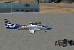
| Category: Flight Simulator 2004 - Scenery | |
| OPDB Dalbandin, Pakistan |

|
Images related to this file:
File Description:

Googly scenery for OPDB Dalbandin, Pakistan - a quiet domestic airport for
which no operational facilities are provided in Flight Simulator 2004. These
scenery files add/correct the runways, apron, taxiways, buildings and other
airport features so that you and your "AI" traffic can land, taxi, park
and take off in a realistic manner.
The airport appears to be served all of once per week by ATRs of Pakistan
International Airways so will hardly buzz with activity, but you will be
assured of a friendly welcome when you arrive.
The scenery does not purport to be ultra-accurate. Based on high-detail satellite
imagery from Google Earth, the layout is proportionally correct but the added
airport features, such as buildings, are built from default Microsoft objects
and add-on libraries so will not look like the real thing.
You are not obliged to download and install any additional scenery libraries,
but to enjoy this scenery in its entirety, you may wish to. It will work fine,
with or without.
[File re-uploaded at the request of AVSIM]
| Filename: | OPDB_Dalbandin_Pakistan.zip |
| License: | Freeware |
| Added: | 5th May 2010, 22:32:37 |
| Downloads: | 1,017 |
| Author: | John Hinson |
| Size: | 65.99 KB |
| Category: Flight Simulator 2004 - Scenery | |
| SPHZ Anta/Comandante German Arias Grazz, Peru |
|
Images related to this file:
File Description:
Googly scenery for SPHZ Anta/Comandante German Arias Grazz, Peru - a small
domestic airport for which nothing more than a runway is provided in Flight
Simulator 2004. These scenery files add the apron, taxiways, buildings and
other airport features so that you and your "AI" traffic can land, taxi, park
and take off in a realistic manner.
The airport is served daily by domestic operator L C Busre and perhaps also
others using small aircraft, but little information has been found on activity
in this area.
The scenery does not purport to be ultra-accurate. Based on high-detail satellite
imagery from Google Earth, the layout is proportionally correct but the added
airport features, such as buildings, are built from default Microsoft objects
and add-on libraries so will not look like the real thing.
You are not obliged to download and install any additional scenery libraries,
but to enjoy this scenery in its entirety, you may wish to. It will work fine,
with or without.
[File re-uploaded at request of AVSIM]
| Filename: | SPHZ_AntaComandante_German_Arias_Grazz_Peru.zip |
| License: | Freeware |
| Added: | 23rd May 2010, 01:24:24 |
| Downloads: | 1,224 |
| Author: | John Hinson |
| Size: | 65.15 KB |
| Category: Flight Simulator 2004 - Scenery | |
| DTTR El Borma, Tunisia |
|
File Description:
Googly scenery for El Borma (ICAO: DTTR, IATA: EBM), a small airport with a
long runway deep in the Tunisian desert near the Algerian border. El Borma,
also known as Al Borma or Al Burmah is one of Tunisia's top onshore oil and
natural gas sources and it is this that probably justifies the twice-weekly
flights operated by ATR turboprops of Sevenair.
Microsoft have only provided runways at this airport in Flight Simulator
2004 and this scenery seeks to redress the situation so that you and your
"AI" traffic can use the airport realistically.
The scenery does not purport to be ultra-accurate. Based on high quality
satellite imagery from Google Earth, the layout is proportionally correct but the
added airport features, such as buildings, are built from default Microsoft objects
and add-on libraries so will not look exactly like the real thing.
You are not obliged to download and install any additional scenery libraries,
but to enjoy this scenery in its entirety, you may wish to. It will work fine,
with or without.
| Filename: | DTTR_El_Borma_Tunisia.zip |
| License: | Freeware |
| Added: | 17th December 2008, 16:49:15 |
| Downloads: | 1,025 |
| Author: | John Hinson |
| Size: | 58.32 KB |
| Category: Flight Simulator X - AFCAD Files | |
| EHAM - Amsterdam Airport Schiphol - Amsterdam, The Netherlands |
|
Images related to this file:
File Description:
Amsterdam Airport Schiphol is the Netherlands' main international airport, located 20 minutes (9.1 km; 5.6 mi) southwest of Amsterdam, in the municipality of Haarlemmermeer.
The airport is the primary hub for KLM as well as for Arkefly, Corendon Dutch Airlines, Martinair and Transavia. The airport also serves as a European hub for Delta Air Lines and as a base for Vueling. Schiphol is considered to be an Airport City.
Using ADEx 1.50, aeronautical maps and Google Earth the default AFCAD has been completely reworked to reflect today's situation including gate assignments.
Schiphol has a complex runway lay-out and usage and FSX may assign a runway that in real life is not used as such. I have implemented Jim Vile's crosswind runway technique to open all runways. Now the pilot can decide which runway to use but AI aircraft may show unrealistic behaviour. Only tailored AFCADs taking into account different wind directions will solve this but that is beyond the scope of this project.
Jetways appear based on your 'scenery complexity' settings.
| Filename: | EHAM__Amsterdam_Airport_Schiphol__Amsterdam_The_Ne.zip |
| License: | Freeware |
| Added: | 2nd November 2012, 19:54:24 |
| Downloads: | 2,201 |
| Author: | Menno C. Robert |
| Size: | 3.86 MB |
| Category: Flight Simulator 2004 - Scenery | |
| HSSS Khartoum, Sudan |
|
File Description:
Googly scenery for HSSS Khartoum, Sudan. For Sudan's main international airport,
the Flight Simulator depiction is somewhat simplified, depicting just a few
buildings which are badly located. These scenery files attempt to reproduce
the real atmosphere of the airport - from the huge clutter of small hangars
and workshops and large quantities of inactive planes through to the aircraft
dump at the north end of the airport.
The scenery does not purport to be ultra-accurate. Based on high-detail satellite
imagery from Google Earth, the layout is proportionally correct but the added
airport features, such as buildings, are built from default Microsoft objects
and third-party object libraries so will not look like the real thing.
You are not obliged to download and install any additional scenery libraries,
but to enjoy this scenery in its entirety, you may wish to. It will work fine,
with or without. These files complement the Sudan Airways AI Fleet Pack by Billy Rutherford &
John Hinson, updating the scenery files contained therein, but the two are not
inter-dependent.
| Filename: | HSSS_Khartoum_Sudan.zip |
| License: | Freeware |
| Added: | 9th March 2007, 17:29:13 |
| Downloads: | 4,416 |
| Author: | John Hinson |
| Size: | 38.74 KB |
| Category: Flight Simulator X - Scenery | |
| Gold Coast Airport (YBCG) |
|
File Description:
The Gold Coast Airport (formerly known as Coolangatta) is a busy international airport located some 100 ks south of Brisbane and 850 ks north of Sydney. This scenery contains and accurate depiction of the terminal, control tower, hangers and the very distinctive lighthouse at Coolangatta (with beacon) plus night lighting of the apron. In addition many buildings have been added to Coolangatta and Surfers some of which are original but many are stock buildings. The scenery has been reduced in complexity to attempt to be reasonably frame rate friendly. All models are GMAX or FSDS3.0. Extensive coastline changes has added beaches as far south as Byron Bay and the canal network behind Surfers Paradise, Bond Uni, Currumbin and Coolangatta. Recent upgrades of the airport to a 2500 metre runway have been reflected as well as a widened apron. Therefore it may look a little different from the current Google Earth image but it is accurate. The airport will now handle direct flights from Asia and typical planes landing might include Airbus 343 or similar wide bodied aircraft.
| Filename: | Gold_Coast_Airport_YBCG.zip |
| License: | Freeware |
| Added: | 12th July 2007, 15:08:44 |
| Downloads: | 6,173 |
| Author: | John Ross |
| Size: | 12.16 MB |
| Category: Flight Simulator X - Scenery | |
| PABE - Bethel Airport - Alaska, USA |
|
Images related to this file:
File Description:
Bethel Airport is a state owned, public use airport located three nautical miles (6 km) southwest of the central business district of Bethel.
Construction began September 21, 1941, and the airfield was activated July 4, 1942; it is also known as Bethel Air Base. It was used by Air Transport Command as auxiliary airfield for Lend-Lease aircraft being flown to Siberia. The facility was transferred to Eleventh Air Force, then to Alaskan Air Command in 1945; it became the joint-use Bethel Airport. It was used for construction of AC&W Bethel Air Force Station in mid 1950s. Full jurisdiction was turned over to Alaska Government in 1958.
Added and adjusted aprons and buildings. Also added additional parking. Added runway 1R/19L.Re-numbered runways to conform with AirNav data.
Created with Airport Design Editor 9x by ScruffyDuck Software using current FAA documentation and Google Earth measurements, this package offers a replacement for FSX's stock airport. All these enhancements are as close to the real airport as I can get with stock library objects and custom buildings.
| Filename: | PABE__Bethel_Airport__Alaska_USA.zip |
| License: | Freeware |
| Added: | 5th December 2014, 13:35:35 |
| Downloads: | 989 |
| Author: | Wayne Roberts |
| Size: | 94.58 KB |
| Category: Flight Simulator X - AFCAD Files | |
| EIDW - Dublin Intl - Dublin, Ireland v1.1 |
|
Images related to this file:
File Description:
With enhanced jetway appearance depending on your scenery complexity settings!
EIDW - Dublin Intl - Dublin, Ireland Dublin Airport is the headquarters of Ireland's flag carrier (Aer Lingus), Europe's largest low-cost carrier (Ryanair) and Ireland's regional airline (Aer Arann). Ireland's fourth airline, CityJet, operates flights from the airport. The current Terminal 1 building originally opened in 1972, and was initially designed to handle five million passengers per year. In October 2007, a new pier was opened to the north of terminal 1. This pier caters for the majority of Ryanair flights. In 2009, a new extension featuring new food and retail outlets was added to the side of Terminal 1. Terminal 2 is a 75,000 m2 (810,000 sq ft) terminal and pier (pier E) which provides 19 air bridges for aircraft and is capable of handling 15 million passengers annually, thereby allowing the airport to handle 35 million passengers a year. Using ADEx 1.50, aeronautical maps and Google Earth (2009) all these changes have been built into the default FSX airport.
| Filename: | EIDW__Dublin_Intl__Dublin_Ireland_v11.zip |
| License: | Freeware |
| Added: | 18th October 2012, 15:17:06 |
| Downloads: | 3,259 |
| Author: | Menno C. Robert |
| Size: | 5 MB |
| Category: Prepar3D V1-4 - Scenery | |
| LRTR Traian Vuia P3D v4 |
|
Images related to this file:
File Description:
Timisoara RO LRTR V-4 (Released October 2017) for P3D v4- This scenery is an update of the stock Airport (ICAO code: LRTR).
What to expect? The entire airport has been updated with correct RWY, taxiways, aprons, COMM's (ATIS, GND, TWR), markings, parkings, roads, some buildings, lights and vegetation. All objects are from stock ADE! Entire work and object placing has been done using a photo overlay image from Google Earth, yet don't expect a photoreal scenery. The used background image has been removed due to Google's copyright policy. Due to using stock objects from library, don't expect perfect shape and colors of objects. I tried to customize the objects so that they look like the real ones. Basic shape and colors should match the real word buildings. NOTE: Some 3rd party addon's might change ground textures or building textures. I have also generated some own ground textures to match those of the airports. Unfortunately there is a problem with those textures not casting shadows. If you still want to see the shadows, you will have to turn on "Buildings" receieve shadows.
| Filename: | LRTR_Traian_Vuia_P3D_v4.zip |
| License: | Freeware |
| Added: | 8th October 2017, 01:15:58 |
| Downloads: | 901 |
| Author: | Gerald Krutsch |
| Size: | 1.07 MB |
| Category: Flight Simulator 2004 - Scenery | |
| MRE Mara Serena, Kenya |
|
File Description:
Googly scenery for Mara Serena, Kenya, a small airfield serving the Mara Serena
Safari Lodge in the Masai Mara National park. The original metalled runway has
fallen into disuse and these days a rough dirt runway alongside it is used by
the twice daily flights of Air Kenya Express to and from Nairobi and the
occasional light aircraft.
Flight Simulator 2004 has made no provision for traffic with only a runway
provided and this scenery seeks to redress the situation. The airport has no
ICAO code (MRE is the IATA code) but Microsoft Flight Simulator has created an
unofficial ICAO of HK0A.
The scenery does not purport to be ultra-accurate. Based on high quality
satellite imagery from Google Earth, the layout is proportionally correct but the
added airport features, such as buildings, are built from default Microsoft objects
and add-on libraries so will not look exactly like the real thing.
You are not obliged to download and install any additional scenery libraries,
but to enjoy this scenery in its entirety, you may wish to. It will work fine,
with or without.
| Filename: | MRE_Mara_Serena_Kenya.zip |
| License: | Freeware |
| Added: | 16th April 2008, 19:19:33 |
| Downloads: | 988 |
| Author: | John Hinson |
| Size: | 68.01 KB |
© 2001-2026 AVSIM Online
All Rights Reserved
Privacy Policy |