
Where Flight Simulation Enthusiasts Gather from Around the World!
AVSIM Library - Search Results

| Category: Flight Simulator X - AFCAD Files | |
| LSZC (LSMU) - Buochs Airport, Nidwalden, Switzerland. |

|
File Description:
This is a redesign of LSZC (LSMU) - Buochs Airport, Nidwalden, Switzerland. Google Maps has been used to provide the correct (as physically possible within FSX and ADE) position, size and type of runway, aprons and buildings. The immediate surrounding scenery has been included. ADE used to compile the design.
| Filename: | LSZC_LSMU__Buochs_Airport_Nidwalden_Switzerland.zip |
| License: | Freeware |
| Added: | 15th April 2018, 21:03:19 |
| Downloads: | 1,275 |
| Author: | Matthew Ward |
| Size: | 1.32 MB |
| Category: Flight Simulator 2004 - Scenery Design | |
| The Warehouse Collection: General Aviation Aircraft object library |
|
Images related to this file:
File Description:
35 GA aircraft downloaded from the Google 3-D Warehouse and converted for use as FS9 scenery objects. Please read Google_3-D_Warehouse.pdf for more information, and Warehouse Airplane Authors.pdf for author credits. Also included are a couple of sets of just pontoons, for help in cluttering up your airports.
| Filename: | The_Warehouse_Collection_General_Aviation_Aircraft.zip |
| License: | Freeware |
| Added: | 16th October 2011, 17:57:15 |
| Downloads: | 1,503 |
| Author: | Sidney Schwartz & various authors |
| Size: | 7.13 MB |
| Category: Flight Simulator X - AFCAD Files | |
| SERB - Riobamba/Chimborazo Airport, Chimborazo, Ecuador. |
|
File Description:
This is a redesign of SERB - Riobamba/Chimborazo Airport, Chimborazo, Ecuador. Google Maps has been used to provide the correct (as physically possible within FSX and ADE) position, size and type of runway, aprons and buildings. The immediate surrounding scenery has been included. ADE used to compile the design.
| Filename: | SERB__RiobambaChimborazo_Airport_Chimborazo_Ecuado.zip |
| License: | Freeware |
| Added: | 23rd March 2018, 00:04:47 |
| Downloads: | 504 |
| Author: | Matthew Ward |
| Size: | 1.44 MB |
| Category: Flight Simulator X - AFCAD Files | |
| RPMJ - Jolo Airport, Sulu, Philippines. |
|
File Description:
This is a redesign of RPMJ - Jolo Airport, Sulu, Philippines. Google Maps has been used to provide the correct (as physically possible within FSX and ADE) position, size and type of runway, aprons and buildings. The immediate surrounding scenery has been included. ADE used to compile the design.
| Filename: | RPMJ__Jolo_Airport_Sulu_Philippines.zip |
| License: | Freeware |
| Added: | 14th October 2018, 22:45:22 |
| Downloads: | 705 |
| Author: | Matthew Ward |
| Size: | 2.14 MB |
| Category: Prepar3D V1-4 - Scenery | |
| WAML - Mutiara Sis Al-Jufri Airport, Palu, Indonesia |
|
File Description:
This Is Scenery Of Mutiara Sis Al-Jufri Airport In Palu, The Capital Of Central Sulawesi. This Scenery Include The New Airport Terminal And Dynamic Night Lighting. The Parking Position, Runway Length And Apron Have Been Positioned As Real As Possible With Photos From Google Maps Using ADE.
| Filename: | WAML__Mutiara_Sis_AlJufri_Airport_Palu_Indonesia.zip |
| License: | Freeware |
| Added: | 12th April 2019, 03:09:04 |
| Downloads: | 1,557 |
| Author: | Adhitya Hadziqan Kasim |
| Size: | 4.23 MB |
| Category: Flight Simulator 2004 - Scenery | |
| RPMY - Laguindingan Airport - Mindanao, Philippines |
|
File Description:
Newest airport for Cagayan de Oro and Iligan cities. It is located at Northern Mindanao, Philippines. Opened last June 15, 2013 as a VFR traffic due to the current installation of navigational facilities and runway lights. Built using Google Sketchup and GMAX. Photo ground scenery by Lymuel Panaligan.
| Filename: | RPMY__Laguindingan_Airport__Mindanao_Philippines.zip |
| License: | Freeware |
| Added: | 28th March 2014, 06:52:01 |
| Downloads: | 961 |
| Author: | PAULO ZOSA/PFSG |
| Size: | 3 MB |
| Category: Flight Simulator X - AFCAD Files | |
| RJSR - Odate-Noshiro Airport, Akita, Japan. |
|
File Description:
This is a redesign of RJSR - Odate-Noshiro Airport, Akita, Japan. Google Maps has been used to provide the correct (as physically possible within FSX and ADE) position, size and type of runway, aprons and buildings. The immediate surrounding scenery has been included. ADE used to compile the design.
| Filename: | RJSR__OdateNoshiro_Airport_Akita_Japan.zip |
| License: | Freeware |
| Added: | 25th November 2017, 19:42:30 |
| Downloads: | 1,370 |
| Author: | Matthew Ward |
| Size: | 1.46 MB |
| Category: Flight Simulator 2004 - Scenery | |
| ZGBS - Bose Airport |
|
Images related to this file:
File Description:
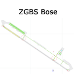
A google-earthed scenery for Bose airport (alternate spelling: Baise) which is missing in FS9 stock version, with basic default terminal & tower, and taxisigns.
All features accurately placed/shaped according to sat imagery. Navaids valid as AIRAC 1110.
No approach coded.
Current scheduled operators at ZGBS: China Express Airlines.
| Filename: | ZGBS__Bose_Airport.zip |
| License: | Freeware, limited distribution |
| Added: | 13th January 2012, 00:34:03 |
| Downloads: | 601 |
| Author: | Yohann Baptiste |
| Size: | 419.21 KB |
| Category: Flight Simulator 2004 - Flight Plans | |
| Hopping Round the World Adventure - Pack 57 |
|
File Description:
We make stops in Indonesia (6) and Australia (4). Coming in for a landing in Bali, Indonesia you realize how beautiful this place on earth is for locals and tourists. By the time you end this pack you will be on the west coast of Australia. Where are the kangaroos?
| Filename: | Hopping_Round_the_World_Adventure__Pack_57.zip |
| License: | Freeware |
| Added: | 18th June 2004, 01:12:58 |
| Downloads: | 1,924 |
| Author: | David Dossiere |
| Size: | 1.92 MB |
| Category: Flight Simulator 2004 - Scenery | |
| OPDB Dalbandin, Pakistan |
|
Images related to this file:
File Description:

Googly scenery for OPDB Dalbandin, Pakistan - a quiet domestic airport for
which no operational facilities are provided in Flight Simulator 2004. These
scenery files add/correct the runways, apron, taxiways, buildings and other
airport features so that you and your "AI" traffic can land, taxi, park
and take off in a realistic manner.
The airport appears to be served all of once per week by ATRs of Pakistan
International Airways so will hardly buzz with activity, but you will be
assured of a friendly welcome when you arrive.
The scenery does not purport to be ultra-accurate. Based on high-detail satellite
imagery from Google Earth, the layout is proportionally correct but the added
airport features, such as buildings, are built from default Microsoft objects
and add-on libraries so will not look like the real thing.
You are not obliged to download and install any additional scenery libraries,
but to enjoy this scenery in its entirety, you may wish to. It will work fine,
with or without.
[File re-uploaded at the request of AVSIM]
| Filename: | OPDB_Dalbandin_Pakistan.zip |
| License: | Freeware |
| Added: | 5th May 2010, 22:32:37 |
| Downloads: | 1,017 |
| Author: | John Hinson |
| Size: | 65.99 KB |


© 2001-2026 AVSIM Online
All Rights Reserved
Privacy Policy |