
Where Flight Simulation Enthusiasts Gather from Around the World!
AVSIM Library - Search Results

| Category: Flight Simulator X - Scenery | |
| LUKK_Chisinau |

|
Images related to this file:
File Description:
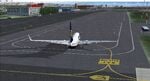
This scenery was built from the official maps for the runway and taxiways with Google Maps as a background image as support. The different signs were positioned without any documentation or references.
| Filename: | LUKK_Chisinau.zip |
| License: | Freeware |
| Added: | 3rd March 2026, 16:17:43 |
| Downloads: | 63 |
| Author: | serge Libon |
| Size: | 245.34 MB |
| Category: Flight Simulator X - Scenery | |
| KMKJ - Mountain Empire Airport - Virginia, USA |
|
Images related to this file:
File Description:
Mountain Empire Airport (ICAO: KMKJ, FAA LID: MKJ) is a public use airport in Smyth County, Virginia, United States.[1] It located nine nautical miles (10 mi, 17 km) northeast of the central business district of Marion (in Smyth County)[1] and 13 nautical miles (15 mi, 24 km) west of Wytheville (in Wythe County).[2] The airport is situated between Interstate 81 and U.S. Route 11 (Lee Highway), near Groseclose. It is owned by Smyth Wythe Airport Commission.
This is a complete re-work of the airport. Added taxiway, additional parking aprons and custom buildings.
Created with Airport Design Editor by ScruffyDuck Software using current FAA documentation and Google Earth measurements, this package offers a replacement for FSX's stock airport. All these enhancements are as close to the real airport as I can get with stock library objects and custom buildings.
| Filename: | KMKJ__Mountain_Empire_Airport__Virginia_USA.zip |
| License: | Freeware |
| Added: | 25th January 2015, 15:55:52 |
| Downloads: | 308 |
| Author: | Wayne Roberts |
| Size: | 339.5 KB |
| Category: Flight Simulator X - Scenery | |
| W91 - Smith Mountain Lake Airport - Moneta, Virginia, USA |
|
Images related to this file:
File Description:
The Smith Mountain Lake Airport (FAA W91) is a
privately owned airport open to the public located 4
miles (6.4 km) southeast of Moneta, in Bedford
County, Virginia, USA. The facility serves primarily
general aviation for the areas around Smith Mountain
Lake. In November of 2013, longtime airport owner Joe
Borgess sold the airport to a New Jersey couple for
approximately one million dollars. Mark A. Dalton, of
Mark A. Dalton & Company REALTORS in Lynchburg, VA
brokered the sale.
Added and adjusted aprons and buildings. Also added
additional parking and custom models.
Created with Airport Design Editor by ScruffyDuck
Software using current FAA documentation and Google
Earth measurements, this package offers a
replacement for FSX's stock airport. All these
enhancements are as close to the real airport as I
can get with stock library objects and custom
buildings.
| Filename: | W91__Smith_Mountain_Lake_Airport__Moneta_Virginia_.zip |
| License: | Freeware |
| Added: | 16th December 2014, 14:45:37 |
| Downloads: | 282 |
| Author: | Wayne Roberts |
| Size: | 387.31 KB |
| Category: Flight Simulator X - AFCAD Files | |
| CZBB Boundary Bay Airport, BC, Canada |
|
File Description:
This is a complete redo of the default FSX CZBB Boundary Bay Airport, BC using ADE v1.37, Google Earth satellite image and the latest airport chart effective as of 31 July 2008. The airport center and boundary repositioned. Control tower moved and replaced. Runway 07/25 extended to 5606 ft from 3540 ft and new taxiway E added. VASI Added to Runway 07/25. Taxiway signs added and/or corrected. Airport aprons resized and added where necessary. Taxiways and roads added. Static airport library objects and vegetation added for an improved look. XWind runways activated. Airport views are from the roof of the control tower when in tower view. A fuel truck has been added - Shift-F will bring this truck to your aircraft for refueling and will automatically refuel AI aircraft after landing and before take off. Airport chart and history included.
| Filename: | CZBB_Boundary_Bay_Airport_BC_Canada.zip |
| License: | Freeware |
| Added: | 5th November 2009, 02:16:37 |
| Downloads: | 448 |
| Author: | Robert Catherall |
| Size: | 381.61 KB |
| Category: Flight Simulator 2004 - AFCAD Files | |
| WAPP Ambon/Pattimura, Indonesia |
|
File Description:
Googlyafcad A&F Data file for WAPP Ambon/Pattimura in Indonesia, based on
Google Earth satellite data.
Unfortunately, Microsoft have provided very limited facilities at this
Indonesian domestic airport, served by about half a dozen flights a day
by airlines such as Airfast Service, Lion Airlines, Mandala Airlines and
Trigana Air Service with jets and smaller craft. This upgrade redresses
the subject by supplementing the GA parking with gates so that you, and
your "AI" traffic can land, taxi, park and take off realistically.
Whilst this file improves the layout of the airport, it is not a full
scenery upgrade and does not attempt correct building locations,
landclass, taxiway signs or those stupid over-sized filling stations
that Microsoft loves to put in annoying places. Regrettably the satellite
data currently available is not of sufficient quality to do so.
| Filename: | WAPP_AmbonPattimura_Indonesia.zip |
| License: | Freeware |
| Added: | 17th March 2007, 20:57:29 |
| Downloads: | 811 |
| Author: | John Hinson |
| Size: | 65.87 KB |
| Category: Flight Simulator X - Scenery | |
| EPLK Lask Air Base Poland Scenery Package with AI PAF Blk 52+ CFT F-16's |
|
Images related to this file:
File Description:

This is a complete "plug and play" scenery package for EPLK Lask AB that includes a squadron of "custom painted" Poland AF AI Block 52+ CFT F-16's!
Using Airport Design Editor, MAIW's Scenery Objects, and Google Earth for reference, I did my best to re-create Lask EPLK for FSX. I started from scratch with just the runways from the basic FSX scenery, then "built it" from there. Since info online about the base is limited, I had to guess about a few things, like taxiway designations as well as the frequency for the ILS, so apologies for any errors there. In addition to the assigned parking for the 10-ELT F-16's, I also created several other "assigned parking areas" around the base for you to add AI aircraft as you wish.
| Filename: | EPLK_Lask_Air_Base_Poland_Scenery_Package_with_AI_.zip |
| License: | Freeware |
| Added: | 10th April 2022, 16:46:04 |
| Downloads: | 492 |
| Author: | Daniel W Gregory |
| Size: | 26.84 MB |
| Category: Flight Simulator X - AFCAD Files | |
| CZBB Boundary Bay Airport, BC |
|
File Description:
This is a complete redo of the default FSX CZBB Boundary Airport, BC using ADE v1.37, Google Earth satellite image and the latest airport chart effective as of 31 July 2008. The airport center and boundary repositioned. Control tower moved and replaced. Runway 07/25 extended to 5606 ft from 3540 ft and new taxiway E added. VASI Added to Runway 07/25. Taxiway signs added and/or corrected. Airport aprons resized and added where necessary. Taxiways and roads added. Static airport library objects and vegetation added for an improved look. XWind runways activated. Airport views are from the roof of the control tower when in tower view. A fuel truck has been added - Shift-F will bring this truck to your aircraft for refueling and will automatically refuel AI aircraft after landing and before take off. Airport chart and history included.
| Filename: | CZBB_Boundary_Bay_Airport_BC.zip |
| License: | Freeware |
| Added: | 26th March 2009, 08:31:55 |
| Downloads: | 491 |
| Author: | Robert Catherall |
| Size: | 137.2 KB |
| Category: Flight Simulator 2004 - AFCAD Files | |
| King Khaled Military City, Hafr Al-Batin, Saudi Arabia (OEKK) |
|
File Description:
FS2004 AFCAD for OEKK - King Khaled Military City - Hafr Al-Batin, Saudi Arabia. In FS9 default scenery, this is a runway only, so I've added all the missing ramps and taxiways, based on Google Earth satellite photos and coordinate readings. Parking spots are for 38 MIL_COMBAT (26m), 4 CARGO (36-50m), 4 Civ/Mil parking (31-38m), 3 Civilian Gate (31-44m). Parking codes are set for RSF F15 F16 EUFI and M000-M003 in the mil_combat spaces only. Ed Kooymans' flightplans send the occasional visitor to this base (ARSAF E-3 AWACS, C-130s, Saudia 757 Flying-Hospital) and you will now be able to see these parked or taxiing. You will need to write your own flightplans to really bring it to life: a circuit OEKM-OEJN-OETB-OEKK-OEDR-OERY patrols the coasts and borders.
| Filename: | King_Khaled_Military_City_Hafr_AlBatin_Saudi_Arabi.zip |
| License: | Freeware, limited distribution |
| Added: | 31st August 2006, 14:57:56 |
| Downloads: | 1,301 |
| Author: | Mark S. Cherry |
| Size: | 10.25 KB |
| Category: Flight Simulator 2004 - Scenery | |
| Malta archipelago |
|
Images related to this file:
File Description:
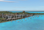
While I carried out a virtual flight from Africa toward Sicily I observes two totally naked islands. The biggest are Malta with its great airport LMML in the center. In Google earth I see that was the archipelago of Malta. Some islands that possess but churches that you hoist. I have just understood like in a piece of esth of 28x12 kilometers the biggest and 7x5 kilometers the island Gozo have been able to build so beautiful monuments. I have build some how many as some well strengths because Malta already takes many centuries defending of invasions of other towns and pirates. This archipelagos that I finish that it lacked to build in the Mediterranean. Now the "piccolissimas"
rot to alternate among my scenerys together with Baleares, Corcega, Cerdenia, Sicily, Cyprus, Crete and the group of islands of the Hreek territory.
| Filename: | Malta_archipelago.zip |
| License: | Freeware |
| Added: | 7th November 2009, 20:59:41 |
| Downloads: | 2,326 |
| Author: | Toni Agramont |
| Size: | 34.79 MB |
| Category: Flight Simulator X - Scenery | |
| JZZ - Koliganek Airport - Alaska, USA |
|
Images related to this file:
File Description:
Koliganek Airport (IATA: KGK, ICAO: PAJZ, FAA LID: JZZ) is a state-owned, public-use airport located one nautical mile (1.85 km) east of the central business district of Koliganek,in the Dillingham Census Area of the U.S. state of Alaska. Scheduled airline service to Dillingham Airport is provided by Peninsula Airways (PenAir).The airport opened in 1997.
Increased length of runway 9/27 from 3,000 feet to 3,300 feet.Added runway 17/35 (3,300 feet and 75 feet wide). Changes were based on 2011 construction plans.
Created with Airport Design Editor 9x by ScruffyDuck Software using current FAA documentation and Google Earth measurements, this package offers a replacement for FSX's stock airport. All these enhancements are as close to the real airport as I can get with stock library objects and custom buildings.
| Filename: | JZZ__Koliganek_Airport__Alaska_USA.zip |
| License: | Freeware |
| Added: | 25th December 2014, 01:15:29 |
| Downloads: | 596 |
| Author: | Wayne Roberts |
| Size: | 214.91 KB |
© 2001-2026 AVSIM Online
All Rights Reserved
Privacy Policy |