
Where Flight Simulation Enthusiasts Gather from Around the World!
AVSIM Library - Search Results

| Category: Flight Simulator 2004 - Scenery | |
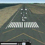
| DNGO - Lawanti International Airport, Gombe, Nigeria |

|
Images related to this file:
File Description:
Gombe, Nigeria - DNGO doesn't have stock in FS2004. The airport has more detail from Google Earth image. Arik Air has service flights.
| Filename: | DNGO__Lawanti_International_Airport_Gombe_Nigeria.zip |
| License: | Freeware |
| Added: | 26th April 2014, 19:54:23 |
| Downloads: | 206 |
| Author: | Stuart J Gilbert II |
| Size: | 1.91 MB |
| Category: Flight Simulator X - Scenery | |
| Port Elizabeth Int. (FAPE) Airport South Africa 2017 |
|
File Description:
An upgrade to the default FSX Port Elizabeth Int. I used the charts from SACAA Airports, Google Earth and Airport Design Editor.
| Filename: | Port_Elizabeth_Int_FAPE_Airport_South_Africa_2017.zip |
| License: | Freeware |
| Added: | 14th January 2017, 09:23:29 |
| Downloads: | 1,968 |
| Author: | Ben Sawkins |
| Size: | 679.48 KB |
| Category: Flight Simulator X - Scenery | |
| LICC - Catania Italy VFR Area v1.2 * Fix * |
|
Images related to this file:
File Description:
Catanese_SBX *FIX* This scenery covers the area around Catania Fontanarossa Airport for FSX Default and for compatible paywere LICC_FSX airport and has been made with "SBuilderX" design tool and with google earth for geographical reference of the various polygons and objects...
Then this scenery area, uses only default texture.
This scenery does not include photoreal satellite imagery (eg. Google-earth).
| Filename: | LICC__Catania_Italy_VFR_Area_v12__Fix_.zip |
| License: | Freeware |
| Added: | 7th June 2014, 05:35:12 |
| Downloads: | 2,541 |
| Author: | ivano marongiu |
| Size: | 1.35 MB |
| Category: Flight Simulator X - Utilities | |
| Final Approach Visualizer V1 |
|
Images related to this file:
File Description:
A small utility to see real-world Final Approach Course of ANY runway of ANY airport with Google Earth.
Just input the airport ICAO code, ".kml" files will be generated for each runway,
then run Google Earth and open ".kml" file to see Final Approach Course animated.
You can select approach speed, angle, distance and so on. (Default : 720kt, 3 degrees, 10NM)
| Filename: | Final_Approach_Visualizer_V1.zip |
| License: | Freeware |
| Added: | 5th January 2012, 18:17:36 |
| Downloads: | 1,668 |
| Author: | Dongjin Shin |
| Size: | 3.08 MB |
| Category: Flight Simulator 2004 - AFCAD Files | |
| Yemeni Major Airports Pack |
|
File Description:
A re-upload of my afcad files for Yemeni Major Airports, all of them made from Google Earth and ideal for ai traffic as well
as for your flights. The airports are: Aden Intl. OYAA/Riyan Intl. OYRN/Sayun Intl. OYSY/Taiz Intl. OYTZ/Hodeidah Intl. OYHD/
Al-Ghaidah OYGD/Socotra OYSQ/Ataq OYAT.
Airports design sources: Google Earth & Jeppesen Charts.
| Filename: | Yemeni_Major_Airports_Pack.zip |
| License: | Freeware |
| Added: | 30th May 2010, 03:56:23 |
| Downloads: | 706 |
| Author: | Nuhaid Ameer |
| Size: | 91.54 KB |
| Category: Flight Simulator X - Scenery | |
| Metropolitan Oakland International Airport, Oakland (CA), Photo Real Scenery (KOAK) |
|
Images related to this file:
File Description:
This Photo Real scenery is a complete rebuild for the FSX Default KOAK airport using the latest version of ADE, SBuilderX scenery design tool, & Google SketchUp. This scenery includes completely rebuilt terminal buildings, FedEx Hub buildings, realistic Google Earth buildings, and Photo Real ground textures that gives the airport a more realistic feeling. I constructed this scenery using all FSX textures and imported Google Earth Buildings via Google SketchUp. I have also added new commercial buildings next to the RWY 11 approach, parking lot lamps, terminal gate assignments, and several other nice scenery enhancements. The runways and airport aprons are aligned to match Google & Yahoo satellite imagery.
| Filename: | Metropolitan_Oakland_International_Airport_Oakland.zip |
| License: | Freeware |
| Added: | 23rd June 2012, 04:27:02 |
| Downloads: | 6,838 |
| Author: | Glenn Johnson |
| Size: | 53.71 MB |
| Category: Flight Simulator 2004 - AFCAD Files | |
| Ghriss Mascara airport (DAOV) |
|
File Description:
Afcad files for Ghriss regional airport located near Mascara city in west Algeria. This Afcad was made using Google earth and SIA informations.
| Filename: | Ghriss_Mascara_airport_DAOV.zip |
| License: | Freeware |
| Added: | 28th December 2012, 00:31:59 |
| Downloads: | 166 |
| Author: | Salah benhenda |
| Size: | 7.05 KB |
| Category: Flight Simulator 2004 - Scenery | |
| Hurlburt Air Force Base |
|
File Description:
Hurlburt Air Force Base. AFCAD totally redone referencing GOOGLE EARTH. Rwy12 objects required (see KHRT.TXT). 38 MIL CARGO parking. Ramp lighting at night.
| Filename: | Hurlburt_Air_Force_Base.zip |
| License: | Freeware |
| Added: | 31st December 2005, 19:01:49 |
| Downloads: | 715 |
| Author: | Jim Donlin |
| Size: | 8.16 KB |
| Category: Flight Simulator 2004 - AFCAD Files | |
| Timimoun airport (Algeria) |
|
File Description:
Afcad files for the regional airport of Timimoun city. This afcad was made with Google earth and a Jeppesen chart (27 JAN 06)
| Filename: | Timimoun_airport__Algeria.zip |
| License: | Freeware |
| Added: | 14th November 2008, 21:53:35 |
| Downloads: | 267 |
| Author: | Salah Benhenda |
| Size: | 2.73 KB |
| Category: Flight Simulator X - AFCAD Files | |
| HEMK - Moubarak Intl. - Sohag - Egypt |
|
File Description:
Moubarak International Airport opened in 25 May 2010 - Sohag Governorate - Upper Egypt - Egypt. Designed as accurate as possible, based on Google Earth images.
| Filename: | HEMK__Moubarak_Intl__Sohag__Egypt.zip |
| License: | Freeware |
| Added: | 21st January 2011, 22:10:44 |
| Downloads: | 558 |
| Author: | Jamal Houssin |
| Size: | 4.52 KB |
© 2001-2026 AVSIM Online
All Rights Reserved
Privacy Policy |