
Where Flight Simulation Enthusiasts Gather from Around the World!
AVSIM Library - Search Results

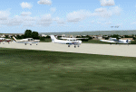
| Category: Flight Simulator 2004 - Scenery | |
| Frazier Lake Airpark (1C9) California Scenery |

|
File Description:
This is a scenery upgrade for Frazier Lake, California (1C9). This is part Eight of a series of small airstrip and minor airfield scenery enhancements which are based on real world data from Google Earth. The scenery mainly reflects the appearance of the airpark from directly above. If you are familiar with the place when on the ground, due to the limited number of buildings available it probably looks quite different. There is now however, a water strip for float planes which was missing from the default. It is proper FS9 water so you may land on it. Also, a few images from the net show that the ground varies from green grass to bare earth so I have made four .bgl files for the base texture. Note, I am using Flight1 Ground Environment; the default fields will look different. You must have rwy12 and EZ scenery libraries installed for the buildings to show. Both libraries of objects are free. EZ Library is available at http://www.abacuspub.com/pub/AbacusEZLibraries.exe. Rwy12 and additional EZ Custom libraries from Avsim. Search under Scenery design.
| Filename: | Frazier_Lake_Airpark_1C9_California_Scenery.zip |
| License: | Freeware |
| Added: | 31st March 2006, 01:00:25 |
| Downloads: | 501 |
| Author: | Kim Gowney |
| Size: | 400.27 KB |
| Category: Orbiter - Orbital Stations | |
| Dockyard One Orbital Construction Station |
|
File Description:
Dockyard One is a near-future Low Earth Orbit space station, designed as a construction yard for larger stations or interplanetary ships.
| Filename: | Dockyard_One_Orbital_Construction_Station.zip |
| License: | Freeware, limited distribution |
| Added: | 12th October 2002, 21:33:00 |
| Downloads: | 1,609 |
| Author: | Brian Burger |
| Size: | 140.43 KB |
| Category: Flight Simulator X - Scenery | |
| Lampedusa Airport LICD |
|
Images related to this file:
File Description:
Scenery for Lampedusa Airport LICD,Scenery done using ADE9X based on Google Satellite Pictures with additional scenery objects,Happy Landings!
| Filename: | Lampedusa_Airport_LICD.zip |
| License: | Freeware |
| Added: | 26th November 2009, 01:43:13 |
| Downloads: | 4,021 |
| Author: | Antoine Calleja |
| Size: | 472.3 KB |
| Category: Flight Simulator X - Scenery | |
| KFKN - Franklin Municipal / John Beverly Rose Airport - Virginia, USA |
|
File Description:
Also known as Franklin Municipal Airport or John Beverly Rose Field (IATA: FKN, ICAO: KFKN, FAA LID: FKN) is a public airport in Isle of Wight County, Virginia, United States. The airport is owned by the City of Franklin and is located at 32470 John Beverly Rose Drive, two nautical miles (4 km) northeast of the city's central business district.
Added aircraft parkng and custom buildings. Created with Airport Design Editor by ScruffyDuck Software using current FAA documentation and Google Earth measurements, this package offers a replacement for FSX's stock airport. All these enhancements are as close to the real airport as I can get with stock library objects and custom buildings.
| Filename: | KFKN__Franklin_Municipal__John_Beverly_Rose_Airpor.zip |
| License: | Freeware |
| Added: | 10th November 2014, 01:11:40 |
| Downloads: | 302 |
| Author: | Wayne Roberts |
| Size: | 344.67 KB |
| Category: Flight Simulator 2004 - AFCAD Files | |
| DGLA Wa, Ghana |
|
File Description:
Yet another totally obscure Googlyafcad A&F Data file - for Wa, based on
Google Earth satellite data. Wa is Wa? Wa is a minor domestic airport in
Ghana with very limited facilities. For limited, read virtually nil.
There is no ramp - aircraft just pull off the runway near a disused piece
of roadway for passengers to board and disembark.
Unfortunately, Microsoft have provided no facilities in Flight Simulator 2004
at this airport (which as far as I can establish does not at present see
commercial flights although it did at one time) and this file will allow you and your "AI" traffic to land,
taxi, park and take off in a realistic manner.
| Filename: | DGLA_Wa_Ghana.zip |
| License: | Freeware |
| Added: | 1st September 2007, 16:54:16 |
| Downloads: | 330 |
| Author: | John Hinson |
| Size: | 61.53 KB |
| Category: Flight Simulator X - Scenery | |
| Thanlwin Bridge Mawlamyine VYMM (Moulmein-Martaban) V2.0 |
|
File Description:
The Thanlwin Bridge of Mawlamyine, linking Mawlamyine, the capital of Mon State, and Mottama side, is the longest and largest of its kind in Myanmar (Burma). It is 11575 feet long and has a 28-foot-wide two-lane motorway with the length of two miles, a 14-foot-wide railroad with the length of four miles, and two six-foot-wide walkways on it. The opening ceremony was on February 5, 2005 (Saturday) at 8 am on Mawlamyine bank. This scenery was produced based on pictures of satellites. Many Thanks go to the teams of FSX Planner, SceneGenX, Open Ports Scanner, AFXBgDownloader, FSUIPC and Google Earth. This scenery is only for FSX, for FS2004 please download bridgevymmfs9.zip
| Filename: | Thanlwin_Bridge_Mawlamyine_VYMM_MoulmeinMartaban_V.zip |
| License: | Freeware, limited distribution |
| Added: | 8th January 2008, 23:44:34 |
| Downloads: | 533 |
| Author: | HOUSE-RP, Robby Pauletto |
| Size: | 16.72 KB |
| Category: Flight Simulator X - Scenery | |
| Nashua Municipal Airport (Boire Field) - KASH |
|
File Description:
This airport was made using Airport Design Editor 9x. (ADE9x). Nashua Municipal Airport, or Boire Field is a general aviation airport located in Nashua, New Hamshire. I made it based on Google Earth and Bing maps. I have replaced most of the stock buildings and added more accurate ones. The flight simulator made the taxiways 75 feet wide but they are only supposed to be 50 feet wide. That is something else I fixed. I also added static aircraft on the ramp and cars in the parking lot. The scenery complexity can not be set to to very sparse or nothing will not show up. Please read the readme for instructions. This file is for Flight Simulator X only.
| Filename: | Nashua_Municipal_Airport_Boire_Field__KASH.zip |
| License: | Freeware |
| Added: | 11th December 2011, 06:40:36 |
| Downloads: | 345 |
| Author: | Tyler Lawrence |
| Size: | 11.38 KB |
| Category: Flight Simulator 2004 - AFCAD Files | |
| LLMG Meggido, Israel |
|
Images related to this file:
File Description:
Googlyafcad A&F Data for Meggido, based on Google Earth satellite data.
Unfortunately, Microsoft have provided no facilities at this airport in Flight Simulator 2004 other than a runway and this file will allow you and your "AI" traffic to land, taxi, park and take off in a realistic manner.
Meggidio airfield was built in 1942 by the British Forces and was used by the Israeli Air Force (under the name Shachar 7) until turned over to general aviation, gliding and crop spraying use in the 1970s. There are proposals to transform it into a commercial airport with international flights to develop tourism. [File re-uploaded at request of AVSIM]
| Filename: | LLMG_Meggido_Israel.zip |
| License: | Freeware |
| Added: | 20th June 2010, 10:49:59 |
| Downloads: | 497 |
| Author: | John Hinson |
| Size: | 47.28 KB |
| Category: Flight Simulator X - Utilities | |
| Locator for Henrik Nielson's Global AI Ship Traffic V1 |
|
Images related to this file:
File Description:
This is a program that can help you find the many vessels in Henrik Nielsen s' wonderful "Global A.I. Ship Traffic".
It covers the latest download, Version 1 and all of the previous programs and updates.
It displays the routes on Google Earth, the route number and a list of the ships that can be found on that route.
There is a separate file containing their departure and arrival times on each of the routes, with instructions on how you can locate them. There is also a full list of the names and types of all the ships that are in the program.
Thanks to Henrik for all his hard work.
This download was created by Carl Vokes.
| Filename: | Locator_for_Henrik_Nielsons_Global_AI_Ship_Traffic.zip |
| License: | Freeware |
| Added: | 2nd April 2016, 12:16:32 |
| Downloads: | 5,311 |
| Author: | Carl Vokes |
| Size: | 9.44 MB |
| Category: Flight Simulator X - AFCAD Files | |
| Haverstraw Heliport (H43), NY |
|
File Description:
This is a public helipad that services the town of Haverstraw, New York. It provides both air freight and charter services for the area. Scenery has been designed based on Google Maps aerial photos, the author has not been to this heliport in person. Trees ringing the heliport are basic Oak models, they are not seasonal objects. This heliport gives you a great excuse to travel far north along the beautiful Hudson River valley from NYC.
Comms are not activated for this heliport, because really what use would you have for them anyways?
This scenery is meant to be used in conjunction with MegaScenery Earth New York 004. It is not required.
| Filename: | Haverstraw_Heliport_H43_NY.zip |
| License: | Freeware |
| Added: | 3rd October 2010, 23:47:07 |
| Downloads: | 237 |
| Author: | Drew Sikora |
| Size: | 1.9 MB |
© 2001-2026 AVSIM Online
All Rights Reserved
Privacy Policy |