
Where Flight Simulation Enthusiasts Gather from Around the World!
AVSIM Library - Search Results

| Category: Flight Simulator X - AFCAD Files | |
| SUMU - Carrasco Intl Airport - Montevideo, Uruguay |

|
Images related to this file:
File Description:
SUMU - Carrasco Intl airport - Montevideo, Uruguay. Carrasco/General Ces�¡reo L. Berisso International Airport commonly known simply by Aeropuerto Internacional de Carrasco in reference to the neighborhood where it is located, is the main airport serving Montevideo, Uruguay, located in the adjoining department of Canelones. It is the largest airport in Uruguay.
Using ADEx 1.51, aeronautical maps and Google Earth the new runway structure and the new terminal building make this rendition of the airport on par with the present situation. It now is a joy to fly!
| Filename: | SUMU__Carrasco_Intl_Airport__Montevideo_Uruguay.zip |
| License: | Freeware |
| Added: | 1st August 2012, 13:13:53 |
| Downloads: | 1,139 |
| Author: | Menno C. Robert |
| Size: | 3.43 MB |
| Category: Flight Simulator X - AFCAD Files | |
| ZGHA - Changsha Huanghua International Airport - Changsha, China |
|
Images related to this file:
File Description:
Changsha Huanghua International Airport is the airport serving Changsha, Hunan province, People's Republic of China, as well as nearby cities such as Zhuzhou and Xiangtan. Located about 25 kilometres (16 mi) from downtown Changsha in the town of Huanghua in Changsha County, the airport has two terminal buildings and is currently among the busiest airports in China.
Terminal 1 is now under construction hence is not used by ai.
Using ADEx 1.67, Aeronautical maps and Google Earth the default airport has been reworked to reflect today's situation.
| Filename: | ZGHA__Changsha_Huanghua_International_Airport__Cha.zip |
| License: | Freeware |
| Added: | 8th March 2016, 18:43:58 |
| Downloads: | 739 |
| Author: | Menno C. Robert |
| Size: | 2.93 MB |
| Category: Flight Simulator X - AFCAD Files | |
| RJFR - Kitakyushu Airport - Fukuoka, Japan |
|
Images related to this file:
File Description:
Kitakyushu Airport (RJFR) is an airport in Kokuraminami-ku, Kitakyushu, Fukuoka Japan. It is built on an artificial island in the western Seto Inland Sea, 3 km (1.9 mi) away from the main body of the city. It opened on March 16, 2006 to replace the old airport in the city.
It is the fourth airport in Japan to begin operating 24 hours a day.
Using ADEx 1.67, SBuilderX 3.14, Aeronautical maps and Google Earth this new airport was built from scratch and is on par with today's appearence.
| Filename: | RJFR__Kitakyushu_Airport__Fukuoka_Japan.zip |
| License: | Freeware |
| Added: | 10th February 2016, 14:36:49 |
| Downloads: | 750 |
| Author: | Menno C. Robert |
| Size: | 2.44 MB |
| Category: Flight Simulator X - AFCAD Files | |
| ZLXY - Xianyang Intl Airport - Xian, China |
|
Images related to this file:
File Description:
ZLXY - Xianyang Intl Airport - Xi'an, China
Xian Xianyang International Airport is the main airport serving Xi'an, capital of China's Shaanxi Province. Covering an area of 5 square kilometres (1.9 sq mi), it is the largest airport in China's northwest. The airport was the hub for China Northwest Airlines until the company was merged into China Eastern Airlines in 2002. Xi'an Airport is also the hub for Joy Air and a focus city for Hainan Airlines.
Using ADEx 1.55, aeronautical maps and Google Earth the default AFCAD has been updated to reflect today's situation.
| Filename: | ZLXY__Xianyang_Intl_Airport__Xian_China.zip |
| License: | Freeware |
| Added: | 21st April 2013, 11:48:36 |
| Downloads: | 1,110 |
| Author: | Menno C. Robert |
| Size: | 702.31 KB |
| Category: Flight Simulator X - Scenery | |
| British Columbia Floatbases |
|
Images related to this file:
File Description:
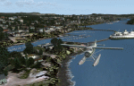
This is a collection of floatbases around the coast of British Columbia made with default scenery objects, and derived from Google Earth and the Canada Waterdrome Supplement. This scenery is designed to complement the work of others and therefore doesn't include waterdromes made by others such as Sidney Schwartz's CYYJ, Ganges Harbour and BCPNW Float Bases which covers an area around the Gulf Islands. You must have Ultimate Terrain Canada for these sceneries to work and in areas away from the immediate coast (Fraser River), a SRTM mesh for the correct elevations.
| Filename: | British_Columbia_Floatbases.zip |
| License: | Freeware |
| Added: | 16th May 2012, 14:02:09 |
| Downloads: | 1,537 |
| Author: | Chris Peschke |
| Size: | 183.32 KB |
| Category: Flight Simulator 2004 - Scenery | |
| Idaho County S80 Airport |
|
File Description:
Another small airport in beautiful Idaho. Near the mountains but not in them, this airport offers easy access and 24 hour operation. The airport NOTAM mentions skydiving activity, so I'm guessing the large circular dirt area is a landing target for the skydivers. All aprons were redrawn and buildings replaced according to better match Google Earth images. The landclass was modified to reduce the nearby city to a more realistic size and replace the farmland surrounding the airport.
This scenery was designed for Ultimate Terrain and may or may not work with the default scenery.
| Filename: | Idaho_County_S80__Airport.zip |
| License: | Freeware |
| Added: | 27th July 2008, 11:51:45 |
| Downloads: | 494 |
| Author: | Sidney Schwartz |
| Size: | 651.96 KB |
| Category: Flight Simulator 2004 - AFCAD Files | |
| MRE Masai Mara/Mara Lodges, Kenya |
|
File Description:
Googlyafcad A&F Data file for Masai Mara/Mara Lodges, Kenya, based
on Google Earth satellite data.
Flight Simulator 2004 has no provision for traffic at this airfield,
and these files will allow you and your "AI" traffic to land, taxi,
park and take off in a realistic manner.
Mara Lodges is a small airfield serving the Masai Mara reserve and
is served by Twin Otter aircraft of Air Kenya Express twice daily.
This airfield does not have an ICAO code, but in Flight Simulator
2004 it has been allocated HK0F.
| Filename: | MRE_Masai_MaraMara_Lodges_Kenya.zip |
| License: | Freeware |
| Added: | 22nd February 2008, 09:15:27 |
| Downloads: | 398 |
| Author: | John Hinson |
| Size: | 54.17 KB |
| Category: Flight Simulator 2004 - Scenery | |
| LPBE Beja civil airfield |
|
File Description:
This freeware scenery was created using pictures taken at the internet, details from APAU (http://roteiro.apau.org/zp_beja.html, VFR manual (http://www.nav.pt/ais/VFRs/beja%20ulm.pdf - it is supposed you download the file) as well as real measures by Google Earth; this ULM certified airfield at south Alentejo and closer to Beja AB, despite technical information, have, in fact, two paralel rwys in good shape.
This scenery is to be used EXCLUSIVELLY with Portugal Terrain from PTSIM (http://www.ptsim.com). For Microsoft FS2004 (ACOF). NOT tested for FSX
| Filename: | LPBE_Beja_civil_airfield.zip |
| License: | Freeware |
| Added: | 14th June 2013, 20:58:26 |
| Downloads: | 517 |
| Author: | Joao A. Graca Ferreira |
| Size: | 5.64 MB |
| Category: Flight Simulator X - Scenery | |
| Kissimmee, FL Gateway Airport (KISM) |
|
Images related to this file:
File Description:
Kissimmee Municipal Airport is the closest land-based general aviation airport to Walt Disney World. It contains several FBOs and Warbird Adventures. All are depicted in this scenery as they appear in Google Earth and Bing Maps at a point in time during 2009. Construction is ongoing, as occurs at many airports, so there will be some variations from what is current. Changes include runway, taxiway and apron adjustments; custom replications of buildings; added roads and parking; placement of library objects; and landclass changes in the airport vicinity.
| Filename: | Kissimmee_FL_Gateway_Airport_KISM.zip |
| License: | Freeware |
| Added: | 4th January 2010, 22:46:20 |
| Downloads: | 2,102 |
| Author: | Art Poole |
| Size: | 1.29 MB |
| Category: Flight Simulator X - Scenery | |
| McDill AFB (KMCF) |
|
File Description:
After reading a forum thread about freeway traffic on the KMCF aprons, it became apparent to me that users of UTX-USA needed this airport to be fixed so that taxiways and aprons are in the correct locations. Fortunately, the FSX default runway is correctly located. Taxiways and aprons have been relocated according to Google Earth, and while at it, some buildings have been changed, taxiway designations corrected, parking added, connecting roads added, landclass and boundary fences around the airfield changed and some library objects placed (including B52s on the ramp).
| Filename: | McDill_AFB_KMCF.zip |
| License: | Freeware |
| Added: | 14th February 2009, 20:57:33 |
| Downloads: | 974 |
| Author: | Art Poole |
| Size: | 117.42 KB |
© 2001-2026 AVSIM Online
All Rights Reserved
Privacy Policy |