
Where Flight Simulation Enthusiasts Gather from Around the World!
AVSIM Library - Search Results

| Category: Flight Simulator X - AFCAD Files | |
| PABR - Wiley Post - Will Rogers Memorial, AK |

|
File Description:
Wiley Post-Will Rodgers Memorial Airport - PABR is located in 320 north of the Artic Circle in Barrow, Alaska. It is the northern most airport in Alaska. Barrow is extremely cold in the winter averaging -25.7C and completely overcast more than 50% of the time. PABR receives regular airline service from Alaska Airlines and various cargo airlines.
This airport was designed using the latest freeware version of Airport Design Editor from ScruffyDuck Software. Only stock library objects were used. Digital-Terminal Procedures and Google Earth were used as reference material.
| Filename: | PABR__Wiley_Post__Will_Rogers_Memorial_AK.zip |
| License: | Freeware |
| Added: | 28th November 2013, 07:05:46 |
| Downloads: | 359 |
| Author: | Bill Bridges |
| Size: | 7.2 KB |
| Category: Flight Simulator 2004 - Scenery | |
| Ponte de Sor - Portugal |
|
Images related to this file:
File Description:
Ponte de Sor Municipal Airfield. Several buildings still under construction as well a new rwy. LPMS is a fake I create once, altough this is an certified airfield, it's ICAO has not yet been published (so far I know).
This scenery is fully compatible with Portugal Terrain from PTSIM (http://www.ptsim.com) and is based on digital pictures, accurate real measures by Aerodromos de Portugal. (http://www.pelicano.com.pt/zmapa.html) and Google Earth. This is 1st release, ugrade expected to be available soon.
Freeware. For Microsoft FS2004.NOT tested for FSX
| Filename: | Ponte_de_Sor__Portugal.zip |
| License: | Freeware |
| Added: | 15th April 2011, 01:05:44 |
| Downloads: | 395 |
| Author: | Joao Antonio Graca Ferreira |
| Size: | 2.58 MB |
| Category: Flight Simulator 2004 - AFCAD Files | |
| KSAT v0312 |
|
Images related to this file:
File Description:

KSATv0312 zip contains 2 bgl's (1 afcad and 1 for building placement).
This is a complete redo of the AP including the new A and B terminals, the removal of the old Terminal 2, my rendition of the Taxiway H where it was missing due to the old Terminal 2 and new Taxiway signage.
I used Google Earth for measurements, the current airport diagram, and info from the KSAT website for current gate assignments.
Created with AFX and IS for FS9 ONLY to replace the default AP.
Have Fun, Joe
| Filename: | KSAT_v0312.zip |
| License: | Freeware |
| Added: | 31st March 2012, 17:10:50 |
| Downloads: | 326 |
| Author: | Joe Bourgeois |
| Size: | 12.08 KB |
| Category: Flight Simulator 2004 - AFCAD Files | |
| KCHO Charlottesville-Albemarle Airport |
|
Images related to this file:
File Description:
FS2004 AFCAD File For KCHO, Charlottesville-Albemarle Airport, Charlottesville, Virginia (VA), USA 2012. CHO flies direct to six major connector airports. This airport needed overhauling. No large homemade scenery; uses default scenery. Modified with ADE 9x. Main changes: added new terminal/gates/jetways, runway 21 800' extension project plus 200' blast pad to name a few. Added default eye candy to give life. Modified airport taxiways/taxiway signs / facilities and structures to reflect current operations. Adjusted passenger terminals, added and realigned other airport buildings to 2012 locations. Verified with Google Earth images / FAA airport charts.
| Filename: | KCHO_CharlottesvilleAlbemarle_Airport.zip |
| License: | Freeware |
| Added: | 22nd August 2012, 03:49:05 |
| Downloads: | 285 |
| Author: | Dale Wingard |
| Size: | 1.04 MB |
| Category: Flight Simulator 2004 - Scenery | |
| Moody Air Force Base |
|
File Description:
Using GOOGLE EARTH, I've recreated Moody AFB for FS9. The scenery is all Rwy12 objects so you will need to download and install the libraries listed below (from RWY12.Com or Avsim.Com). Because there are two zones for arming/disarming and hot cargo, I've modified those parking spots as HOT. Training Aircraft and Helo parking were set up as MIL COMBAT. (See AFCAD2_KVAD_Parking.jpg) Parking: MIL COMBAT: 24 T37 T6, 29 T38 T1, 8 UH60 HH60, 11 HOT; MIL CARGO: 8 C-130, 6 HOT. Ramp lighting modified for FS9.
| Filename: | Moody_Air_Force_Base.zip |
| License: | Freeware |
| Added: | 23rd January 2006, 05:21:22 |
| Downloads: | 1,198 |
| Author: | Jim Donlin |
| Size: | 84.02 KB |
| Category: Flight Simulator 2004 - AFCAD Files | |
| MRE Masai Mara/Mara Lodges, Kenya |
|
File Description:
Googlyafcad A&F Data file for Masai Mara/Mara Lodges, Kenya, based
on Google Earth satellite data.
Flight Simulator 2004 has no provision for traffic at this airfield,
and these files will allow you and your "AI" traffic to land, taxi,
park and take off in a realistic manner.
Mara Lodges is a small airfield serving the Masai Mara reserve and
is served by Twin Otter aircraft of Air Kenya Express twice daily.
This airfield does not have an ICAO code, but in Flight Simulator
2004 it has been allocated HK0F.
| Filename: | MRE_Masai_MaraMara_Lodges_Kenya.zip |
| License: | Freeware |
| Added: | 22nd February 2008, 09:15:27 |
| Downloads: | 398 |
| Author: | John Hinson |
| Size: | 54.17 KB |
| Category: Flight Simulator X - Scenery | |
| Oakland International Airport 'KOAK' |
|
File Description:
This scenery if built for FSX and can ONLY BE USED ON FSX. This scenery was created with Abacus EZ Scenery, but you do not need the EZS libraries. On the contrary you will need the RWy12 libraries installed. This scenery adds many GA T-hangars, a large cargo area, a default terminal replacement, parking spots, jetways, lights, and much more. The gates are designed for certain planes. The gates are assigned as the airport's website (http://www.flyoakland.com/index2.cfm) indicates. I used Google Earth Imagery to very accurately place the gates.
| Filename: | Oakland_International_Airport_KOAK.zip |
| License: | Freeware |
| Added: | 15th December 2007, 03:25:09 |
| Downloads: | 2,990 |
| Author: | Brandon DePalo / Watsup Sceneries |
| Size: | 1.29 MB |
| Category: Flight Simulator X - Scenery | |
| McDill AFB (KMCF) |
|
File Description:
After reading a forum thread about freeway traffic on the KMCF aprons, it became apparent to me that users of UTX-USA needed this airport to be fixed so that taxiways and aprons are in the correct locations. Fortunately, the FSX default runway is correctly located. Taxiways and aprons have been relocated according to Google Earth, and while at it, some buildings have been changed, taxiway designations corrected, parking added, connecting roads added, landclass and boundary fences around the airfield changed and some library objects placed (including B52s on the ramp).
| Filename: | McDill_AFB_KMCF.zip |
| License: | Freeware |
| Added: | 14th February 2009, 20:57:33 |
| Downloads: | 975 |
| Author: | Art Poole |
| Size: | 117.42 KB |
| Category: Flight Simulator 2004 - AFCAD Files | |
| KMSPv1109 |
|
Images related to this file:
File Description:

KMSPv1109 zip contains 2 bgl�s (1 afcad and 1 for building placement),
Which reflect �
1) New R 17/35, Taxiways, Aprons and Navaids,
2) Add Taxiway T.
3) Properly located the MSP VOR.
I used Google Earth for measurements, the current airport diagram, and info from the KFLL website for current gate assignments.
Created with AFX and IS for FS9 ONLY to replace the default AP.
Bonus file--
1) Printable Main Terminal Parking Map
2) Printable Humphrey Terminal Parking Map
Have Fun, Joe
| Filename: | KMSPv1109.zip |
| License: | Freeware |
| Added: | 11th November 2009, 22:51:34 |
| Downloads: | 373 |
| Author: | Joe Bourgeois |
| Size: | 203.39 KB |
| Category: Flight Simulator X - Scenery | |
| British Columbia Floatbases |
|
Images related to this file:
File Description:
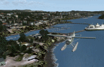
This is a collection of floatbases around the coast of British Columbia made with default scenery objects, and derived from Google Earth and the Canada Waterdrome Supplement. This scenery is designed to complement the work of others and therefore doesn't include waterdromes made by others such as Sidney Schwartz's CYYJ, Ganges Harbour and BCPNW Float Bases which covers an area around the Gulf Islands. You must have Ultimate Terrain Canada for these sceneries to work and in areas away from the immediate coast (Fraser River), a SRTM mesh for the correct elevations.
| Filename: | British_Columbia_Floatbases.zip |
| License: | Freeware |
| Added: | 16th May 2012, 14:02:09 |
| Downloads: | 1,540 |
| Author: | Chris Peschke |
| Size: | 183.32 KB |


© 2001-2026 AVSIM Online
All Rights Reserved
Privacy Policy |