
Where Flight Simulation Enthusiasts Gather from Around the World!
AVSIM Library - Search Results

| Category: Flight Simulator X - Scenery | |
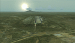
| Visalia Municipal Airport (KVIS) |

|
File Description:
This is the next addition to my California airport series: Visalia Municipal. This package updates many aspects of this airport. Buildlings were resized and placed in their real-life locations, parking was updated, the parking ramp at the southern end of the airfield was added, and more. Satellite images from Google Earth were used for accuracy. Many default scenery objects were placed from the FSX scenery libraries. View Readme file for installation and notes. Compiled using Airport Design Editor.
| Filename: | Visalia_Municipal_Airport_KVIS.zip |
| License: | Freeware |
| Added: | 1st December 2008, 02:30:11 |
| Downloads: | 765 |
| Author: | Phillip Coyle |
| Size: | 315.36 KB |
| Category: Flight Simulator X - Scenery | |
| Paraguana Airport (SVJC) - Venezuela |
|
Images related to this file:
File Description:
Josefa Camejo International Airport, located in Las Piedras
near the city of Punto Fijo, in western Venezuela.
This scenery add facilities Amuay refinery, the world's largest.
Includes some interesting special effects, like the explosion of a transformer
at the airport every hour o'clock and smoke effects in the refinery.
With photo-terrain scenery from satellite imagery in Google Earth.
Includes terminal building and hangars with realistic
textures from images obtained from Internet.
Also includes a friendly Auto-Install.
| Filename: | Paraguana_Airport_SVJC__Venezuela.zip |
| License: | Freeware |
| Added: | 11th September 2011, 20:59:37 |
| Downloads: | 1,912 |
| Author: | David Maldonado |
| Size: | 79.54 MB |
| Category: Flight Simulator X - AFCAD Files | |
| UWUU - Ufa International Airport |
|
File Description:
Ufa International Airport is situated near the capital of Bashkortostan and serves 2.2 million passengers each year.
As usual I have used ADEX to rework this airport. Google Earth for measurements. Charts for parking sizes and positions.
You should download the brilliant car park package by Sidney Schwartz, modified my Martin Gossman at Owls Nest. Also the great lights package by Jim Dhaenens. Both can be found on AVSIM and other good flight sim libraries.
| Filename: | UWUU__Ufa_International_Airport.zip |
| License: | Freeware |
| Added: | 27th September 2016, 19:36:29 |
| Downloads: | 638 |
| Author: | Mike Major |
| Size: | 5.92 MB |
| Category: Flight Simulator 2004 - Scenery | |
| Calgary International Airport (CYYC) Version 2 |
|
Images related to this file:
File Description:

This is Calgary International Airport (CYYC) - version 2 located in Alberta, Canada. 4th Busiest Airport in Canada. Built using Sketchup, SBuilder and ADE v178, AFLT. Built from current google earth info. Requires Rwy12 Object library. You can get RWY12 in avsim.com or flightsim.com. See readme for install instructions.
This is a new airport and doesnt need version 1 to run. If you decide to use this one, uninstall Version 1 using instructions on the readme that came with it.
| Filename: | Calgary_International_Airport_CYYC_Version_2.zip |
| License: | Freeware |
| Added: | 17th October 2021, 15:49:51 |
| Downloads: | 654 |
| Author: | EMMANUEL P MWANDOSYA |
| Size: | 92.84 MB |
| Category: Flight Simulator X - AFCAD Files | |
| ZWWW - Urumqi Diwopu International Airport - Urumqi, China |
|
Images related to this file:
File Description:
Urumqi Diwopu International Airport is an airport serving Urumqi, the capital of the Xinjiang Uygur Autonomous Region in northwestern China. The airport is a hub for China Southern Airlines and a focus city for Hainan Airlines. Urumqi Airport was opened to foreign passengers in 1973 and has been the emergency landing ground for airlines to Europe and west Asia.
Using ADEx 1.67, Aeronautical maps and Google Earth the default airport has been reworked to reflect today's situation.
| Filename: | ZWWW__Urumqi_Diwopu_International_Airport__Urumqi_.zip |
| License: | Freeware |
| Added: | 25th February 2016, 21:35:19 |
| Downloads: | 1,069 |
| Author: | Menno C. Robert |
| Size: | 2.28 MB |
| Category: Flight Simulator X - Scenery | |
| Boundary Bay Airport, British Columbia (CZBB) |
|
File Description:
The airport was based on a Google Earth photo, and the buildings are not 100% accurate, but are reasonably accurately placed and should give a good feel for the airport.
The airport was based on a Google Earth photo, and the buildings are not 100% accurate, but are reasonably acurately placed and should give a good feel for the airport. Historically this his represents a period at the airport in its GA heyday before Heli One and the new terminal building went up cica 2007-2009, from when McLeod Aviation was still in the big hanger and there were plenty of small flying Schools about, to when the new Alpha Aviation building went up.
There is a fuel truck, a single small gate area for commercial flights (even though there is none in reality) and various static items around the field, including the old white dome hangars down the East end of the field (where I used to keep my plane. Watch out for a surprise if you are taxiing out to 25 or 30!
Enjoy.
| Filename: | Boundary_Bay_Airport_British_Columbia_CZBB.zip |
| License: | Freeware |
| Added: | 6th December 2011, 00:42:16 |
| Downloads: | 581 |
| Author: | Bernie Garrett |
| Size: | 914.75 KB |
| Category: Flight Simulator X - AFCAD Files | |
| CYXX Abbotsfor Intl - British Columbia, Canada. |
|
File Description:
This airport has been completely reworked using ADE v1.39 and satellite images from Google Earth and Microsoft Virtual Earth. Both runways have been extended to correct length: 01/19 from 5260ft to 5328ft and 07/25 from 7988ft to 9600ft (see attach airport chart). Thesholds have been corrected. VASI updated on both runwaysw. Xwind runways activated. Roads, buildings and apron areas updated. Static aircraft, vehicles, vegetation, fuel truck and automated jetways added. I have added flood lights to cover ramp and parking areas also red obstruction lights have been added to some taller buildings. These lights are visibled between the hours of dusk and dawn. For these light to be visible the included folder - FSX_LTS - must be placed in your Addon Scenery folder and activated.
| Filename: | CYXX_Abbotsfor_Intl__British_Columbia_Canada.zip |
| License: | Freeware |
| Added: | 5th November 2009, 02:16:29 |
| Downloads: | 660 |
| Author: | Robert Catherall |
| Size: | 936.14 KB |
| Category: Flight Simulator X - Scenery | |
| KFRR - Front Royal-Warren County Airport - Front Royal - Virginia, USA |
|
Images related to this file:
File Description:
Front Royal-Warren County Airport (IATA: FRR[2], ICAO: KFRR, FAA LID: FRR) is a county owned, public use airport located three nautical miles (6 km) west of the central business district of Front Royal, a town in Warren County, Virginia, United States. It is included in the National Plan of Integrated Airport Systems for 2011-2015, which categorized it as a general aviation facility.
This is a complete re-work of the airport based on Google Maps. Created with Airport Design Editor by ScruffyDuck Software using current FAA documentation and Google Earth measurements, this package offers a replacement for FSX's stock airport. All these enhancements are as close to the real airport as I can get with stock library objects and custom buildings.
| Filename: | KFRR__Front_RoyalWarren_County_Airport__Front_Roya.zip |
| License: | Freeware |
| Added: | 1st October 2014, 14:01:40 |
| Downloads: | 366 |
| Author: | Wayne Roberts |
| Size: | 232.02 KB |
| Category: Flight Simulator X - Scenery | |
| French Polynesian Island Tour, Part 1 |
|
File Description:
This is Part 1 of a 2 Part 45 leg mostly VFR "tour" of a geographical area of the South Pacific where the FSX default island airports even with
the addition of add-ons such as Orbx LC and Vector are typically not rendered very well. All the French Polynesian airports of these 2 packages
have tested successfully in FSX Acceleration with Orbx Vector and Orbx LC installed by 2 FSX users. They may also be compatible with the early
(32 bit) versions of P3D; up to, but not including P3Dv4. ADE, Ver 1.78 was primarily used as the tool for airport modification and creation,
with the help of Google Earth, Google Maps, and several online airport information and flight planning utilities.
| Filename: | French_Polynesian_Island_Tour__Part_1.zip |
| License: | Freeware |
| Added: | 8th June 2024, 17:41:42 |
| Downloads: | 56 |
| Author: | Ken Boardman |
| Size: | 347.01 KB |
| Category: Flight Simulator X - Scenery | |
| French Polynesian Island Tour, Part 2 |
|
Images related to this file:
File Description:
This is Part 2 of a 2 Part mostly VFR "tour" of a geographical area of the South Pacific where the FSX default island airports even with
the addition of add-ons such as Orbx LC and Vector are typically not rendered very well. All the French Polynesian airports of these 2 packages
have tested successfully in FSX Acceleration with Orbx Vector and Orbx LC installed by 2 FSX users. They may also be compatible with the early
(32 bit) versions of P3D; up to, but not including P3Dv4. ADE, Ver 1.78 was primarily used as the tool for airport modification and creation,
with the help of Google Earth, Google Maps, and several online airport information and flight planning utilities.
| Filename: | French_Polynesian_Island_Tour_Part_2.zip |
| License: | Freeware |
| Added: | 8th June 2024, 17:41:50 |
| Downloads: | 58 |
| Author: | Ken Boardman |
| Size: | 342.47 KB |
© 2001-2026 AVSIM Online
All Rights Reserved
Privacy Policy |