
Where Flight Simulation Enthusiasts Gather from Around the World!
AVSIM Library - Search Results

| Category: Flight Simulator 2004 - AFCAD Files | |
| Voi, Kenya (HKVO) |

|
File Description:
Googlyafcad A&F Data file for HKVO Voi, Kenya, based on Google Earth satellite data. Unfortunately, Microsoft has provided no facilities at this small airstrip in Flight Simulator 2004, which is served occasionally by Mombasa Air Safari flights. This upgrade redresses the subject by providing parking facilities so that you and your "AI" traffic can land, taxi, park and take off realistically.
| Filename: | Voi_Kenya_HKVO.zip |
| License: | Freeware |
| Added: | 21st March 2007, 13:42:59 |
| Downloads: | 533 |
| Author: | John Hinson |
| Size: | 52.47 KB |
| Category: Flight Simulator 2004 - AFCAD Files | |
| Isiolo, Kenya (HKIS) |
|
File Description:
Googlyafcad A&F Data file for HKIS Isiolo, Kenya, based on Google Earth satellite data. Unfortunately, Microsoft has provided no facilities at this small airstrip in Flight Simulator 2004, which is served once daily by Air Kenya. This upgrade redresses the subject by providing parking facilities so that you and your AI traffic can land, taxi, park and take off realistically.
| Filename: | Isiolo_Kenya_HKIS.zip |
| License: | Freeware |
| Added: | 21st March 2007, 13:40:39 |
| Downloads: | 444 |
| Author: | John Hinson |
| Size: | 47.64 KB |
| Category: Flight Simulator X - Scenery | |
| Santa Elena de Uairen, Venezuela (SVSE) |
|
Images related to this file:
File Description:
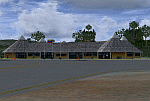
Located to south of Venezuela, to few kilometers from the border with Brazil.
The airport design, reflects the Pemon indigenous culture.
With photo-terrain scenery from satellite imagery of Google Earth.
Not compatible with versions prior to FSX.
This scenery requires SP1, SP2, or the Acceleration
expansion pack in order to be displayed correctly.
Also includes a friendly Auto-Install.
| Filename: | Santa_Elena_de_Uairen_Venezuela_SVSE.zip |
| License: | Freeware |
| Added: | 3rd August 2013, 17:34:22 |
| Downloads: | 1,411 |
| Author: | David Maldonado |
| Size: | 76.57 MB |
| Category: Flight Simulator X - Scenery | |
| Monte Real Air Base |
|
File Description:
Monte Real Air Base, home of the squadrons 201 and 301, with F-16MLU. This scenery was developed in ADE9X with the help of Google Earth. The runway and aprons have the right size, were added default FSX buildings and pine trees (many), and from Mario Cera the Control Tower building (Beta version) and weather shelters for the fighters. Enjoy!
| Filename: | Monte_Real_Air_Base.zip |
| License: | Freeware |
| Added: | 9th December 2011, 15:54:59 |
| Downloads: | 1,687 |
| Author: | Jorge Ferreira, Mario Cera |
| Size: | 36.57 MB |
| Category: Flight Simulator 2004 - Scenery | |
| KPOY Powell, Wyoming Airport |
|
File Description:
Powell, Wyoming was a major stop-over for Frontier Airlines starting in 1950 with DC-3's for people going from Billings, Montana to Salt Lake City, Utah and points in-between. A nice little airport that needed alot of help.
I discovered this airport flying the Frontier route in my DC-3 and didn't like the looks of it at all! So I fixed it.
It has a 6175X100' asphalt runway and 2 dirt-grass useable runways.
Look at the default pics and then see what lots of help from Google Earth and FS Earth can do to a sad airport.
| Filename: | KPOY_Powell_Wyoming_Airport.zip |
| License: | Freeware |
| Added: | 23rd November 2008, 11:38:50 |
| Downloads: | 894 |
| Author: | Alan C. Heiner |
| Size: | 3.5 MB |
| Category: Flight Simulator X - Scenery | |
| KHLX - Twin County Airport - Virginia, USA |
|
File Description:
Twin County Airport is located in the heart of the beautiful Blue Ridge mountains of southwest Virginia, adjacent to Interstate 77 near exit 19. We are 6 miles west of Hillsville and 11 miles northeast of Galax
This is a complete re-work of the airport based on Google Maps. Created with Airport Design Editor by ScruffyDuck Software using current FAA documentation and Google Earth measurements, this package offers a replacement for FSX's stock airport. All these enhancements are as close to the real airport as I can get with stock library objects and custom buildings.
| Filename: | KHLX__Twin_County_Airport__Virginia_USA.zip |
| License: | Freeware |
| Added: | 11th October 2014, 01:02:53 |
| Downloads: | 259 |
| Author: | Wayne Roberts |
| Size: | 196.49 KB |
| Category: Flight Simulator X - Miscellaneous Files | |
| FsGoogleEarthView v3.0 |
|
Images related to this file:
File Description:

FsGoogleEarthView enables Flight Simulator flight with realistic Google Earth view! With FsGoogleEarthView, you can take both - Google Earth's great photoreal ground, 3D Buildings, detailed terrain mesh and Flight Simulator's great flight model, flight instruments, add-on aircrafts, add-on airport sceneries - with no downloading and very short loading time, anywhere in the world! It will provide more enjoyable VFR flight than any other sceneries. Now with v3.0, additional functions such as VDGS, Landing Report, Airport Moving Map, Route Visualization and Flight Logging are also included. And it's freeware now. It works with FSX, FS2004, Prepar3d, X-plane all.
| Filename: | FsGoogleEarthView_v30.zip |
| License: | Freeware, limited distribution |
| Added: | 5th May 2017, 19:08:37 |
| Downloads: | 2,745 |
| Author: | Dongjin Shin |
| Size: | 14.9 MB |
| Category: Flight Simulator 2004 - AFCAD Files | |
| OSDI Damascaus International, Syria |
|
File Description:
Googlyafcad A&F Data for Damascus International, based on Google Earth satellite
data.
Unfortunately, Microsoft have provided only limnited facilities at this important
airport in Flight Simulator 2004 and the absence of many taxiways present in the
real world can cause traffic to queue for long periods. This file will allow you
and your "AI" traffic to land, taxi, park and take off in a realistic manner.
| Filename: | OSDI_Damascaus_International_Syria.zip |
| License: | Freeware |
| Added: | 16th May 2008, 11:24:41 |
| Downloads: | 570 |
| Author: | John Hinson |
| Size: | 59.5 KB |
| Category: Flight Simulator X - AFCAD Files | |
| CYKF - Region of Waterloo International Airport |
|
File Description:
* Created using ADE version 1.47, based on import of stock FSX airport.
* Renumbered runway 25/07 to 26/08
* Adjusted taxiways, aprons, parking spots, buildings, access roads, parking lots, airport boundary, and various airport objects, based on most recent Google Earth.
* Assigned taxi signs, and other miscellaneous, as per Nov 2008 aerodrome chart - the most recent I was able to get my hands on, sorry.
| Filename: | CYKF__Region_of_Waterloo_International_Airport.zip |
| License: | Freeware |
| Added: | 4th May 2011, 06:08:39 |
| Downloads: | 728 |
| Author: | William Ruppel |
| Size: | 12.21 KB |
| Category: Flight Simulator 2004 - AFCAD Files | |
| Leeuwarden AB update |
|
File Description:
This is an AFCAD File for Leeuwarden AB, located near Leeuwarden in Frisian, the Netherlands.
This is the first afcad file for the default Leeuwarden and it's made with maps en real-life pictures.
This is a very realistic AFCAD file made with Google Earth and maps from www.scramble.nl.
I´ve added more parkingspots for shelthers(buildings not included) and I fixed some minor errors.
| Filename: | Leeuwarden_AB_update.zip |
| License: | Freeware |
| Added: | 27th October 2005, 12:14:29 |
| Downloads: | 677 |
| Author: | Gijsbrecht van Batum |
| Size: | 86.82 KB |
© 2001-2026 AVSIM Online
All Rights Reserved
Privacy Policy |