
Where Flight Simulation Enthusiasts Gather from Around the World!
AVSIM Library - Search Results

| Category: Flight Simulator 2004 - Scenery | |
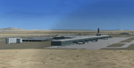
| EDAO Nordhausen |

|
File Description:
Small German grass airfield West of
Leipzig/Halle (EDDP) and North of Erfurt
(EDDE). Based on google earth picture,
the surroundings have been adjusted
and missing lakes and objects added.
Made especially for those pilots flying the
IVAO German VFR Tour 2008.
Needs rwy12 objects.
| Filename: | EDAO_Nordhausen.zip |
| License: | Freeware |
| Added: | 4th February 2008, 21:22:29 |
| Downloads: | 1,119 |
| Author: | Detlev Rohmer |
| Size: | 3.82 MB |
| Category: Flight Simulator X - AFCAD Files | |
| Hana Airport (PHHN) |
|
File Description:
This is an update for Hana Airport in Hana, Hawaii. It updates runways and taxiways based on real world demensions from Google Earth. Various objects from the default FSX scenery libraries were also added. View Readme for installation and notes. Compiled using Airport Design Editor.
| Filename: | Hana_Airport_PHHN.zip |
| License: | Freeware |
| Added: | 9th June 2008, 09:08:14 |
| Downloads: | 1,048 |
| Author: | Phillip Coyle |
| Size: | 327.06 KB |
| Category: Civil Flight Simulators - Looking Glass Flight Unlimited 3 | |
| Gelink Simulated GPS |
|
File Description:
GELink provides simulated GPS functionality and optional moving map display to Flight Unlimited III (FU3) users. Moving map is based on Google Earth via a .kml interface.
Some configuration is required, users will need basic computing skills to install and run GELink.
| Filename: | Gelink_Simulated_GPS.zip |
| License: | Freeware |
| Added: | 23rd June 2010, 11:09:59 |
| Downloads: | 177 |
| Author: | Bruce Hannah |
| Size: | 3.04 MB |
| Category: Flight Simulator 2004 - Scenery | |
| RAF Kinloss Scenery |
|
Images related to this file:
File Description:
kinloss air base afcad produced using google earth as a guide and static scenery objects added using ez Scenery with hangers only available to hand from downloads. therefore ez Scenery downloads
will be necessary, some essential ones have been named in the readme file.
| Filename: | RAF_Kinloss_Scenery.zip |
| License: | Freeware |
| Added: | 15th February 2010, 23:28:22 |
| Downloads: | 432 |
| Author: | Douglas Clark |
| Size: | 18.18 KB |
| Category: Flight Simulator X - Scenery | |
| EDDR - Saarbruecken Ensheim Airport - Saarland, Germany **UPDATED VERSION ** |
|
Images related to this file:
File Description:
Frame rate friendly version of EDDR. The positions of the gates, the taxiways and the runway are accurate in Google Earth. ILS is 108.7 for runway 27. Runway 09 has only RNAV approaches (via PETID at 3500'). For more information see https://sites.google.com/site/fsxvideosairports/.
| Filename: | EDDR__Saarbruecken_Ensheim_Airport__Saarland_Germa.zip |
| License: | Freeware |
| Added: | 25th May 2016, 11:23:19 |
| Downloads: | 1,211 |
| Author: | Rene Scharlach |
| Size: | 1.93 MB |
| Category: Flight Simulator 2004 - Scenery | |
| UK ROADS & RAILS |
|
File Description:
UK Roads and Rails replaces all road and rail textures with images from Google Earth. The images are taken from West Yorkshire (the M62, the stretch of railway between Cross Gates and Micklefield and Dewsbury Road). I advise you to have Medium High display settings.
| Filename: | UK_ROADS__RAILS.zip |
| License: | Freeware |
| Added: | 8th August 2006, 21:48:32 |
| Downloads: | 6,595 |
| Author: | Chris Kellett |
| Size: | 301.61 KB |
| Category: Flight Simulator X - AFCAD Files | |
| UWWW - Kurumoch International Airport - Samara, Russia |
|
File Description:
UWWW, Kurumoch International Airport serves Samara in Russia. It handles 2.3 million passengers each year to international and domestic locations.
I have used ADEX to rework the stock airport. Using Google Earth for measurements and the charts for parking positions and NavAids.
| Filename: | UWWW__Kurumoch_International_Airport__Samara_Russi.zip |
| License: | Freeware |
| Added: | 16th August 2016, 22:29:33 |
| Downloads: | 632 |
| Author: | Mike Major |
| Size: | 6.76 MB |
| Category: Flight Simulator X - Scenery | |
| Santa Lucia airport (MMSM) in Mexico |
|
Images related to this file:
File Description:
Santa Lucia airport is a new facility serving Mexico City, opened in 2022. The FSX scenery of this airport was built with the Airport Design Editor program, based on satellite images from Google Earth and on actual Jeppesen charts. The buildings are made with GMAX.
| Filename: | Santa_Lucia_airport_MMSM_in_Mexico.zip |
| License: | Freeware |
| Added: | 23rd December 2022, 21:34:40 |
| Downloads: | 733 |
| Author: | Winfried Orthmann |
| Size: | 5.49 MB |
| Category: Flight Simulator X - Scenery | |
| Boca Raton, FL Airport (KBCT) |
|
Images related to this file:
File Description:
One runway and taxiway for private jets of the rich and famous. Generic floating buildings have
been replaced with custom and library objects. Landclass changes, roads, rework of runways,
taxiways and aprons, placement of library objects and a library of new airport buildings are
included. Scenery in this package is based on Virtual Earth (Bing) and Google Earth imagery. An
optional AI Traffic file is also included to populate the airport with executive aircraft.
| Filename: | Boca_Raton_FL_Airport_KBCT.zip |
| License: | Freeware |
| Added: | 5th February 2011, 03:10:42 |
| Downloads: | 2,305 |
| Author: | Art Poole |
| Size: | 2.95 MB |
| Category: Flight Simulator X - Scenery | |
| 0V4 - Brookneal-Campbell County Airport - Virginia |
|
Images related to this file:
File Description:
Created with Airport Design Editor by ScruffyDuck Software using current FAA documentation and Google Earth measurements, this package offers a replacement for FSX's stock airport. All these enhancements are as close to the real airport as I can get with stock library objects and custom models.
| Filename: | 0V4__BrooknealCampbell_County_Airport__Virginia.zip |
| License: | Freeware |
| Added: | 5th August 2014, 20:17:14 |
| Downloads: | 197 |
| Author: | Wayne Roberts |
| Size: | 417.97 KB |
© 2001-2026 AVSIM Online
All Rights Reserved
Privacy Policy |