
Where Flight Simulation Enthusiasts Gather from Around the World!
AVSIM Library - Search Results

| Category: Flight Simulator X - AFCAD Files | |
| SBSR - Sao Jose do Rio Preto, Brazil |

|
Images related to this file:
File Description:
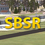
This AFCAD depicts Aeroporto Estadual Prof. Eribelto Manoel Reino (SJP/SBSR) (Default Scenery). This AFCAD has improved position of all objects based on charts and Google Earth aerial photos. Some improvised elements of the default library added.
| Filename: | SBSR__Sao_Jose_do_Rio_Preto_Brazil.zip |
| License: | Freeware |
| Added: | 11th June 2012, 12:58:03 |
| Downloads: | 469 |
| Author: | Silvio Ricardo |
| Size: | 5.81 MB |
| Category: Flight Simulator 2004 - Scenery | |
| Little Rock Air Force Base |
|
File Description:
Little Rock Air Force Base. AFCAD totally redone referencing GOOGLE EARTH. Rwy12 objects required (see KLRF.TXT). 18 MIL COMBAT parking, 87 MIL CARGO parking. Ramp lighting at night. Includes AFCAD files for ALL AMERICAN and BLACKJACK dropzones.
| Filename: | Little_Rock_Air_Force_Base.zip |
| License: | Freeware |
| Added: | 31st December 2005, 19:00:51 |
| Downloads: | 1,165 |
| Author: | Jim Donlin |
| Size: | 13.23 KB |
| Category: Flight Simulator X - AFCAD Files | |
| VVVD Quang Ninh Van Don Airport, Vietnam |
|
File Description:
This airport does not exist in FSX. I made it using Airport Design Editor by Scruffyduck and Google Earth for a preferably exact display of runways and gates. Feel free to add or modify anything you want.
| Filename: | VVVD_Quang_Ninh_Van_Don_Airport_Vietnam.zip |
| License: | Freeware |
| Added: | 4th February 2020, 18:48:18 |
| Downloads: | 443 |
| Author: | Max Schloegl |
| Size: | 5.28 KB |
| Category: Flight Simulator 2004 - Scenery | |
| Frankfurt EDDF Airport - Update |
|
File Description:
This AFCAD file adds the fourth runway 07L/25R and associated taxiways.
I have created this using AFCAD 2.2.1.0 and ADE 175. Dimensions taken mostly from Google Earth and airport charts.
Updated to fix the "disappearing runway"
| Filename: | Frankfurt_EDDF_Airport__Update.zip |
| License: | Freeware, limited distribution |
| Added: | 20th April 2019, 04:57:24 |
| Downloads: | 295 |
| Author: | Chris Langley |
| Size: | 207.42 KB |
| Category: Flight Simulator X - Scenery | |
| SBRD - Rondonopolis Airport - Mato Grosso, Brazil |
|
Images related to this file:
File Description:
Maestro Marinho Franco airport, located on the city of Rondonopolis, state of Mato Grosso, Brazil. Includes ADE CAD and Personalized 3D objects , createds based of the google earth dimensions and coordinates. FSX scenery. Works in Prepar3D v3.
| Filename: | SBRD__Rondonopolis_Airport__Mato_Grosso_Brazil.zip |
| License: | Freeware, limited distribution |
| Added: | 14th September 2019, 00:01:49 |
| Downloads: | 1,334 |
| Author: | Eduardo Mello |
| Size: | 18.85 MB |
| Category: Flight Simulator X - Scenery | |
| FSX Lawrence Munincipal Airport (KLWM) North Andover, Massachusetts - USA |
|
Images related to this file:
File Description:
This is my rendition of the Lawrence Municipal Airport (KLWM) in North Andover, Massachusetts. Established in 1934, it is an important transportation resource, situated in the heart of Massachusetts’ Merrimack Valley. I searched the internet extensively for any images I could find to help make a reasonably accurate rendition of this airport. I used Google Earth, Google Maps street view and Google images to redraw the aprons and taxiways and create 29 custom buildings and hangars from scratch.
| Filename: | FSX_Lawrence_Munincipal_Airport_KLWM_North_Andover.zip |
| License: | Freeware, limited distribution |
| Added: | 26th September 2023, 15:31:09 |
| Downloads: | 81 |
| Author: | JFBrubaker1969 |
| Size: | 4.21 MB |
| Category: Flight Simulator X - Scenery | |
| Leesburg, FL International Airport (KLEE) |
|
Images related to this file:
File Description:
Leesburg Municipal Airport has changed to Leesburg International Airport since the release of FSX, with a lengthened runway and a control tower. Scenery in this package is based on Virtual Earth (Bing) and Google Earth imagery. Landclass changes, rework of runways-taxiways-aprons, placement of library objects and a library of new airport buildings are included as well as custom objects.
| Filename: | Leesburg_FL_International_Airport_KLEE.zip |
| License: | Freeware |
| Added: | 13th July 2010, 02:56:19 |
| Downloads: | 1,138 |
| Author: | Art Poole |
| Size: | 1.17 MB |
| Category: Flight Simulator X - Scenery | |
| Merritt Island, FL Airport (KCOI) |
|
Images related to this file:
File Description:
Merritt Island is located on the east coast of Florida in the vicinity of Cape Canaveral and Cocoa Beach. Scenery in this package is based on Virtual Earth (Bing) and Google Earth imagery. This is a complete redo of the default FSX KCOI layout, surrounding landclass, FBO and hangers. Also includes placement of library objects and a library of new airport buildings.
| Filename: | Merritt_Island_FL_Airport_KCOI.zip |
| License: | Freeware |
| Added: | 17th April 2010, 19:47:04 |
| Downloads: | 1,683 |
| Author: | Art Poole |
| Size: | 1.14 MB |
| Category: Flight Simulator X - Scenery | |
| Mobile, AL - Mobile Regional Airport (KMOB) |
|
Images related to this file:
File Description:
Replaces generic floating buildings with replicas of the actual terminal, FBOs and other structures,
including the U.S. Coast Guard aviation training facility with military cargo parking. Actual airlines are
assigned to terminal gates. Includes landclass changes, roads, rework of runways, taxiways, aprons and
parking, and placement of library objects. Scenery in this package is based on Virtual Earth (Bing) and
Google Earth imagery.
| Filename: | Mobile_AL__Mobile_Regional_Airport_KMOB.zip |
| License: | Freeware |
| Added: | 15th February 2012, 04:36:23 |
| Downloads: | 1,965 |
| Author: | Art Poole |
| Size: | 2.78 MB |
| Category: Flight Simulator 2004 - AFCAD Files | |
| Davison Army Air Field, Fort Belvoir, Virginia (KDAA) |
|
File Description:
AFCAD2 file for Davison Army Air Field, Fort Belvoir, Virginia (KDAA). Extremely accurate, dimensions correct, based on Google Earth. The default buildings were accurately placed, so I didn't have to make any compromises in laying out the airport
| Filename: | Davison_Army_Air_Field_Fort_Belvoir_Virginia_KDAA.zip |
| License: | Freeware |
| Added: | 13th August 2006, 04:11:23 |
| Downloads: | 584 |
| Author: | Matt Heden |
| Size: | 4.37 KB |
© 2001-2026 AVSIM Online
All Rights Reserved
Privacy Policy |